Reconnecting Communities: East Atlanta Boulevard

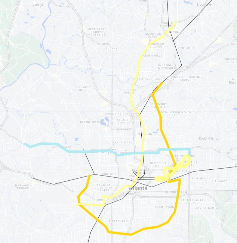
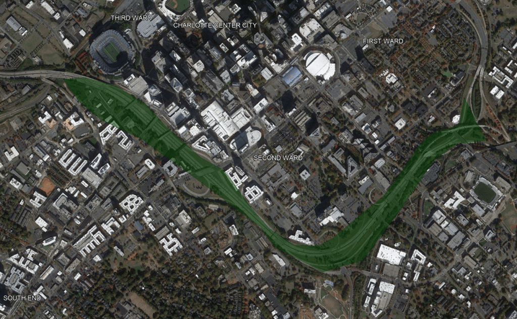
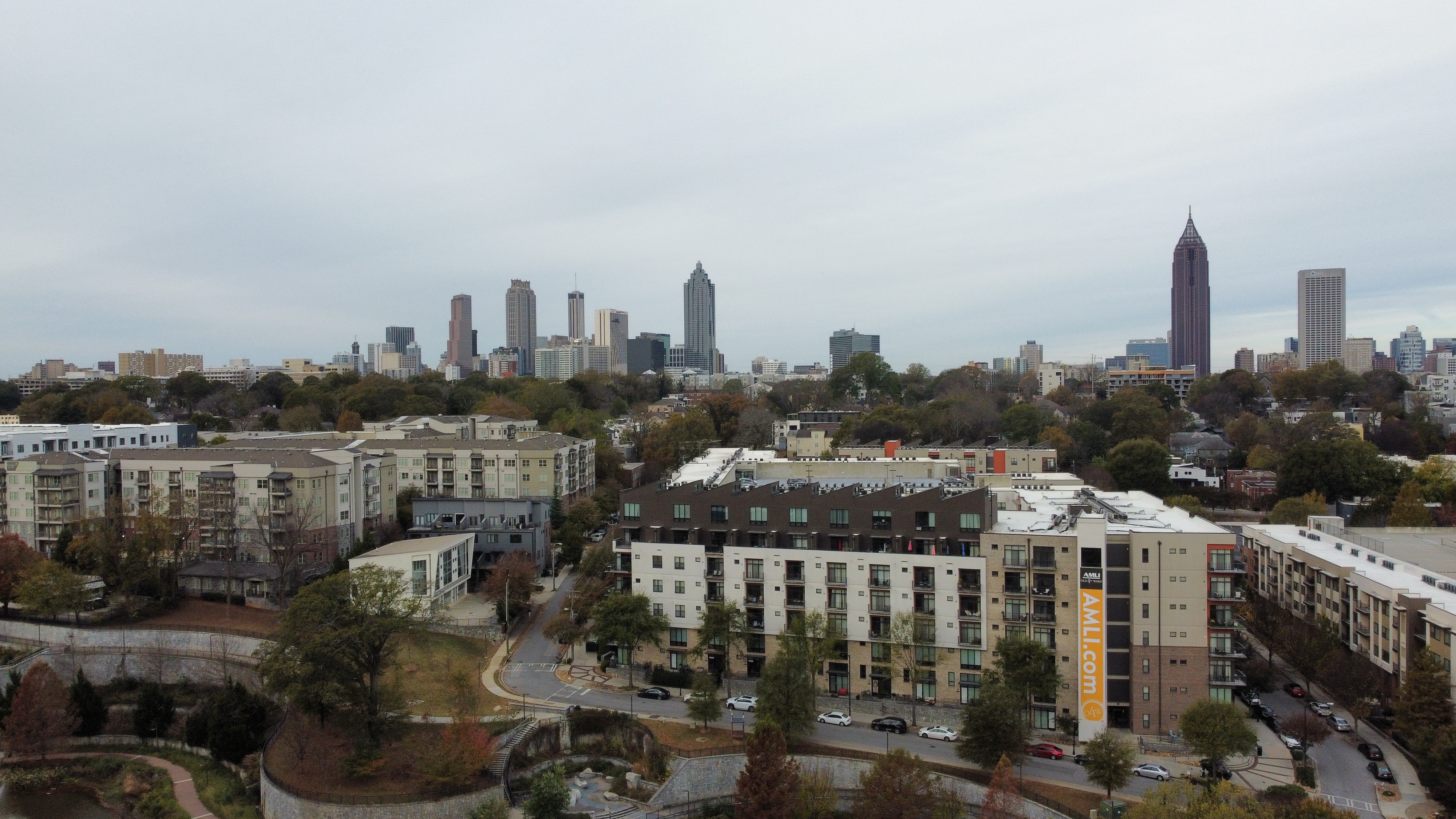
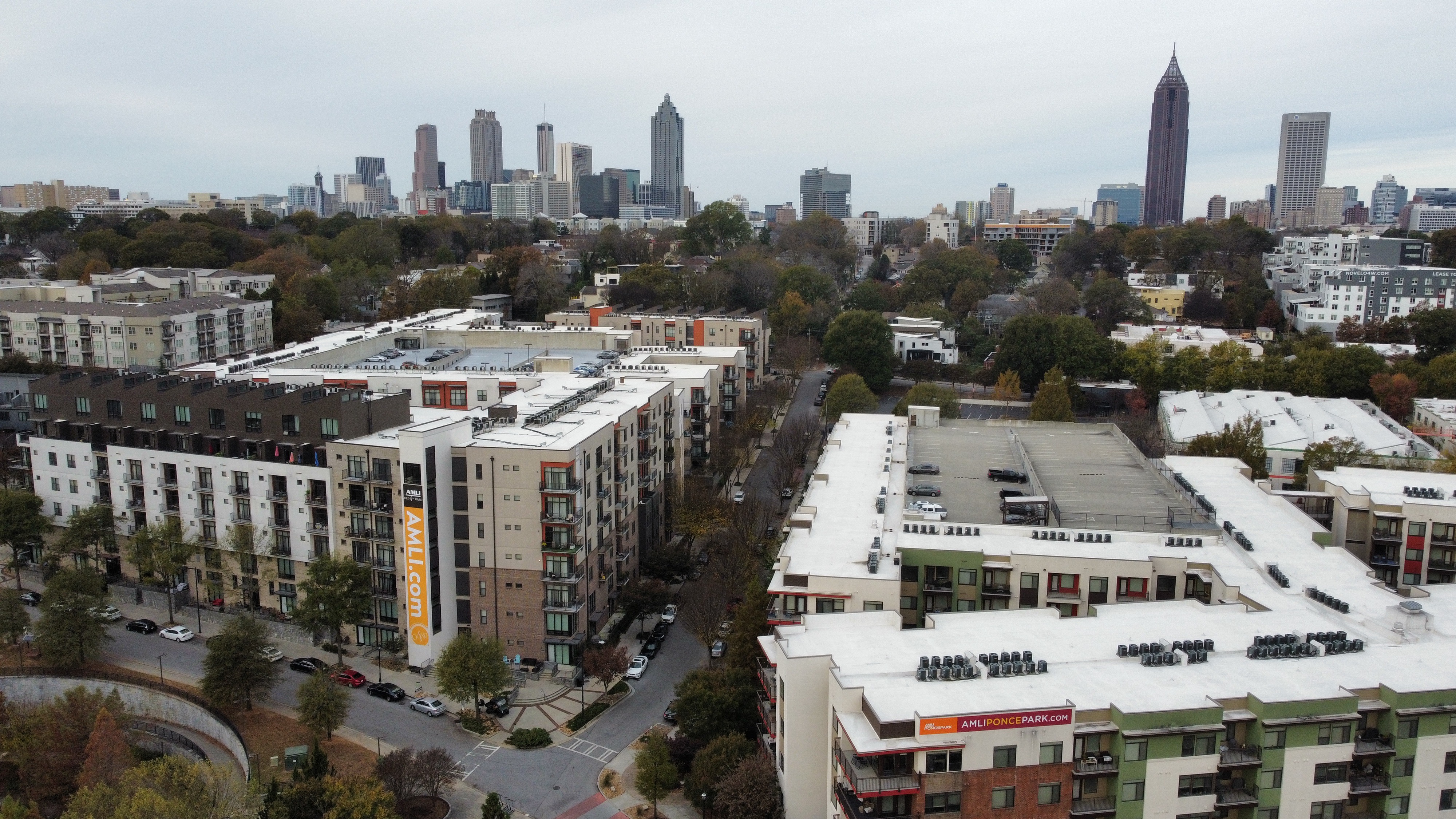
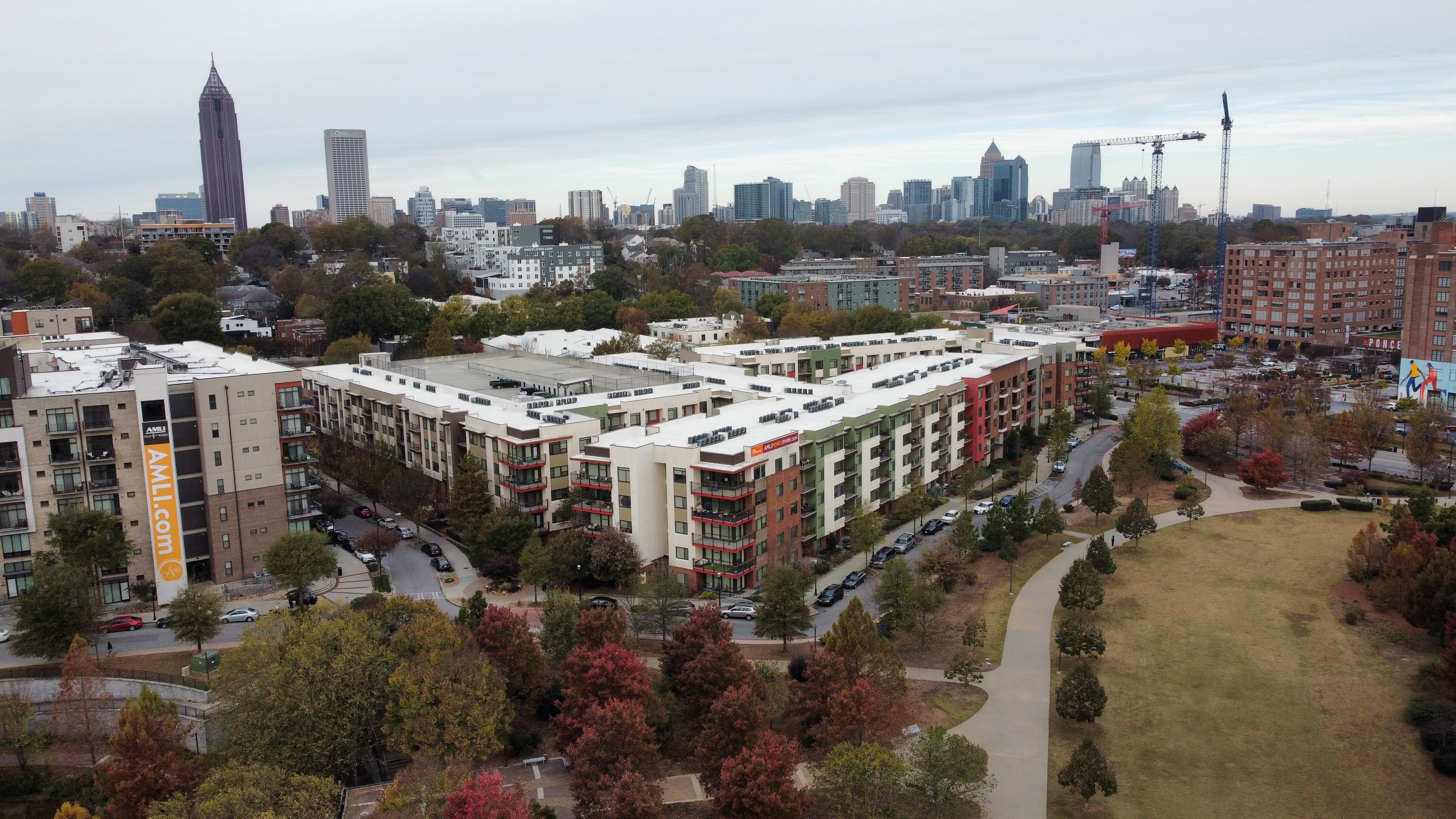
Atlanta is embarking on a massive highway capping project called The Stitch. While it will be transformative in connecting Downtown Atlanta, there’s another area that should be considered for highway capping that would also have benefits on the everyday lives of residents along with providing dense, affordable housing options.

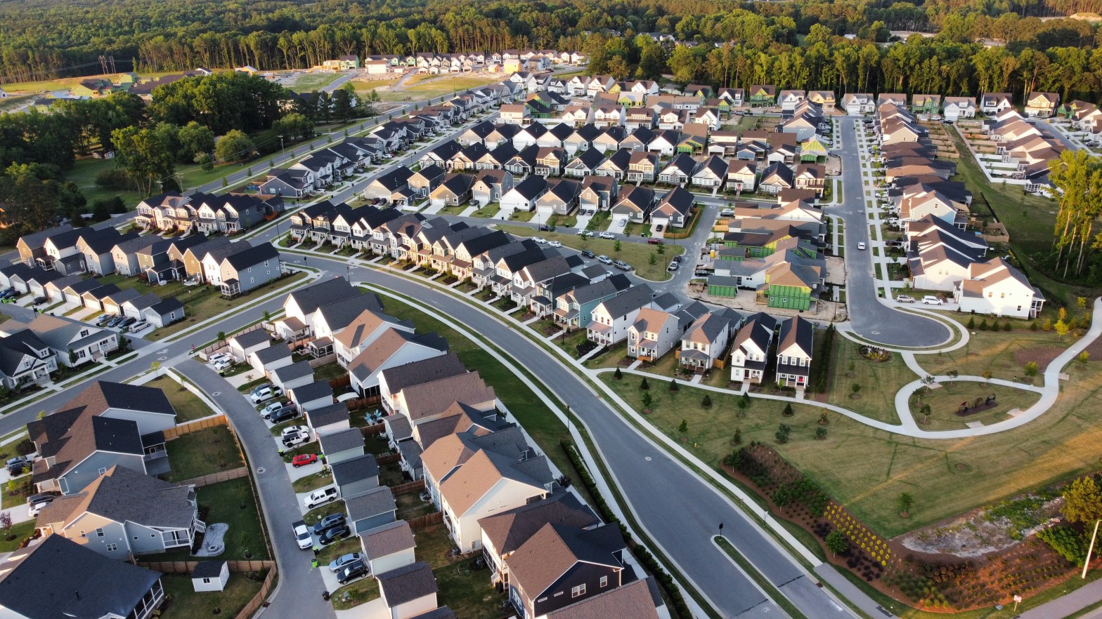
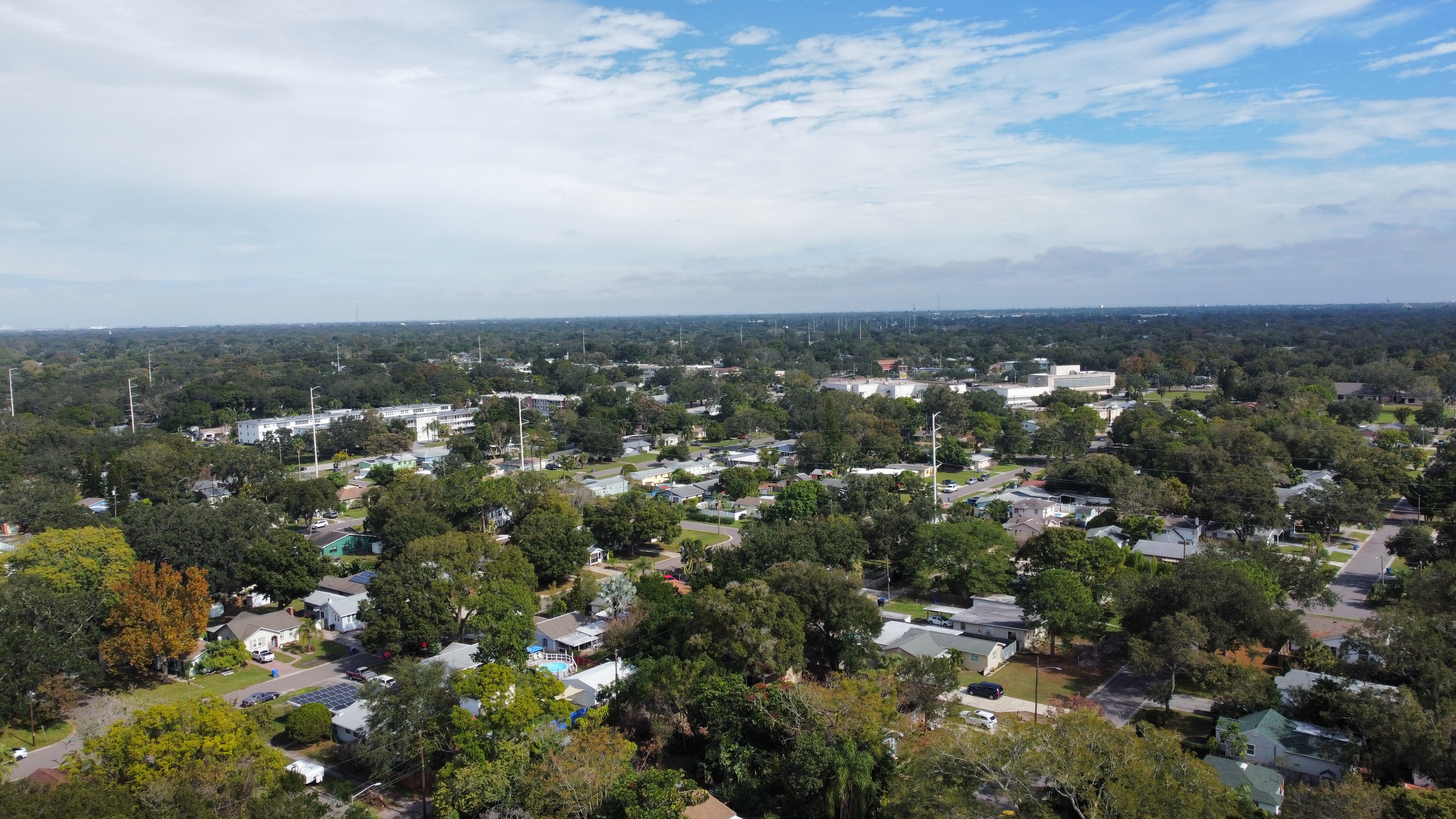
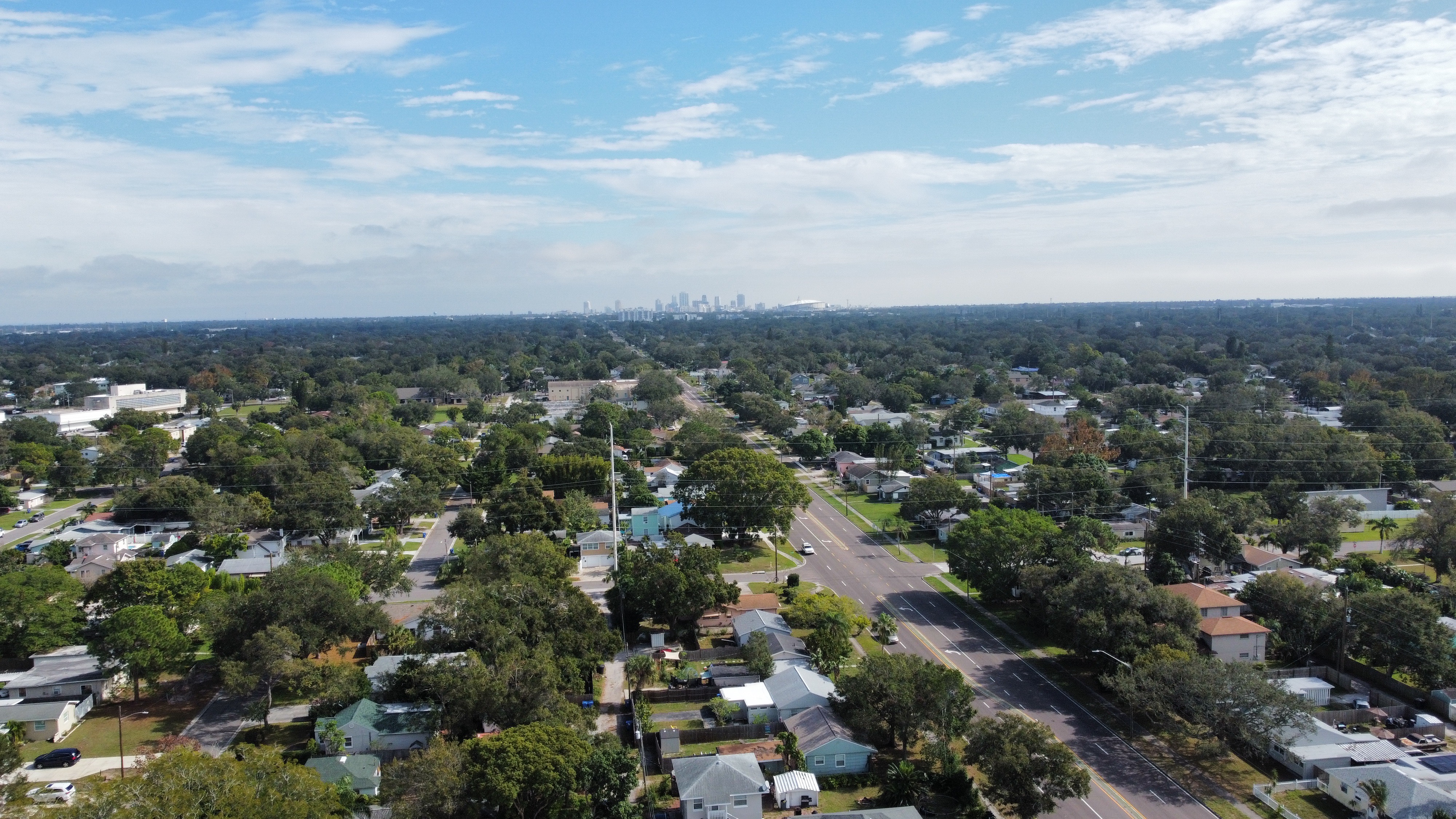
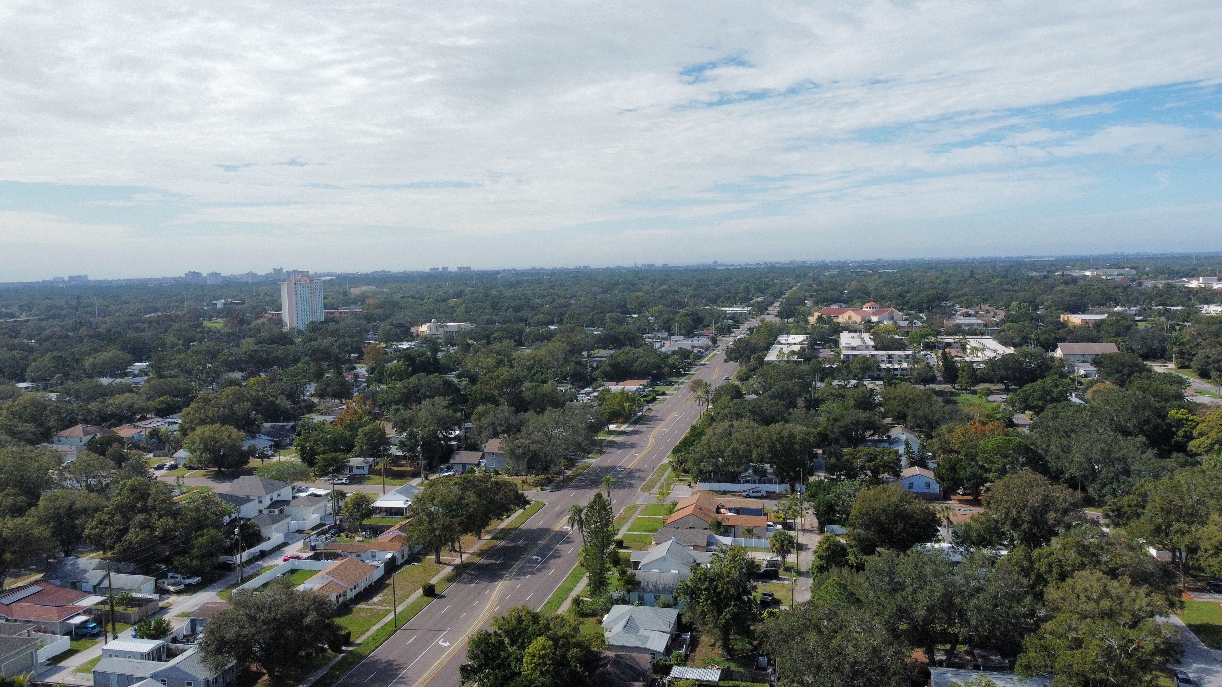
Currently, I-20 slices through some of the most densely populated residential areas East and West of Atlanta. Numerous Black communities – especially West of Downtown were severed from each other after it’s construction.

Why not just remove it?

Highway removal 100% would be the best option here. But, in most situations is a non-starter with officials. In this case, it would actually prove more difficult to remove due to all of the streets being above the current interstate. However, as this is just a dream idea – any formal analysis would certainly consider the possibility. The goal here is to start a conversation. I’d love to hear input and ideas from everyone.

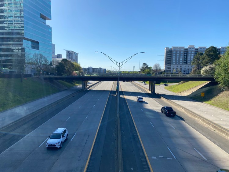
From the Downtown Connector out toward Maynard Terrace, I-20 sits below grade from most of the cross streets. Unfortunately West of Downtown, most of the intersecting roads are under the interstate so it will be harder to work out a plan for that. There’s also a high concentration of on and off ramps within a short distance leading to increased weaving, congestion, and driver confusion.

GoogleEarth

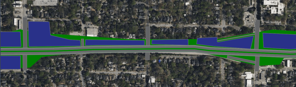
Using the sub grade to our advantage a series of bridges to create a cap structure over the highway is feasible.

Capping the interstate between Capital Ave and Maynard Terrace would include:

  • Over a dozen new connections that do not exist today to reconnect East Atlanta neighborhoods
  • Elimination of four sets of on / off ramps to reduce weaving and confusion along the main line
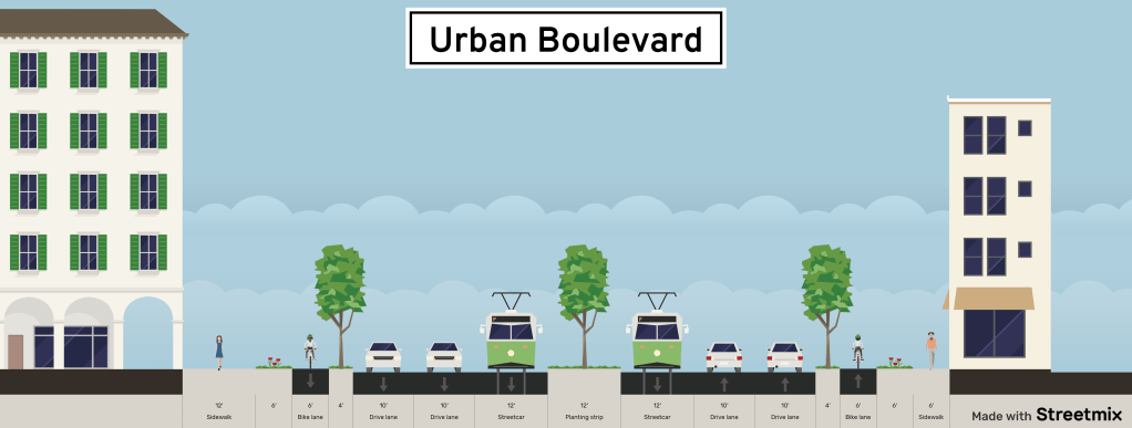
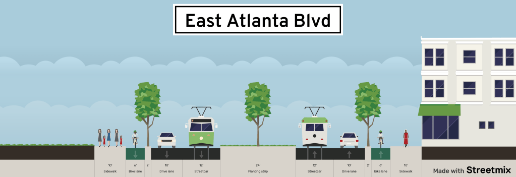
  • A new urban boulevard serving as the heart of East Atlanta
  • Dedicated bike facilities linking from Downtown to Maynard Terrace
  • Potential for Streetcar or BRT service along the Boulevard
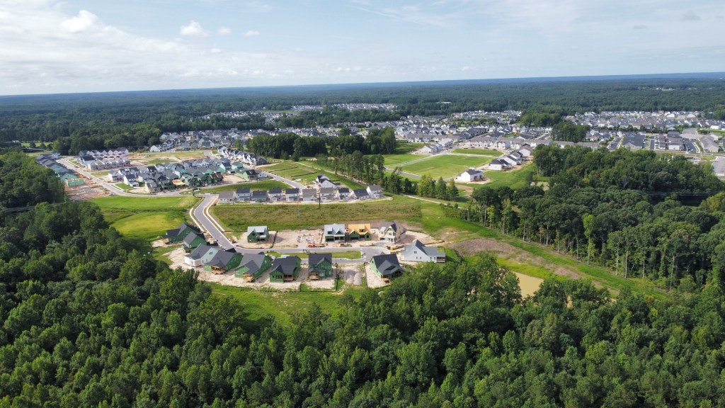
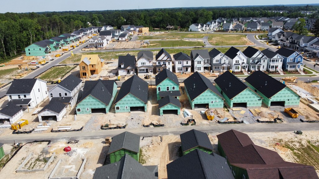
  • Over 100 acres of reclaimed development land for dense housing, and mixed-use development leading to increased affordable housing options
  • Ample opportunity for new greenspace

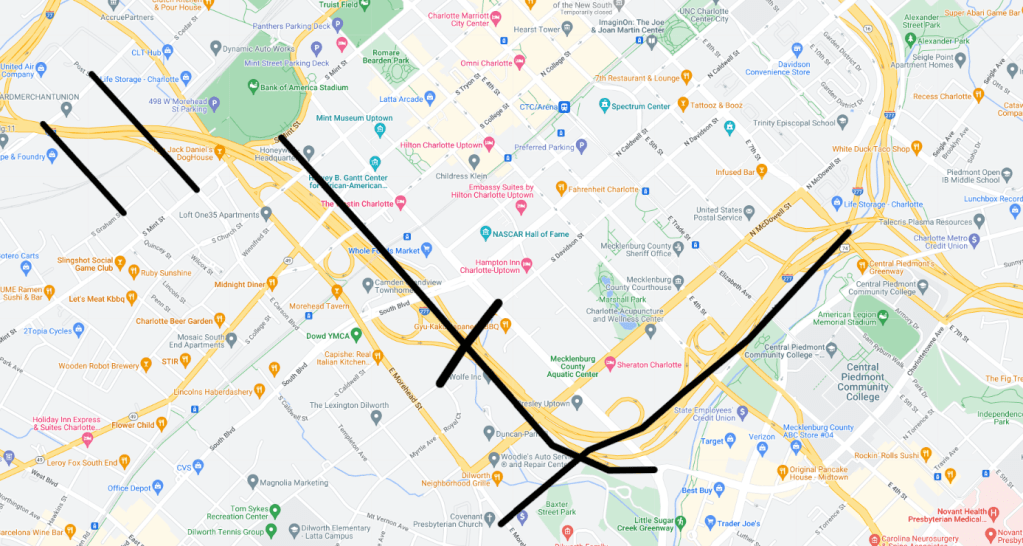
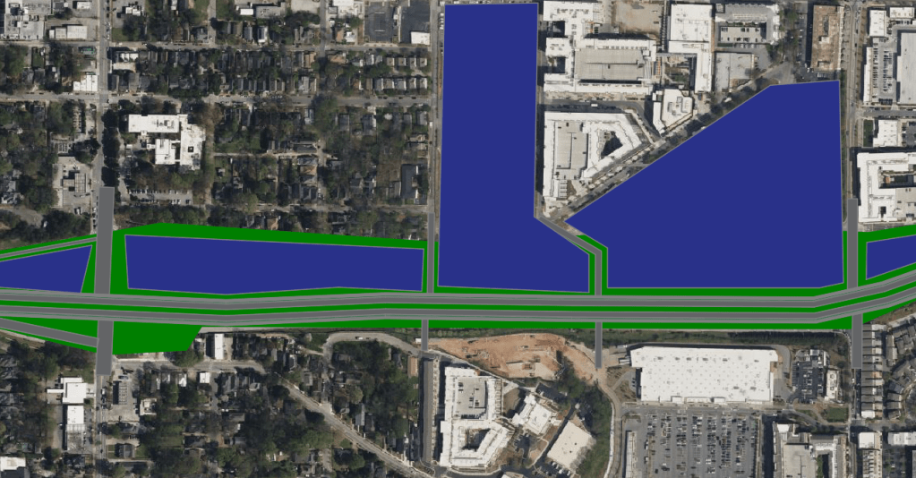
Segment 1: Capital Ave to Hill St

Segment 1 would serve as the transition point. New ramps would be constructed to / from I-20 up to the new Boulevard while the interstate continues below. At the intersection with Martin St is where the Boulevard would formally begin with development opportunity in the Northeast Quadrant.

Segment 1

Segment 2: Hill St to Boulevard

Segment 2 would stretch from Hill St to Boulevard. The Hill St interchange would be eliminated. The interchange would no longer be needed due to the enhanced access the new East Atlanta Boulevard would bring. West facing ramps going down to the capped highway at Boulevard would be provided for access toward the Downtown Connector. Residential development zones would straddle the reclaimed land on the North side of East Atlanta Boulevard with larger mixed use opportunities at the corners.

Segment 2

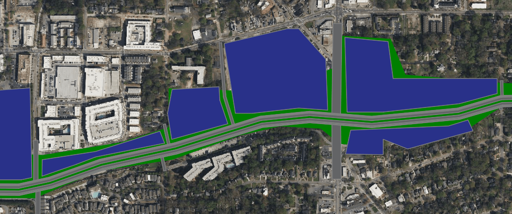
Segment 3: Boulevard to Bill Kennedy Way

Segment 3 is perhaps where the most development and connectivity opportunity is found and where the Atlanta Beltline would intersect East Atlanta Boulevard. The elimination of the East facing Boulevard ramps and Bill Kennedy Way ramps would be eliminated to maximize the urban feel. The Glenwood Place Kroger should also be reoriented to face East Atlanta Boulevard and it’s surface lots redeveloped to maximize density.

Segment 3

Segment 4: Bill Kennedy Way to Moreland Ave

Segment 4 sees a large opportunity for development with the land reclaimed from the Moreland Ave interchange as well as the addition of several new neighborhood connections.

Segment 4

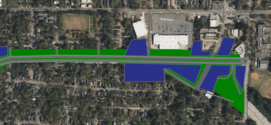
Segment 5: Moreland Ave to Maynard Terrace

Segment 5 stretches Eastward to Maynard Terrace and Clifton St where there would be a modified interchange to facilitate users to and from I-20 below. It also presents several greenspace and development opportunities to maximize the urban density.

Segment 5

Challenges and Benefits

Challenges:

  • While all the existing bridges have sufficient clearance there may be areas in between that do not, which would drive the price up
  • Cost
  • Department approval: Could be a tough sell to get all parties on board

Benefits:

  • A thriving focal point for East Atlanta
  • Opportunities to integrate transit into a densely populated neighborhood
  • Countless new connections that have been severed since the 1960’s
  • Opportunity to add 1000s of new residents less than three miles from Downtown creating a dense, non car dependent neighborhood
  • Reduced pollution, emissions, noise resulting in better health for the area
  • Opportunity to add much needed affordable housing close to Downtown and Transit
GoogleEarth

This project would truly reconnect and set up East Atlanta for the future and fits the bill perfectly for what the Reconnecting Communities initiative is meant to do. It must be done with equity as the centerpiece though.

Love the idea? Hate it? Suggestions to make it better? The goal is to start a conversation and to create better cities for our future. I’d love to hear from everyone.

Coming soon, I’ll explore something similar for I-20 West of Downtown Atlanta. Stay tuned!

Opinions and insights are my own and are not representative of my employer or any organization. Any ideas displayed on this site are purely that – just ideas to help improve the future of the built environment.

August 2022 Wendell Falls Drone Construction Tour

While home sales may be returning to a normal pace, the Wendell Falls construction boom is still going strong!

Treelight Square Dining District

Work is largely complete on the exteriors of the first group of buildings (Phase 1A). Crews have been busy working on the interior of the Smiling Turtle Dentistry and have finally started making progress on Don Beto’s and Falls Local.

Phase 1B continues it’s vertical build but we have not learned of any new tenants as of late. The latest site plan courtesy of CBRE follows.

https://www.cbre.com/resources/fileassets/US-SMPL-64740/fc5a66bd/16189788-cb55-4381-bdab-6e07a128e0b9.pdf

Construction still hasn’t started on the Treelight Office Building so that Q4 2022 delivery date will likely be late 2023 at the earliest. We’ve not had any word on tenants for that building which is likely why they’ve not broken ground.

As for the Treelight Square outparcels, nothing new has been announced, but the lot on the corner of Taylor Rd and Wendell Falls Pkwy is under contract as well as the Senior Apartments lot adjacent to Publix.

https://www.cbre.com/resources/fileassets/US-SMPL-36015/5ffb99f2/7cc7d94c-ee56-401f-b884-a90a4015b2c6.pdf

Dental Care of Wendell Falls

Now open!

AFC Urgent Care

Work is wrapping up on the exterior. The selection of finishes and materials goes to show further proof that the architectural requirements of all businesses in Wendell Falls is far above standard.

Starbucks building and Bojangles

Framing and site work on the Starbucks plaza is moving along at a rapid pace. The building will contain a drive-thru Starbucks, Jersey Mike’s Subs, and a tenant to be annoucned.

Bojangles grading and site prep is nearing completion.

Wendy’s

Wendy’s continues to progress and is nearly complete.

The Collective

Grading on the Lifestyle District is complete. Roadway infrastructure is being implemented now and we should see paving soon. Unfortunately it appears that there are no tenant agreements yet.

Per the developer, The Collective Lifestyle District will consist of a mixed-use district which could include apartments, large scale shopping, dining, and entertainment. https://www.wendellfalls.com/whats-happening/blog/posts-by-date/2022/march/whats-new-at-wendell-falls/.

There’s also some plots of land that are not affiliated with Wendell Falls for sale adjacent to the Collective but are priced way above market value.

Zillow.com

Adjacent to the Lifestyle District will be Wake Med. Still no word when work may begin.

Behind there will be the Collective Office District where grading is underway where paving should also take place soon.

And finally, Phase 10 have completed grading. The only thing before we see houses start is pavement. Phase 11 has started clearing. This will include roughly 500 residential lots as well as a new pool. It’s important to note that there will be no connection between Phase 9 and 10/11 so travel on Wendell Falls Pkwy will be necessary. My hope is that a trail along the sewer easement is at least constructed. There are also no plans at this time for any of the land between the two parts of Wendell Falls to be developed but one of the 24 acre plots just went under contract.

Even further out, toward and even past Knightdale-Eagle Rock Rd, will be another two future Residential phases and even perhaps some industrial on the NW side of Knightdale-Eagle Rock.

Neuse River Vet and Martin Pond Apartments / Outparcels

Nuese River Vet’s site should be going vertical soon.

The Richardson Apartment and Townhome section has been fully graded and infrastructure work is well underway.

The other three outparcels have been graded and one is under contract. I’m hoping for a Dairy Queen but we shall soon see.

https://www.cbre.com/resources/fileassets/US-SMPL-36015/5ffb99f2/7cc7d94c-ee56-401f-b884-a90a4015b2c6.pdf

Residential Phases
Work continues on scores of homes in Phases 9A, 9B, and 12.

Phases 8A and B recently received their final layer of pavement and an RRFB (first in Wendell I believe) was installed in front of Cardinal. Hopefully that is just the first of many pedestrian and bike accommodations to come. Again what stands out to me are the ridiculously wide travel lanes for a 25 mph residential street. Striping these roads to include bike / golf cart lanes would go a long way in keeping speeds down and enhancing safety. I explored that idea in depth late last year here.

Wendell Falls Bike Lanes and Street Calming

Elsewhere, still no movement on the tunnel path, a 4-way stop was installed at Big Falls Drive and Liberty Star.

As always be sure to check out https://philveasley.com/wendell/wendellfalls/ for an up to date view of confirmed and rumored tenant locations.

Illustrative graphics courtesy of CBRE. Drone photography is for recreational purposes only. Views and insights are mine and not representative of my employer or any organization.

Transforming Camden Rd into a People Centered Space

The South End of Charlotte continues to boom with development and has become one of the go-to destinations in the Southeast. From the Rail-Trail, adaptive reuse developments, luxury apartments and more there’s something for everyone to enjoy.

Camden Road parallels the CATS Blue Line from Tryon Street to Tremont Road. It’s a two lane corridor with standard sidewalks and becomes chocked with vehicular traffic during evenings and weekends.

Closing Camden Road to vehicular traffic and reclaiming the space for an enhanced Rail Trail and public plazas would go a long way. While there are a few access driveways to some of the developments, all of them have their primary access points on the side roads. Explore the interactive GoogleMap here.

Google MyMaps

Between Tryon Street and Park Ave will be transformed into a public plaza featuring outdoor gathering spaces, seating and more.

South of Park Ave, Camden Ave will become the signature section of the Rail Trail. This section of Camden Ave is lined with shops and restaurants who would enjoy trail frontage with increased outdoor seating and visibility similar to the Atlanta Beltline.

It’s time to prioritize places for people instead of just vehicles. Camden Rd is the perfect place to start.

Opinions and insights are my own and are not representative of my employer or any organization.

MARTA Fantasy Map

Everyone from Planners, Engineers, to everyday citizens with interests in Atlanta have probably made a MARTA fantasy map. Here I’ve tried to strike a balance between realistic and serving the needs of all potential users.

To view the interactive GoogleMap click here. Keep reading for some light analysis on the plan.

https://www.google.com/maps/d/viewer?mid=1mPRsE4cjRBbsXSMf7FeghMieDSn1-oU&ll=33.77219604802186%2C-84.39792564999999&z=11

Building from the center

While Atlanta has several distinct urban cores, I tried to ensure Downtown remained the focus of the system. Downtown Atlanta is on the cusp on a renaissance in my opinion so having most of the lines lead there in some way is imperative.

Rail Line Extensions

https://www.google.com/maps/d/viewer?mid=1mPRsE4cjRBbsXSMf7FeghMieDSn1-oU&ll=33.77219604802186%2C-84.39792564999999&z=11

Extensions of the existing lines as well as three new lines to hit the major employer and civic destinations. This would add over 50 stations and roughly 75 miles of track to create a world class system.

Light Rail / StreetCars

While the current StreetCar system may be seen as a bust, I still believe there is reason to expand it. Lines along portions of the Beltline, West End to Buckhead, Bankhead to Ponce and the Eastside Circulator would allow for everyday hop on / hop off access to many of Atlanta’s prime destinations.

https://www.google.com/maps/d/viewer?mid=1mPRsE4cjRBbsXSMf7FeghMieDSn1-oU&ll=33.77219604802186%2C-84.39792564999999&z=11

In-Line Express BRT

https://www.google.com/maps/d/edit?mid=1mPRsE4cjRBbsXSMf7FeghMieDSn1-oU&ll=33.810179794267555%2C-84.3346385157835&z=11

These lines would utilize the Express Lanes with in-line median stations with Park and Ride facilities.

BRT

https://www.google.com/maps/d/edit?mid=1mPRsE4cjRBbsXSMf7FeghMieDSn1-oU&ll=33.810179794267555%2C-84.3346385157835&z=11

BRT lines serving some of the regions busiest arterial corridors. All BRT lines would offer direct transfer opportunities to the rail corridors.

Opinions and insights are my own and are not representative of my employer or any organization.

Reconnecting Charlotte

Charlotte is one of my favorite cities to visit. From the immaculate skyline, booming South End District, sports teams, decent transit and bike infrastructure, and more – it’s the perfect weekend getaway and change of pace from Raleigh.

GoogleMaps

The transportation makeup of Charlotte is similar to most mid / large sized cities. There’s I-77 traveling North to South and I-85 traveling West to Northeast. There’s a large 70 mile outer loop that was completed in the past decade. More impactful however is the I-277 five mile inner ring that completely chokes off Uptown Charlotte (for those who aren’t familiar with Charlotte, Uptown is “Downtown”).

The Southern segment of I-277 separates Uptown and the South End. Uptown is the main business district featuring banking towers, sport facilities, parks and more. The South End is more of the trendy area featuring breweries, restaurants, adaptive reuse warehouses, shopping, and dining along the Blue Line light rail and trail.

While both segments of Charlotte are booming in their own way, there’s a couple of blocks of dead zone where I-277 plows through at the width of a full city block.

What if we were able to reclaim that space?

GoogleEarth

For years, various plans have floated around to Cap I-277 for this roughly 1/2 mile segment. There’s also a interim solution to extend the rail trail over I-277 to help bridge the gap as well. https://charlottenc.gov/Projects/Pages/RailTrailBridge.aspx

While these are great solutions that could go a long way, I believe Charlotte can and should aim higher. Various cities throughout the world have embarked on ambitious plans to remove disruptive urban freeways to reconnect communities. The federal government has also reserved funds to facilitate urban freeway removal. https://www.nytimes.com/interactive/2021/05/27/climate/us-cities-highway-removal.html

Removing the Southern and Eastern segments of I-277 would allow for a seamless transition between Uptown and South End as well as Uptown and the Medical District.

GoogleEarth

But where would the traffic go? Currently the South and East segments carry between 60,000 and 100,000 vehicles per day on average. Unlike some freeway removals, there is a parallel alternative with the Northern segment of I-277 that wouldn’t add much distance at all.

GoogleEarth

There are a few approaches cities have taken once they’ve removed freeways.

Urban Boulevard

StreetMix

Urban Boulevards are a great way to incorporate all modes of travel in Downtown environments. While the Freeway takes approximately 400′ of Right of Way, an urban Boulevard could accommodate everyone in less than 150′ and still leave room for new buildings.

Greenspace

Charlotte is lacking Downtown Greenspace. While Bearden and First Ward Parks are gems, growing cities can never have too much greenspace. Converting the South segment footprint into an urban linear park would allow for upwards of 100 acres of new park space. with a similar feel as the Washington DC mall. It would also connect to Elizabeth Park and the Little Sugar Creek Greenway System.

GoogleEarth

Grid Extension

Another option would be to extend the grid system seamlessly into the surrounding neighborhoods.

Google MyMaps

#Make277ARiver

Because why not?! Head over to this hashtag on Twitter for some more great ideas.

Opinions and insights are my own and are not representative of my employer or any organization.

Cycle Audit Part 1- Anderson Point Park to Downtown Raleigh

Back in May, the City of Raleigh had their annual Bike to Work Day. Unfortunately, I live a bit far out and do not have access to safe bike facilities. I was however able to drive about halfway to Anderson Point Park and bike in from there.

Since then, I’ve gone on several other rides in the Raleigh area. This has led me to begin a new series where I’ll examine the conditions and ease of biking in the area.

Segment 1: Crabtree Creek Greenway from Anderson Point Park to Millburnie Road

Crabtree Creek Greenway follows Crabtree Creek pretty closely. This section of the greenway was constructed a few years ago and provides a connection between Knightdale and Raleigh. While this is good for scenic views and shade, it does cause a lot of twists and turns. There are no grade crossings along the corridor with some tunnel crossings of the major roads.

Unfortunately, there are no other access points with the intersections roads, or trail fronting developments yet rendering this greenway as purely a recreational facility.

GoogleMaps

If we are to transition to trails being seen as vital transportation links instead of just recreational facilities, we must provide links to existing road crossings. Access points at S Rodgers Ln, New Hope Rd, Holston Ln, Calumet Dr, and New Bern Ave would go a long way in inviting additional trail users.

Additional on-street facilities on either Poole Rd, or New Bern Ave to provide a direct East-West corridor will also help facilitate more ridership.

Although closely following the creek, opportunities for infill along the trail should be analyzed. Much like transit, we need to ensure as much density as possible is placed along bikeways.

With the future BRT line and trail coming to New Bern, a direct connection from Crabtree Creek Greenway to New Bern Ave should be constructed.

Segment 2: On-Street to Downtown

The 2nd half of my journey included on-street travel as the greenway continued along the creek.

Milburnie Road contains a striped bike lane in each direction. The AADT is around 4,000 so it wasn’t too uncomfortable. There was however lots of debris and a few parked cars in the bike lane.

A couple of the intersections contained some traffic calming elements, but I must say it was a bit weird being forced into a shared lane just for 100 feet.

One of the major crossings came at Raleigh Blvd. While there were cars there to trigger the light when I crossed, bike detection so a rider does not need to get off and press the button would help.

Continuing onto Oakwood Ave was a shared lane condition but with the low volumes was pretty stress free.

Downtown, East and Bloodworth streets have shared lane conditions with also rather low volumes. Both of these streets are pretty low volume and have rather wide widths so in the future a one-way protected bike lane on each – similar to West and Harrington would increase safety and ridership.

Main Takeaways

  • E-Bikes are the future
  • Overall, it was a pretty easy and safe feeling ride
  • The New Bern BRT multi-use trail will be a game-changer for the area
  • Greenways are great but when following creeks, may be seen as inefficient for travel due to curves
  • Treat zoning around trails similar to zoning around Transit
  • Intersections need attention. While many of the roads themselves are quiet, the intersections can feel unsafe. Bike detection at signals will help.

Opinions and insights are my own and are not representative of my employer or any organization.

Things Wendell Must Get Right to Avoid Becoming “Just Another Suburb”

It’s no secret that the Town of Wendell is booming. It’s location just East of the City of Raleigh, lower housing costs than Raleigh and Cary, direct interstate access, good schools, great community and more have catapulted Wendell to being the fastest growing municipality in the area.

Realizing this, the Town put together a 2030 Blueprint Plan to help guide development. Please be sure to check it out here: https://www.blueprintwendell2030.com/ The plan strives to strike a balance of mixed-use nodes while maintaining greenspace. While the plan provides the framework for the next decade, there are five specific things in my eyes that are imperative to keeping Wendell from becoming a typical car-choked, traffic filled suburb.

Make the Most of the Downtown Core

I believe that Downtown Wendell has the best bones of any suburban Downtown in Raleigh. We have a classic Main Street lined with shops and restaurants, but without the traffic. In most other area towns, the Main Street carries the actual main route and is filled with traffic. Wendell’s Downtown also has a few solid blocks of classic early 20th century shop fronts which have done pretty well the past few years which is something else that really sets us apart.

Also working in Wendell’s favor are the multiple warehouses that could be converted to additional shops, restaurants, lofts, food halls, etc, the possibilities are ENDLESS and could transform Downtown Wendell in to a true gem and destination. While this may not sound ideal to some people, the additional foot traffic would do wonders for our local businesses and could bring people in from far and near.

To further build upon the client-base, underutilized Downtown parcels should be transformed into a mix of housing types. Currently there are three Townhome developments planned or under construction for a total of 30 units. We must continue on that path by allowing for a mix of dense housing types such as Apartment blocks within our core. Once again, the possibilities are endless and will set us apart from any other Wake County Downtown.

The Town will be conducting a Downtown Plan soon which like the Blueprint Plan will help guide development.

Connectivity

Wendell published a Transportation plan in 2016 and a Pedestrian Plan in 2017 which both can be viewed here https://www.townofwendell.com/departments/planning/transportation.

Those plans contain a multitude of roadway and infrastructure improvements. More importantly though, Wendell has an innovative Golf Cart program where residents are able to ditch the car on non-state routes for neighborhood trips.

Contrary to the beliefs of many, continued development will only help our traffic problems. As each development commences, that’s more opportunity for commercial development to take place which means less driving. Each development must also construct their portion of new connections that are in the Transportation Plan.

While there are a few intersections that need immediate attention, large scale road widening is not necessary for Wendell to thrive. The only road widening necessary in my view is Wendell Falls Pkwy from Martin Pond Rd to Jake May Drive where the future Wendell circulator will be.

Instead focus should be on connectivity in forms of multi-use paths, ensuring Go Triangle expands bus access, ensuring there are no golf-cart dead zones, and facilitating mixed-use nodes where residents are not forced to leave for basic needs.

Currently there are two areas where residents commonly use golf carts – Wendell Falls and Downtown Wendell. Due to state regulations, golf carts are not allowed on Wendell Falls Pkwy, thus there is no way to get between the two in anything other than a car. It is imperative to ensure that a system of pathways is implemented to facilitate golf cart travel between Wendell Falls, Downtown Wendell, and the Wake Tech district. Greenways are planned but may only facilitate bike and ped movements.

Mixed-Use

Despite the beliefs of many, Dense Mixed-Use development is the only way to save Wendell from becoming a typical car-choked traffic filled suburb. While the Wendell Blueprint plan lays the framework for that, it must be followed when analyzing future developments.

This will allow area residents to not have to travel by car for every need, and more importantly add a diversity of housing types and increase affordability. As gas prices continue to rise, housing prices continue to rise, and as society becomes more climate aware, more and more people want to live the lifestyle of not needing a car for every trip.

Do Everything Possible to Attract Business

One of the main complaints in recent Public Hearings was that Wendell has no good jobs. While that is true, town officials can not just snap their fingers and bring jobs. There are things that can be done though such as offering incentives, having the infrastructure such as a dedicated Business Park in place, and having the households, infrastructure, and commercial activity in place to sustain the needs of larger businesses.

Wendell is just getting to the point where you could consider that the households and commercial activity is in place. There is a dedicated space within Wendell Falls for a corporate HQ and an Innovation District planned in the Blueprint Plan. The addition of Wake Tech and the build up of the surrounding area should help land Wendell the jobs it hopes for.

Do Not Cave to the Anti-Density Crowd

Perhaps the worst thing Wendell could do is caving to the anti-density crowd. If we do that, we will end up with a bunch of low-mid density residential sprawl where everyone sits in traffic daily to go to work, go shop and more. While they may present compelling cases, they are usually built on fear of change more than anything. Unfortunately they are usually the vocal minority and can inflict a great deal of pressure on town officials.

Wendell only gets one chance to build itself toward a sustainable, livable future where people from all walks of life can live, work, play, and thrive.

For more information on what’s coming to the Wendell Falls, ideas to make Wendell Falls a better place, information about Wendell and more please visit https://philveasley.com/wendell/ and www.townofwendell.com.

Opinions and insights are my own and are not representative of my employer or any organization.

Breaking Down the Wendell Falls PUD

The 1200 acres that make up Wendell Falls have been on the Town’s docket since 2006. The initial developer unfortunately went bankrupt during the Great Recession and the land sat idle until NASH acquired the rights to the land and PUD (Planned Unit Development) in 2013. To view the full document visit https://nmcdn.io/e186d21f8c7946a19faed23c3da2f0da/3834b95a93b14b3689a528c1f97c5d69/files/files/Wendell_Falls/2015.11.09_Final_Merged_PUD_As_Approved_.pdf and the 2018 update https://nmcdn.io/e186d21f8c7946a19faed23c3da2f0da/3834b95a93b14b3689a528c1f97c5d69/files/departments/planning/development/wendell-falls-project/2018.07.20_PUD_DOC_FINAL_Assembled_In_Full_.pdf

A PUD in the eyes of Wendell is a singular development containing more than 200 acres.

Many times when new components of Wendell Falls are announced, particularly apartments and non-small business retail are announced there are complaints among residents who felt as though only single family housing and small businesses were in store. This is far from the case.

As stated in the PUD, Wendell falls is slated for up to:

  • 4000 total housing units
  • 2,000,000 square feet of commercial
  • Maximum density of 3.43 units per acre
  • Minimum open space of 273 acres
  • Maximum 1200 apartments and 750 townhomes – Updated in 2018 from 1400 townhomes / apartments combined

It is important to note that the density and open space figures account for the project in total and some some areas will be denser than others. Even more importantly is that all the Apartment complexes and non-local business were always planned to be just as big a part of Wendell Falls as the Single Family homes. None of the main components of the PUD have changed since it’s inception.

There are five major zoning components of Wendell Falls including:

Regional Mixed Use

Near the interstate, known now as the Collective which will be a major mixed use node featuring large scale stores, restaurants, Wake Med, and an office Park.

Neighborhood Mixed Use

The Treelight Square area featuring Publix and our local dining area.

Residential

Just one component of Wendell Falls is the Single Family Housing / Townhomes. While the 2018 update separated the Townhomes and Apartment values, townhomes are for sale while apartments are for rent and the townhomes are within the residential sections. This was a wise move by the town to add a bit more flexibility in the housing diversity.

Old Value: 1400 Townhomes and Apartments

New Value: 1200 Apartments 750 Townhomes

Here is a list of full 2018 changes

https://nmcdn.io/e186d21f8c7946a19faed23c3da2f0da/3834b95a93b14b3689a528c1f97c5d69/files/departments/planning/development/wendell-falls-project/2018.07.20_PUD_DOC_FINAL_Assembled_In_Full_.pdf

Recreational

The area around the Farmhouse and the future amenity area of Phase 10.

Flex

The areas adjacent to The Collective are to follow business needs and trends of Eastern Wake County.

https://nmcdn.io/e186d21f8c7946a19faed23c3da2f0da/3834b95a93b14b3689a528c1f97c5d69/files/files/Wendell_Falls/2015.11.09_Final_Merged_PUD_As_Approved_.pdf Page 36

For the most part, the Zone map has been followed with the exception of the exclusion of the Neighborhood Business area at the intersection of Daniel Ridge and Wendell Falls Pkwy. The Neighborhood Business area in what is now being dubbed Phase 10 has also been altered somewhat.

For a full matrix of specific allowable uses in each zone please view pages 5 thru 8 of the PUD.

The document goes on to pour through the nitty-gritty of road widths, lot layouts etc. However, the bottom line remains that Wendell Falls is and has always been planned to be a major mixed-use district of Single Family Homes, Townhomes, Apartments, Small Business, and major business. Wendell Falls is also meant to serve as an economic driver of the entire Eastern Wake community by spurring additional mixed-use, commercial, residential, and cultural developments within the surrounding area. In other words, expect a lot of the surrounding land to end up developed as well as the area transforms to a thriving hub of live-work-play lifestyle.

While the PUD is not something that is set in stone, the close following of it so far should be noted. Also the leasing success of Treelight Square should bode well for the future commercial components.

For more information on what’s coming to the Wendell Falls, ideas to make Wendell Falls a better place, information about Wendell and more please visit https://philveasley.com/wendell/ and www.townofwendell.com.

June 2022 Wendell Falls Drone Construction Tour

The Wendell Falls construction boom is still going strong! For the first time, I used my drone to stop by some of sites under construction.

Treelight Square Dining District

Work is wrapping up on the exterior of the last building group which we recently found out will be Parkside Restaurant. This will be their second location with the first being in Downtown Raleigh.

Interior work has started on The Smiling Turtle Dentist and we should see interior work on Don Beto’s and Falls Local soon.

The parking lot was recently paved and striped and the exterior lights now function at night.

Phase 1B continues it’s vertical build and we know a few more tenants courtesy of CBRE. https://www.cbre.com/resources/fileassets/US-SMPL-64740/c1e18b12/847be4ff-67a3-46d6-81b1-31c1fdc4ebb0.pdf. Romeo’s Pizza will join Envy Nail Spa in Phase 1B as well as a handful of other tenants to be announced soon.

https://www.cbre.com/resources/fileassets/US-SMPL-64740/c1e18b12/847be4ff-67a3-46d6-81b1-31c1fdc4ebb0.pdf

Construction should be start soon on the Treelight Office Building.

Other than the Senior Apartments next to Publix, there have been no announcements on tenants for the other area outparcels.

Heartland Dental

Interior work looks to be wrapping up and we should see a grand opening date soon.

AFC Urgent Care

Framing is complete and exterior finishes will be applied soon.

Starbucks and Bojangles

Grading looks to be complete. Next step will be footers and utilities before we start to see vertical construction.

Dirt has begun to move and this week we should see some grading activities.

Wendy’s

Footers have been dug and utilities are going in. The slab may be poured within the next few days and vertical construction will follow shortly.

The Collective

Grading on the Lifestyle District is complete. Roadway infrastructure is being implemented now. It is still unclear if a developer has agreed to actually build anything here as of yet but if the leasing activity of Treelight Square is any hint, we should have great interest on this land.

Per the developer, The Collective Lifestyle District will consist of a mixed-use district which could include apartments, large scale shopping, dining, and entertainment. https://www.wendellfalls.com/whats-happening/blog/posts-by-date/2022/march/whats-new-at-wendell-falls/.

Adjacent to the Lifestyle District will be Wake Med.

Behind there will be the Collective Office District where grading is underway.

And finally, Phases 10 and 11 are undergoing grading and roadway infrastructure. This will include roughly 500 residential lots as well as a new pool. It’s important to note that there will be no connection between Phase 9 and 10/11 so travel on Wendell Falls Pkwy will be necessary. There are also no plans at this time for any of the land between the two parts of Wendell Falls to be developed.

Even further out, toward and even past Knightdale-Eagle Rock Rd, will be another two future Residential phases. and even perhaps some industrial on the NW side of Knightdale-Eagle Rock.

Neuse River Vet and Martin Pond Apartments / Outparcels

Nuese River Vet’s site is undergoing grading.

The Richardson Apartment and Townhome community on has been graded and we should see actual construction soon. Tenants have not been announced for the other three outparcels.

Residential Phases
Work continues on scores of homes in Phases 9A, 9B, and 12.

Here’s a few other images of the neighborhood as well as a peek of Downtown Raleigh from just above the tree line.

As always be sure to check out https://philveasley.com/wendell/wendellfalls/ for an up to date view of confirmed and rumored tenant locations.