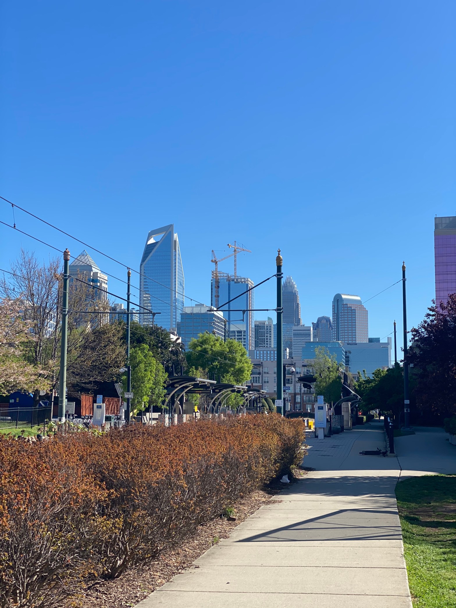
Charlotte is one of my favorite cities to visit. From the immaculate skyline, booming South End District, sports teams, decent transit and bike infrastructure, and more – it’s the perfect weekend getaway and change of pace from Raleigh.
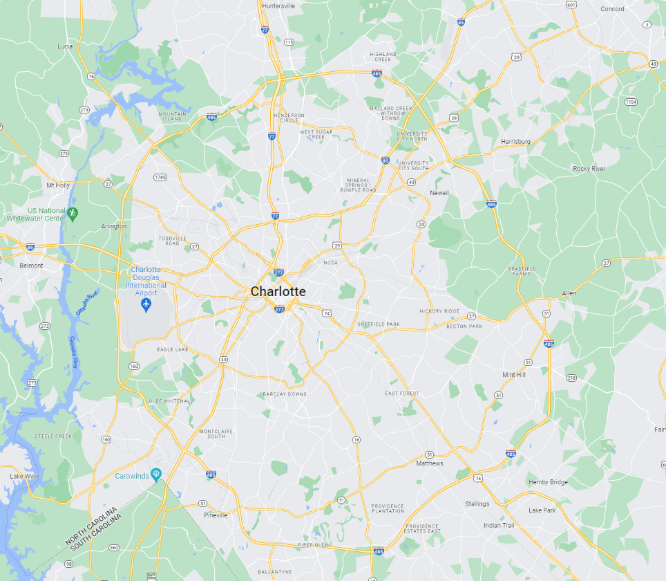
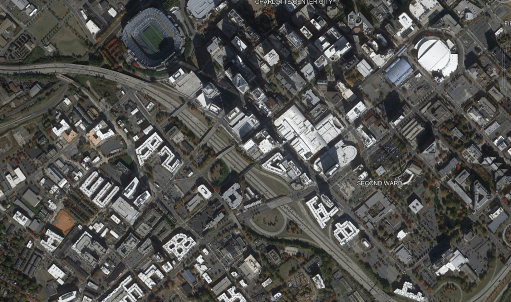
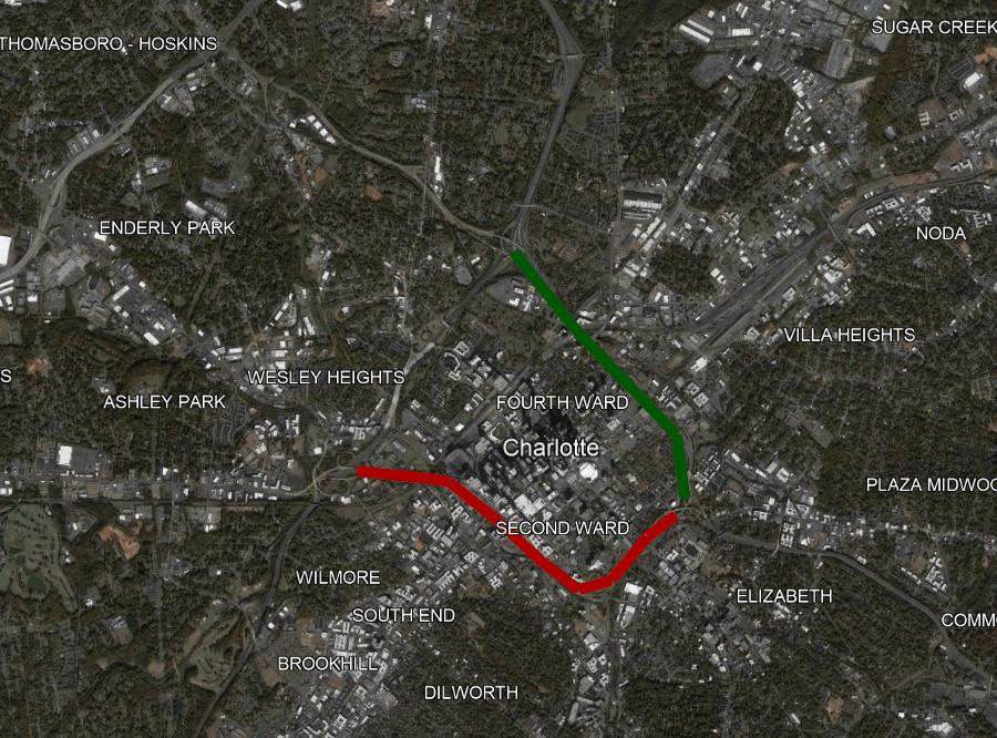
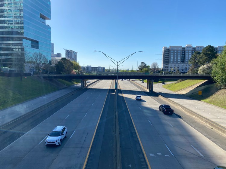
The transportation makeup of Charlotte is similar to most mid / large sized cities. There’s I-77 traveling North to South and I-85 traveling West to Northeast. There’s a large 70 mile outer loop that was completed in the past decade. More impactful however is the I-277 five mile inner ring that completely chokes off Uptown Charlotte (for those who aren’t familiar with Charlotte, Uptown is “Downtown”).
The Southern segment of I-277 separates Uptown and the South End. Uptown is the main business district featuring banking towers, sport facilities, parks and more. The South End is more of the trendy area featuring breweries, restaurants, adaptive reuse warehouses, shopping, and dining along the Blue Line light rail and trail.
While both segments of Charlotte are booming in their own way, there’s a couple of blocks of dead zone where I-277 plows through at the width of a full city block.
What if we were able to reclaim that space?
For years, various plans have floated around to Cap I-277 for this roughly 1/2 mile segment. There’s also a interim solution to extend the rail trail over I-277 to help bridge the gap as well. https://charlottenc.gov/Projects/Pages/RailTrailBridge.aspx
While these are great solutions that could go a long way, I believe Charlotte can and should aim higher. Various cities throughout the world have embarked on ambitious plans to remove disruptive urban freeways to reconnect communities. The federal government has also reserved funds to facilitate urban freeway removal. https://www.nytimes.com/interactive/2021/05/27/climate/us-cities-highway-removal.html
Removing the Southern and Eastern segments of I-277 would allow for a seamless transition between Uptown and South End as well as Uptown and the Medical District.
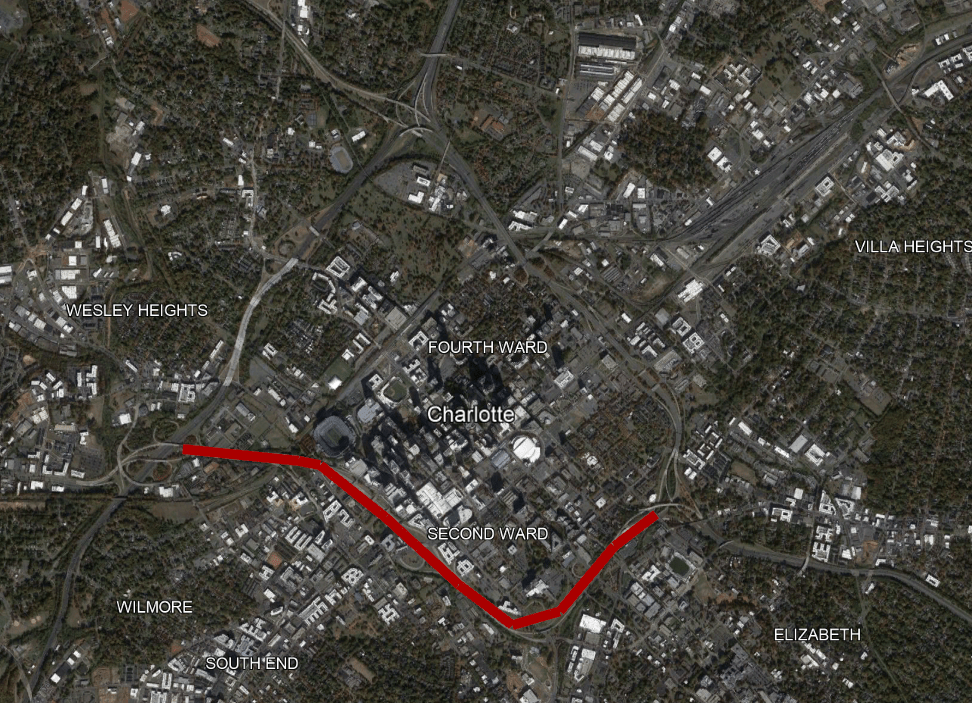
But where would the traffic go? Currently the South and East segments carry between 60,000 and 100,000 vehicles per day on average. Unlike some freeway removals, there is a parallel alternative with the Northern segment of I-277 that wouldn’t add much distance at all.
There are a few approaches cities have taken once they’ve removed freeways.
Urban Boulevard
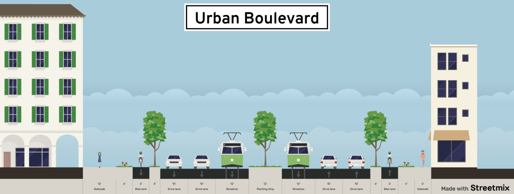
Urban Boulevards are a great way to incorporate all modes of travel in Downtown environments. While the Freeway takes approximately 400′ of Right of Way, an urban Boulevard could accommodate everyone in less than 150′ and still leave room for new buildings.
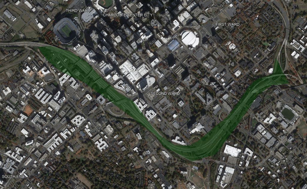
Greenspace
Charlotte is lacking Downtown Greenspace. While Bearden and First Ward Parks are gems, growing cities can never have too much greenspace. Converting the South segment footprint into an urban linear park would allow for upwards of 100 acres of new park space. with a similar feel as the Washington DC mall. It would also connect to Elizabeth Park and the Little Sugar Creek Greenway System.
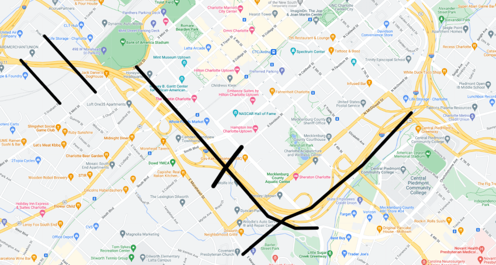
Grid Extension
Another option would be to extend the grid system seamlessly into the surrounding neighborhoods.
#Make277ARiver
Because why not?! Head over to this hashtag on Twitter for some more great ideas.
Opinions and insights are my own and are not representative of my employer or any organization.

if we want to get radical, create a car-free affordable housing district along that line and call it ‘New Brooklyn’. We erased the old Brooklyn neighborhood in much of what is South I-277
LikeLiked by 1 person