Everyone from Planners, Engineers, to everyday citizens with interests in Atlanta have probably made a MARTA fantasy map. Here I’ve tried to strike a balance between realistic and serving the needs of all potential users.
To view the interactive GoogleMap click here. Keep reading for some light analysis on the plan.
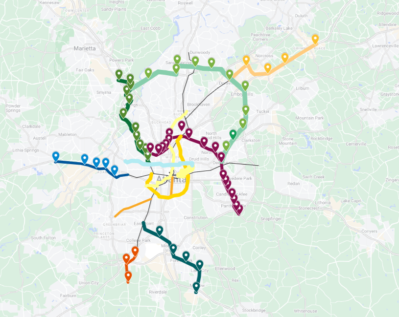
Building from the center
While Atlanta has several distinct urban cores, I tried to ensure Downtown remained the focus of the system. Downtown Atlanta is on the cusp on a renaissance in my opinion so having most of the lines lead there in some way is imperative.
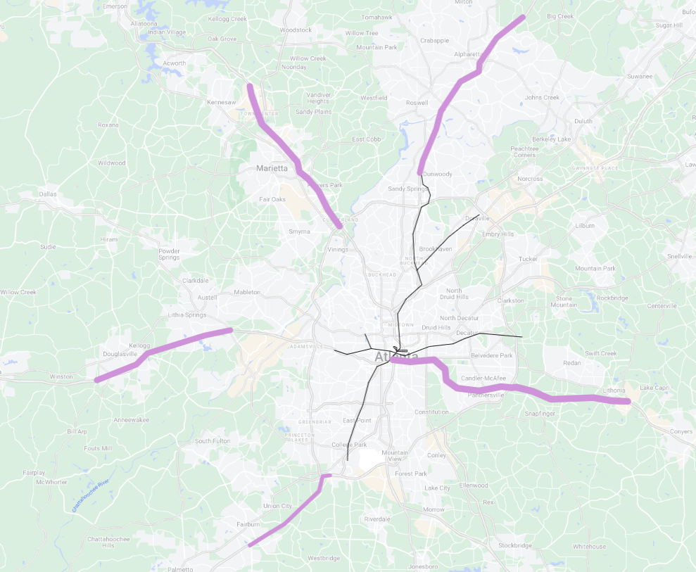
Rail Line Extensions
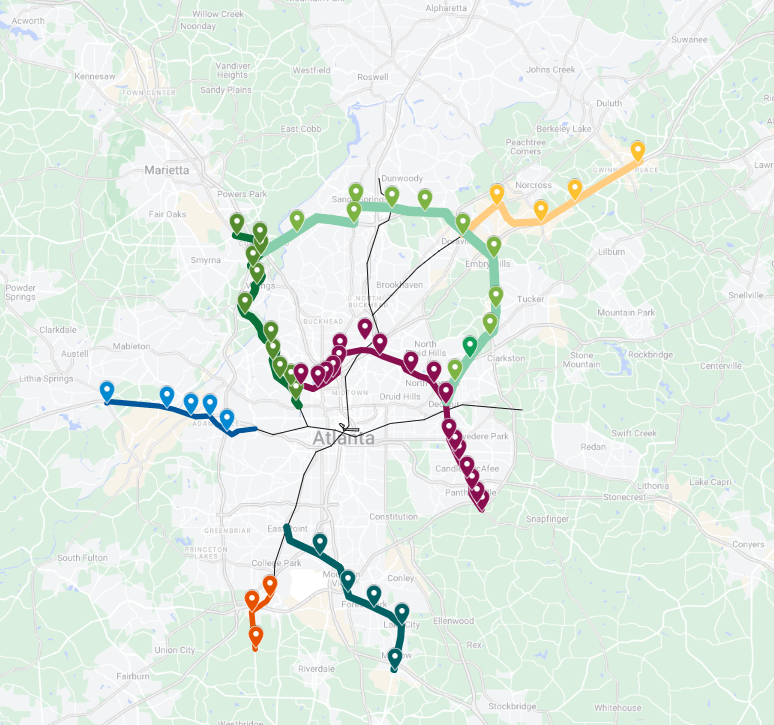
Extensions of the existing lines as well as three new lines to hit the major employer and civic destinations. This would add over 50 stations and roughly 75 miles of track to create a world class system.
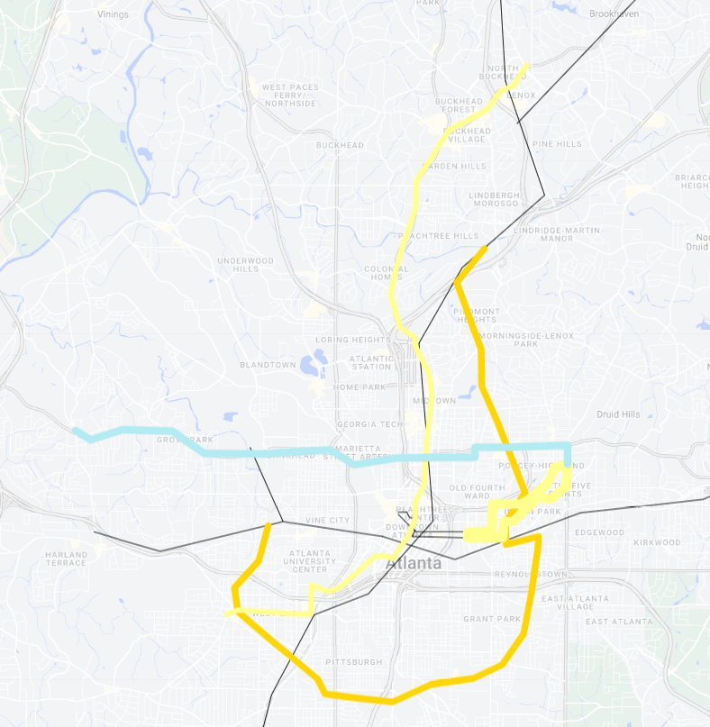
Light Rail / StreetCars
While the current StreetCar system may be seen as a bust, I still believe there is reason to expand it. Lines along portions of the Beltline, West End to Buckhead, Bankhead to Ponce and the Eastside Circulator would allow for everyday hop on / hop off access to many of Atlanta’s prime destinations.
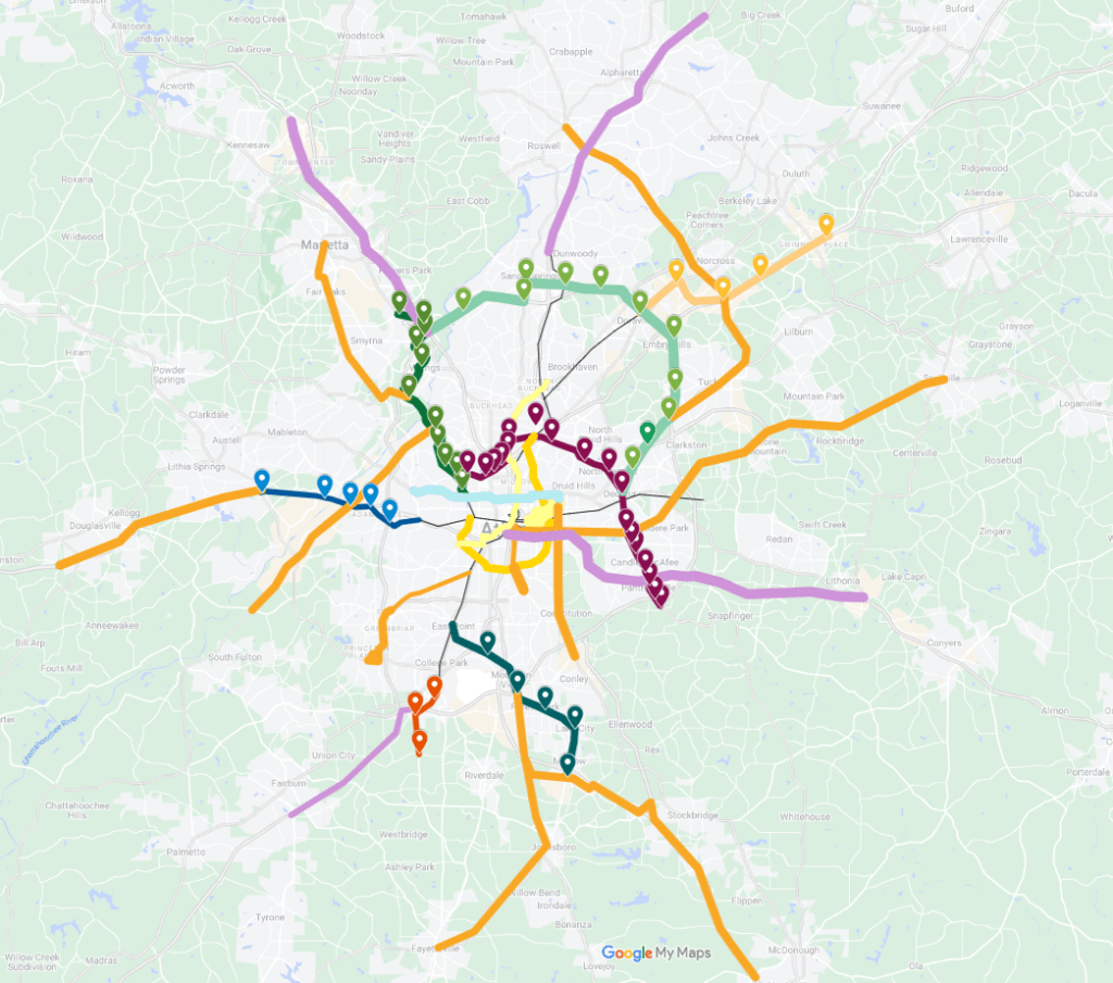
In-Line Express BRT
These lines would utilize the Express Lanes with in-line median stations with Park and Ride facilities.
BRT
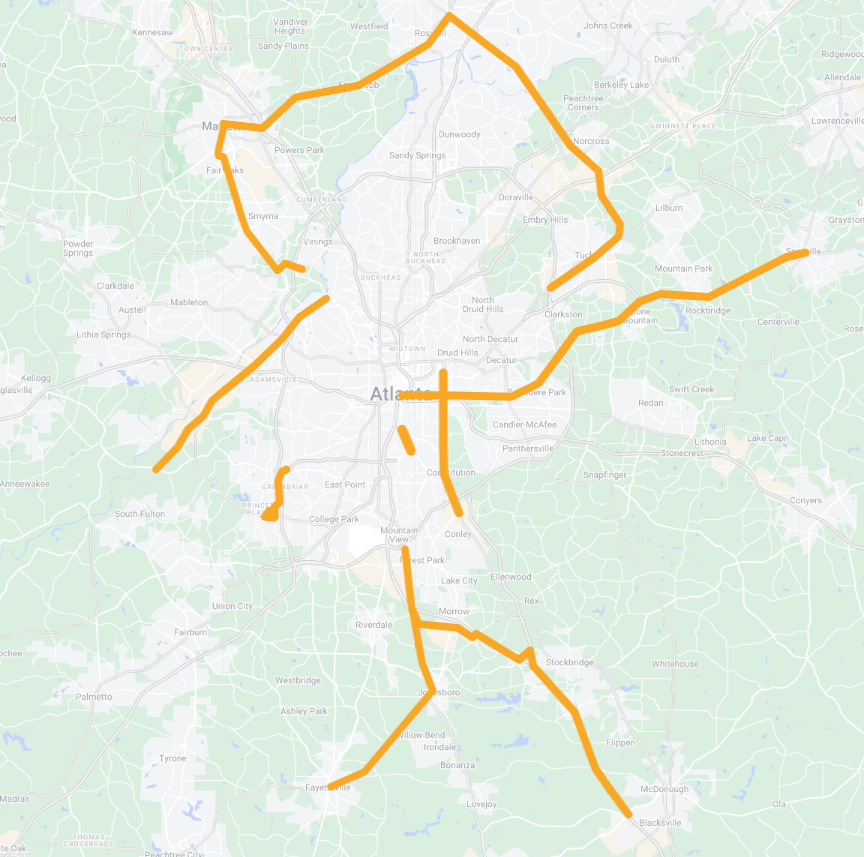
BRT lines serving some of the regions busiest arterial corridors. All BRT lines would offer direct transfer opportunities to the rail corridors.
Opinions and insights are my own and are not representative of my employer or any organization.

I’m really surprised you don’t spend time talking about measures that would improve the usefulness (in turn boosting ridership) of the streetcar as it begins to serve as the long-awaited BeltLine transit voters were promised. At least I haven’t found that info yet. I also found commentary about transit needing to come after density confusing. I’m not an urban planner, engineer or anything like that, so maybe it’s just me. And it sure seems that the BeltLine’s east side is plenty dense, and getting denser by the day. It also seems that the south side has had an explosion of housing too. Frankly, I don’t know how people who live there manage to get around with the infrastructure that currently exists there.
LikeLike