My reconnecting communities series continues in West Atlanta with some relatively “quick” build projects to help bridge together neighborhoods severed by the construction of I-20.
Catch up with the other reconnecting community plans I’ve examined to date:
Durham Freeway, I-277 Charlotte, I-20 East Atlanta Full Build
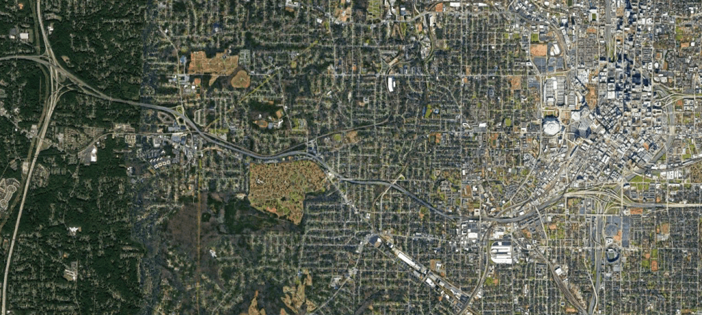
I-20 West of Downtown Atlanta snakes through historically Black neighborhoods separating what was once a comprehensive grid structure.
While these projects shouldn’t be seen as an end all – be all fix, they could go a long way to increasing connectivity, promoting equity, and attempting to remedy the scars caused by the construction of the highway.
Long term solutions similar to the East Atlanta Boulevard proposal, complete removal and other strategies should be analyzed and will also be explored in future articles.
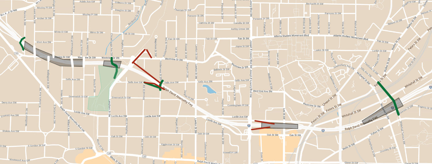
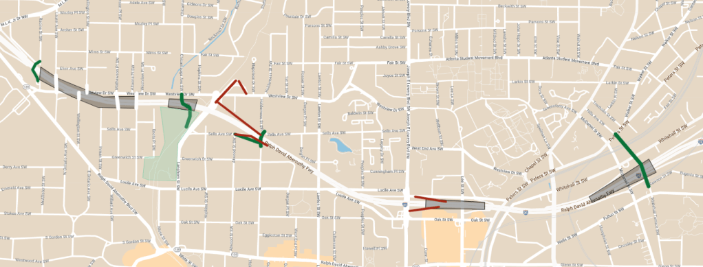
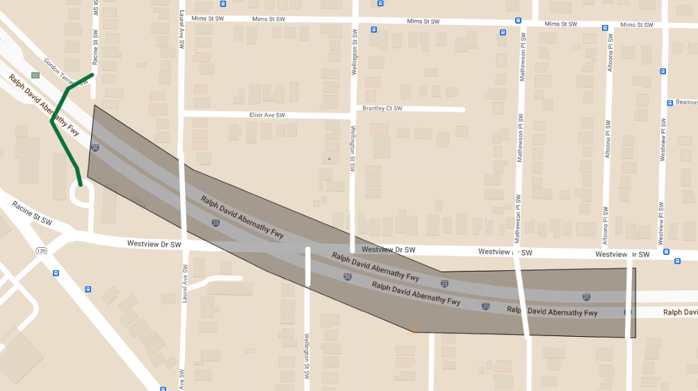
Westview Drive
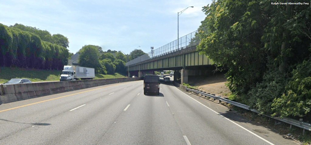
The Westview Drive bridge currently crosses I-20 at an extremely acute angle making for a very long crossing.
Using the grades to our advantage here, expanding the bridge in both directions over I-20 would present several opportunities. Several several neighborhood streets could be connected to Westview and up to 10 acres of community park space or developable land could be reclaimed.
Just to the West of the cap, a statement pedestrian bridge would serve as an extension of Racine Street.
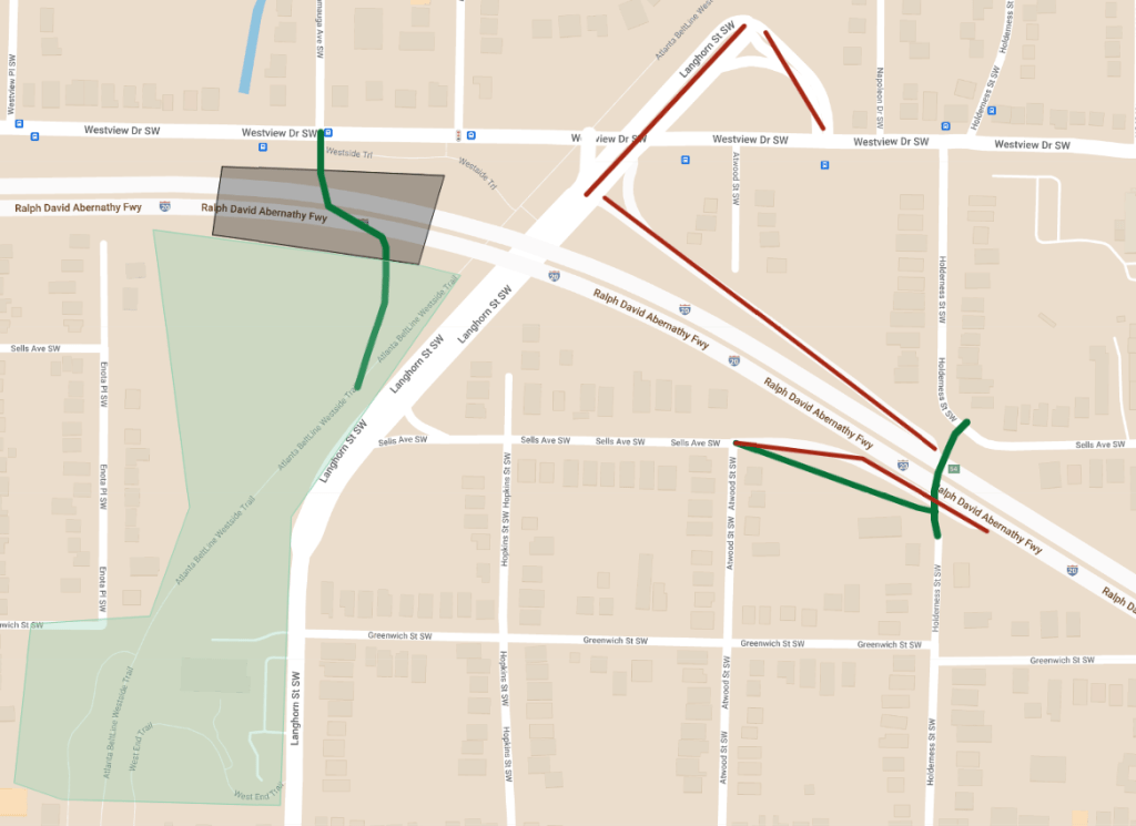
Enota Park
While there are plans to enhance Enota Park, the crossing of the Westside Beltline under I-20 is very subpar and the Langorn Street interchange is massively overbuilt.
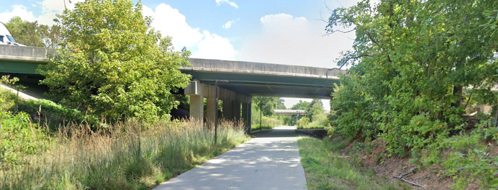
Constructing a trail and wide bridge over I-20 would effectively extend Enota Park northward to Westview Drive and opening it up directly to the Mozley Park neighborhood.
The overbuilt half-diamond interchange with Langhorn St and the interchange at Westview Dr should also be eliminated giving the area a more appropriate neighborhood feel.
Additional trail connections to the East would increase the grid system.
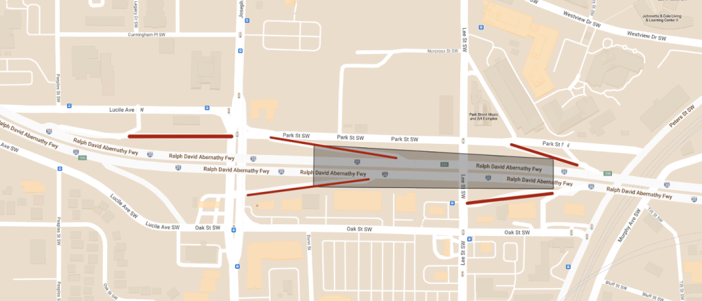
Lee Street
Perhaps the area with the biggest need for increased connectivity, greenspace, and redesign is the Lee St area. I-20 splits the AUC from the Mall at West End commercial area with multiple highway ramps and one-way streets.
Closing a pair of ramps, two-waying the frontage roads and capping where the grades allow for it would stitch together two of the most important neighborhoods in Atlanta.
The eventual redevelopment of the Mall at West End area should focus on re-establishing the street grid along with orienting focus toward the Lee St cap and AUC.
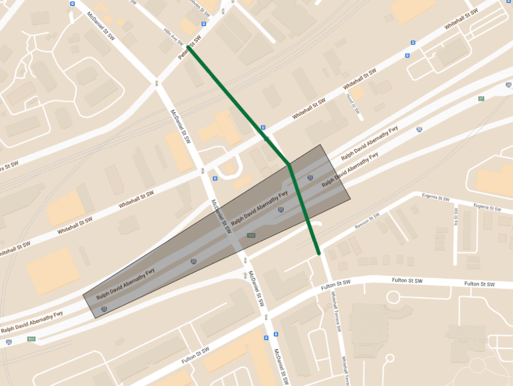
McDaniel Street
McDaniel St features 100s of newer apartments in the shadows of Downtown but without much in the way of safe access without a car.
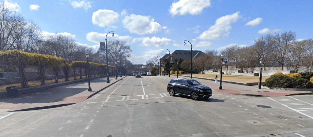
A 5th Street style bridge and new cycle track on the parallel Whitehall Terrace would give the community safer access to and from Downtown as well as a sense of place.
Together these four projects will help the West Atlanta neighborhoods being to reconnect from the scars of I-20.
Interactive GoogleMap of the projects: https://www.google.com/maps/d/edit?mid=1HR22LA9HbfAG0rERm-cCsJ-6PHdxsVk&usp=sharing
Coming soon I’ll explore a more long term solution for I-20 West, an interim solution for I-20 East and the removal of the Lakewood Freeway.
Opinions and insights are my own and are not representative of my employer or any organization. Any ideas displayed on this site are purely that – just ideas to help improve the future of the built environment and begin discussions.

2 thoughts on “Reconnecting Communities: West Atlanta Interim Plan”