With the East End Connector nearly complete in Durham, the idea of transforming the Durham Freeway through Downtown is a feasible one. While browsing local development news I came across an amazing three part series exploring the possibility in depth. Give the series a read at
http://www.buildingbullcity.com/2022/02/147-from-freeway-to-boulevard-pt-4-new.html?m=1
http://www.buildingbullcity.com/2021/07/147-from-freeway-to-boulevard-pt-1.html.
To further develop the idea, I conceptually drew it up.
The limits of construction would stretch from Anderson Street near Duke Hospital to Briggs Ave – just west of the East End Connector interchange.
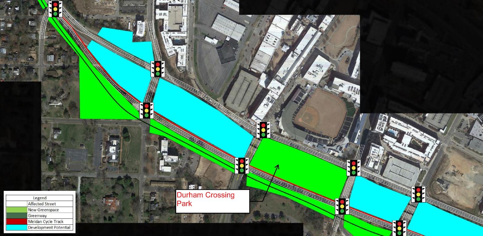
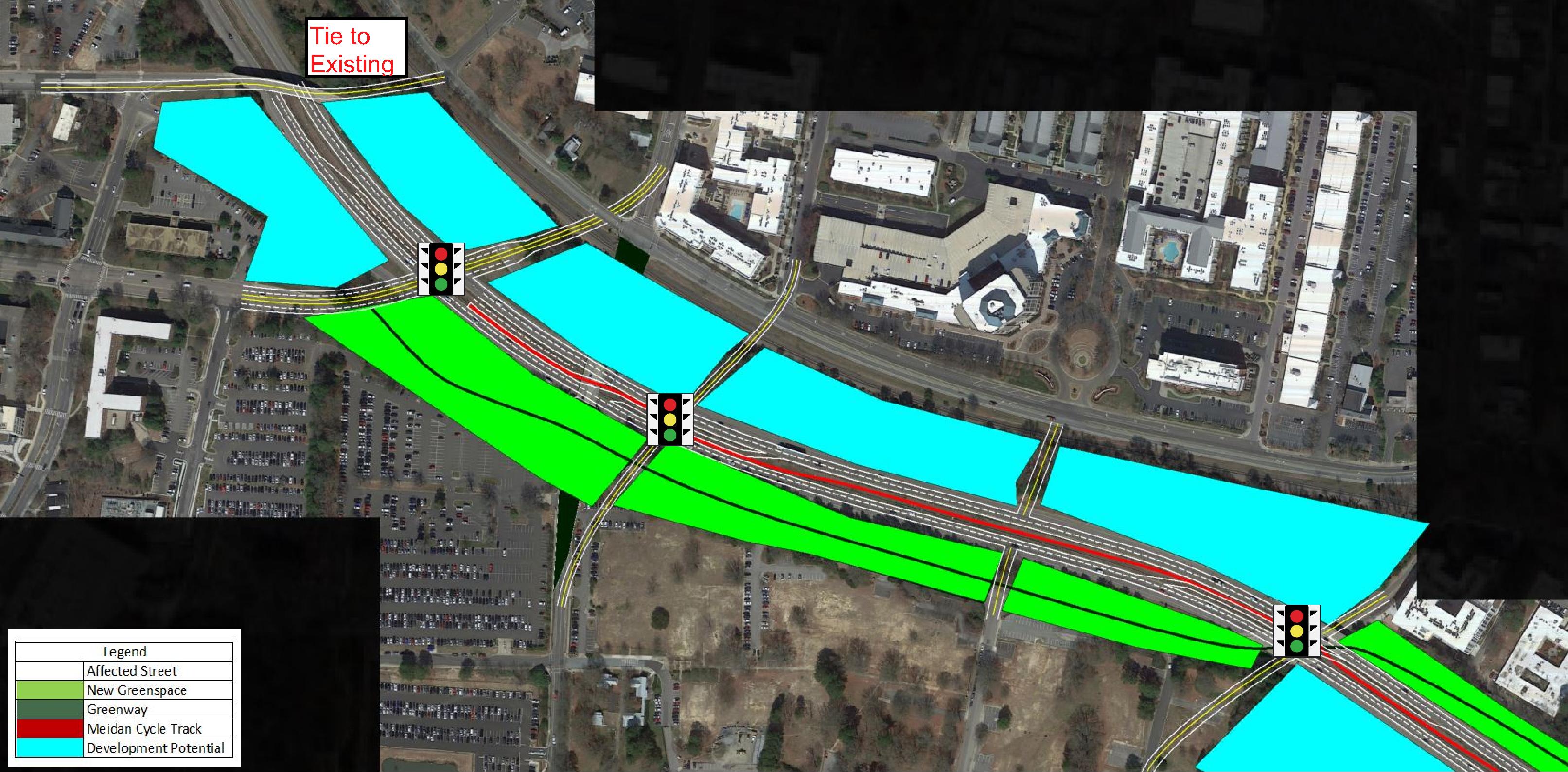
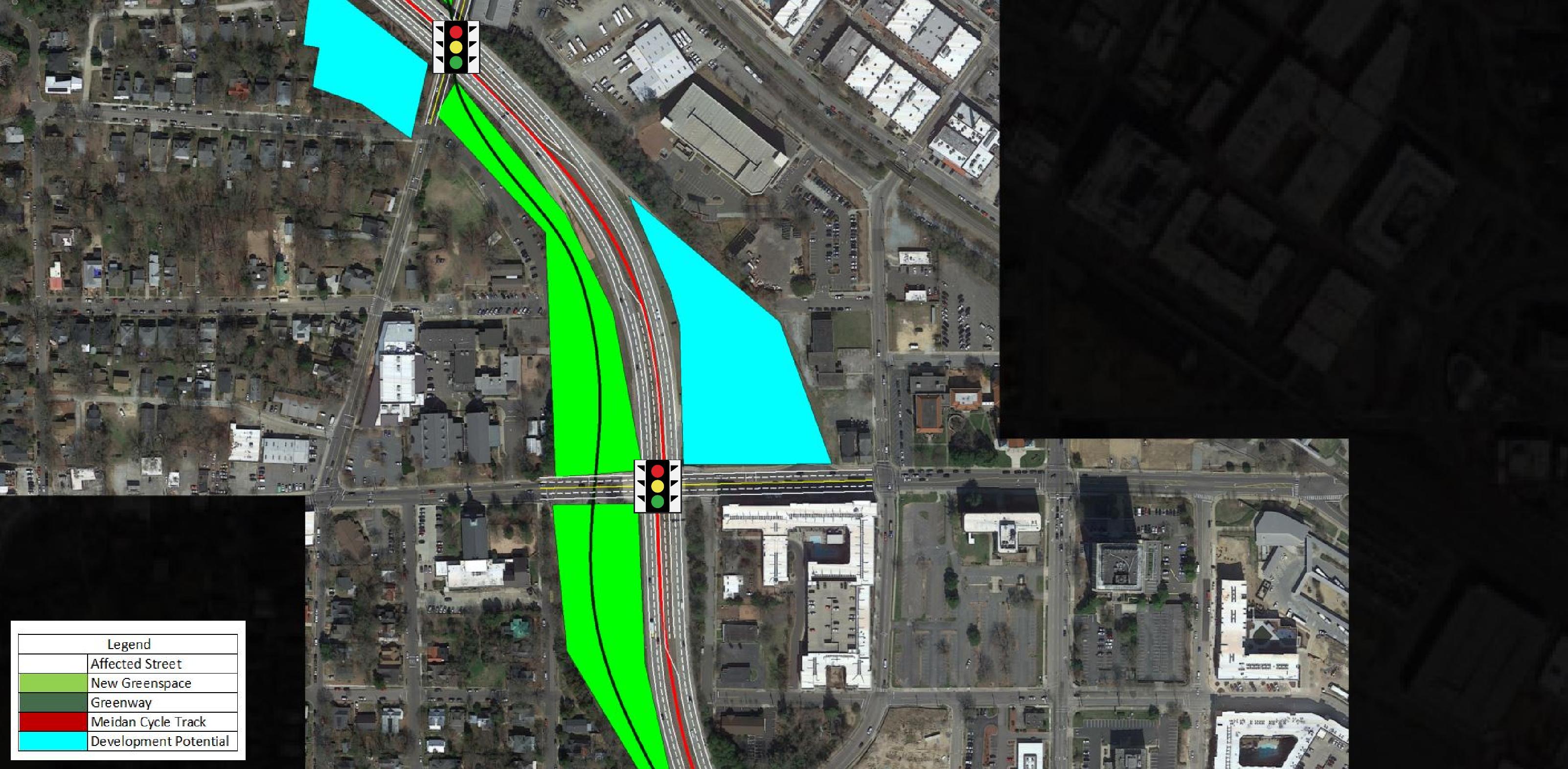
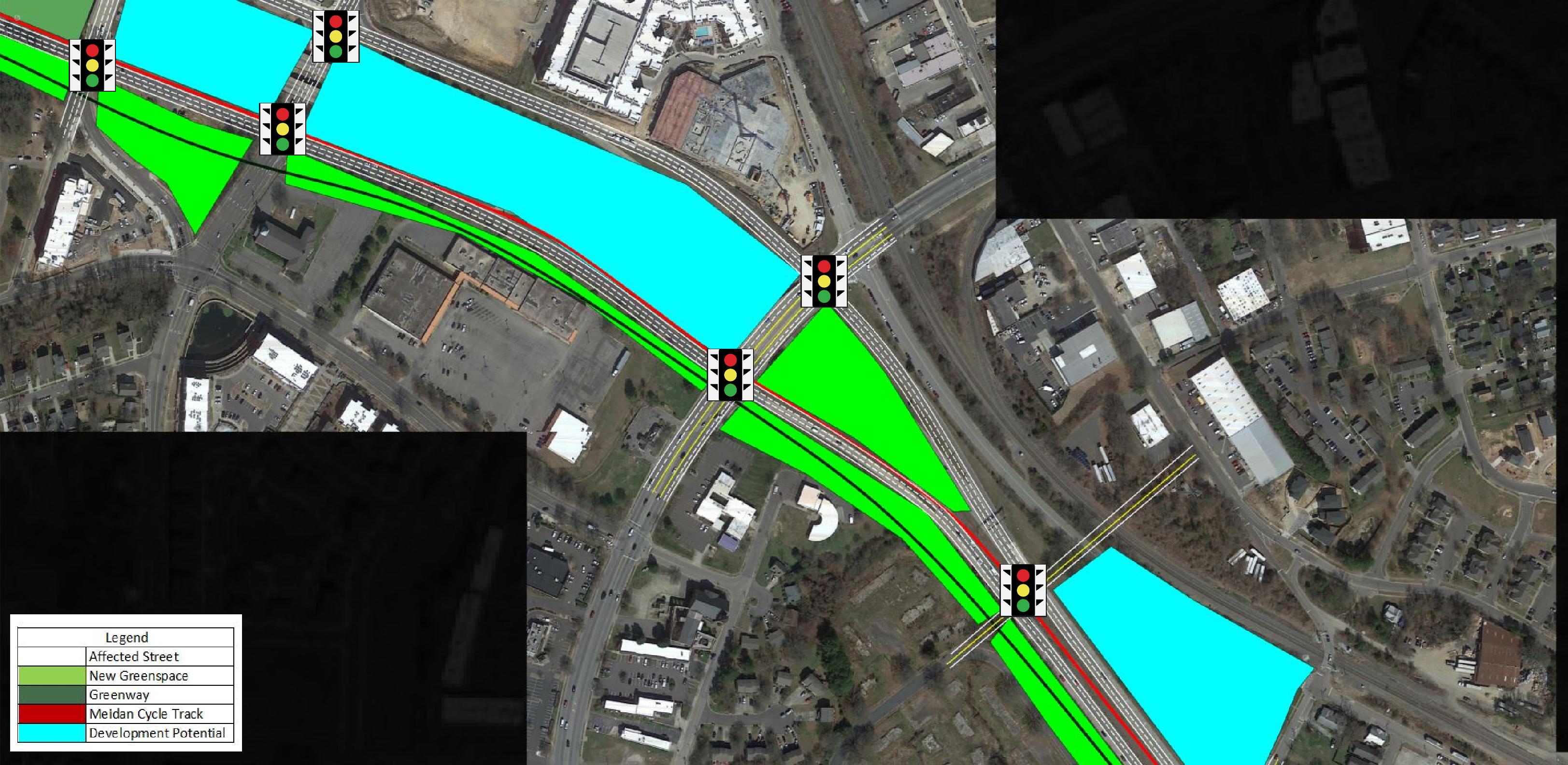
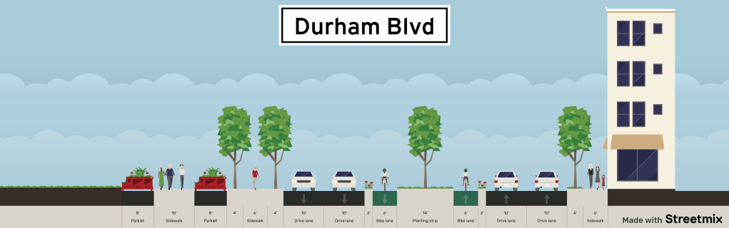
The Durham Blvd would transform roughly 4 miles of urban freeway to an urban boulevard.
Features would include:

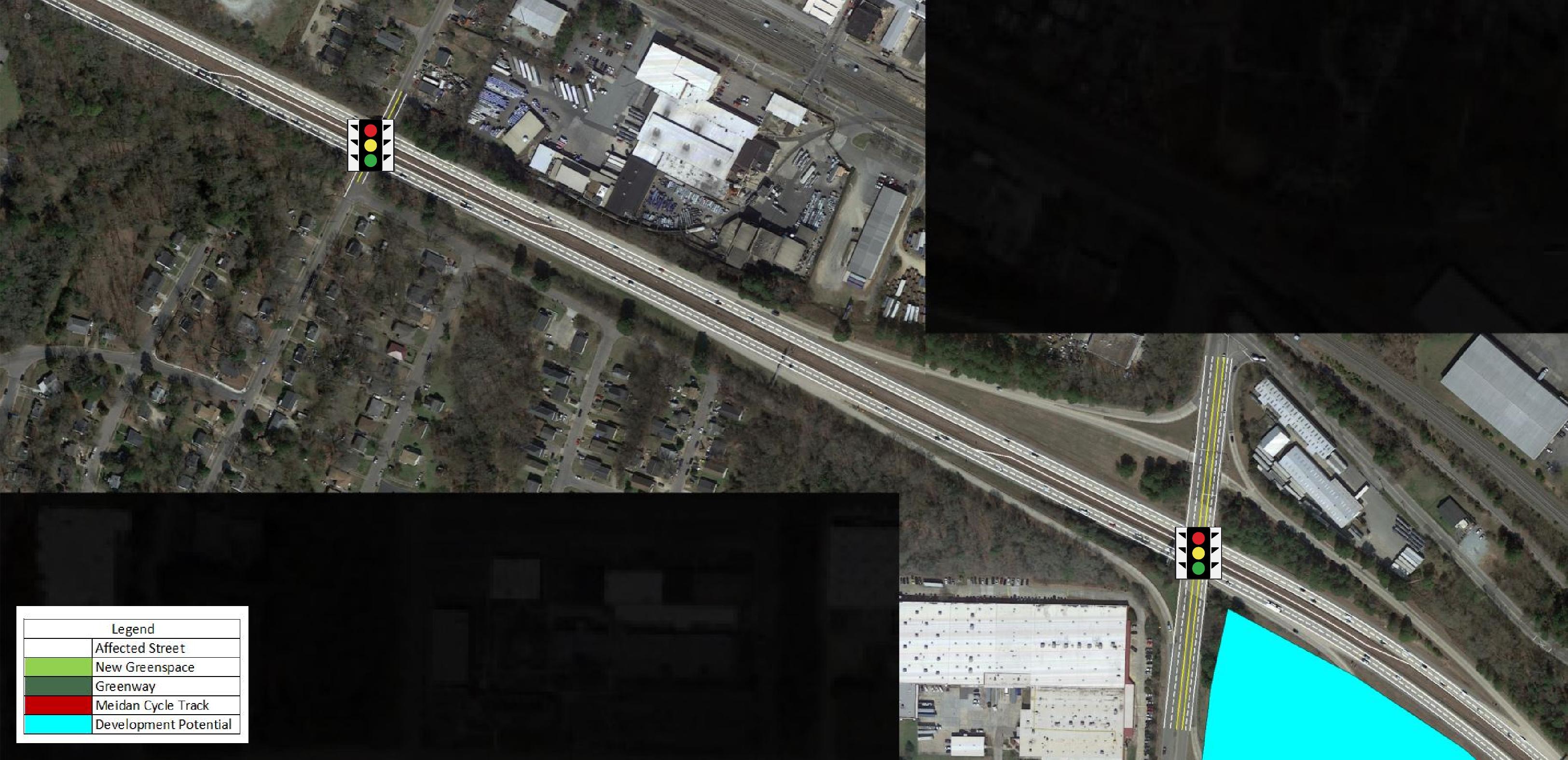
– First signal on the West End is at Anderson near Duke Hospital
– Last signal on the East End is at Briggs Ave
– A linear Park with Greenway alongside Durham Blvd from the West end to the Lakeland Street pedestrian bridge
– A two-way median 8′ cycle track from the West end to the Lakeland Street pedestrian bridge. This would ensure dedicated signals and as few conflicts as possible at every intersection
– A total of 18 new signalized intersections of “Durham Blvd” – this ensures any through traffic will use East End Connector, and that Durham Blvd is a slow speed urban gateway- First signal on the West End is at Anderson near Duke Hospital
– Last signal on the East End is at Briggs Ave
– A linear Park with Greenway alongside Durham Blvd from the West end to the Lakeland Street pedestrian bridge
– A two-way median cycle track from the West end to the Lakeland Street pedestrian bridge. This would ensure dedicated signals and as few conflicts as possible at every intersection
– Split to one-way pairs in the heart of Downtown
– A total of 18 new signalized intersections of “Durham Blvd” – this ensures any through traffic will use East End Connector, and that Durham Blvd is a slow speed urban gateway
– Approx 20 new development parcels from the elimination of the on / off ramps
– Durham Crossing Park just south of DBAP
– Tree lined boulevard with sidewalks on both sides
View the conceptual drawings below and head back over to Building Bull City for more background on this awesome idea.


2 thoughts on “Sketching the Durham Freeway Conversion Idea”