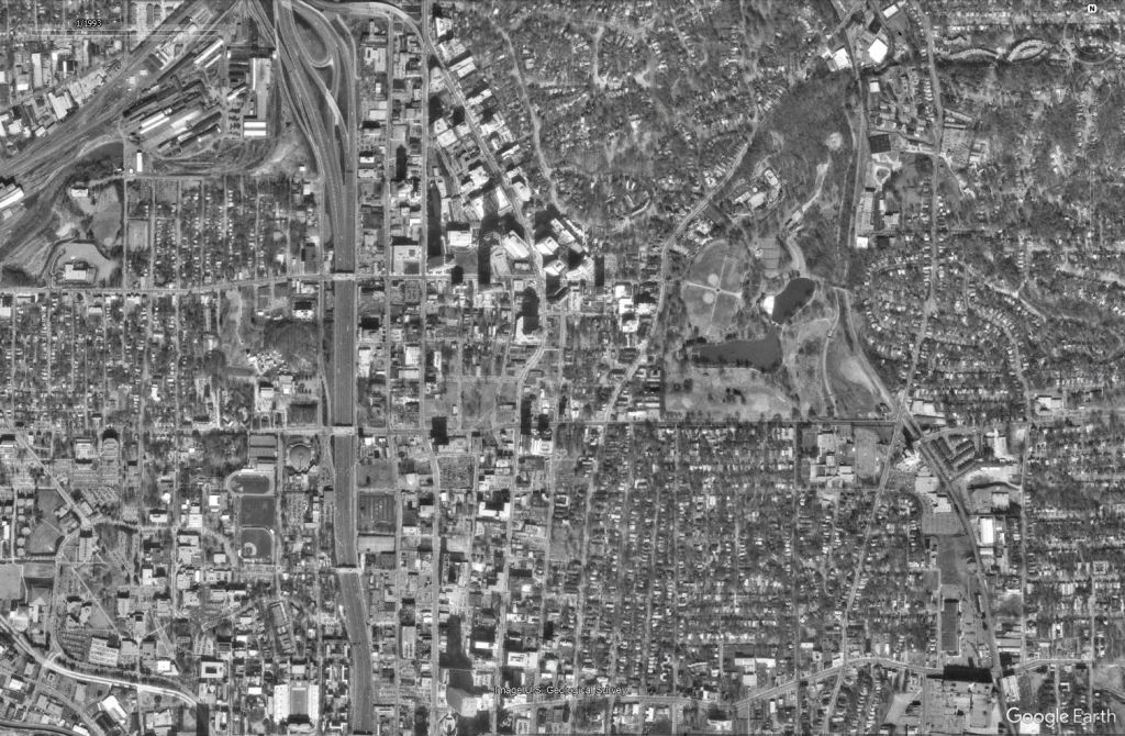
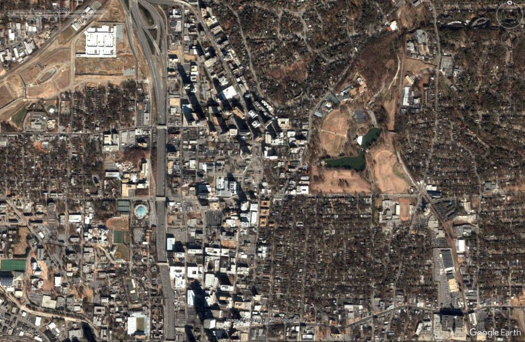
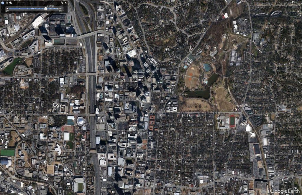
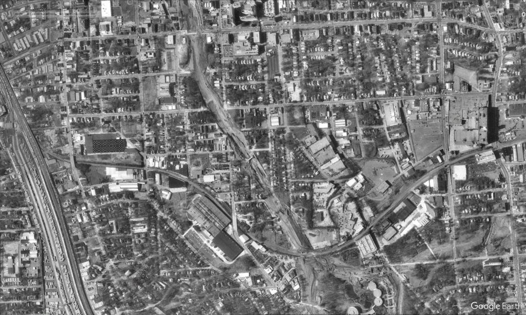
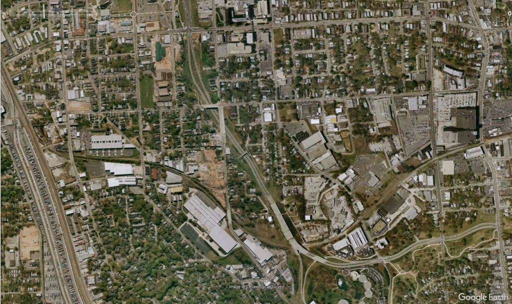
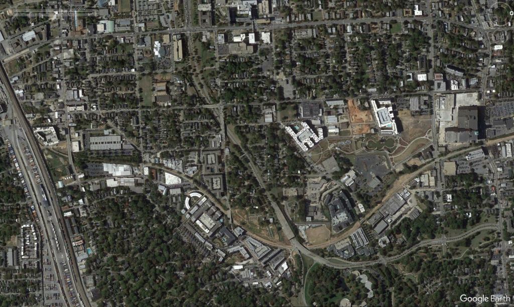
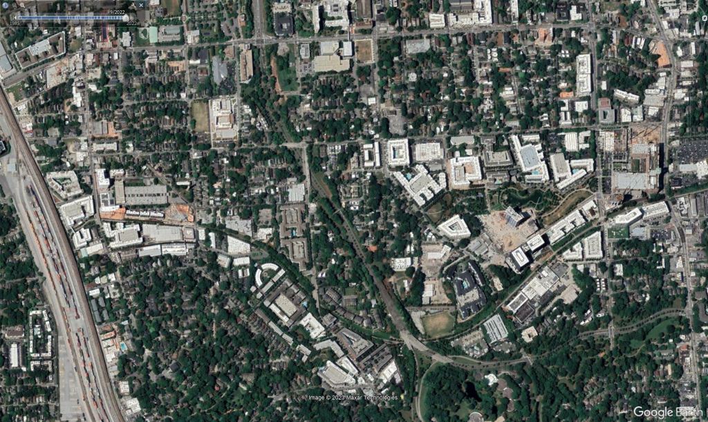
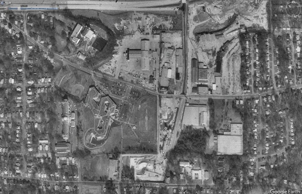
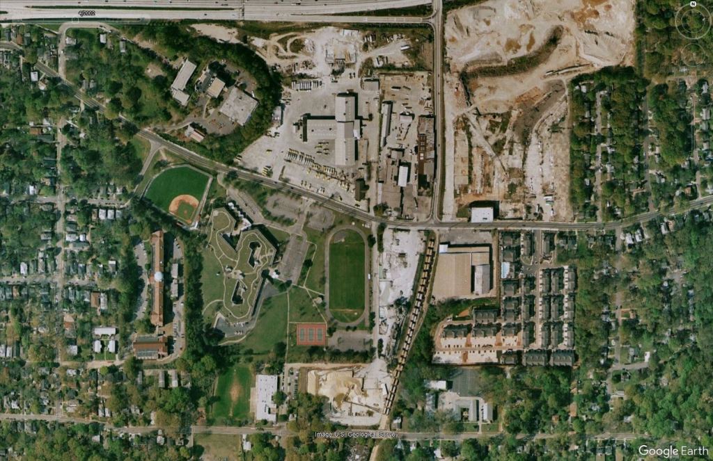
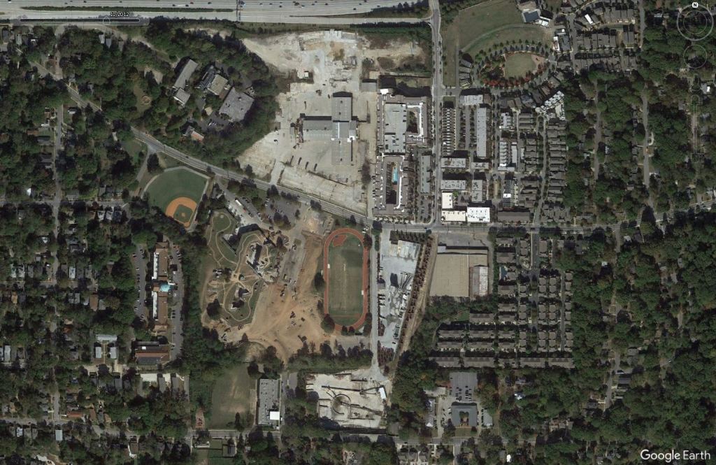
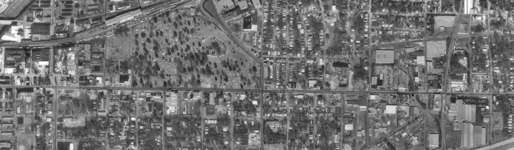
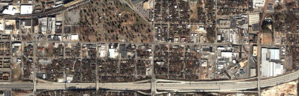
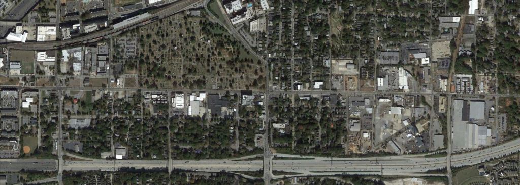
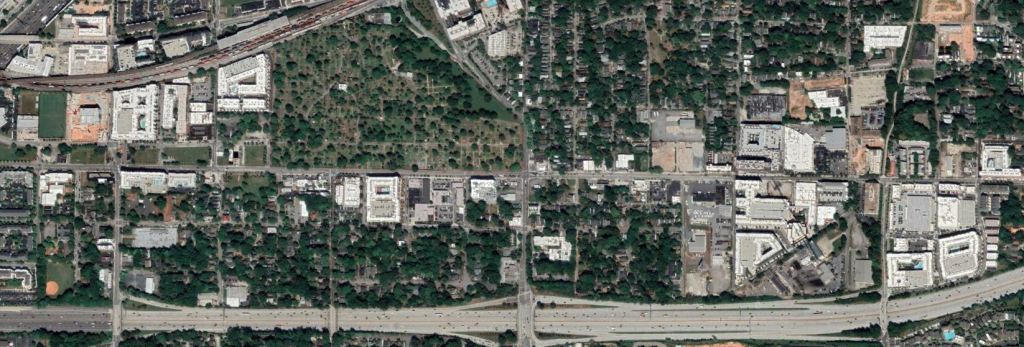
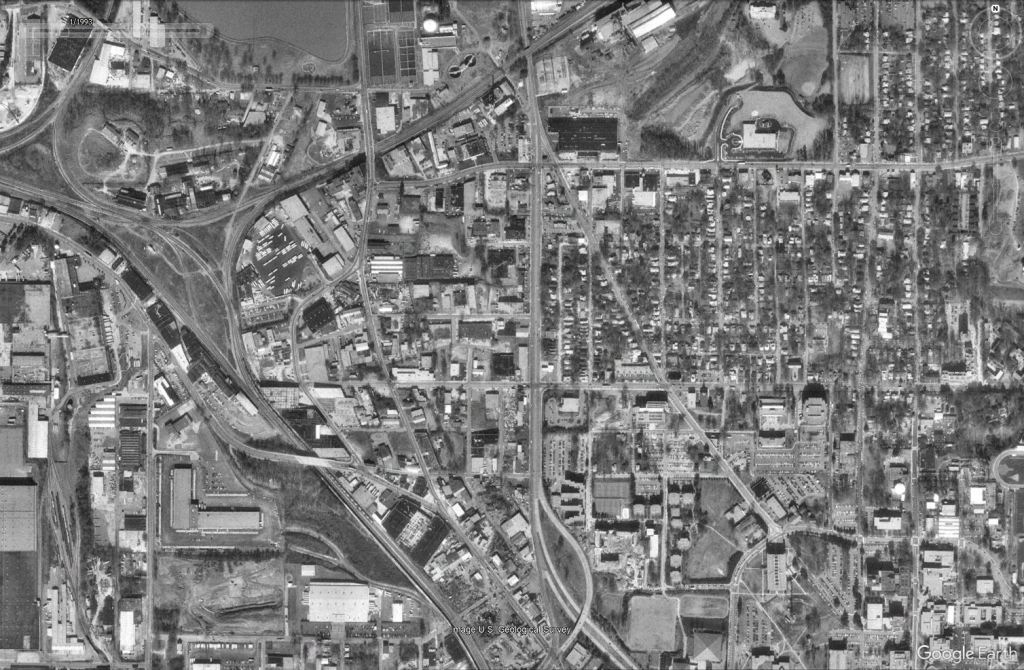
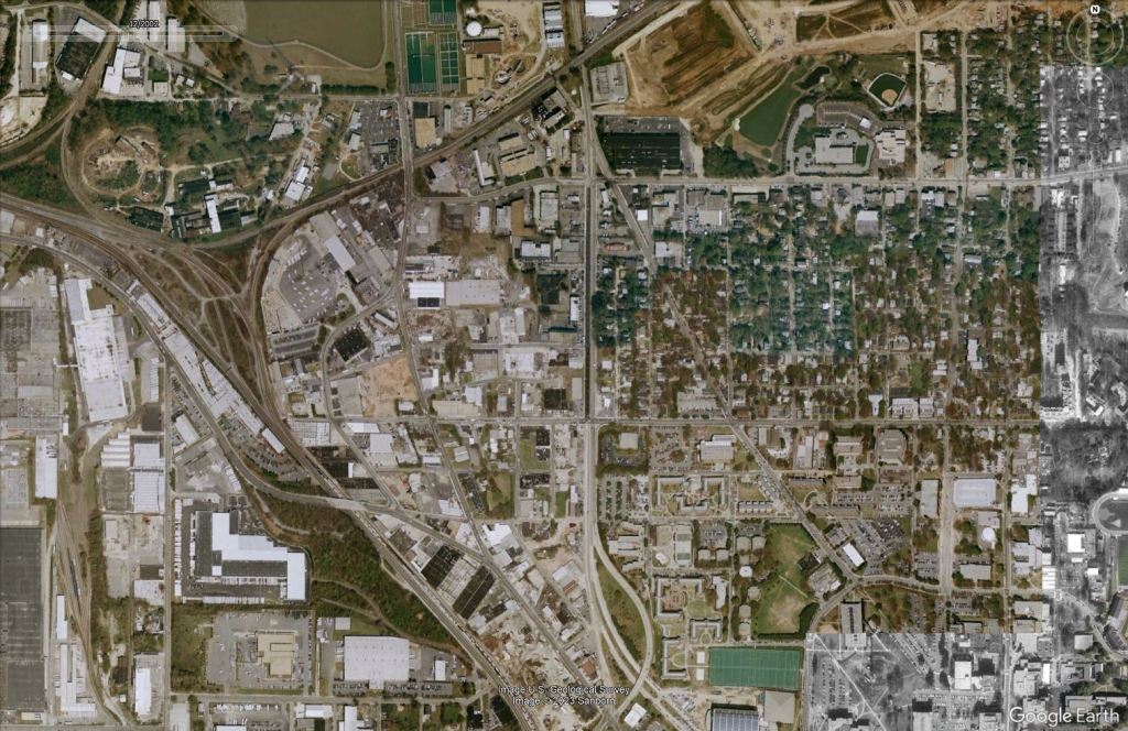
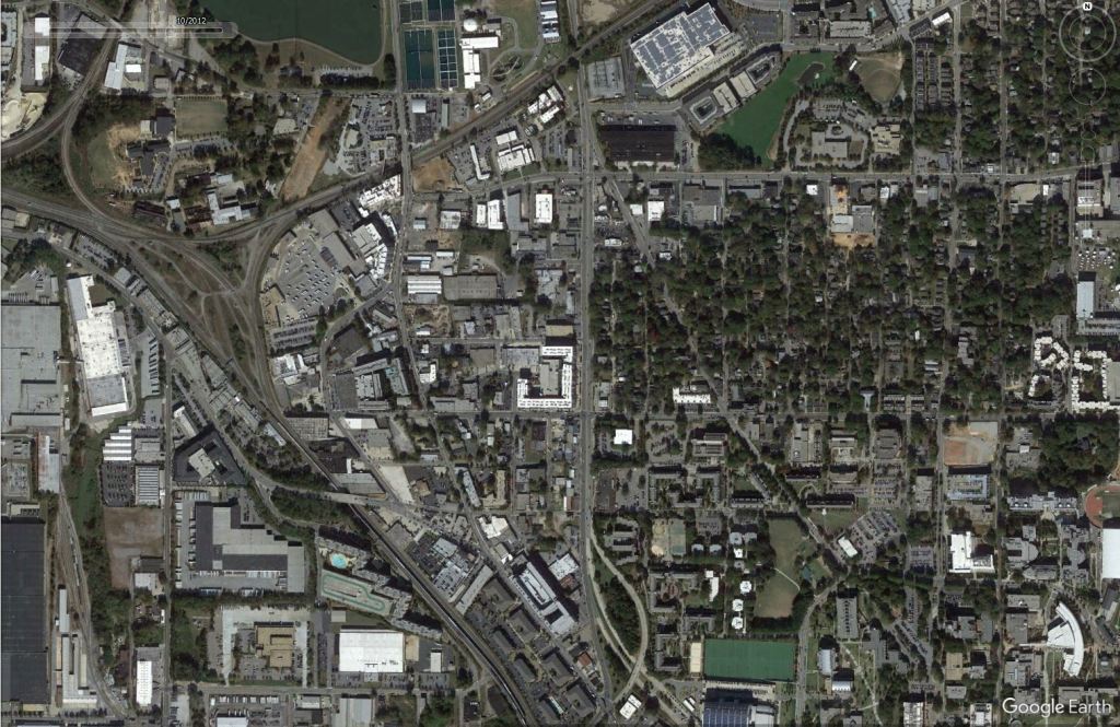
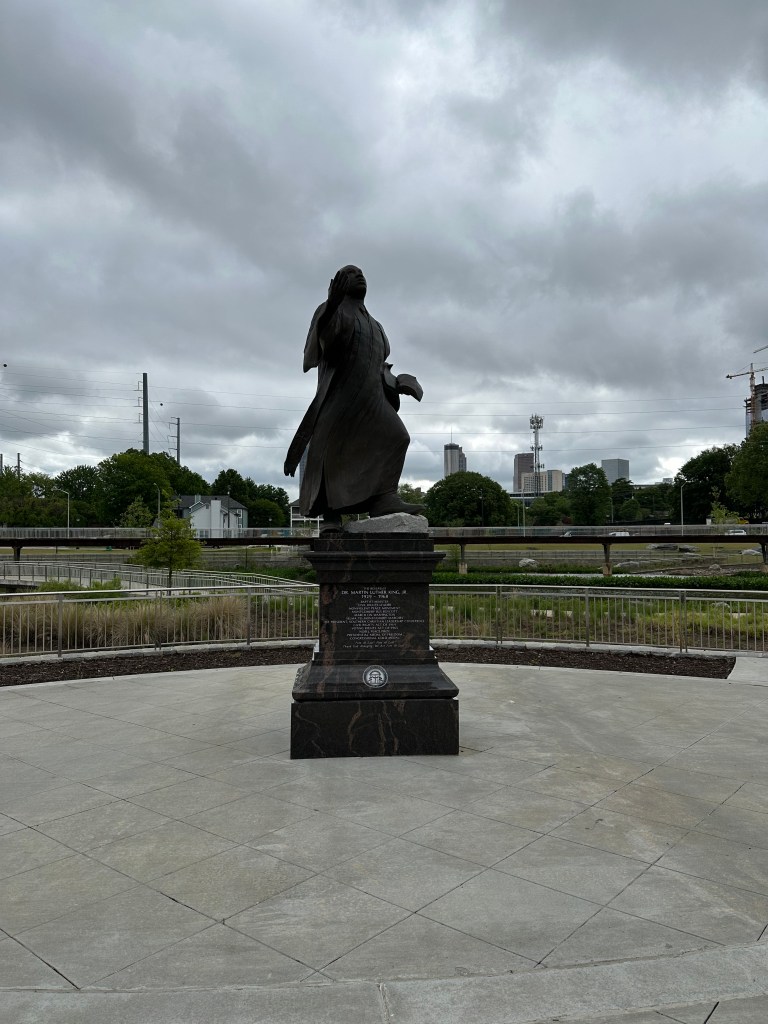
The City of Atlanta urban core has seen a complete transformation over the past couple of decades. GoogleEarth gives us the power to look back at how things have changed over time.
Aerials courtesy Google Earth. Captures are in order from 1993, 2003, 2012, and 2022. For photos of all of these neighborhoods and more visit my Atlanta page.
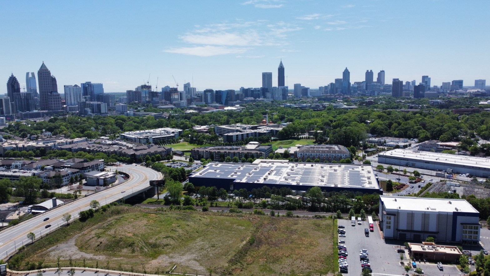
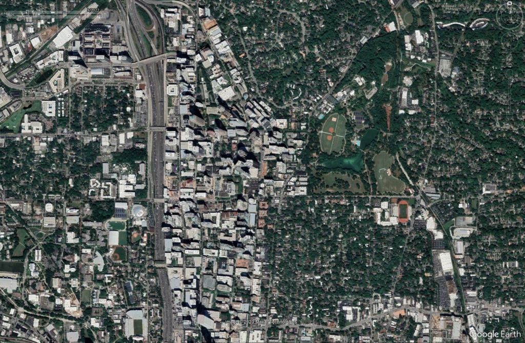
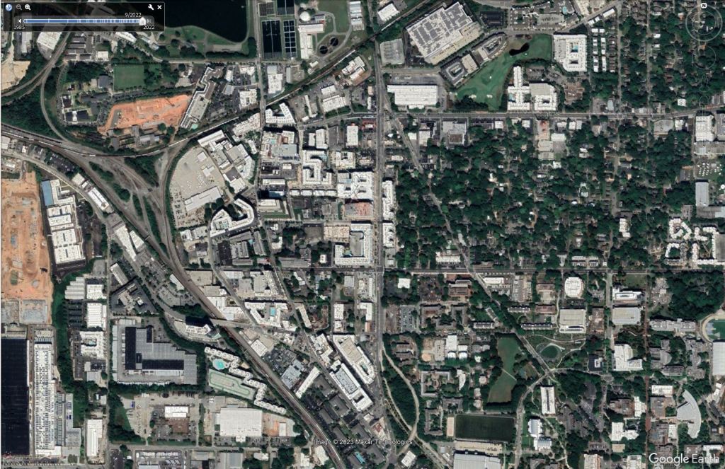
Midtown
In just a few decades, Atlanta’s Midtown has grown from a few towers near Colony Square to a thriving mixture of business and residential towers. It’s arguably the most high profile neighborhood in the Southeast and shows no signs of slowing down.
Old Fourth Ward
Most people consider this segment of the Beltline the epicenter of Atlanta’s 21st century boom. The area straddling the Beltline here has completely changed from a sleepy industrial zone to a booming corridor of adaptive reuse and new build mixed-use buildings. While the area has transformed into one of the most desirable areas around (and my favorite place) it has also created great affordability challenges that the City is struggling to grapple with.
Glenwood Park
Another industrial corridor that has seen transformation is the area of Glenwood Park. It’s become one of the best designed new urbanist neighborhoods in Atlanta (if we ignore the Kroger parking lot).
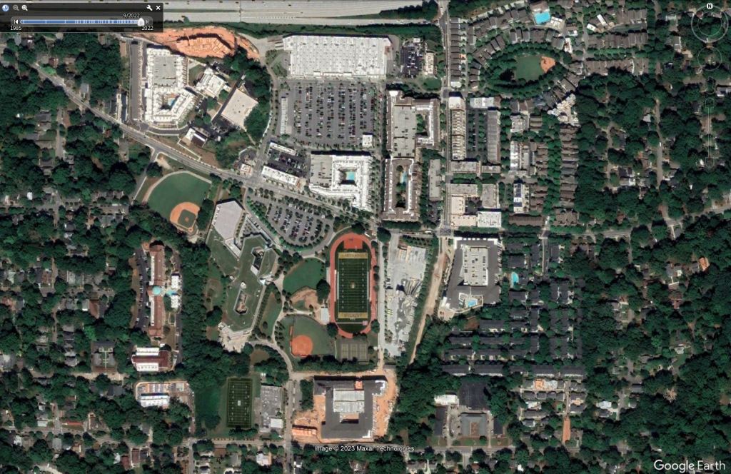
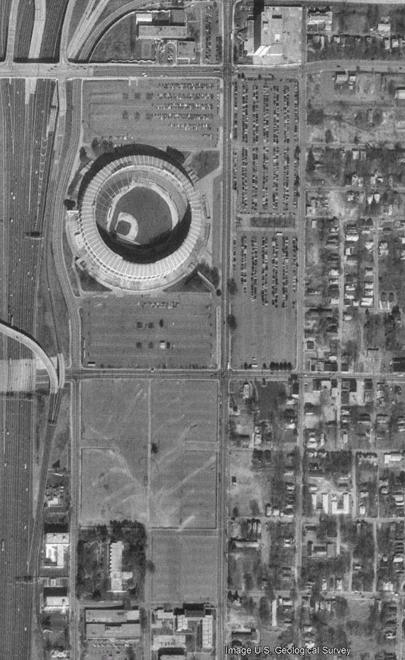
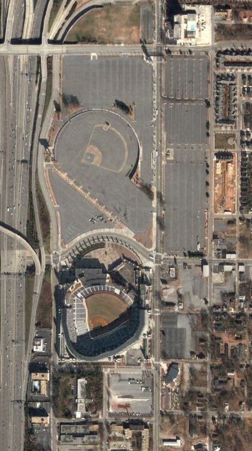
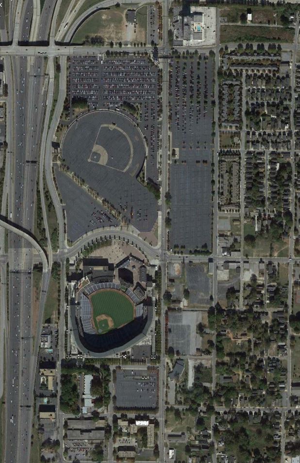
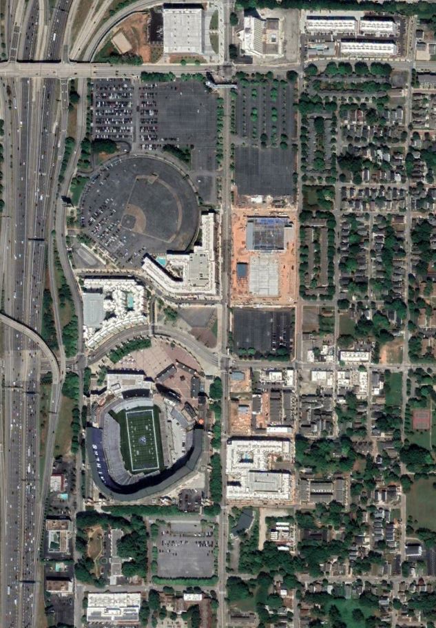
Summerhill
Out with the Braves, in with a thriving neighborhood.
Memorial Drive Corridor
The area once full of auto shops, and other non descript light industrial uses is now home to 1000s of residents.
West Midtown
The Howell Mill corridor has seen some of the fastest changes in the past decade. It now is home to some of the best mix of buildings but is an absolute pain to access due to the disrupted street grid caused by the various rail yards and lack of transit. Northside Drive and Georgia Tech’s campus also make it feel a bit cut off from the rest of the urban fabric.
Next time we’ll explore some of the explosive areas of growth in Raleigh.
A look into why the suburban mindset of some in Raleigh will lead us down a dangerous path.
The Triangle consistently ranks high on “best places to live” lists, but we won’t stay there for long if a vocal minority gets their way.
It’s not for a lack of effort on the city’s part however. When looking at the other major cities of the Southeast, Raleigh has been on the forefront of change. From eliminating parking minimums, eliminating no turn on red, to the missing middle housing code Raleigh’s Planning and Transportation staff have gotten it right. Downtown Raleigh Alliance also does a great job programming events to try to liven up Downtown from pop ups to full blown festivals.
Canes fan fest in Downtown Raleigh
The region experienced its first growth spurt at the worst possible time – post WWII, when suburban ideologies had a stranglehold on planning policies. Some people even refer to Raleigh as “spraleigh” or “the city in the suburbs” and it’s for good reason. This led to nothing but windy streets, culdesacs, and large single family estate lots to blanketing the majority of the city outside of Downtown proper. In fact, Raleigh has the smallest formal grid of a city this size in the South. This makes infill harder and gives some residents the false feeling that they live in a suburb rather than a major city center despite being just blocks in some cases from Downtown. This also plays a major part in some people thinking missing middle, transit, density, or anything you’d find in a proper city should be located near them.
Streets of North Raleigh
Recently, residents of Oakwood – one of Raleigh’s only true urban neighborhoods- contested that the upcoming BRT line could be likened to the planned 1970s Downtown Freeway. Thankfully, this holds no merit and the BRT will break ground this year, but it’s just one of the many examples of a select few rich homeowners who are used to getting their way trying to dictate the direction of the City.
Even in North Hills which is full of new shiny towers, residents fought the further development citing traffic and such. Kane has since pulled his rezoning but many fail to realize that stuff can still be built by-right. Now the city doesn’t get the transit infrastructure, greenway or affordable units that were part of the rezoning proposal. But there’s no problem with every house in the area going from modest brick ranch to multi-million dollar mansion.
Multi-million dollar mansion in the shadows of North HillsView from a multi-million dollar mansion in the shadow of North Hills
Even in other Southern cities around this size, you’ll a plethora of mid 1900s missing middle type housing. Raleigh was mainly formed as a bedroom community for the State Government so we’re devoid of much of that.
Rare example of a Missing Middle housing building in Downtown Raleigh
You’ll find some in historic ones Boylan Heights but if you tried to build a new one, you’d promptly be ran out of town and probably be sued. In fact, a few residents of Hayes Barton which is made primarily of multi-million dollar estate homes on acre + lots is suing to reverse Raleigh’s Missing Middle plan. Despite being close to Downtown, they believe the 17 unit million dollar townhome development on one estate lot will “ruin the character of their neighborhood”, “bring traffic, “crime” etc; you know all the typical arguments that have been disproven time and time again. Across the country however, most true neighborhoods with character feature a mix of housing types. It’s only recently that we stopped building diverse housing choices.
If these few ultra-rich homeowners get their way it could have disastrous effects on the missing middle plan. They’ve even gone as far as attempting to convince Black neighborhoods that missing middle will “destroy” their neighborhoods as well. Meanwhile modest single family home after another is torn down and replaced with another single family home in East Raleigh. Missing Middle allows flexibility to construct smaller homes on smaller lots, multiple homes on one lot, and adding ADUs to existing lots.
With the intense growth and pressure on the few urban neighborhoods that we have, missing middle is the way that existing residents will be able to stay in their homes. By allowing for increased housing types and numbers, we’ll see less single family tear downs and more in the way of dense infill. This will lead to more neighborhood amenities and services and increased affordability options.
With the lack in urban housing choices most families are forced to outlying communities to find housing. Places such as Johnston County, Franklin County, and even Sanford have seen explosive growth recently. Unfortunately most of it is extremely sprawl based, low density single family subdivisions wherever developers can find land. With that comes a slew of drawbacks, such as long commute times, lack of access to shopping and dining, forest and farmland destruction, and increased infrastructure costs by way of water, sewer and road needs.
Also while the housing prices may be lower further out, once you consider the cost of driving, if often times evens out. This is yet another thing that missing middle aims to tamp down by giving more people the option of living in town.
While Downtown Raleigh is great and full of things to do, it has to compete with several other cores: North Hills, RTP, Durham, and Chapel Hill. While I believe they all offer different things and compliment each other, they also leech off each other development and placemaking wise. For all the greatness that Downtown Raleigh holds in terms of small business, shopping and dining, it can feel a bit scattered and not cohesive. There’s not what I call “that one spot” that most cities have. If you asked 10 people where they bring out of town guests, you may get 10 different answers. Meanwhile, cities like Greeneville with Reedy Falls, Charlotte with the Rail Trail, Atlanta with the Beltline, and St Pete with the Pier offer those focal points.
Dix Park has the opportunity to become that spot but even there, accessibility from Downtown is a challenge due to Western Blvd and lack of density surrounding the park.
I have several ideas to help get us there, such as converting the prison site and converting Western Blvd into a true urban boulevard. The city should also explore reconverting Fayetteville Street to a pedestrian oriented space and converting Martin Street between the two transit centers into a Transit oriented space. The city’s party scene along Glenwood Ave should also be pedestrianized during the weekends.
A few overarching themes I’d focus on are:
Blanket Downtown zoning heights
Prioritize public-private partnerships to increase mixed income Downtown housing
TOD (Transit Oriented Development) incentives along BRT lines
Prioritize convention center expansion
Prioritize Dix buildout and attract more festivals in the park
Negotiate redevelopment of prison site
As with every big idea, they’re met with instant pushback. But cities that do not evolve get left behind or low to middle income residents get pushed out.
Will we continue to be one of the best places to live for everyone, or will we become a low density playground for the rich where everyone else has to drive into town or decides to move elsewhere. At the very least we have to get downtown, and the land use around the BRT lines right. While I’m confident the City will put the proper plans in place, I fear for what a select few will do to stop it.
Opinions and insights are my own and are not representative of my employer or any organization. Any ideas displayed on this site are purely that – just ideas to help improve the future of the built environment and begin discussions.
The much forgotten part of town is finally starting to show signs of life.
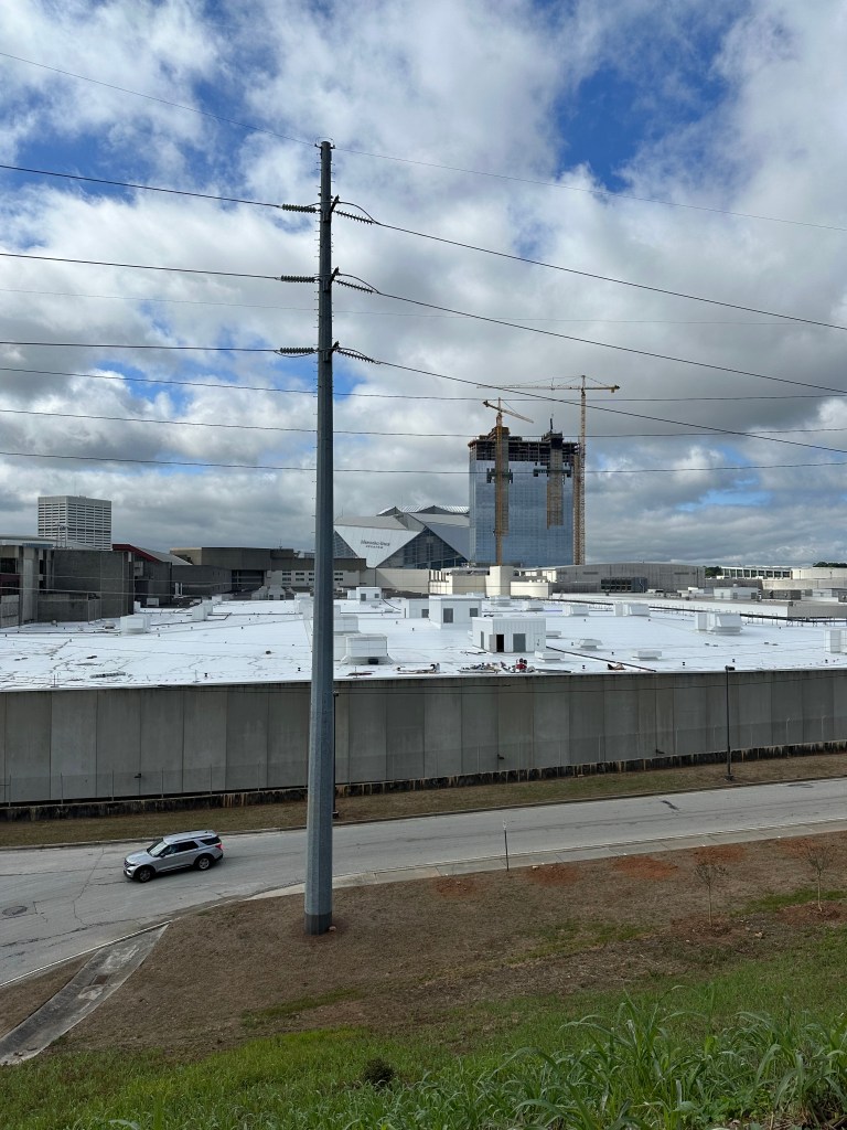
For years, all of Atlanta’s development energy has been in Midtown, and along the Beltline. From mega projects like Centennial Yards, to adaptive reuse efforts from Newport, to seemingly small – yet important projects like the Downtown Resurfacing program,(which more importantly brings a web of protected bike lanes to South Downtown) things are heating up. Several times over the past few months, I’ve mentioned that if I had money to invest in land or property that it would be in South Downtown.
The area is ripe with potential from blank slate parking lots, to beautiful 19th and 20th century buildings. Coupled with the prime location, transit, connectivity, and relatively low land values when compared to other parts of the city, the only way is up.
I recently polled Twitter users on which mega development will have the biggest impact on Downtown a couple of decades from now. While Centennial Yards eked out the victory, all three projects received significant votes.
Centennial Yards
Centennial Yards aims to transform roughly 50 acres of sunken parking lots and rail lines better known as the Gulch into a thriving extension of Downtown Atlanta. Proposed plans include 8 million square feet of mixed-use development. The first few elements which included an overhaul of a historic warehouse, a pedestrian bridge, and Downtown’s first brewery are ready. A number of ground up builds are in progress now including apartments and hotels adjacent to Mercedes-Benz Stadium.
While there’s hope that “significant completion” of the project takes place before the World Cup in 2026, that remains to be seen and seems ambitious. Current plans also seem a bit skewed toward office rather than residential which will have to change given the economic landscape currently.
Newport RE has assembled over 50 properties in South Downtown Atlanta and is transforming the long blighted area into the walkable, livable, inclusive, and connected neighborhood it deserves to be. Plans feature new build and re-use residential, office, commercial and more. Hotel Row, on Mitchell Street has been beautifully restored and new shops and restaurants have already started to move in.
General area of Newport controlled properties. Google Earth
Soon to come are 650 ground up apartment units plus 70,000 sq ft of retail in what will breathe further life into the neighborhood. Hopefully this will soon bring Downtown’s first grocery store since Kroger shuttered nearly two decades ago near City Hall.
The Stitch is one of several planned and proposed highway caps and mitigations in the region. Out of all the proposals, the Stitch is the one with the most funding, movement, and likeliness of happening soon. The project will cap approximately 3/4 mile of the Downtown connector creating a platform for 14 acres of greenspace and countless new buildings effectively “stitching” together Downtown and Midtown.
This area is currently a dead zone chocked off by the massive 14-lane freeway that has been left behind from the development boom of Midtown and the business hub a bit further down Peachtree.
Atlanta’s Downtown Connector at Rush Hour on a Friday where the future Stitch will cover the interstate
Other Major Projects that get me excited about Downtown’s future
MARTA has received funding to overhaul the system’s signature station. Main goals include Transit Oriented Development and restoration of the urban fabric by reconnecting several city blocks. MARTA received a $25 million RAISE grant to help move things along.
It seems like we’ve been talking about Underground Atlanta’s overhaul for years now but according to the leasing site, we may be getting close to an actual vision.
One station south of Five Points, Invest Atlanta is looking for developers to transform a parking lot into mixed income housing. As Newport’s South Downtown transformation continues, I bet we’ll see more and more of these parking lots get snatched up.
Housing construction / Office conversions
With the Office market still struggling and many companies looking for Class A space in Midtown or along the Beltline, many office buildings remain empty. While there are rumors of many proposed transformations, a major one at 2 Peachtree Street is getting ready to get underway. Hundreds of other ground up units are also currently under construction scattered throughout Downtown.
Stretching from the Capitol, over the Connector and over to Oakland Cemetery, the Memorial Drive Greenway would be a linear park bridging the gap leaving Downtown to the East. There hasn’t been movement on this in a few years, but most of the required land is cleared. If the park aspect of the is dead, the opportunity for dense housing and and the cap over the connector should happen ASAP.
The Downtown Resurfacing project is underway. The bigger aspect of this project will be the additon of protected bike lanes to multiple South Downtown streets, dramatically increasing multimodal access in advance of the Summerhill BRT line.
The regions’ first BRT will be starting construction soon. It will link South Downtown to the Beltline along Hank Aaron Drive. Many eyes will be on the system as there are multiple other corridors planned.
The Atlanta Streetcar extension to Ponce is going to happen, for better or for worse. In my opinion, we can’t let the failure of the initial line which went nowhere and served little purpose prevent us from constructing the extension which will service high impact locations and finally directly connect the Beltline to a heavy rail station. I also discount the fears of it changing the feel of the Beltline for the worse due. Ever been on Charlotte’s Rail Trail anyone? Grass guideways and slower speeds may even eliminate the need for fencing which has been the main concern of the feeling of the Beltline being “cut-off” even though you can’t really enter and exit the Beltline as you please now due to grade differences.
Maybe as time goes on we can convert parts of the existing line to dedicated Right of Way along Edgewood creating a Transit mall. Even further out, as rail is developed along the entire Beltline (one day, right?), the streetcars used on Edgewood will be independent of the Beltline streetcars which would increase reliability. I’ve previously explored other ways I’d improve MARTA as well.
I’m still not over how the pilot was shuttered but hopefully the full build version can happen soon. Atlanta’s Main Street deserves it.
Peachtree Street on a recent evening.
Things I think Downtown should do to thrive
Create dense, seamless, and safe multimodal corridors between Downtown and the Beltline
I spoke about this a good bit here – but there is a great need for the area between Downtown and the Beltline to feel cohesive and safe to exist outside of a car. Key corridors for up zoning and multimodal uses should be along Memorial Drive, Decatur Street (complete streets project underway), Edgewood Ave (streetcar corridor), Irwin Street, Highland Ave, Ralph McGill, Angier Ave, North Ave (future BRT Corridor), and Ponce.
Corridors along the Beltine where upzoning and multimodal access should be prioritized vs current protected bike lanes between Downtown and The Beltline.Corridors along the Beltine where upzoning and multimodal access should be prioritized vs current protected bike lanes between Downtown and The Beltline.
Freedom Parkway Interchange Simplification
The Freedom Parkway Interchange with the Downtown Connector is vastly overbuilt since Freedom Pkwy was originally planned to be an interstate out to Stone Mountain. Removing the flyovers, eliminating the ramps to / from Highland and Erwin, reconstructing some of the grid, and two-way restorations of Young and Ellis, as well as a wide 5th street style landscaped bridge will go a long way.
GoogleEarth
Other ways to mitigate the Downtown Connector’s affects on Downtown should be explored. The grade works in our favor for the most part with many of the cross streets crossing above the Connector making for easier capping possibilities.
Areas the grade works for capping. GoogleEarth
Build the Housing!
Downtown needs residents. Every city and privately owned lot should be explored for getting dense mixed income housing into the core.
For Atlanta to truly become a world-class city, Downtown needs to be the heartbeat of the City. I think we’re on the right track and can’t wait to see how things turn out. What are you looking forward to in Downtown Atlanta’s future?
I’ll see you all in a couple of months after a brief hiatus to focus on my upcoming PE exam!
Opinions and insights are my own and are not representative of my employer or any organization. Any ideas displayed on this site are purely that – just ideas to help improve the future of the built environment and begin discussions.
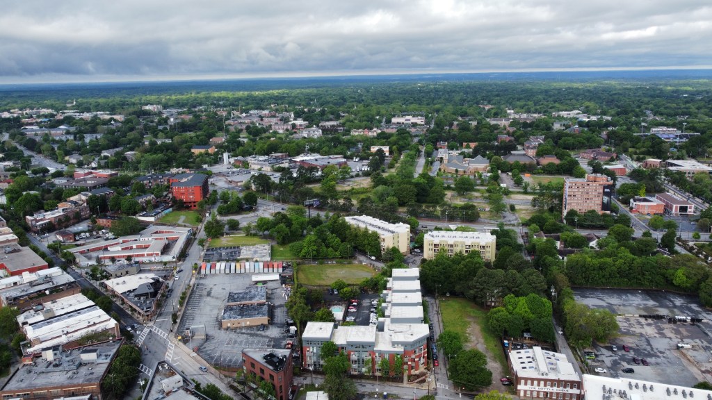
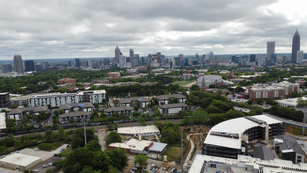
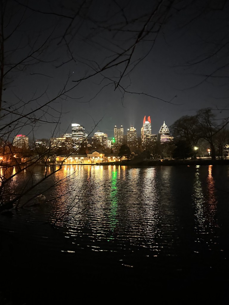
Who said you need a car to have a great day in Atlanta?
While Atlanta is extremely car-centric by big city standards I recently had the pleasure of exploring Atlanta for a full day without a car. The end result: 36,000 steps, 16 miles walked, 10 scooter miles, and multiple MARTA trips.
The day started by taking in the views down a very quiet Peachtree Street where you can still see the remnant striping of the Shared Peachtree Pilot Project (that needs to be made permanent). From there, I made my way over to Ponce City Market to get a couple hours of work done.
Despite the Beltline being the biggest draw in Atlanta these days, there’s a lack of safe and direct facilities to get there without driving. The route I chose snakes along Highland Ave, Jackson St Bridge, and John Lewis Freedom Pkwy. The route should be getting enhancements along Jackson Street at any time with the addition of a parklet that I had the privilege of helping produce plans for a few years back. Overall though, it was enjoyable rather low stress route and I came across several children making their way to school via bike busses and walk busses.
Car Free Challenges:
Not a straight shot. Need more direct, safe multimodal corridors between Downtown and the Beltline
Very difficult crossing and slip lanes at the intersection of John Lewis Freedom Pkwy and Boulevard
After a couple of hours working and watching Ponce wake up and come to life, I headed Northbound on foot along the Beltline to beautiful Piedmont Park where I captured some done photos.
Car Free Challenges:
10th and Monroe may have the highest ped and bike crossing counts but other than having a ped scramble is like any other busy intersection. Changes are coming though.
From there, I met a co-worker for lunch nearby at one of my favorite local spots, The Nook. Spent a few minutes too long with the drone, so took a short scooter ride down 10th and up Piedmont.
Car-Free Challenges
“Protection” on 10th Street is mostly damaged
Piedmont Street has no bike lane
After lunch, was a trip back through the park and down the Beltline. This stretch contains some of my favorite developments around such as 760 Ralph McGill, and The Krog District, The mix of adaptive reuse, small scale new construction, midrise towers and more create an amazing environment. All of which use the Beltline as their front door and not vehicular streets.
Heading West from the Beltline to Downtown brought me past one of my favorite intersections in the city – Auburn Ave @ Randolph and Old Wheat. This corner has a mix of uses featuring a small condo building, corner retail, a pocket park and an uniquely shaped house.
From there my journey took me past the birthplace of MLK, and up a new bike lane on Jackson Street where I rejoined the trail along Highland Ave.
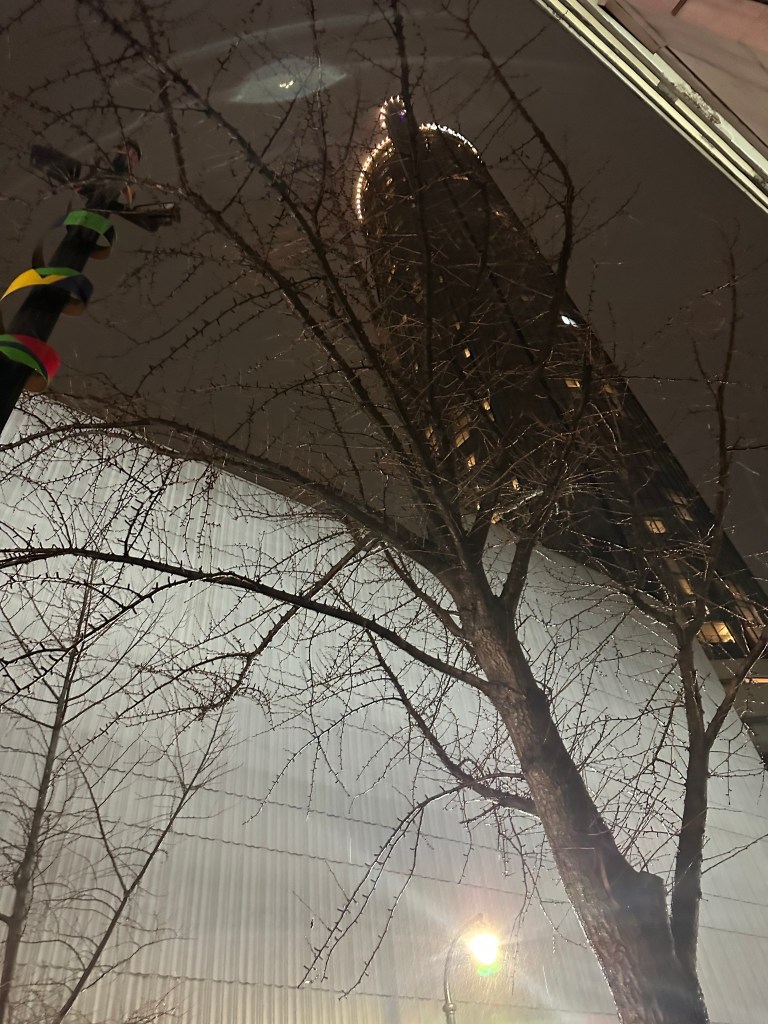
After a few minutes to relax, I headed down the massive Peachtree Center MARTA escalator to catch the train up to Midtown. There I had a great chat at Dancing Goats with Darin Givens of Thread ATL about the future of urbanism in Atlanta.
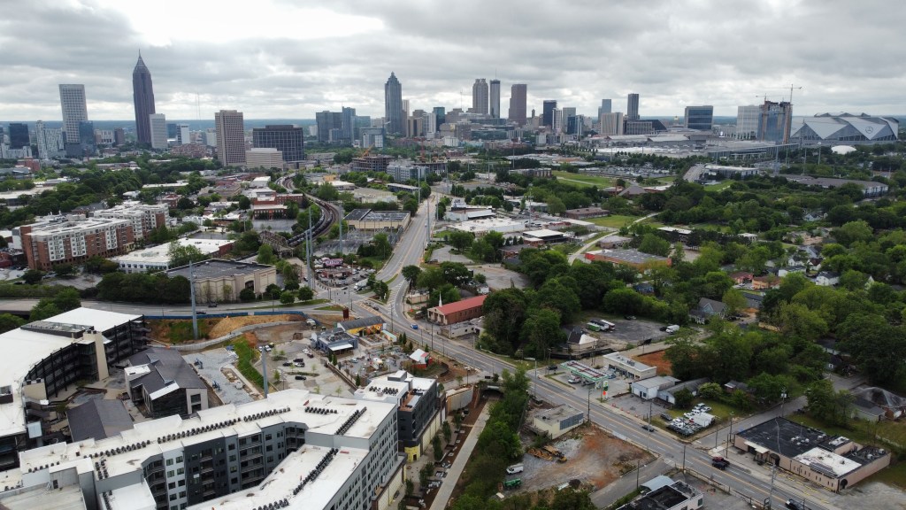
The walk back down Peachtree was a great opportunity to take in the great mix of old and new architecture along the famous street. It also took me past the massive Downtown Connector which will hopefully be buried soon in what would be the first of hopefully many Reconnecting Communities projects in Atlanta.
Next up was a MARTA trip up to Lenox Mall where there may have been more cops in the mall than people. One has to think we may be getting close to the legendary mall re-thinking the large parking lots and traditional setup and transforming it into some sort of urban shopping and mixed-use hub. A quick walk down Peachtree felt very out of place on foot despite being surrounded by 40+ story towers. After a quick loop I boarded MARTA at the site of another future highway cap to head back to Midtown.
Car Free Challenges:
Peachtree Road is massive and isn’t very inviting when considering the uses along the road. Ped refuge islands, protected corners and proper bike lanes are needed
A walk down 14th Street toward Piedmont was in store after departing MARTA. From there I grabbed dinner at Ponce and continued down the Beltline to get some night shots of the same places as earlier. The biggest challenge was getting to a MARTA station after passing Krog. I decided to scooter through the Inman Park neighborhood to the station. This is where the Streetcar extension will really help as there’s no good access from the Beltline currently.
To end the day, a quick walk from the Centennial Olympic Park MARTA station through Downtown was all I had energy left for.
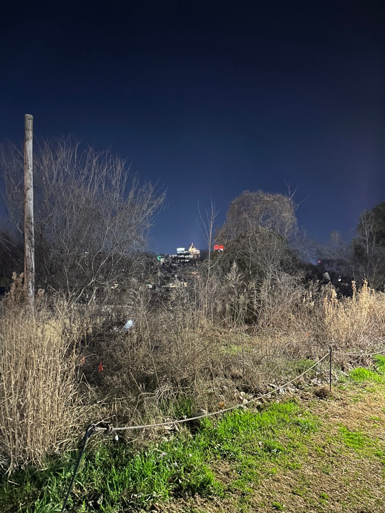
Bonus shots: A few rainy shots from the night before and shots of the Westside Beltline where I finally explored with some co-workers before heading out the next day. The Westside Beltline is full of history and sites prime for adaptive reuse.
Pro tip: It is also extremely easy, and cheap to get to the airport from MARTA.
While not ideal to some, it is possible and fun to experience Atlanta on foot. You get to see, take in, and experience so much more. As the city continues to grow and densify, the goal needs to be to make it even safer and enjoyable to thrive outside of the car.
Opinions and insights are my own and are not representative of my employer or any organization. Any ideas displayed on this site are purely that – just ideas to help improve the future of the built environment and begin discussions.I own the right to all photography. I’d love if photos are shared, just give credit please.
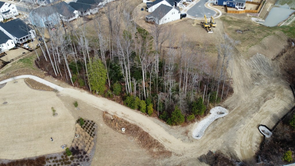
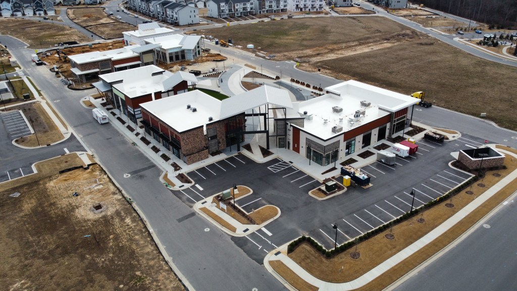
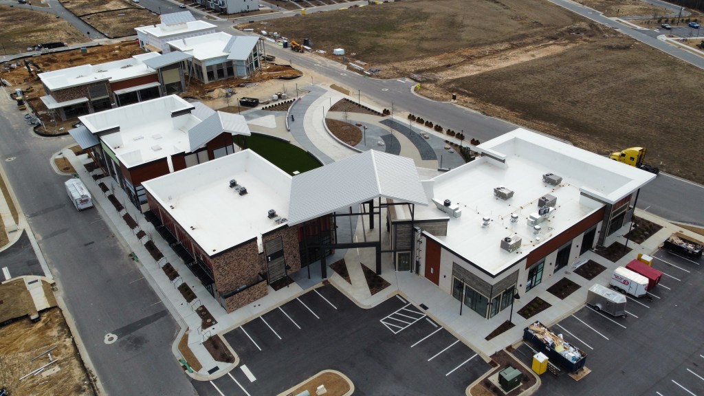
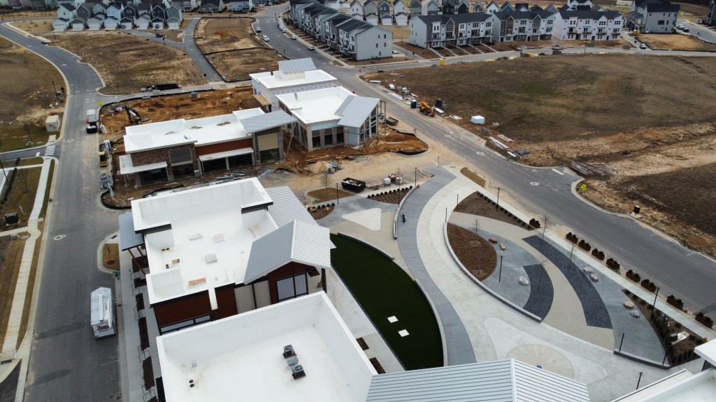
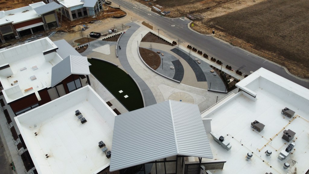
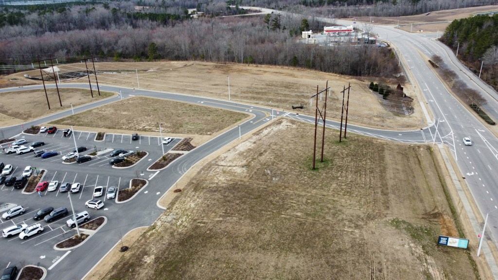
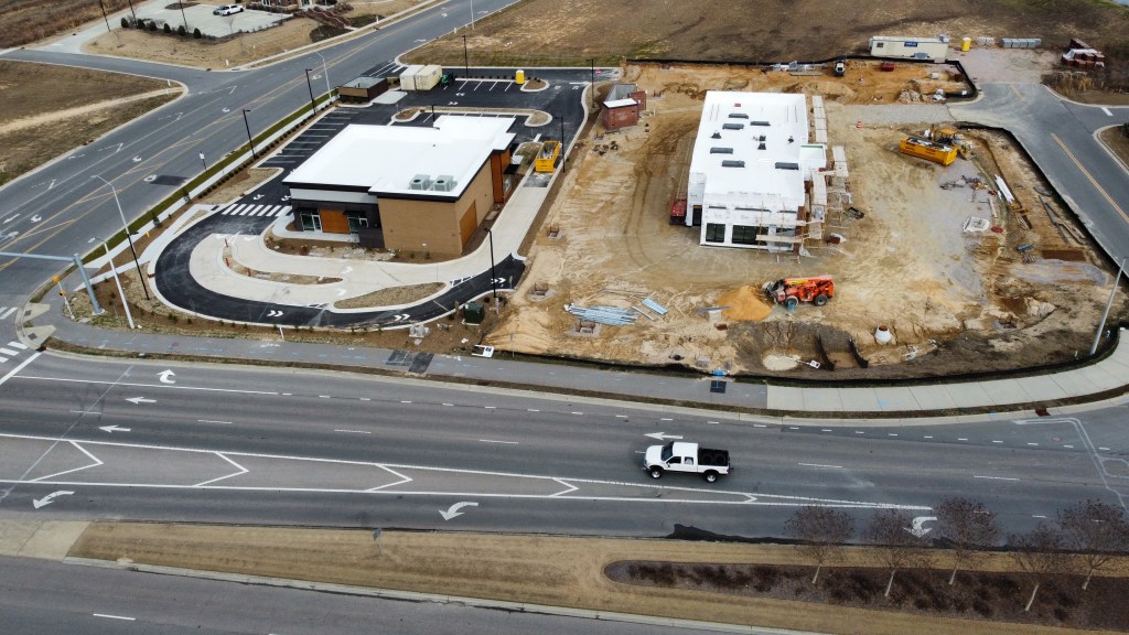
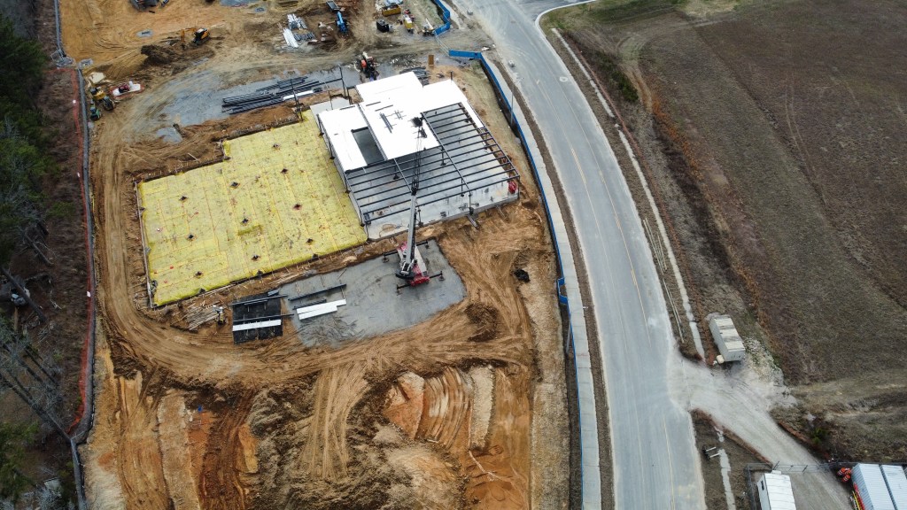
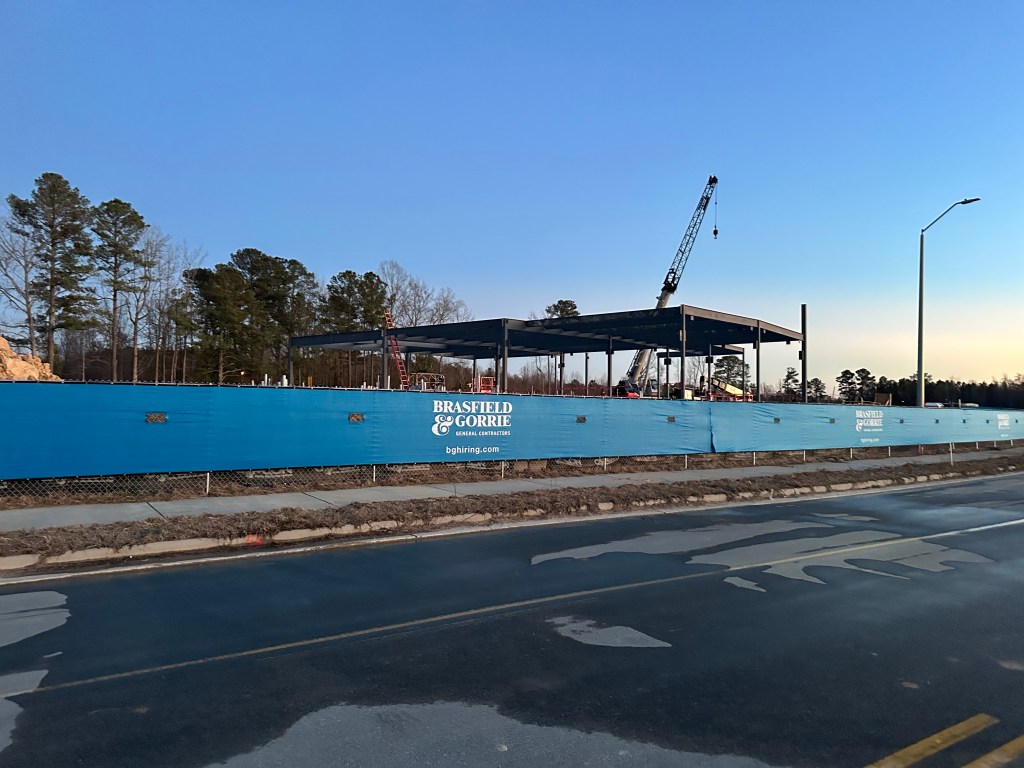
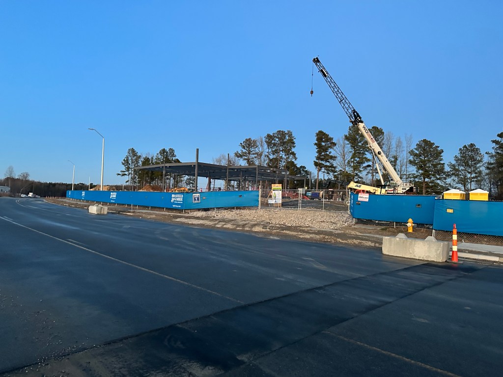
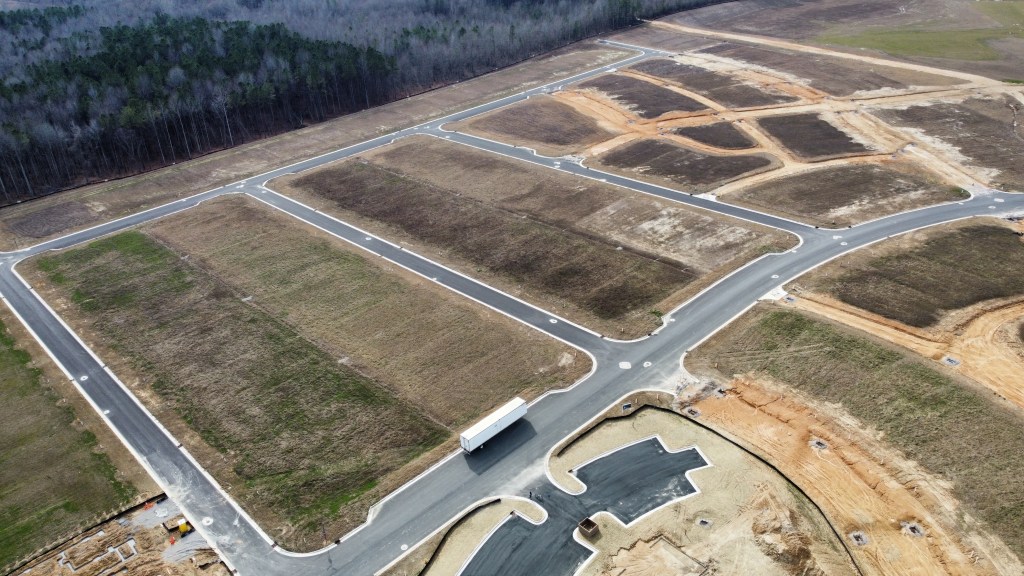
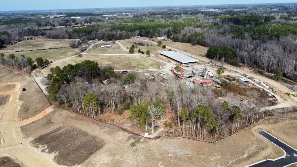
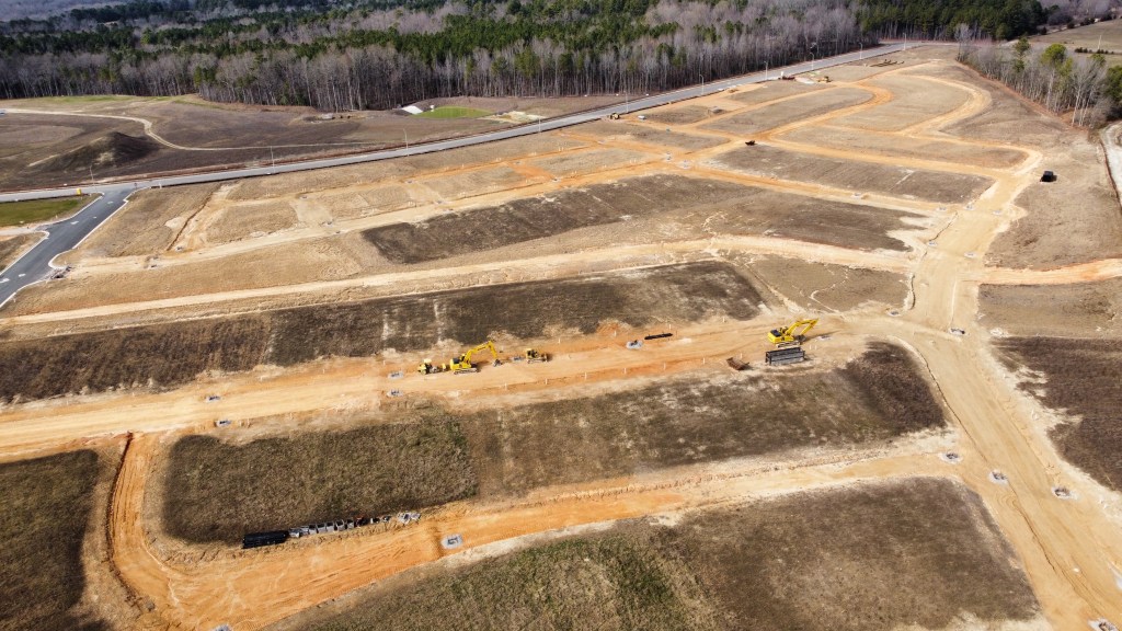
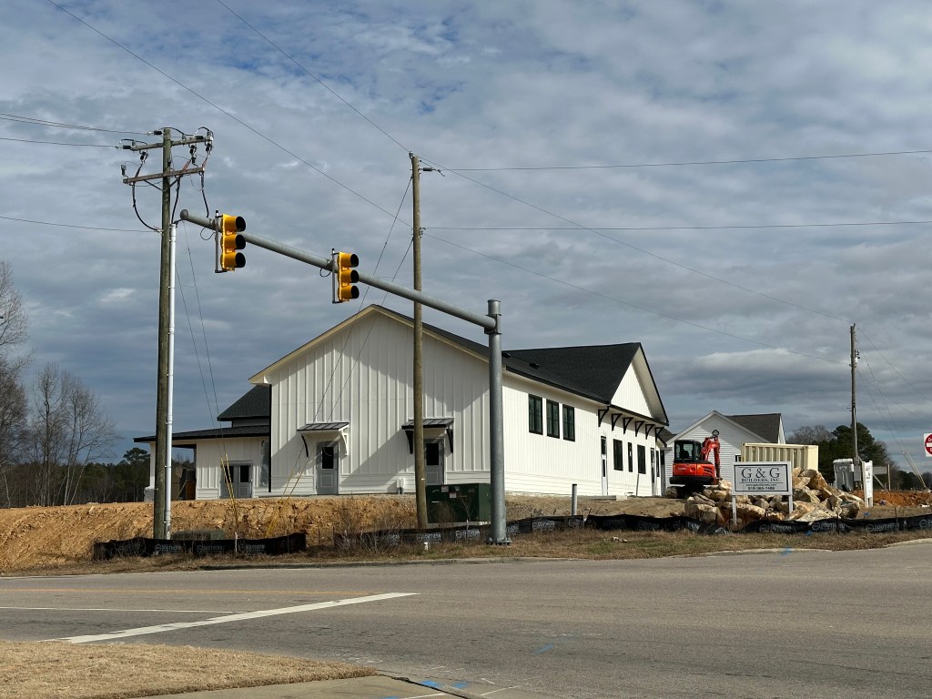
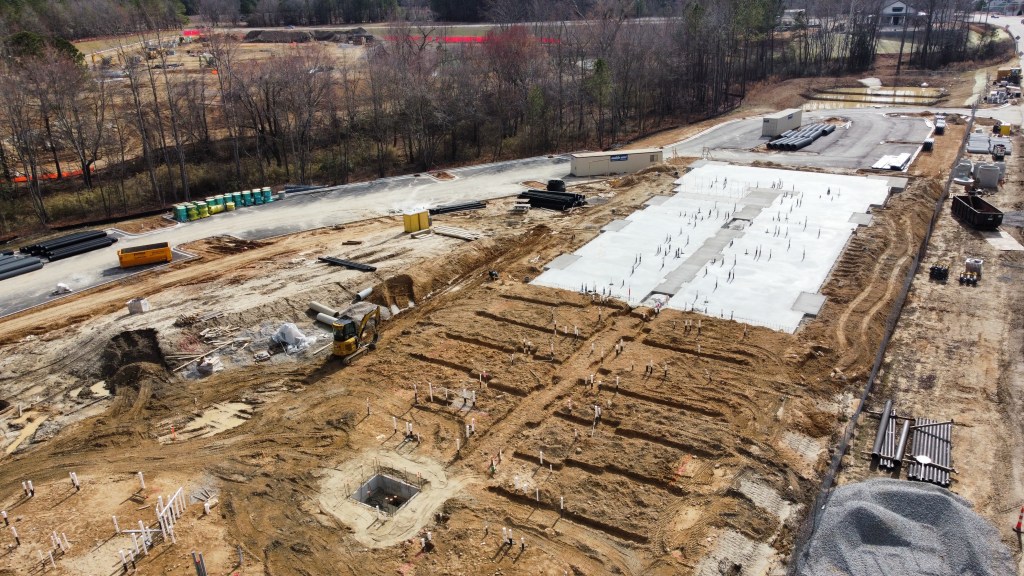
Don Beto’s, Falls Local, and Parkside are busy working on their interior build outs. Things are looking great- swing on by and take a look. Unfortunately, the glare is too much on the windows to get pictures.
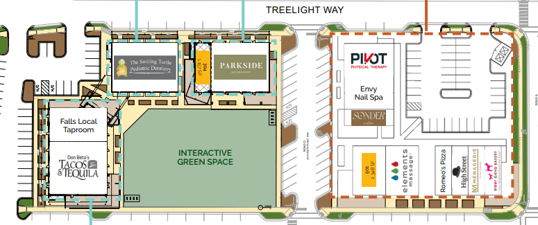
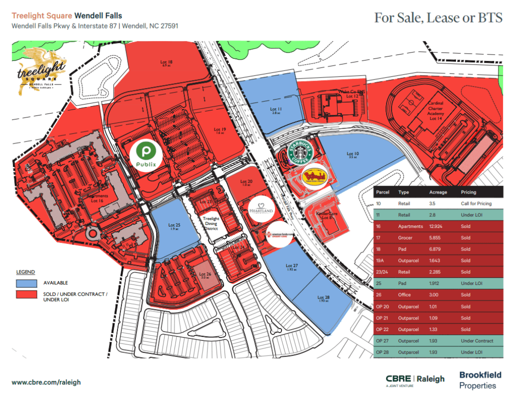
The Smiling Turtle Dentist is now open and we’ve had several new tenants announced as of late. The latest site plan courtesy of CBRE follows.
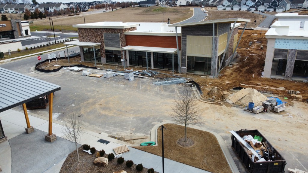
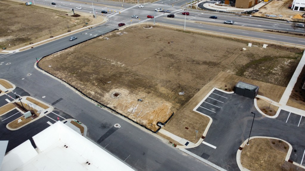
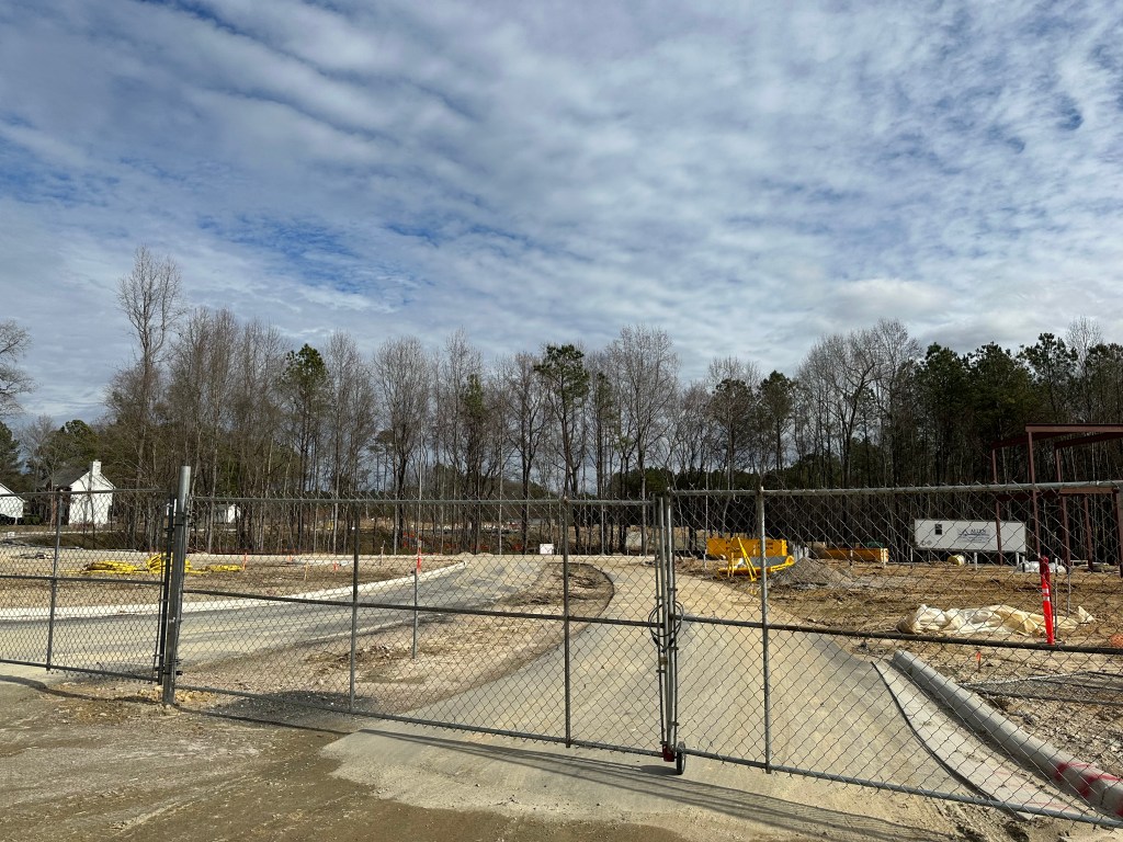
Construction still hasn’t started on the Treelight Office Building. Office in general is still struggling coming out of COVID. Given the great success leasing the Dining District, we may end up seeing more retail / restaurant instead.
Future Treelight Buildings
As for the Treelight Square outparcels, all are either Under Contract or Letter of Intent except for Parcel 10. Parcel 18 will be 55+ age targeted apartments. Parcel 19 will be McDonald’s. Parcel 20 will be Fifth Third Bank. Outside of that, nothing has been rumored or confirmed for parcels 27, 28, and 11.
Parcel 11McDonald’sSenior LivingFifth Third Bank
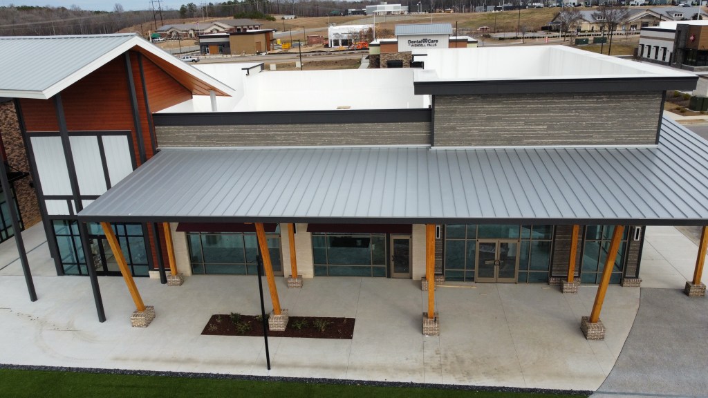
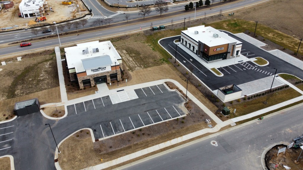
AFC Urgent Care and Dental Care of Wendell Falls
OPEN
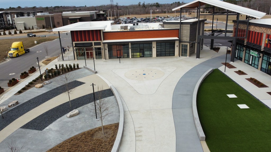
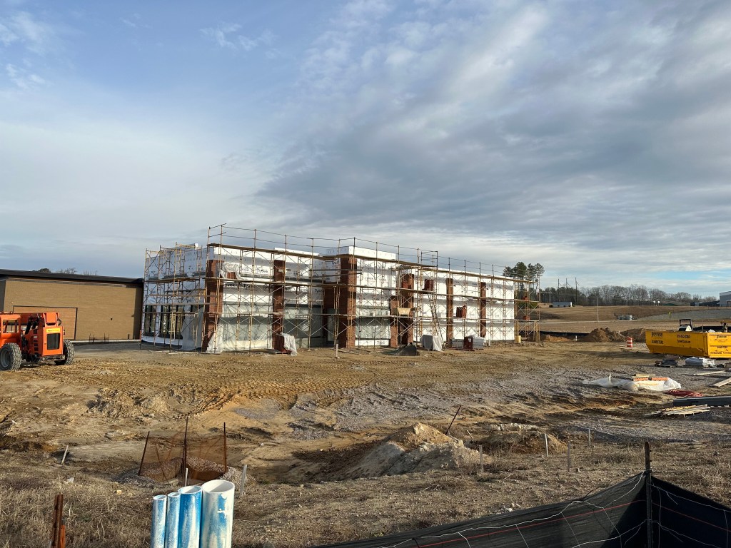
Starbucks building and Bojangles
The Starbucks building exterior is complete and turned over to the tenants (Starbucks, Jersey Mike’s, Wing Stop) to complete the insides.
Bojangles is working on their exterior brick finishes and inside has been framed and is starting dry-wall and other installations.
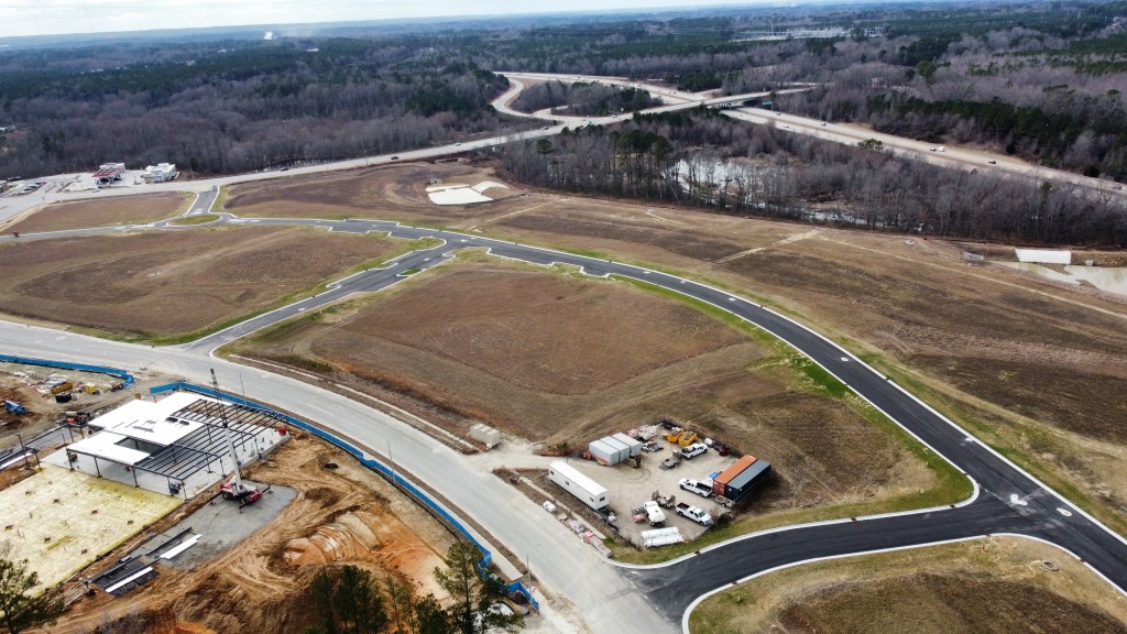
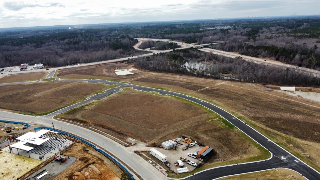
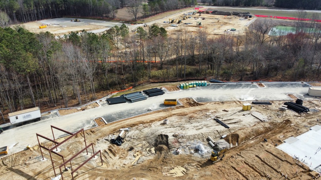
The Collective
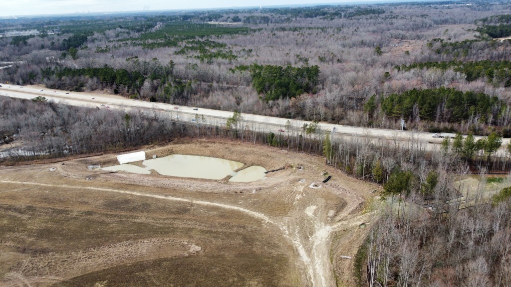
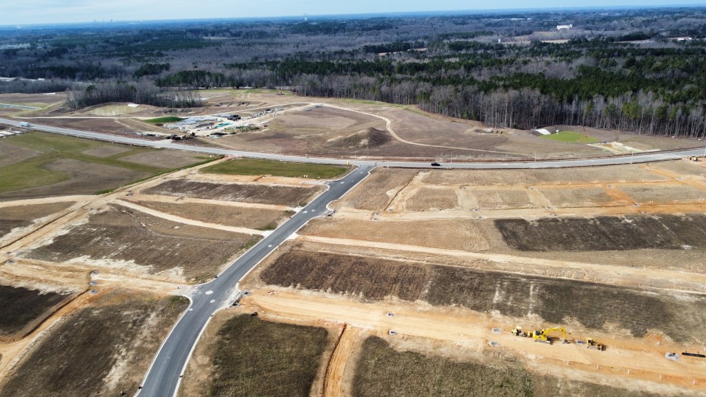
Wendell Valley Blvd has fully opened and lot survey lines have been established. This new road will eventually provide seamless and direct access to Rolesville Road and enhance connectivity between Wendell Falls and the Wake Tech / Wendell Commerce area. As of now, there’s no timeline available for the two sides to actually connect due to no funding for the railroad crossing.
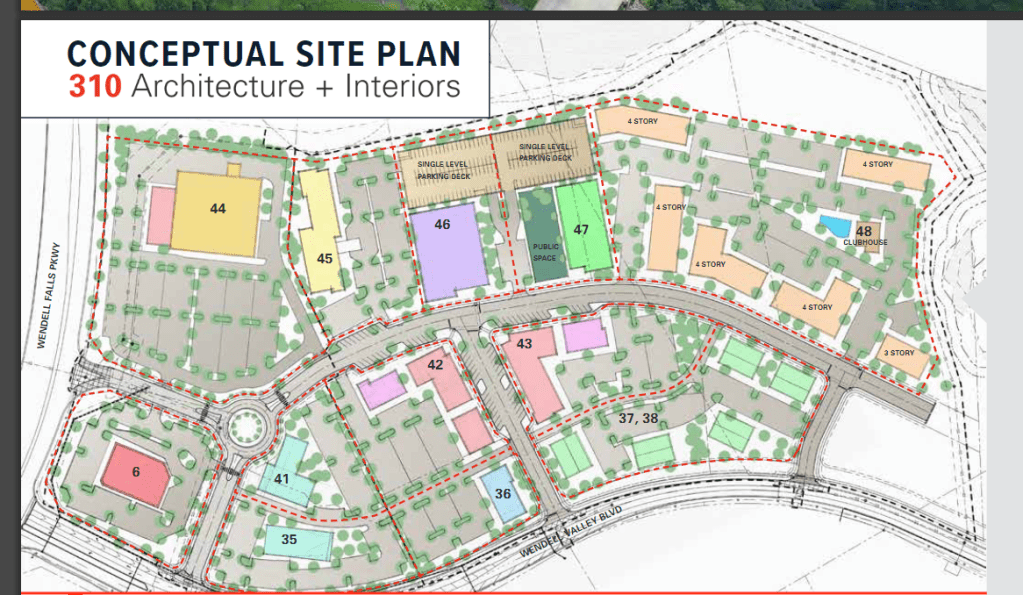
JLL had put out new marketing material that paints a picture of what may be to come for the Collective Lifestyle District! Plans could include another grocery store, pharmacy, movies, hotel, apartments, retail, restaurants and office. Be sure to check out the fly-through video on Youtube. Shortly after the listing went live though, it seemingly disappeared. When I reached out to the developer they were unaware of any sales of the property so it may be under contract / LOI.
JLLJLL
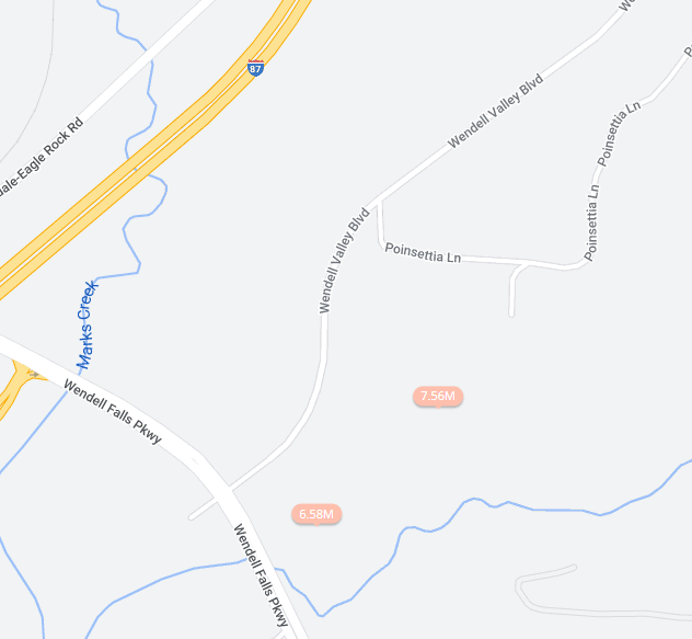
There’s also some plots of land that are not affiliated with Wendell Falls for sale adjacent to the Collective but are priced way above market value and have seen no movement since being listed.
Zillow.com
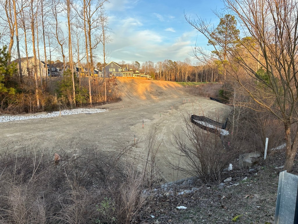
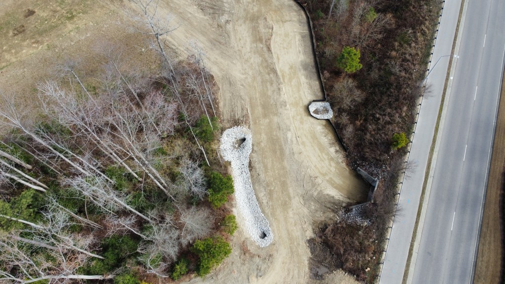
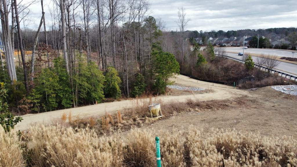
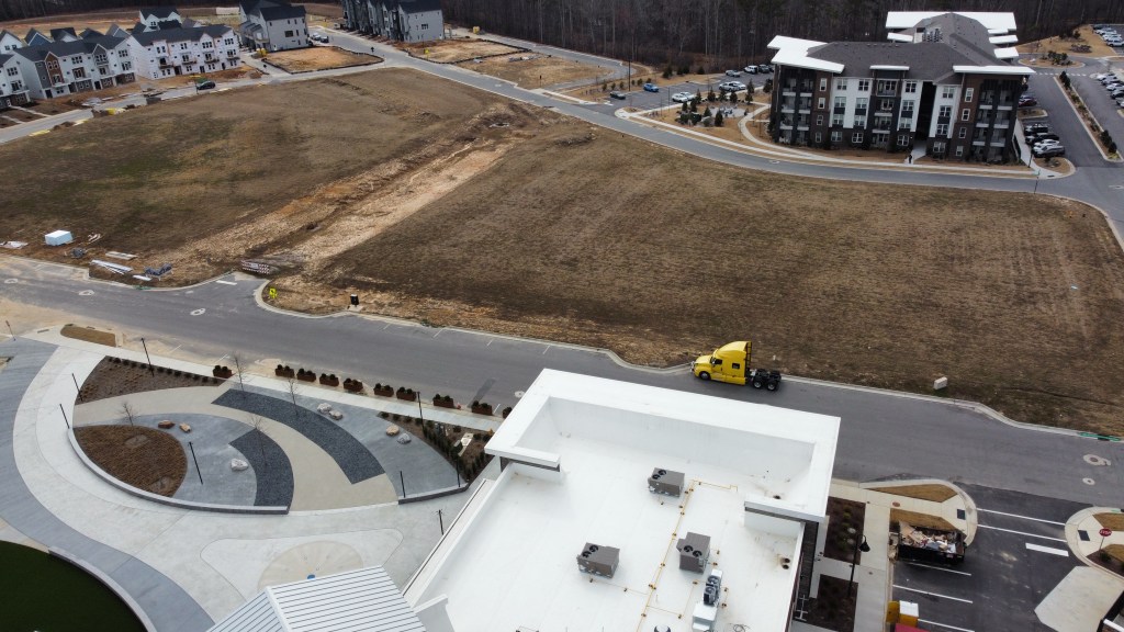
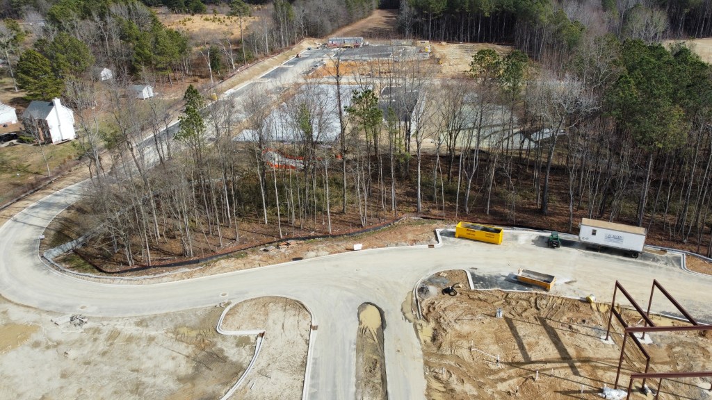
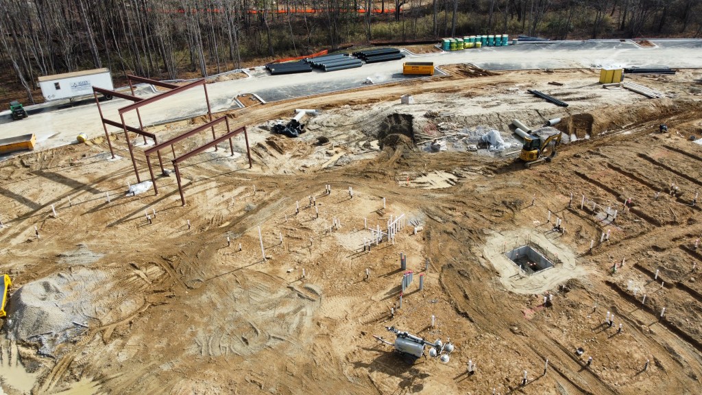
Adjacent to the Lifestyle District will be Wake Med. Work has advanced and the vertical build has began.
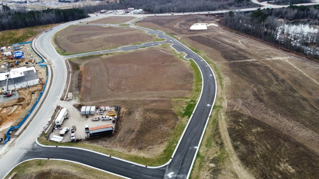
Behind there will be the Collective Office District where grading was complete and is now being used as a construction staging area.
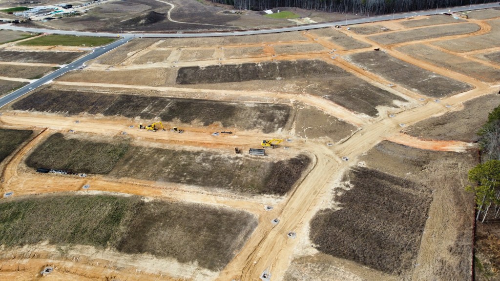
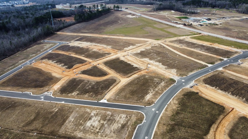
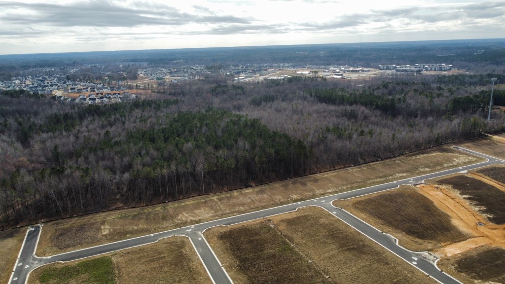
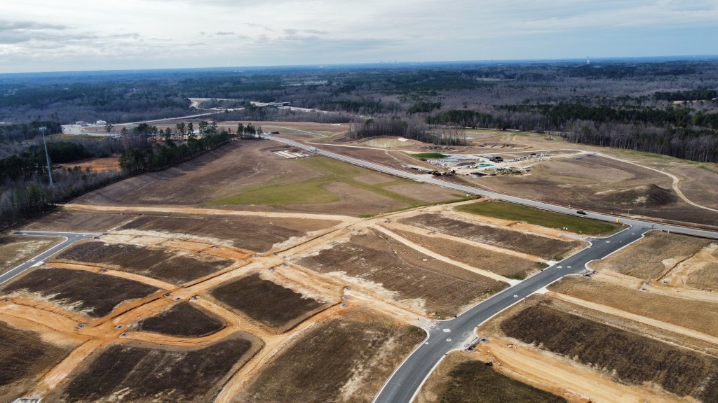
Parts of Phase 10 have opened and the first homes had their footers dug this week. Phase 11 has started clearing. These phases will include roughly 500 residential lots as well as a new pool. It’s important to note that there will be no connection between Phase 9 and 10/11 so travel on Wendell Falls Pkwy will be necessary. It is roughly 2 miles from the Farmhouse. My hope is that a trail along the sewer easement is at least constructed.
Even further out, toward and even past Knightdale-Eagle Rock Rd, will be another two future Residential phases and even perhaps some industrial on the NW side of Knightdale-Eagle Rock.
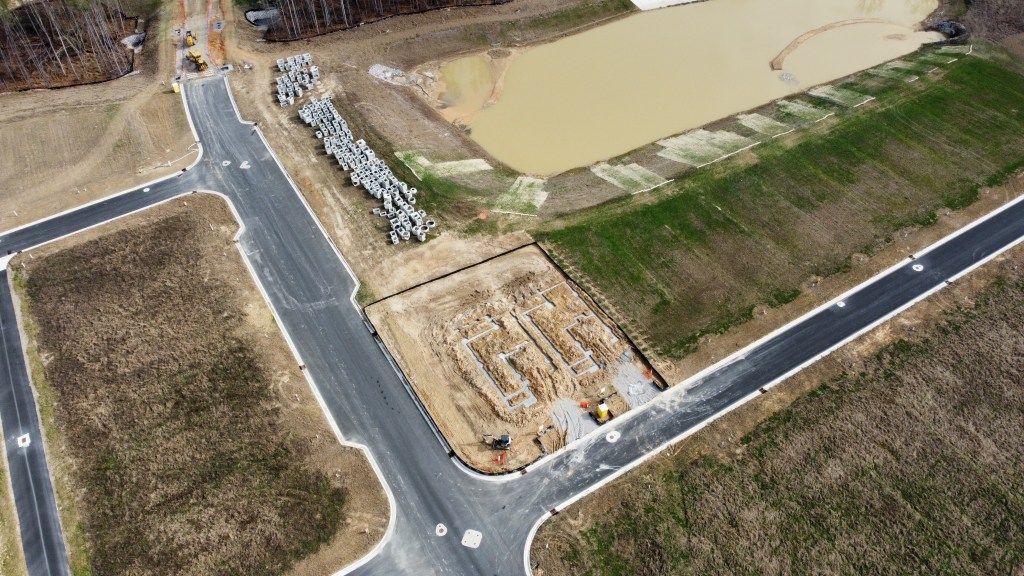
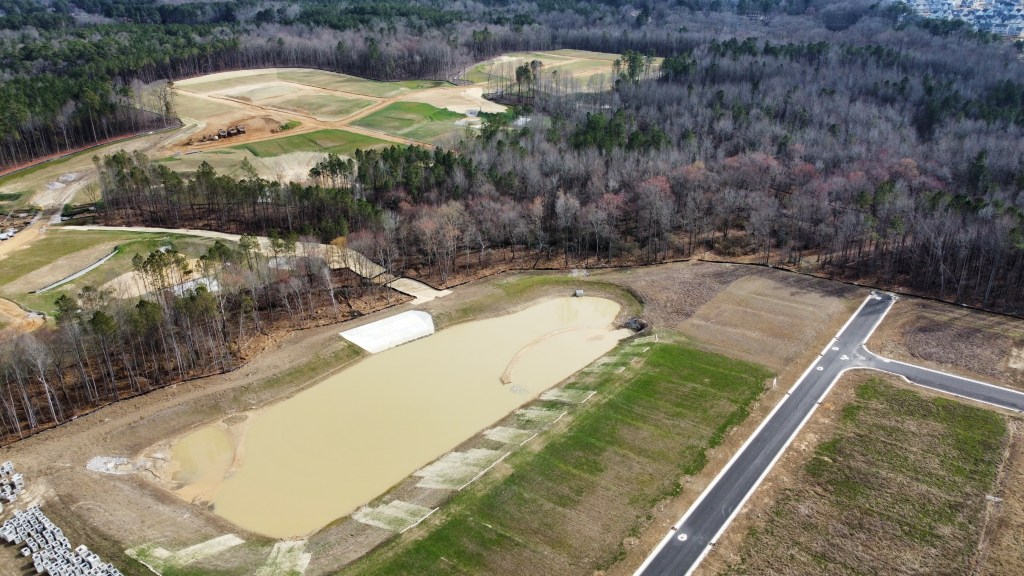
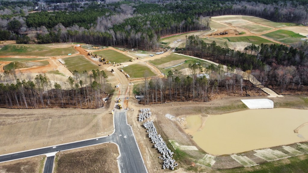
Neuse River Vet and Martin Pond Apartments / Outparcels
Neuse River Vet is nearing completion.
This phase of Apartments and Townhomes is installing utilities and pouring foundations. We’ll see vertical construction any day now.
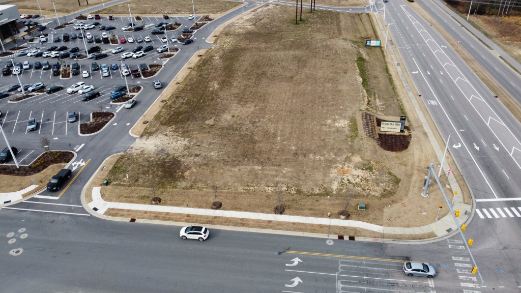
The other three outparcels have been graded and are available for purchase / lease.
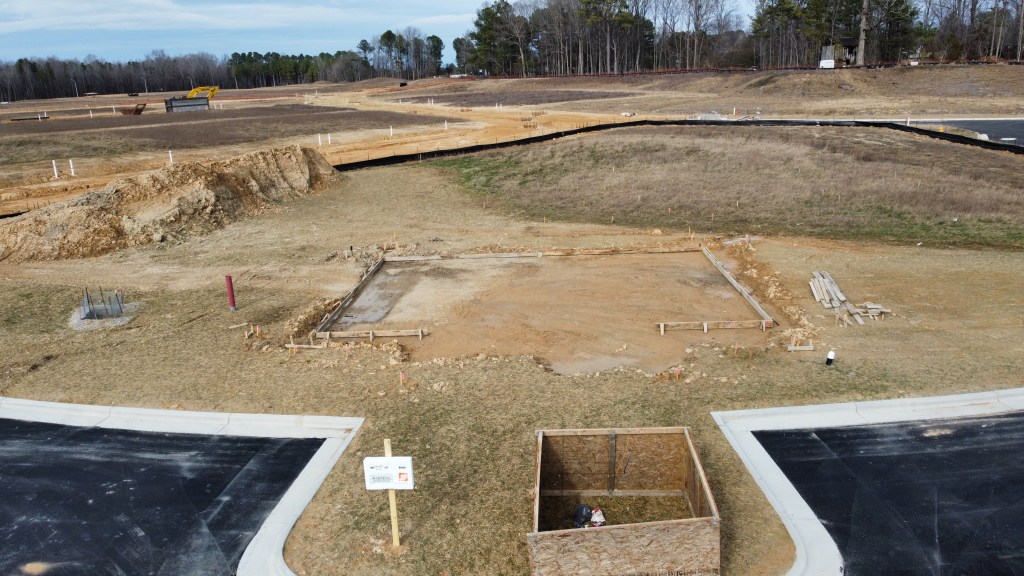
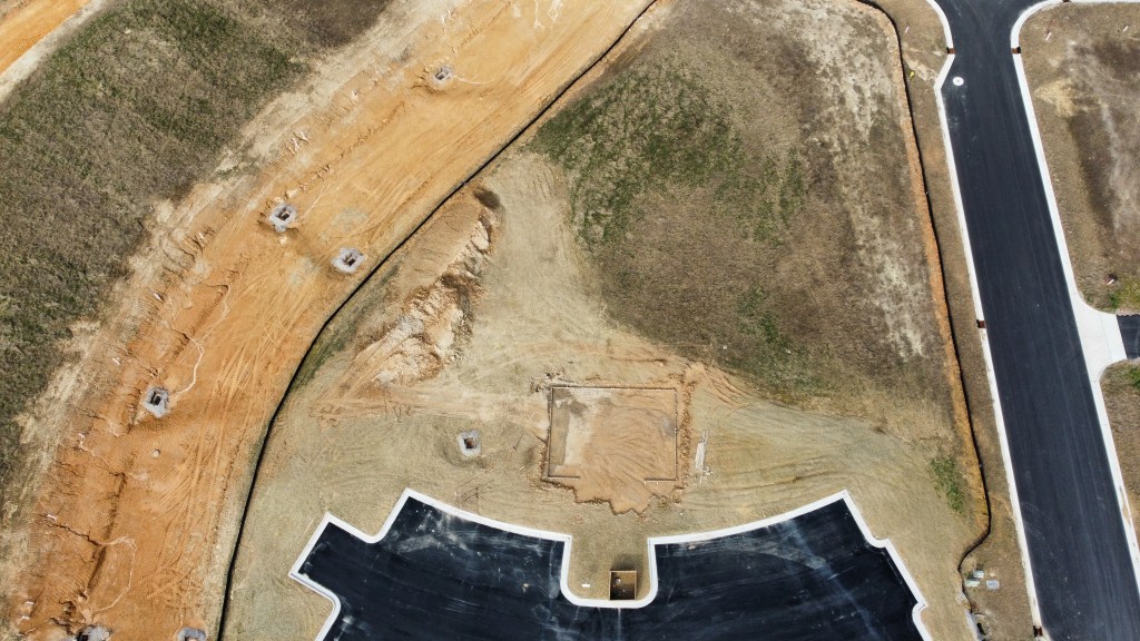
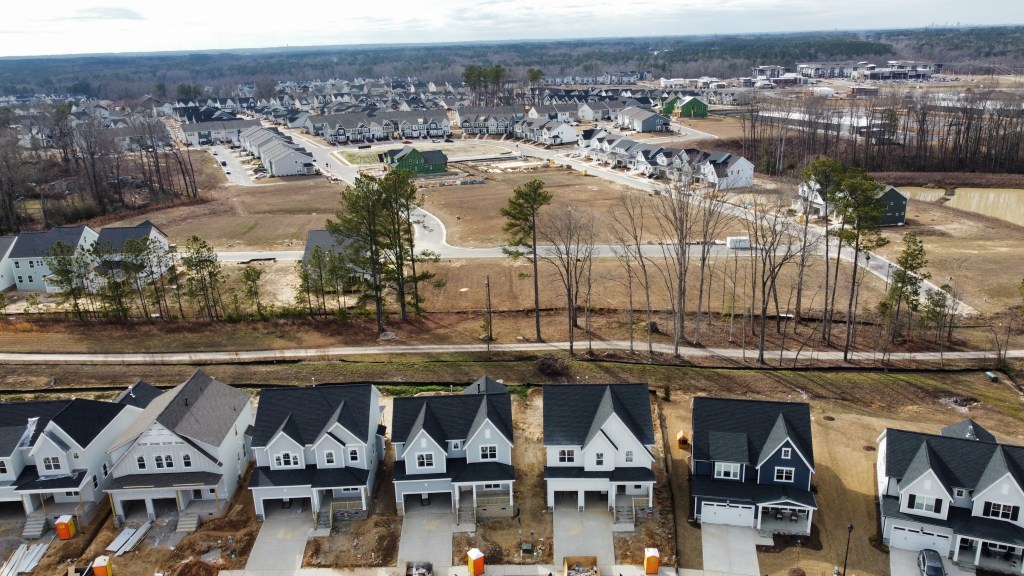
Residential Phases Work continues on tons of homes in Phases 9B, 9C, and 12. There are many homes available for quick move ins.
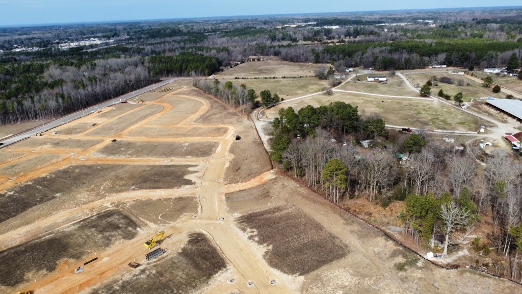
Richardson Farms
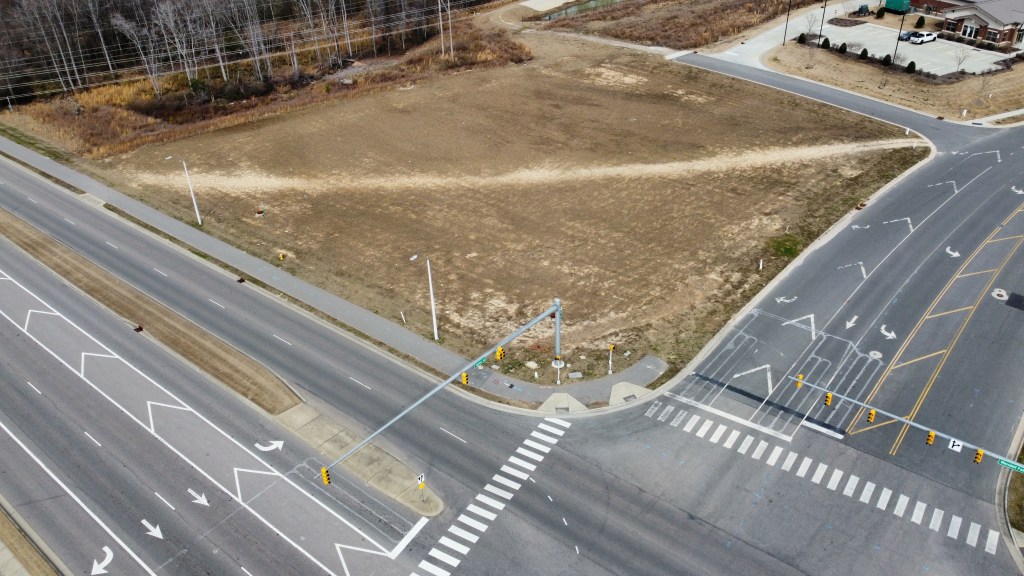
While not officially Wendell Falls, a major development opposite of the vet will be entering public hearing soon. I urge everyone in the area to voice their support to the Town Board on February 13th. This project will add to the commercial and retail offerings of the area as well as adding another dense mixed-use node that will help lead the area in the right direction. Plans can be found here.
Illustrative graphics courtesy of CBRE / JLL. Drone photography is for recreational purposes only. Views and insights are mine and not representative of my employer or any organization.
Raleigh was recently ranked the best place for driving which is a honor that actually carries a bunch of negatives. Mainly, it means that it’s extremely difficult and not safe to function outside of the car.
Here’s a look at some of the most ridiculous intersections in the area based on sheer size, land use, and demographics around them. Images via GoogleEarth
Dr. MLK Jr Blvd at Dawson / McDowell
Dr. MLK Jr Blvd at Dawson / McDowell serves as the gateway to Downtown Raleigh and is home to some of the best views of the city. But it’s an overbuilt freeway style interchange when it should serve as a walkable hub between Downtown and Dix Park. Fortunately, as the parcels on the North side of the interchange are developed, there are plans to modify a couple of the ramps into more of a quadrant interchange (similar to Peace and Capital on the other end of Downtown). Hopefully as Raleigh continues to densify and Downtown South develops the spine of South Saunders St, we’ll see the days where this is a complete at-grade typical intersection.
Glenwood Ave at Five Points
One of the most desirable neighborhoods just outside of Downtown is also home to one of the most dangerous and confusing intersections in the City. While it’s named Five Points, it’s actually a six-legged intersection in the middle of an underbuilt town-center village type area (we’ll save the underbuilt part for another day). The City is currently evaluating options to revamp this intersection.
Six Forks Rd at North Hills
As North Hills continues to grow and evolve, Six Forks Rd does not. For patrons who want to transverse the two sides of the massive development, they are faced with crossing nine lanes of busy Six Forks Rd just North of I-440. For the billions poured into North Hills, it’s a shame that Kane hasn’t invested in a pedestrian bridge here. He could even light it up and have his name all over it, just like his cranes. Kane if you’re listening, I have more ideas here for you. It’d make a worlds difference for North Hills to feel like one cohesive neighborhood instead of separate developments.
New Bern Ave at New Hope Rd
I-87 was built to relieve New Bern Ave and divert through and truck traffic that was headed up North and to the Coast. But, they forgot the part where they come back and diet New Bern into a safer street. They even re-designated it as US 64 Business in order to keep it under state control. This has also led to complications with the coming BRT route not being able to have dedicated lanes even though there’s four in each direction! All this plus being the economic hub of Raleigh’s Black community, lack of sidewalks, and insane crossing lengths make not just this intersection dangerous, but the whole stretch in the area. What good will BRT be around here without dedicated lanes and treacherous crossing conditions? I guess time will tell.
S Saunders St at Tryon Rd
Look at the size of this intersection! Just two miles South of Downtown, this is what we’ve built. And I haven’t even mentioned the horrible land use so close to the core. This is another location of Black and Hispanic commerce that doesn’t even have sidewalks and crosswalks. There are some big new connections and land use changes planned with the future BRT, and they can’t come soon enough.
US 70 at White Oak Blvd
About 7 miles Southeast of Downtown Raleigh you’ll find this sprawling strip-mall in Garner. If by chance wanted to walk from the North strip-mall to the South one, you’d be greeted with a 10 lane crossing with no crosswalks or pedestrian signal.
Glenwood Ave at Brier Creek Pkwy
Similar situation up in Brier Creek where you’d also be greeted by a nine lane unmarked crossing. Somehow when Glenwood in this stretch is converted to a highway, it will actually be safer to get around on foot since Brier Creek will be a bridge and you’d just have to cross the two on and off ramps.
Capital Blvd at Old Wake Forest Rd
Park once and get all your shopping done? Good Luck! Discontinued sidewalks, 10 lanes to cross and slip lanes say hello.
Glenwood Ave at Creedmoor Rd
What a massive slip lane! Do you live at one of the complexes less than 1/4 from the mall and want to walk there? Not so fast, unless you’re a car. Wait, actually then maybe not so fast either as this is the most clogged stretch in the city. This is another crazy situation where the upcoming interchange project may actually make it easier to transverse on foot.
Western Blvd at Avent Ferry Rd
At first glance this one doesn’t seem awful, right? There’s ped refuge islands and the road isn’t the biggest on the list. But, this intersection connects the two main campuses of NC State University and may have the highest ped counts of any intersection in the city. How the city, boosters, somebody, anybody hasn’t gotten a pedestrian bridge, or culvert here is beyond me!
Did I miss any that you think should be on there? Let me know!
Opinions and insights are my own and are not representative of my employer or any organization. Any ideas displayed on this site are purely that – just ideas to help improve the future of the built environment and begin discussions.
Tampa Bay’s secondary city has a lot to show for itself, with no plans of slowing down.
When you glance at the skyline of St. Pete, the first thing you’ll notice is that nearly all of the towers are residential in nature contrary to the Bay’s primary city in Tampa who’s focus is more corporate. The city of 300,000 sits about 20 miles Southwest of Tampa. Currently, eight of the nine tallest buildings are housing with all of the proposed towers containing residential as well. This creates an active buzz Downtown that punches way above it’s weight compared to cities of similar size. This also leads to streets that are lined with shops, restaurants and services that are active upwards of 18 hours per day. The mix of community feel with big city energy is what attracts many to the city.
Other Downtown attractions include St Pete Pier, which is one of my favorite urban spaces, multiple museums, parks, and countless shopping, dining, and nightlife opportunities in a mix of classic 1900s era to modern storefronts.
This map created by St Pete Rising, illustrates the amount of construction activity right now stretching from the heart of Downtown, down the spine of Central Ave. Some notable developments include towers 40+ stories, to low-rise mixed use activity hubs.
The big blights in Downtown currently are the two Freeway stubs of I-175 and I-375 as well as the massive sea of parking surrounding the Ray’s stadium.
Efforts are underway to remove I-175 and restore the original grid system which would provide a huge opportunity to stich together the Black community that was essentially severed from Downtown.
While I-375 serves more of a purpose in the eyes of many, it too is being considered for removal.
Together, these two freeways serve very little purpose other than getting people directly in and out of Downtown quickly. They also take up acres and acres of valuable land that could be used for housing and greenspace, and disrupt the otherwise perfect grid system.
The Rays have been aiming to replace their aging stadium for decades now. Outside of the eyesore sit over 50 acres wasted on surface parking in one of the most up and coming Downtowns. Threats of moving to Tampa, Montreal or elsewhere have not led to much progress but there are several proposals to repurpose the space into an urban destination.
The latest proposals sees the 86 dead acres transform into a thriving extension of Downtown with a focus on equity, sustainability and affordable housing.
The urban evolution of what’s called the Grand Central District stretches from the heart of Downtown Westward toward the Gulf along Central Ave. From Downtown to roughly 34th Street, Central Ave is lined with repurposed historical Main Street buildings that are now shops, breweries, food halls and more. There’s also been an increase of dense housing which have transformed this once sleepy stretch into an amazing walkable mix that feels like it stretches on forever. The area is also served by the brand new SunRunner BRT system which runs primarily in dedicated lanes along with the Central Ave trolley.
One of the most unique things about St. Pete is the impressive grid and alley system. The grid encompasses over 50 square miles of the city which is rare for the Sun Belt. Many of the residential streets aren’t cluttered with driveways or garages.
The nature of development in St Pete is also sprawl proof due to being surrounded by water. This has led to special attention to zoning and infill especially along Transit and major corridors.
While there is still a ways to go as far in allowing multifamily uses within single family zones, ADUs are extremely prevalent throughout the city and significant infill has taken place along the aforementioned Central Ave.
They have also made great strides in reducing parking requirements, minimum dwelling and lot size standards, as well as increasing the areas ADUs are allowed.
There is also an abundant supply of missing middle housing when compared to cities of similar size in the South. This has led to some relatively affordable options remaining through the recent surge in prices. According to Zillow, there are nearly 300 properties within the city limits under $250,000 and nearly 200 when a second bedroom is added. This number drops to 29 when adding a third bedroom. Raleigh, which has very little in the way of missing middle housing or grid system sees just 30 units for under $250,000.
ZillowZillowZillowZillowZillow
As with every city, there are a fair share of challenges. St Pete is very segregated, is seeing immense displacement in the historically Black neighborhoods and has seen affordability decrease with the influx of new residents.
While St Pete has the great grid system, land use is extremely poor along the main stroads.
GoogleMapsGoogleMapsGoogleMapsGoogleMaps
There are also more people who use bikes to get around than most cities even without much bike infrastructure. Repurposing many of the underused commercial corridors and overbuilt roads will be key to maintaining affordability. It will not only increase housing stock but also reduce car dependency and traffic with the addition of more mixed use nodes.
Opinions and insights are my own and are not representative of my employer or any organization. Any ideas displayed on this site are purely that – just ideas to help improve the future of the built environment and begin discussions.
The city of Raleigh saw most of it’s growth after racist, suburban development trends had been entrenched in American’s planning trends. This led to an extremely small original grid structure when compared to other cities.
Raleigh is referred to as “a giant suburb” by people for many reasons. The lack of true grid system outside of Downtown is one of the main reasons why. This makes implementing things like Missing Middle, bike and ped infrastructure and more much harder. Many people who live even a mile from Downtown have the feeling that they live in a single family suburb since they live on cul-de-sacs and windy roads. Let’s take a look at Raleigh’s grid compared to other cities. For this analysis, the grid is considered the area where most roads make rectangles.
Raleigh | Pop 500,000 | Metro Pop 2,100,000 | Grid Size 8 Sq Mi | City Size150 Sq Mi | Density 3333/mi | Grid % of City Limits 5
Durham | Pop 285,000 | Metro Pop 2,100,000 | Grid Size 10 Sq Miles | City Size 110 Sq Mi | Density 2590/mi | Grid % of City Limits 9
Greensboro | Pop 300,000 | Metro Pop 1,600,000 | Grid Size 18 Sq Miles | City Size 130 Sq Mi | Density 2300/mi | Grid % of City Limits 14%
Savannah | Pop 150,000 | Metro Pop 405,000 | Grid Size 23 Sq Miles | City Size 115 Sq Mi | Density 1300/mi | Grid % of City Limits 20
Charlotte | Pop 880,000 | Metro Pop 2,600,000 | Grid Size 23 Sq Miles | City Size 308 Sq MiDensity 2850/mi | Grid % Of City Limits 7
Atlanta | Pop 500,000 | Metro Pop 6,200,000 | Grid Size 56 Sq Miles | City Size 134 Sq Mi | Density 3731/mi | Grid % of City Limits 42
St Pete | Pop 300,000 | Metro Pop 3,100,000 | Grid Size 54 Sq Miles | City Size 135 Sq Mi | Density 2222/mi | Grid % of City Limits 40
Portland | Population 650,000 | Metro Population 2,500,000 | Grid Size 59 Sq Miles
New York | Population 8,500,000 | Metro Population 20,000,000 | Grid Size 600 Sq Miles
Images made with GoogleMyMaps
Thoughts
Cities that are smaller than Raleigh even have bigger grids
The grids of Raleigh and Charlotte make up a tiny fraction of the city
Grids make infill, multimodal transportation, transit and overall city building easier
Grids decrease infrastructure costs and are more sustainable due to decrease in road centerline miles
Sunbelt cities have smaller grids than elsewhere due to the time periods that they grew
Opinions and insights are my own and are not representative of my employer or any organization. Any ideas displayed on this site are purely that – just ideas to help improve the future of the built environment and begin discussions.
Nashville sits at the intersections of I-65, I-40, and I-24 making it one of the biggest freight corridors in the country. It also ranks as one of the of the biggest major freight bottleneck areas with greater than 65,000 annual truck hours of delay per mile.
Much of this has to do with the makeup of the freeway network through the city. The three major freeways converge and diverge in various configurations. There are 16 system to system interchanges within shouting distance of Downtown Nashville with 6 of them being interchanges where two of the major freeways merge to run concurrently.
GoogleMyMaps
These interchanges lead to a large increase in merging, weaving, sudden grade changes are sharp radii, leading to gridlock during rush hour and even during non-peak hours. As seen below, much of the urban freeway network suffers from delay during the PM rush hour.
GoogleMaps
Proposed Solution
Untangling this web of urban freeway mess will go a long way in the continuing transformation Nashville is seeing. While it will add a couple of miles to I-65, I-40, and I-24, it will increase safety, eliminate several system to system interchanges – which are the source of gridlock, and eliminate multiple freeway segments closest to Downtown.
I-65 | Existing Mileage (I-440 to TN 155): 10.5 Miles | Proposed Distance: 12.2 Miles
The new I-65 alignment will follow I-440 to the West then North of Downtown to the existing I-40/I-24 merge. The previous stretch from I-440 to Downtown can be converted to an Urban Boulevard serving as a new gateway and focal point coming into Downtown.
GoogleMyMaps
This will also facilitate the removal of the most offensive stretches of freeways damaging Nashville’s urban fabric allowing to stich together Downtown and Midtown.
GoogleMaps
I-40 | Existing Mileage (I-440 to I-440): 7 Miles | Proposed Distance: 8.4 Miles
GoogleMyMaps
The new I-40 alignment would simply follow the extents of I-440. This would bypass and eliminate three of the most congested interchanges that exist today while also creating another Urban Boulevard and removal possibility heading into Downtown.
I-24 | Existing Mileage (TN 155 to TN 155): 10.5 Miles | Proposed Distance: 15 Miles
The proposed I-24 alignment follows TN 155 / Bailey Pkwy East of Nashville. Out of the big three, I-24 would see the largest increase in distance needed to get through the city but offers big benefits by freeing the future improved Stadium area from being freeway bound and letting it become part of the East Nashville neighborhood.
GoogleMyMaps
From reclamation of urban space by the removal of freeways and interchanges, to enhancing a safe and efficient freight network, the benefits are endless for all parties involved.
Opinions and insights are my own and are not representative of my employer or any organization. Any ideas displayed on this site are purely that – just ideas to help improve the future of the built environment and begin discussions.