The North Hills area of Raleigh has been booming with development since the conversion of North Hills Mall into a lifestyle center in the early 2000s.
As the North Hills area has grown and densified, the lack of greenspace and connectivity usually seen in urban environments continues to hold the area back.
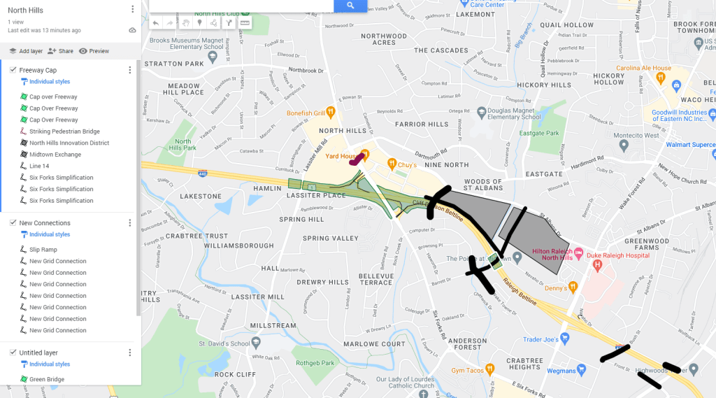
A combination of new connections, green bridges, and 20 acre freeway cap would enhance the lifestyle and connectivity of the area.
New Connections
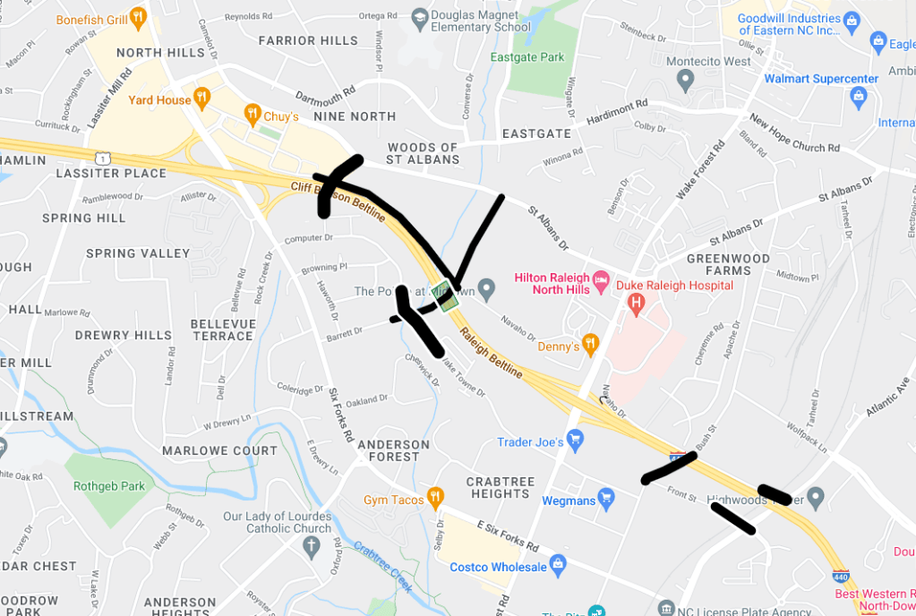
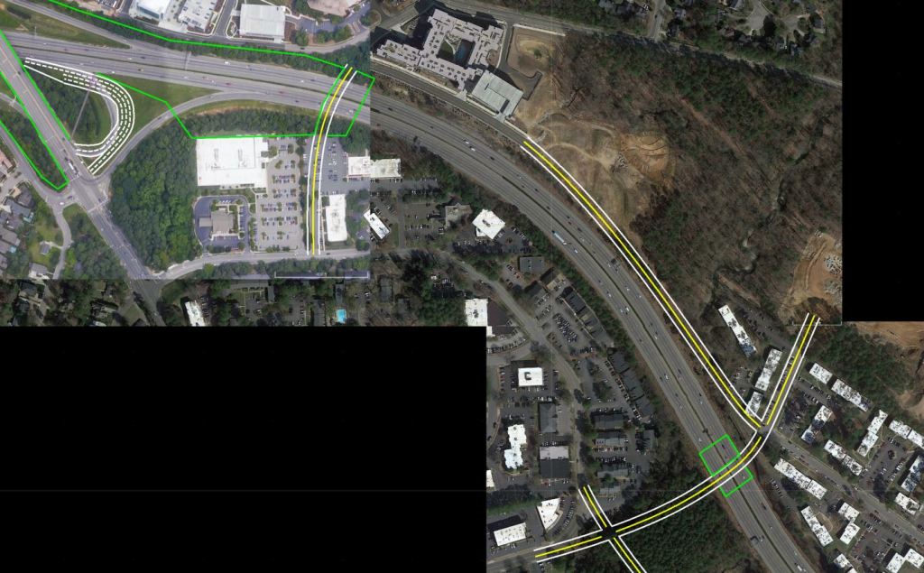
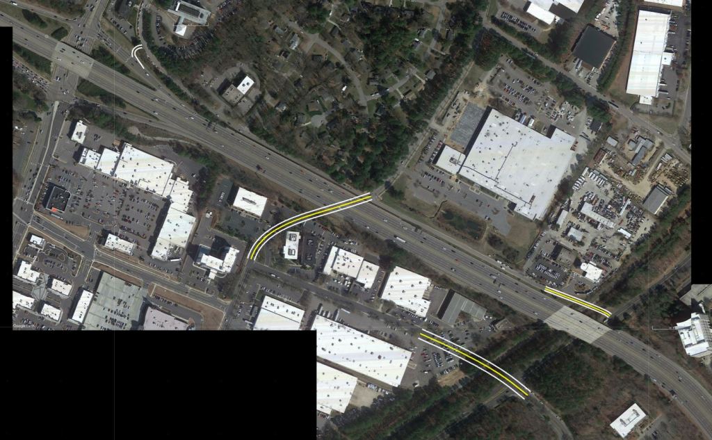
A series of new connections are proposed to enhance the street grid of the area. All new connections should be constructed as shared streets complete with wide sidewalks, bike facilities and street trees.
Currently, the only crossings of I-440 in North Hills are Wake Forest Rd, Six Forks Rd, and Lassister Mill Rd. The first two being major commuter exits to and from North Raleigh and beyond. With the proposed connections, pressure would be alleviated from the current major crossings and the interstate would be seen as less of a barrier.
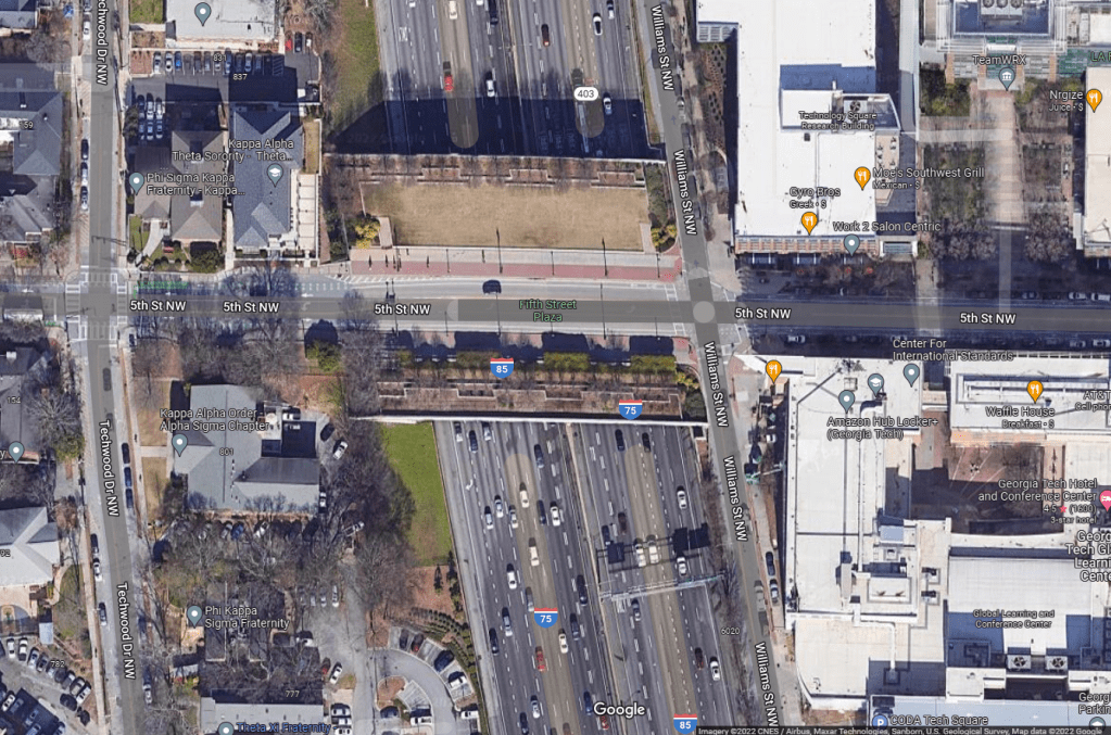
The Barret Drive extension should be constructed as a Green Bridge similar to 5th Street in Midtown Atlanta.
Freeway Cap
Freeway caps are beginning to gain traction in areas where full highway removal is deemed unfeasible.
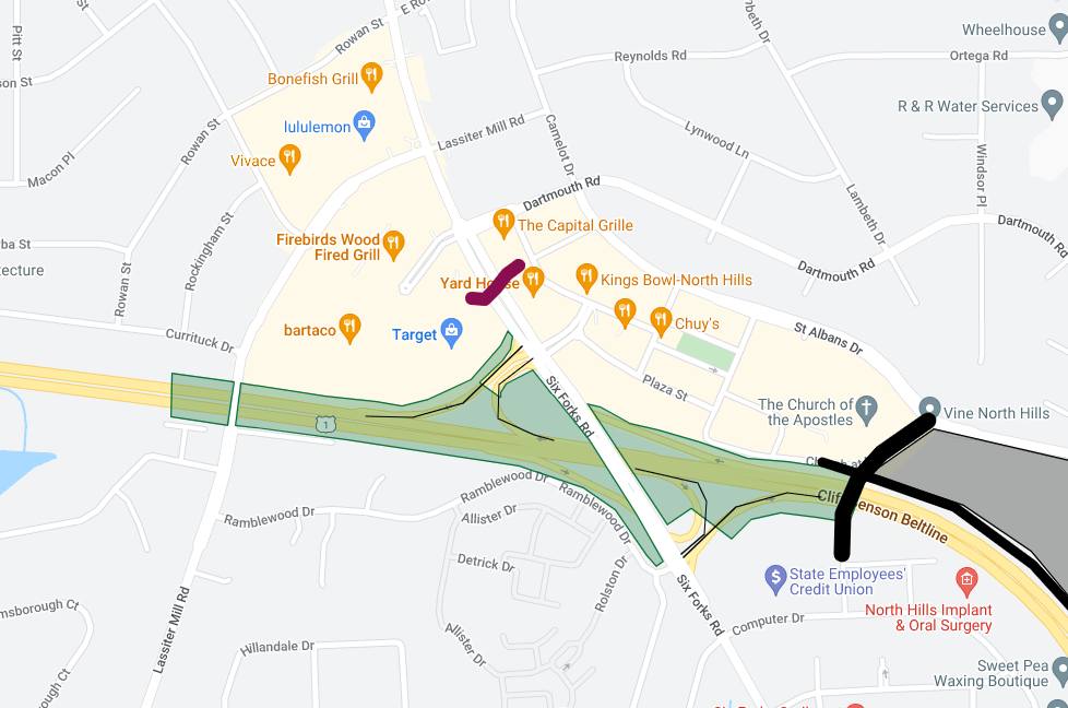
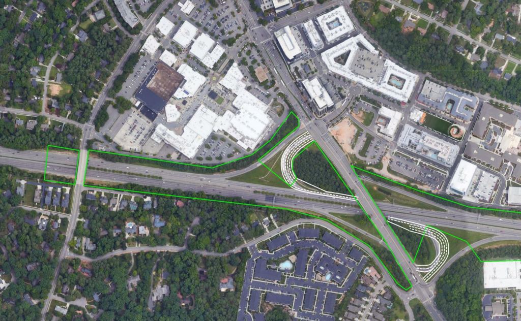
Adding a cap over the Interstate Right of Way from just West of Lassiter Mill Rd to the New Connection East of Six Forks would add over 20 acres of greenspace to North Hills. It would instantly become a beacon and center of activity for Raleigh’s Midtown, while also bridging together neighborhoods.
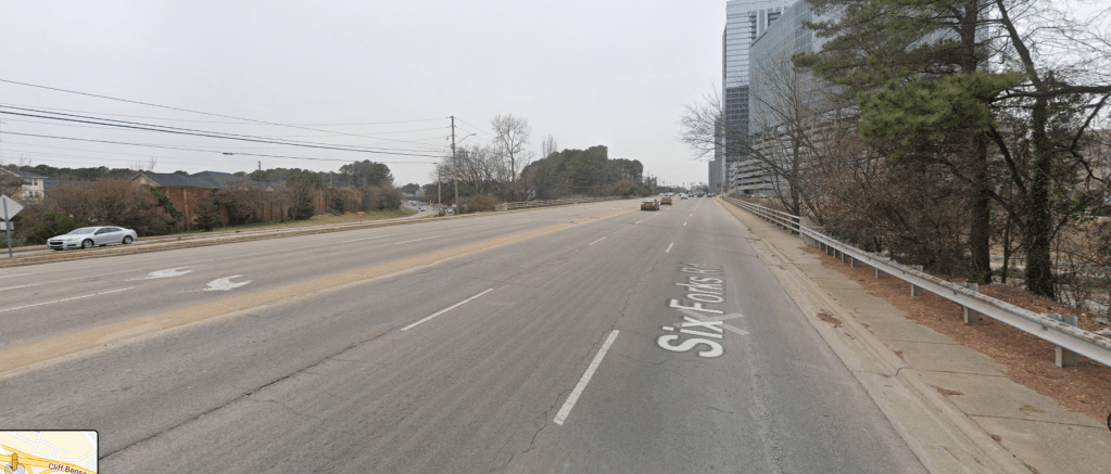
Currently, the bridge on Six Forks road is uninviting, and lacks proper multi-modal accommodations.
The cap will allow for the addition of seating areas, play areas, a greenway trail, and proper bike facilities throughout.
The elevation works out for the freeway cap as well with the Six Forks and Lassiter Mill Rd bridges both passing over I-440.
The City of Raleigh is getting set to embark on a Six Forks Rd enhancements project where bike lanes, medians, and safety improvements will be installed from Lynn Rd to Rowan St. These improvements should be carried down to past the interstate with the cap plan. In addition, a signature pedestrian bridge should be added to further connect the two sides of North Hills at the Main St intersection.
View the interactive Google Map and sketches below.
Opinions and insights are my own and are not representative of my employer or any organization.

4 thoughts on “Connecting Downtown Raleigh Bonus: North Hills Freeway Cap and Grid Plan”