Phil Veasley is a Professional Engineer working with Toole Design Groupto design safer multimodal infrastructure in cities throughout the US.
My goal is to create cities that are safe and effective for all people to move about outside of cars. To achieve that we have to focus on creating equitable, dense, and vibrant cities full of walkable neighborhoods with a various mix of housing choices, schools, restaurants, and services. We cannot have safe multimodal infrastructure without the density to support it and we cannot have equitable density without safe multimodal infrastructure. Outside of designing safe streets, my passions are sketching ideas for infill neighborhoods, floor plans, urban photography, and exploring our cities on foot or bike. Please check out the menus above for all of my ideas and also check out my YouTube, Instagram, and Twitter accounts.
Opinions and insights are my own and are not representative of my employer or any organization.
The dog days of Summer are here, and are we sure feeling it! The Urban Connector monthly newsletter looks back on the best of the previous month as well as ways to get involved in the coming month.
Please make sure you sign up below to have these delivered straight to your inbox and follow on YouTube,Twitter, and Instagram.
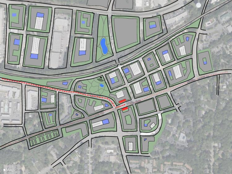
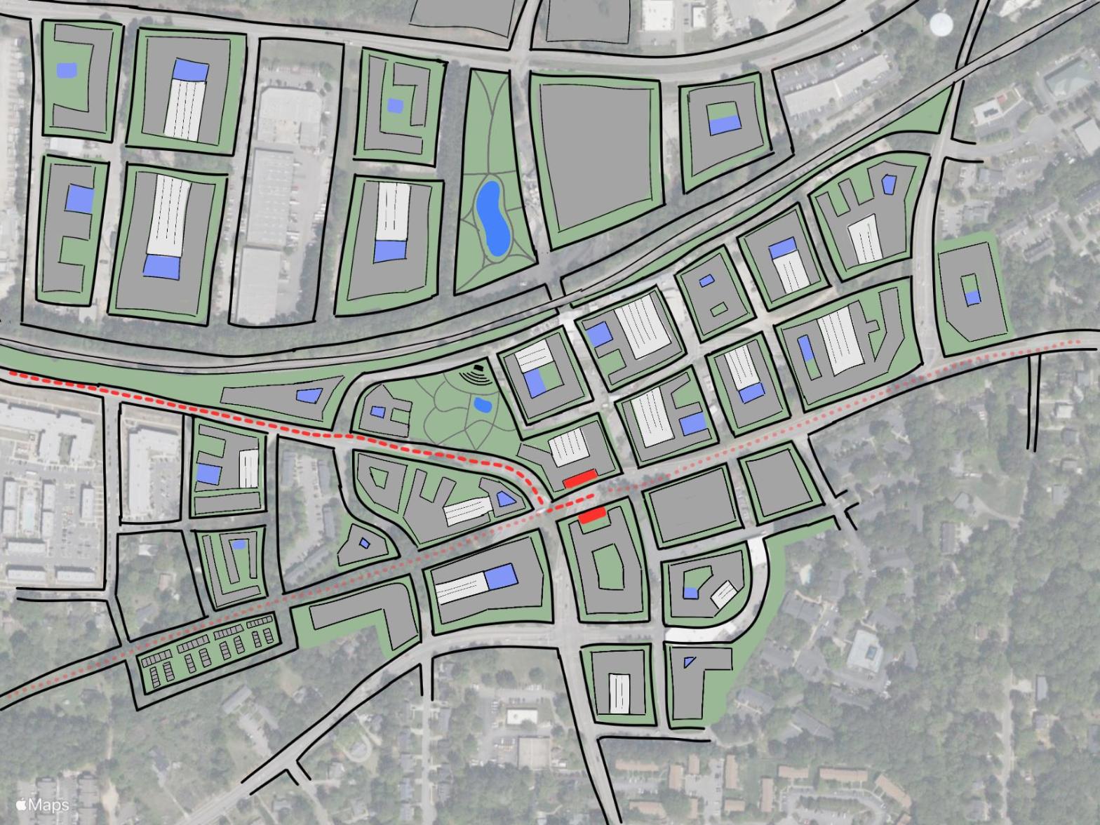
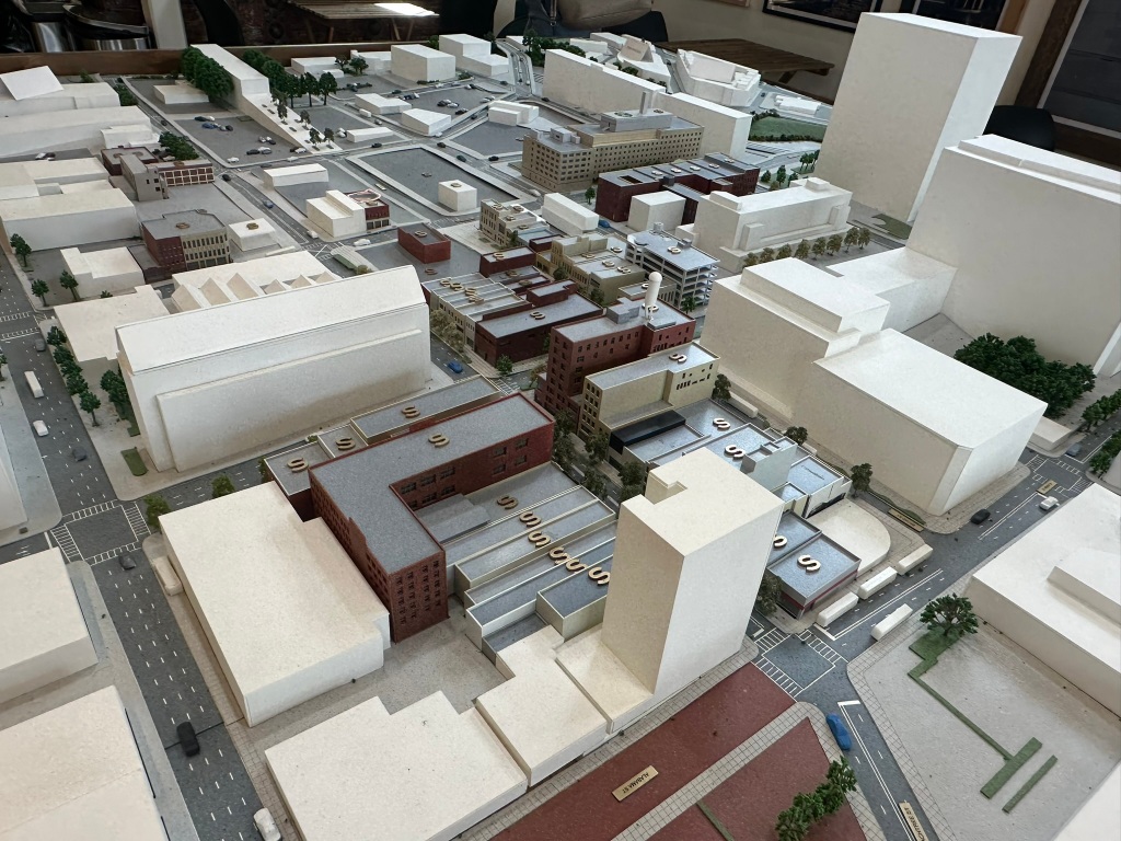
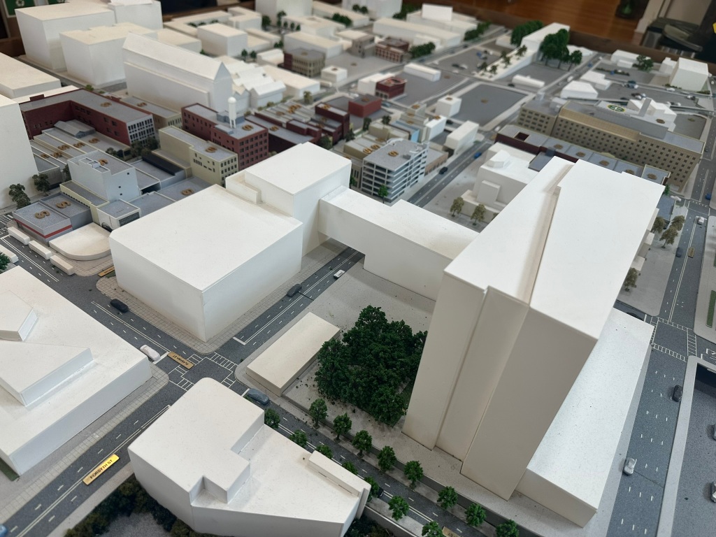
Conceptual station area plan for the 1st stop along a hypothetical Northern Arc BRT line in Raleigh. NOTE: I do not own, control, have actual say, etc over any of the proposed redeveloped parcels. This is just an idea and just a sketch.
Memorial Drive Cycle Track – GDOT is adding a protected two-way cycle track connecting Downtown Atlanta to (just about) the Beltline along Memorial Drive! Paving is complete, and bike signals are being installed. We could be close to seeing the actual striping alignment going in. This one is absolutely a game-changer for getting around the area. GDOT deserves credit here.
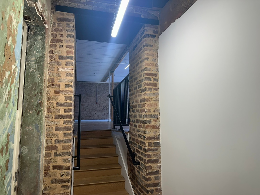
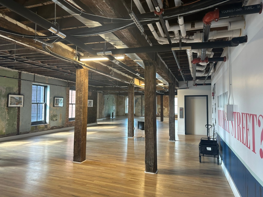
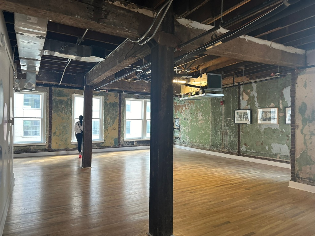
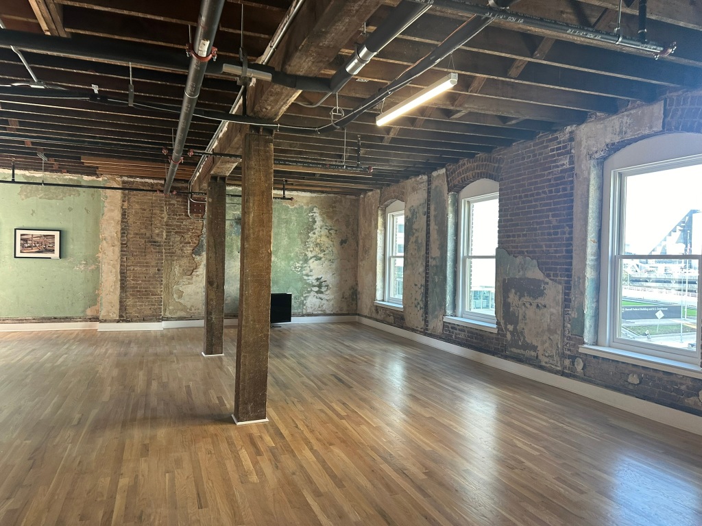
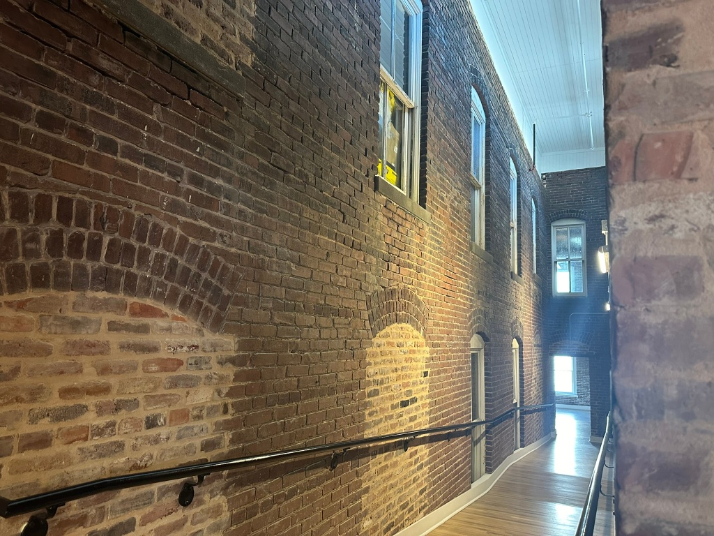
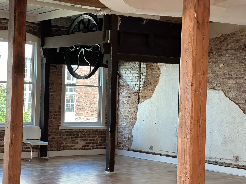
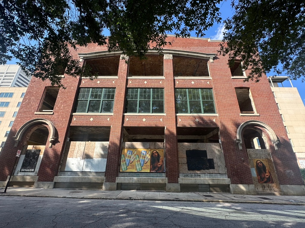
Raleigh Iron Works – Raleigh Iron Works has reached completion in Phase 1 and several restaurants and spaces are open including an adult slide! The finishes, material choices, and spaces are top notch and it would probably be my favorite spot in Raleigh if it had any sort of connections and cohesiveness with the surrounding neighborhoods or safe access outside of the car.
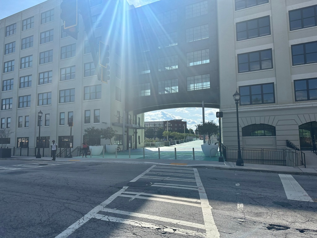
Centennial Yards funding – The next phase of the Gulch filling development is taking steps forward by selling $500 million in bonds for funding. This phase will be an entertainment hub across from State Farm Arena to capitalize on the tourist nature of the area. Things have taken a significant turn toward residential and entertainment from the earlier office heavy plans. The more housing, the better for Downtown.
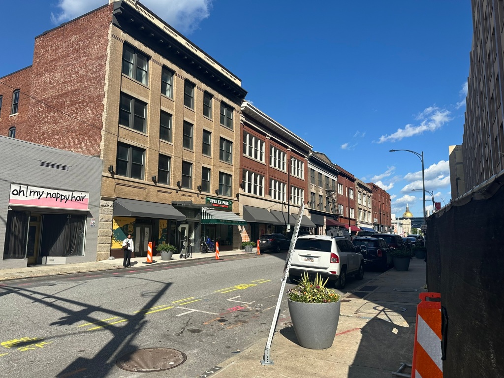
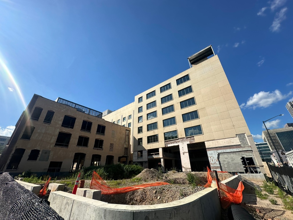
South Downtown, rolling ahead! – Next door, South Downtown‘s $100 million next phase known as “Project Elle” is moving forward and could be complete in time for the World Cup. I have such high hopes for the South Downtown project. The right people and right minds are on board to make it happen. Like I mentioned, the more residential, the better. Check out last month’s newsletter if you missed it for a behind the scenes tour of South Downtown!
Upper Westside leading the way in trails – More trails are coming to the Upper Westside by way of a $16 Million RAISE grant which will connect Midtown directly to Westside Park.
North DeKalb Mall suburban retrofit – North DeKalb Mall is out to make way for Lulah Hills. The largely abandoned suburban style mall will now be home to nearly 2000 residences, retail, restaurants, and a hotel. My only gripe is the lack of interaction and cohesiveness with the main roads and surrounding neighborhoods.
Beltline budget boost – Atlanta Beltline, Inc released their largest budget to date which will accelerate construction and aim to build more housing. The goal is to still have the “U” open by the World Cup. Also be sure to check out their great construction updates.
Downtown rail hub has life?! – AMTRAK has requested $30 million for the preliminary design, planning, acquisition, and engineering for a “key Downtown site at imminent risk of development” for a multimodal rail hub. One could only imagine it is in Centennial Yards. It can not be understated how big it would be for the City and the future of passenger rail for the hub to be right there!
Things to Know – Atlanta
Very quiet month upcoming with a lot of Summer recess for councils and committees. On 7/10 I’ll have the privilege of participating in the Beltline Rail Now panel discussion. Details at the link below!
I’m sure this newsletter will evolve as time goes on. Comments or suggestions? Let me know!
Phil Veasley is a Professional Engineer working with Toole Design Groupto design safer multimodal infrastructure in cities throughout the US.
My goal is to create cities that are safe and effective for all people to move about outside of cars. To achieve that we have to focus on creating equitable, dense, and vibrant cities full of walkable neighborhoods with a various mix of housing choices, schools, restaurants, and services. We cannot have safe multimodal infrastructure without the density to support it and we cannot have equitable density without safe multimodal infrastructure. Outside of designing safe streets, my passions are sketching ideas for infill neighborhoods, floor plans, urban photography, and exploring our cities on foot or bike. Please check out the menus above for all of my ideas and also check out my YouTube, Instagram, and Twitter accounts.
Opinions and insights are my own and are not representative of my employer or any organization.
Today, the area sees a low density mix of strip malls, underutilized industrial land, and over-built suburban style roadway network.
GoogleEarth
In the future, the possibilities exist to transform the area into a vibrant, mobility rich mix of housing, shopping, and dining that would make car-lite and car-free living a realistic option. NOTE: I do not own, control, have actual say, etc over any of the proposed redeveloped parcels. This is just an idea and just a sketch.
The district is anchored by over a dozen new blocks of realigned roadways to create a grid system anchored by residential over ground floor retail, parks, and greenspace.
Stay tuned over the coming months as we’ll work through all of the stations along the corridor.
Phil Veasley is a Professional Engineer working with Toole Design Groupto design safer multimodal infrastructure in cities throughout the US.
My goal is to create cities that are safe and effective for all people to move about outside of cars. To achieve that we have to focus on creating equitable, dense, and vibrant cities full of walkable neighborhoods with a various mix of housing choices, schools, restaurants, and services. We cannot have safe multimodal infrastructure without the density to support it and we cannot have equitable density without safe multimodal infrastructure. Outside of designing safe streets, my passions are sketching ideas for infill neighborhoods, floor plans, urban photography, and exploring our cities on foot or bike. Please check out the menus above for all of my ideas and also check out my YouTube, Instagram, and Twitter accounts.
Opinions and insights are my own and are not representative of my employer or any organization.
Those who know me know my favorite thing in the world to do is reimaging our spaces and picturing infill on them or InPhilDesigns.
Bill Kennedy Way presents an important opportunity for us to remedy a dangerous ramp situation but also create a seamless thriving neighborhood. Stay tuned, because I have loads more of these coming!
South Downtown Tour – I had the pleasure of attending one of the South Downtown tours last month. The history, the vision, the potential – it’s all there. And I believe the team to make it all happen is in place. Can’t wait to see something special take place the next few years. A true City is only as strong as it’s Downtown.
Huge TOD coming to the Indian Creek Station
More of this at every station, please! If TOD was applied at scale to every MARTA stations’ walkshed, the City could double it’s population without the necessity of anyone having a car!
I’m sure this newsletter will evolve as time goes on. Comments or suggestions? Let me know!
Phil Veasley is a Professional Engineer working with Toole Design Groupto design safer multimodal infrastructure in cities throughout the US.
My goal is to create cities that are safe and effective for all people to move about outside of cars. To achieve that we have to focus on creating equitable, dense, and vibrant cities full of walkable neighborhoods with a various mix of housing choices, schools, restaurants, and services. We cannot have safe multimodal infrastructure without the density to support it and we cannot have equitable density without safe multimodal infrastructure. Outside of designing safe streets, my passions are sketching ideas for infill neighborhoods, floor plans, urban photography, and exploring our cities on foot or bike. Please check out the menus above for all of my ideas and also check out my YouTube, Instagram, and Twitter accounts.
Opinions and insights are my own and are not representative of my employer or any organization.
Subscribe to receive email notifications for new articles.
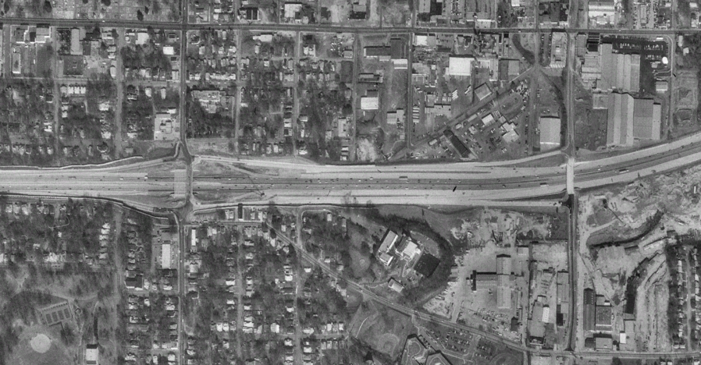
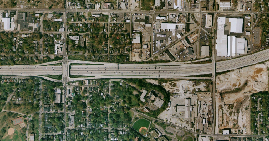
The Glenwood Park and Reynoldstown neighborhoods have seen rounds of change in the past couple of decades. The community has changed from a sleepy industrial powerhouse to a thriving mixed-use neighborhood. Unfortunately, I-20 piercing through the middle with it’s over-built and unorthodox interchanges are a dangerous stain on what’s otherwise a great place to be.
1993200220122024 – Google Earth
There have been a series of dangerous crashes where cars have flown off the Bill Kennedy Way ramp and in one case directly into the house that sits opposite the ramp. To compound matters, Bill Kennedy Way also carries the Eastside Atlanta Beltline.
Long term, this ramp has no place feeding into a residential neighborhood in it’s current form. Other than just flat out closing it, there are some short-term and long-term solutions to enhance safety while still providing access to the shopping district.
Current Setup
GoogleEarth
Two I-20 East exits to Boulevard and a slip exit to Bill Kennedy Way
I-20 East entrance ramp East of Boulevard
One I-20 West exit to Boulevard with a U-Turn to loop back to Bill Kennedy Way
Two I-20 West entrance ramps from Boulevard and a slip ramp from Bill Kennedy Way
My view on the problems
OVERBUILT! None of these ramps carry very much traffic outside of rush hour and the surplus of lanes cause high speeds
Non-intuitive: the U-Turn, slip ramps, and half diamonds may cause confusion
No deflection or curves cause high speeds
Signage: The signage and overall atmosphere feel like a highway-to-highway ramp setup
High speed off-ramp leading directly to Bill Kennedy Way – Google Earth
To GDOT’s credit, new signal heads, warning signs, and striping were recently added but there are some more easy fixes that can be implemented ASAP.
Bill Kennedy Way off-ramp – GoogleEarth
Short Term Improvements
Close the slip lanes and route Bill Kennedy Way traffic through the Boulevard interchange
WHY: This will create a more natural feeling interchange, reduce weaving, reduce speeds, and reduce confusion from cars flying off the interstate and directly up to Bill Kennedy Way.
This could be done with just restriping.
Add deflection by way of chicanes on the Bill Kennedy Way off-ramp
WHY: Again, slows cars down by introducing curvature into the ramp
This could be done with restriping by eliminating the 2nd lane until about 200′ before the signal which should be enough queuing space during the majority of the day
Add transverse rumble strips
WHY: They get your attention
Add an entrance to the Kroger plaza off of the Bill Kennedy Way off-ramp
WHY: Less traffic using Bill Kennedy Way
Short-term Bill Kennedy Way ramp solution
Long Term
New Pearl St extension under I-20 with reconfigured ramps
WHY: Enhance access between Reynoldstown and Glenwood Park, partially restores the historic grid structure of the neighborhood, removes the direct highway on/off-ramp from Bill Kennedy Way.
Redevelopment of industrial parcels for infill and grid system
WHY: This is a mobility rich neighborhood with access to the Beltline, shopping, dining, and multiple bike and transit corridors
NOTE: I do not own, control, have actual say, etc over any of the proposed redeveloped parcels. This is just an idea and just a sketch.
Mini-cap over the Bill Kennedy Way bridge
WHY: This area deserves a place to gather, hang out, linger and enjoy without being squeezed above 70 MPH traffic. It can also serve as a neighborhood focal point connecting some of the most car-lite neighborhoods in the City.
While it would be years (let’s face it, decades) to implement these long-term changes – it’s fun to dream and envision a safer, more complete neighborhood.
Phil Veasley is a Professional Engineer working with Toole Design Groupto design safer multimodal infrastructure in cities throughout the US.
My goal is to create cities that are safe and effective for all people to move about outside of cars. To achieve that we have to focus on creating equitable, dense, and vibrant cities full of walkable neighborhoods with a various mix of housing choices, schools, restaurants, and services. We cannot have safe multimodal infrastructure without the density to support it and we cannot have equitable density without safe multimodal infrastructure. Outside of designing safe streets, my passions are sketching ideas for infill neighborhoods, floor plans, urban photography, and exploring our cities on foot or bike. Please check out the menus above for all of my ideas and also check out my YouTube, Instagram, and Twitter accounts.
Opinions and insights are my own and are not representative of my employer or any organization.
Phil Veasley is a Professional Engineer working with Toole Design Groupto design safer multimodal infrastructure in cities throughout the US.
My goal is to create cites that are safe and effective for all people to move about outside of cars. To achieve that we have to focus on creating equitable, dense, and vibrant cities full of walkable neighborhoods with a various mix of housing choices, schools, restaurants, and services. We cannot have safe multimodal infrastructure without the density to support it and we cannot have equitable density without safe multimodal infrastructure. Outside of designing safe streets, my passions are sketching ideas for infill neighborhoods, floor plans, urban photography, and exploring our cities on foot or bike. Please check out the menus above for all of my ideas and also check out my YouTube, Instagram, and Twitter accounts.
Opinions and insights are my own and are not representative of my employer or any organization.
Subscribe to receive email notifications for new articles.
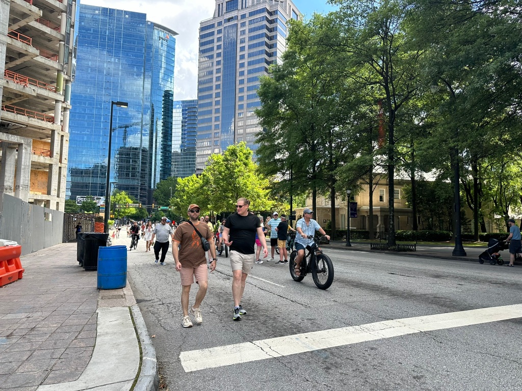
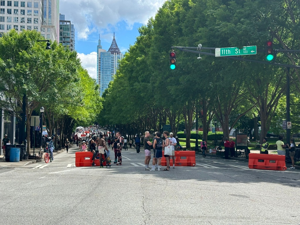
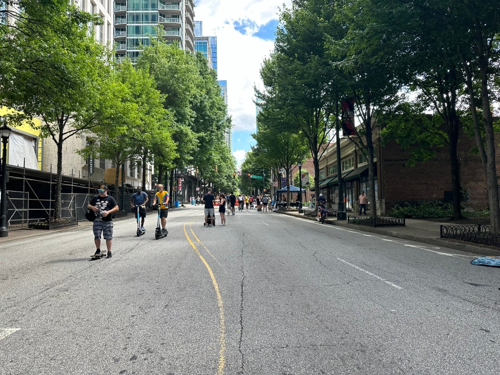
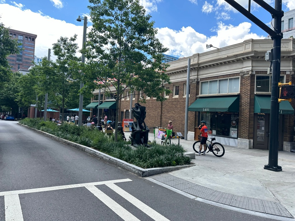
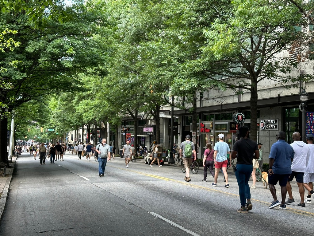
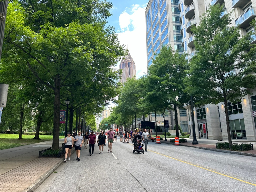
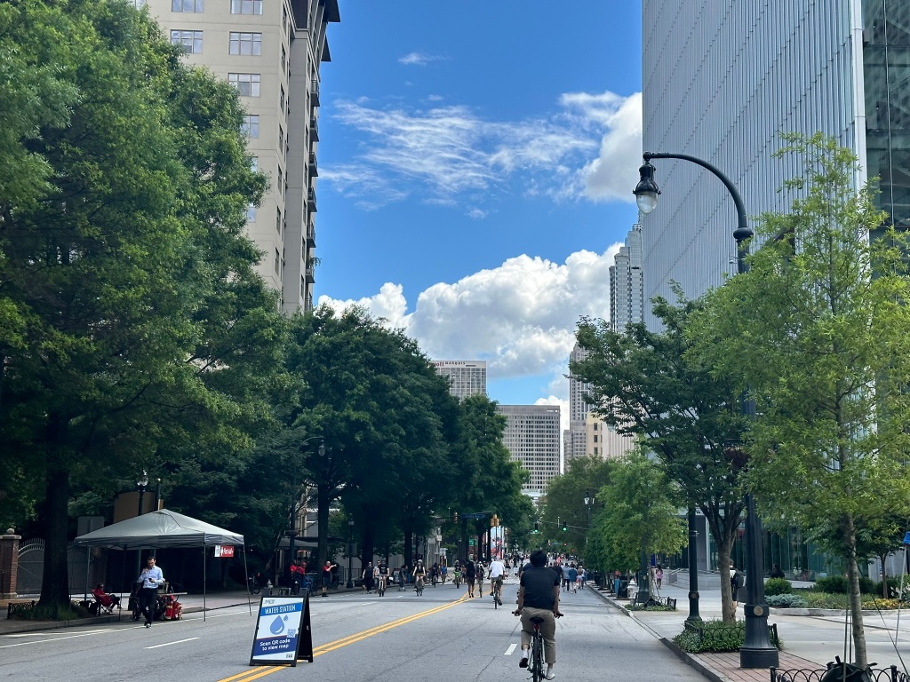
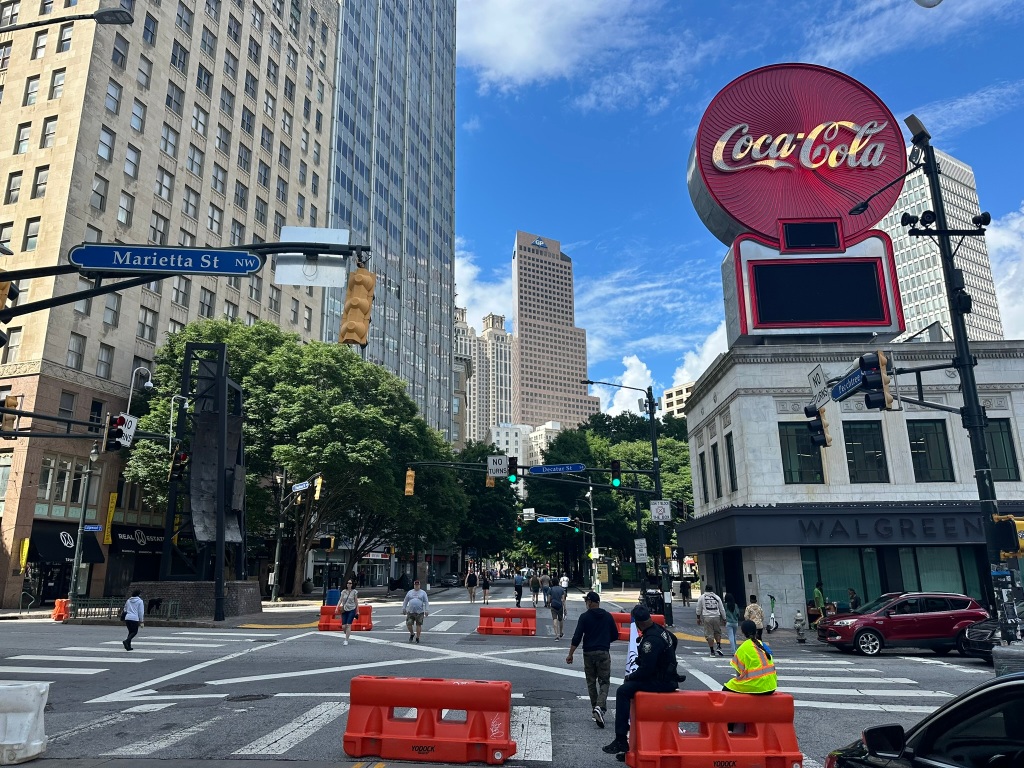
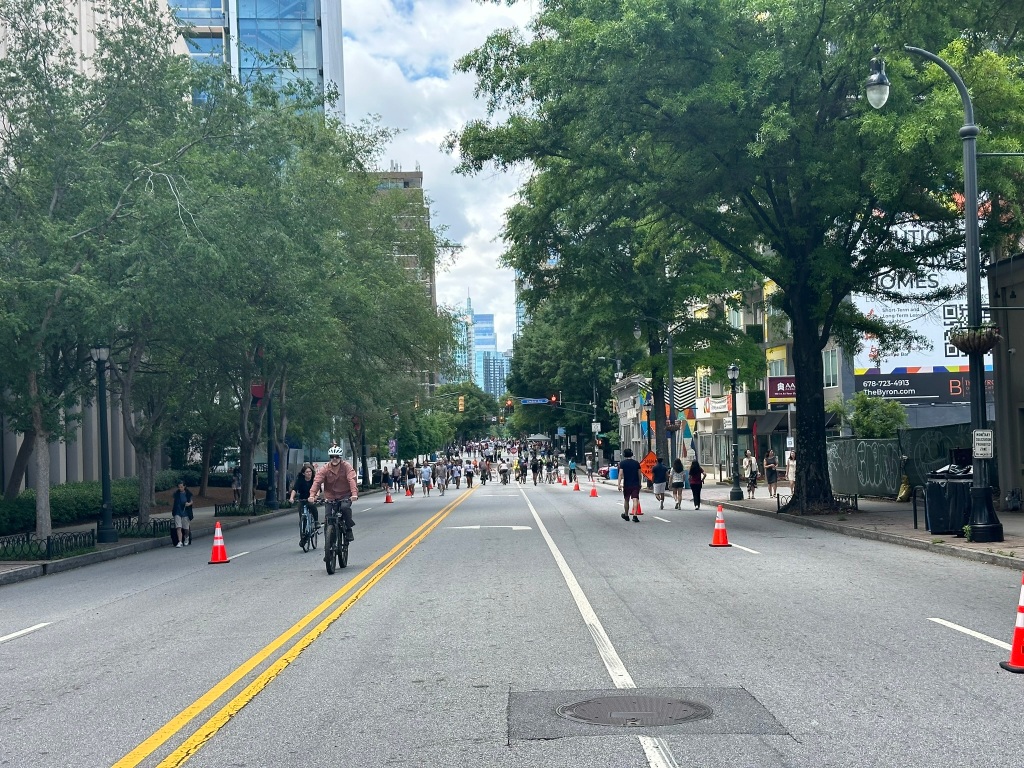
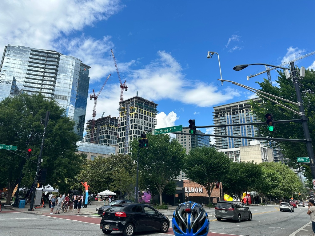
Atlanta’s Streets Alive event is back! Three miles of Peachtree were open for everyone but cars. Here’s a look at some of of the sights from a wonderful afternoon plus a bonus ride-through video! Head to YouTube.
Phil Veasley is a Professional Engineer working with Toole Design Groupto design safer multimodal infrastructure in cities throughout the US.
My goal is to create cites that are safe and effective for all people to move about outside of cars. To achieve that we have to focus on creating equitable, dense, and vibrant cities full of walkable neighborhoods with a various mix of housing choices, schools, restaurants, and services. We cannot have safe multimodal infrastructure without the density to support it and we cannot have equitable density without safe multimodal infrastructure. Outside of designing safe streets, my passions are sketching ideas for infill neighborhoods, floor plans, urban photography, and exploring our cities on foot or bike. Please check out the menus above for all of my ideas and also check out my YouTube, Instagram, and Twitter accounts.
Opinions and insights are my own and are not representative of my employer or any organization.
Subscribe to receive email notifications for new articles.
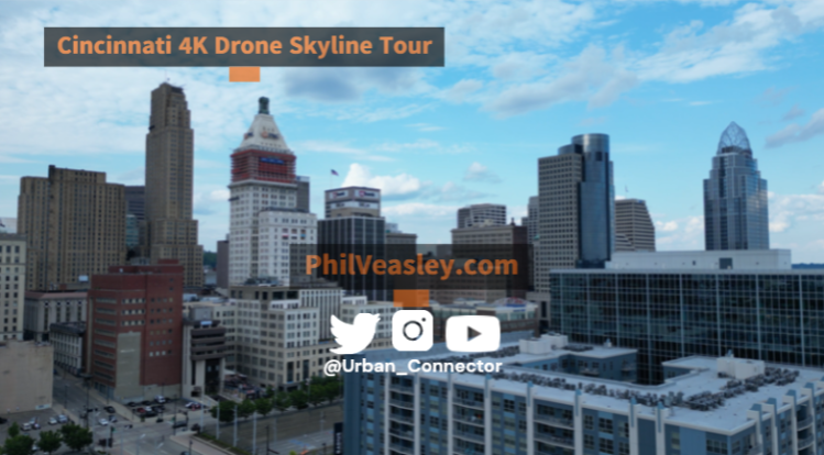
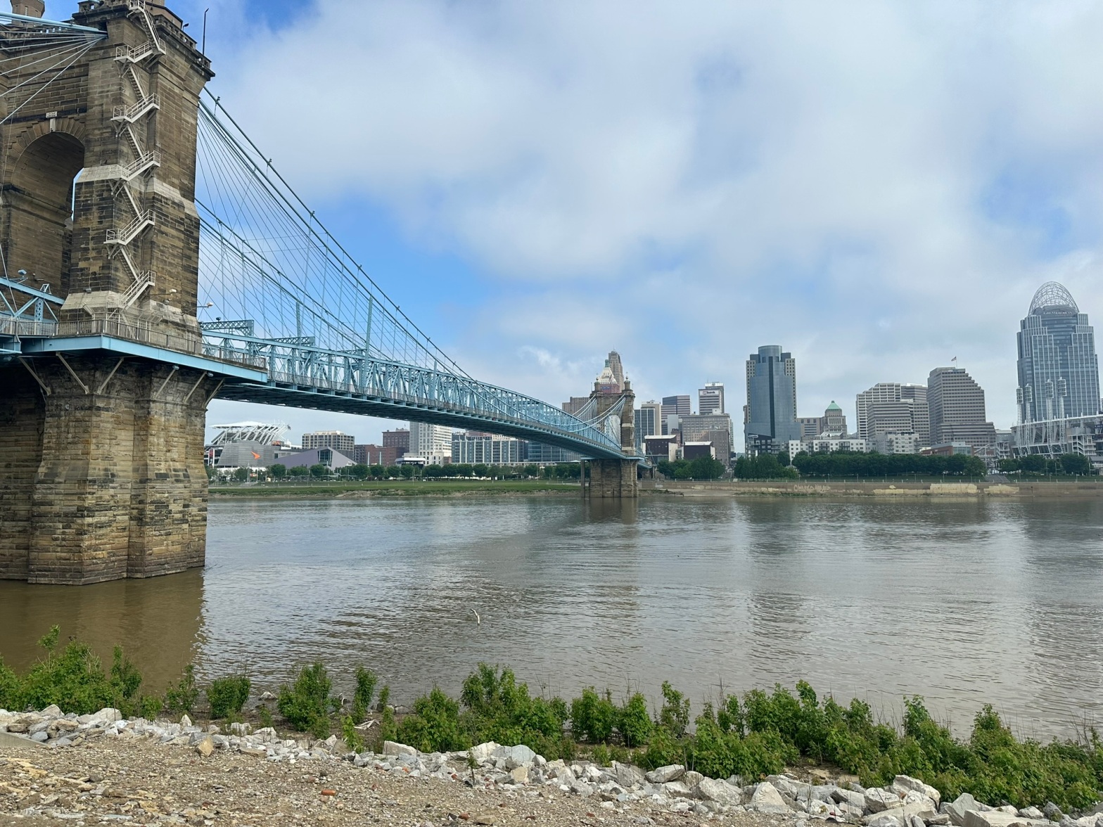
CNU 32 is in the books and I have to say it was a great one! Cincinnati far and away blew away my expectations as a City. From the rolling hills, beautiful waterfront, to bridges and architecture that honestly rival New York it was in no way what I was expecting. The City has done a fantastic job restoring their urban fabric. Head over to YouTube for my drone tour of the QC. Also stay tuned for my complete Cincy recap soon as well!
The Congress opened up with an energizing talk from Cincinnati Mayor Aftab Pureval who is currently overseeing the cities’ efforts at a housing and zoning reform (which passed Planning Commission Friday)!
I had the privilege of again participating in the Highway Transformation workshop where my colleague Lucy Gibson and I presented on Toole Design’s highway removal work in Minneapolis and Detroit.
The group also workshopped the upcoming Highway Transformation Manual which will hopefully serve as a model for the future of Highway Removal work.
Some other sessions of note that really stood out to me were the highlights of work from Incremental Development Alliance members. It is amazing and inspiring to see the work small-scale neighborhood developers are doing across the Country. More and more cities and towns all over are realizing that the key to solving the housing crisis is making it easier for everyday people to invest in their neighborhoods!
It’s no secret that arbitrary parking requirements inflate housing costs. Patrick Siegman, Todd Litman, and Tony Jordan dove into the details of those numbers. Also, highly suggest getting involved with the Parking Reform Network.
Dr. Andre M Perry delivered a powerful talk on the connection between the housing crisis and climate crisis.
These were just a few of the many wonderful sessions. I can’t wait to see everyone again next year at CNU 33 in Providence! Let’s get to work making our cities better.
Phil Veasley is a Professional Engineer working with Toole Design Groupto design safer multimodal infrastructure in cities throughout the US.
My goal is to create cites that are safe and effective for all people to move about outside of cars. To achieve that we have to focus on creating equitable, dense, and vibrant cities full of walkable neighborhoods with a various mix of housing choices, schools, restaurants, and services. We cannot have safe multimodal infrastructure without the density to support it and we cannot have equitable density without safe multimodal infrastructure. Outside of designing safe streets, my passions are sketching ideas for infill neighborhoods, floor plans, urban photography, and exploring our cities on foot or bike. Please check out the menus above for all of my ideas and also check out my YouTube, Instagram, and Twitter accounts.
Opinions and insights are my own and are not representative of my employer or any organization.