Subscribe to receive email notifications for new articles
This video takes a look at development patterns in Raleigh over the past 30 years.
YouTube
Phil Veasley is a Professional Engineer working to design safer multimodal infrastructure in cities throughout the US. My goal is to create cites that are safe and effective for all people to move about outside of cars. To achieve that we have to focus on creating equitable, dense, and vibrant cities full of walkable neighborhoods with a various mix of housing choices, schools, restaurants, and services. We can not have safe multimodal infrastructure without the density to support it and we can not have equitable density without safe multimodal infrastructure. Outside of designing safe streets, my passions are sketching ideas for infill neighborhoods, floor plans, urban photography, and exploring our cities on foot or bike. Please check out the menus above for all of my ideas and also check out my YouTube, Instagram, and Twitter accounts.
Opinions and insights are my own and are not representative of my employer or any organization.
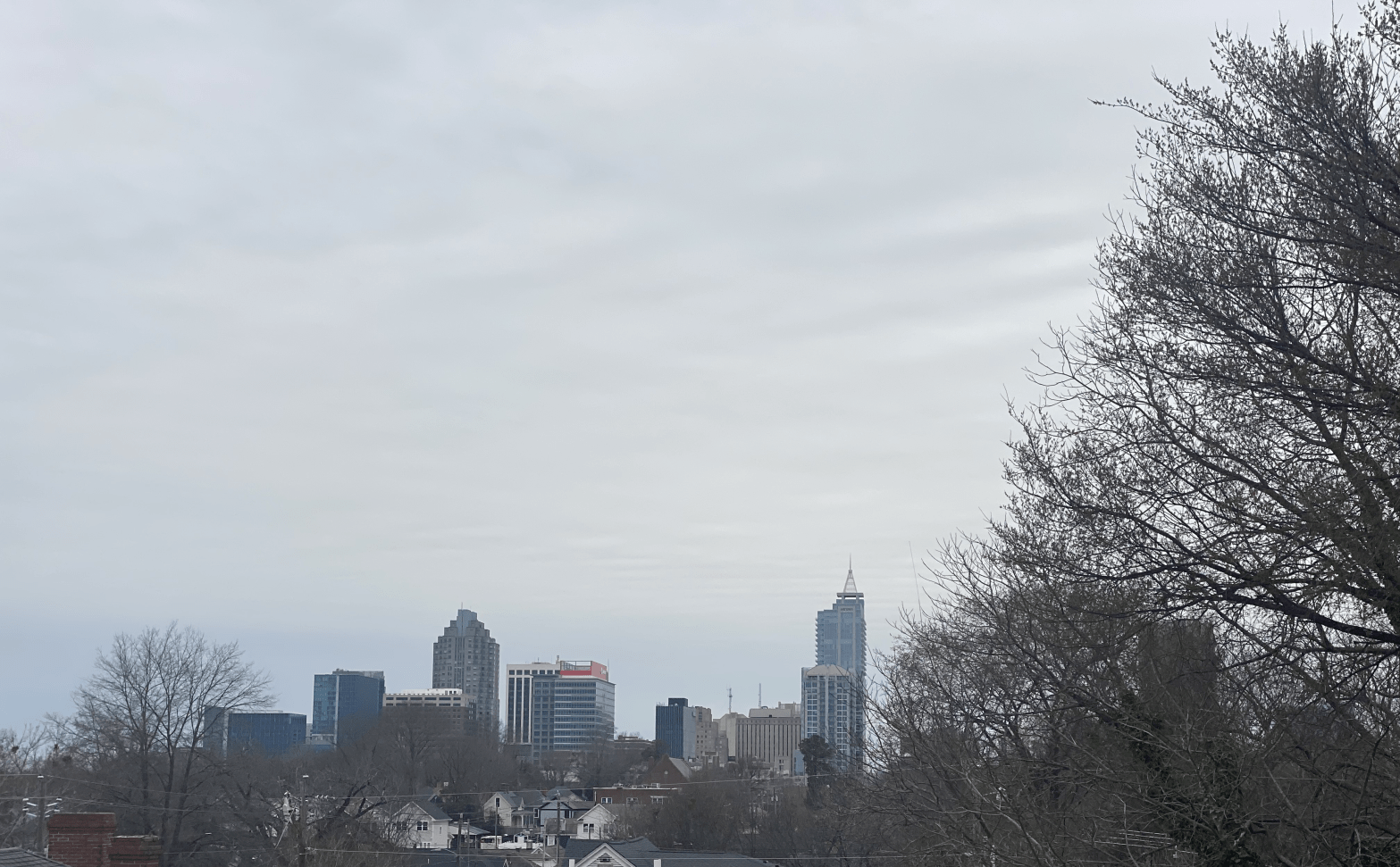
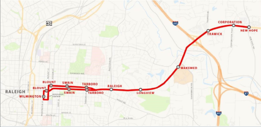
Raleigh recently broke ground on the first of four highly anticipated BRT (Bus Rapid Transit) lines. The New Bern BRT will stretch from Downtown Raleigh a few miles East out to New Hope Rd.
From Downtown to Wake Med, the BRT will operate in a dedicated median guideway that functions more like light rail than a bus. Outside of Wake Med, the system will be featured in a mixed traffic setup (that’s another story for another day).
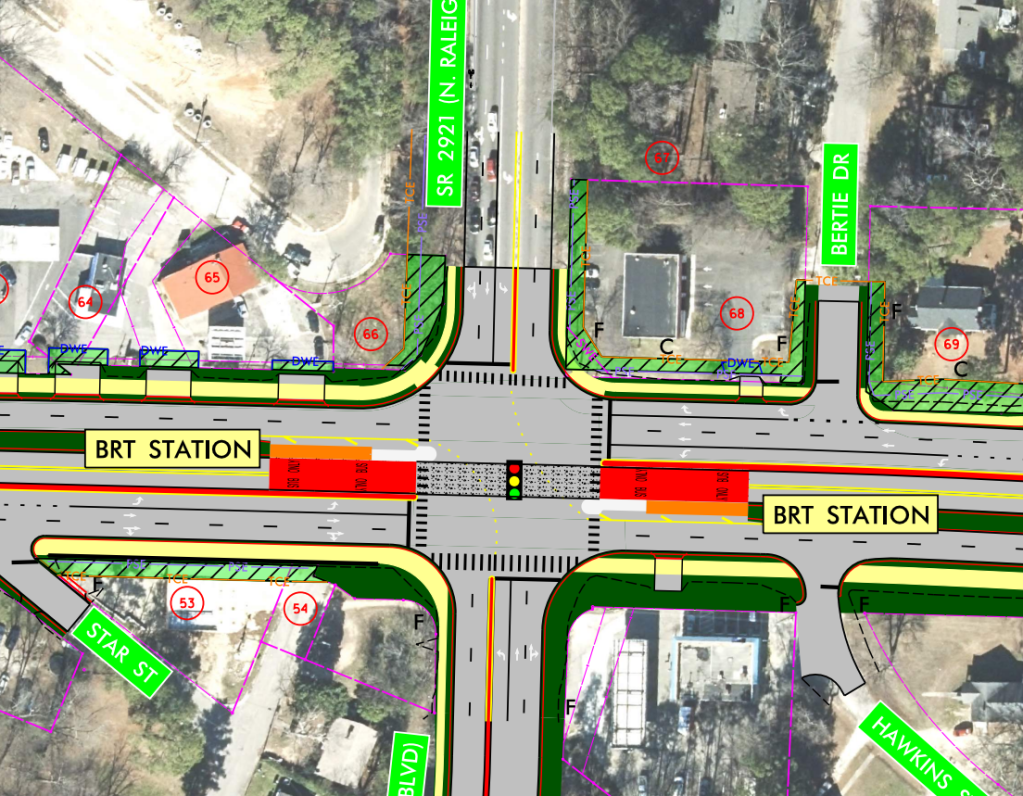
Other improvements will include filling in sidewalk gaps West of Wake Med, adding a shared-use path, and realigning the Poole Rd intersection.
As with any high capacity transit system, you need the ridership to back up the cost. The 15 bus line which currently runs along the BRT corridor, sees some of the highest levels of ridership on the system. In addition, the BRT will service some of the areas of Raleigh with the lowest levels of car-dependency, some of the most diverse neighborhoods, and shopping centers.
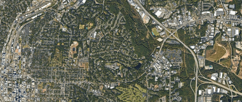
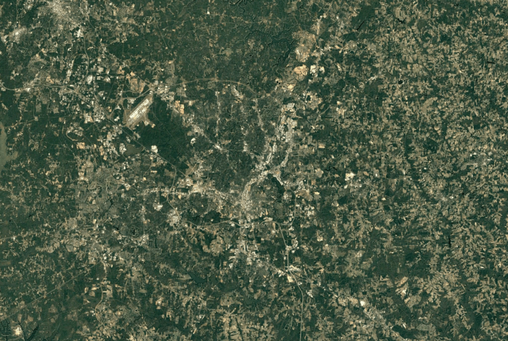
Aerial of the corridor and surrounding area – GoogleEarth
To help facilitate ridership, reduce car-dependency, promote affordability, reduce displacement, and combat climate change, the City of Raleigh has proposed a Transit Overlay District (TOD) to surround the corridor. The aforementioned link does a great job explaining with the TOD is and is not.
The consequences of not up-zoning along the BRT corridor are dire. As we all know, the region is growing at a rapid pace. Over 60 people move to the region a day and need somewhere to call home.
We have two options on where to house all those new residents: Infill or Sprawl.
As the region has continued to sprawl further into Johnston County, Harnett County, Franklin County and beyond, many things are happening – traffic, deforestation, loss of farmland, increased cost of services, and displacement.
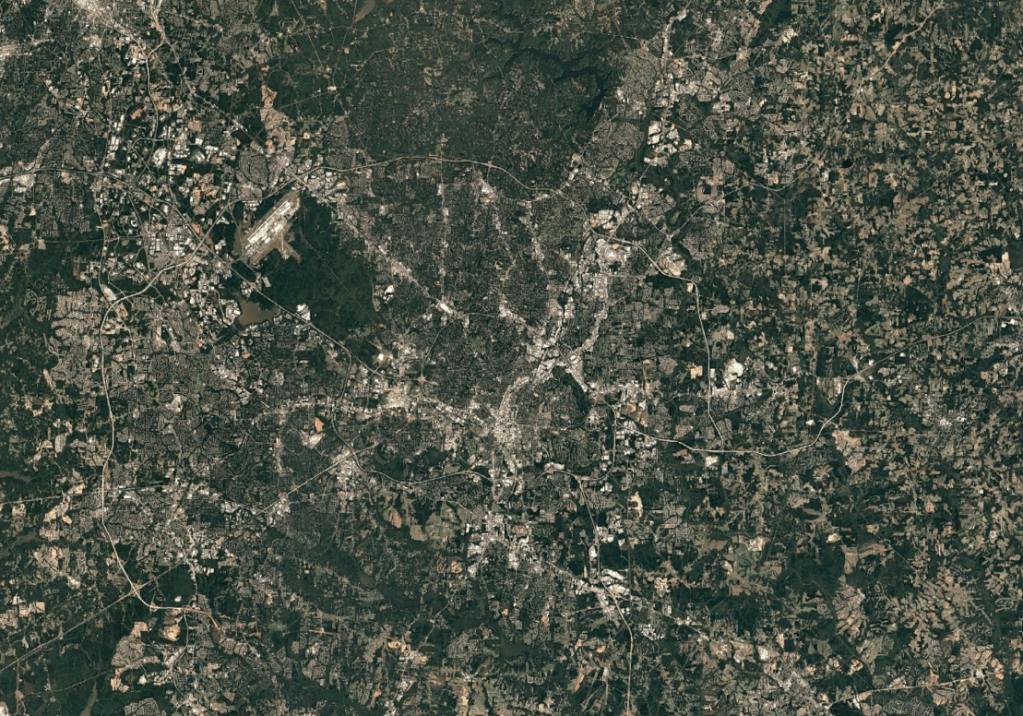
Raleigh region’s sprawl in 2002 vs 2022 – GoogleEarth
People want to live in the city and people want to live near transit. Without up-zoning (even if BRT wasn’t built), the displacement pressure on long time residents and businesses would further increase. As with any in-demand area, the people who are able to afford the area will. Look at what’s happening in North Hills right now – every modest mid-century brick house is being bought up by investors, torn down, and being rebuilt as a multi-million dollar single family mansion. This is the future of the New Bern corridor without up-zoning.
Up-zoning will do several things to help alleviative this:
Allows for many more units which will decrease the pressure for investors to tear down / displace existing single family homes in the area
Allows for more families to live in a mobility rich neighborhood
Diversifies housing options allowing for more affordable options and more housing choices to be built
Slows the rate of destructive sprawl development by allowing more families to live in the City
Reduces car-dependency by allowing more families to live along the BRT corridor
Reduces pressure on existing useable properties to redevelop due to infill parcels seeing more density
Increases opportunities for multimodal infrastructure
Decreased infrastructure costs with less needed new service construction in the suburbs
Slows the rate of climate change by reducing Vehicle Miles Traveled (VMT)
More neighbors, more friends!
Transit Oriented Development in Charlotte with the Uptown Skyline in the distance
The future of the residents of today and tomorrow along the BRT network, City of Raleigh, and Triangle region as a whole depend on getting the land use right around the system. There are currently 100s of vacant, abandoned, or otherwise prime parcels that could handle 1000s of residential units, commercial uses, services, parks, schools and more.
Conceptual mockup of infill in and around the BRT corridor
There are many ways learn more, get involved, or to help get the word out about the importance of the TOD rezoning:
Speak in support at a Council meeting
Spread the word
Get involved in your community and combat disinformation about what the TOD is and is not
Phil Veasley is a Professional Engineer working to design safer multimodal infrastructure in cities throughout the US. My goal is to create cites that are safe and effective for all people to move about outside of cars. To achieve that we have to focus on creating equitable, dense, and vibrant cities full of walkable neighborhoods with a various mix of housing choices, schools, restaurants, and services. We can not have safe multimodal infrastructure without the density to support it and we can not have equitable density without safe multimodal infrastructure. Outside of designing safe streets, my passions are sketching ideas for infill neighborhoods, floor plans, urban photography, and exploring our cities on foot, drone, or bike. Please check out the menus above for all of my ideas and also check out my YouTube, Instagram, and Twitter accounts.
Opinions and insights are my own and are not representative of my employer or any organization.
Subscribe to receive email notifications for new articles
I had the honor of being a guest on the ThreadATL podcast to discuss the intersection of Transportation and Land Use in the City of Atlanta. Please give it a listen! Also, be sure to check out the other episodes featuring other industry experts.
Phil Veasley is a Professional Engineer working to design safer multimodal infrastructure in cities throughout the US. My goal is to create cites that are safe and effective for all people to move about outside of cars. To achieve that we have to focus on creating equitable, dense, and vibrant cities full of walkable neighborhoods with a various mix of housing choices, schools, restaurants, and services. We can not have safe multimodal infrastructure without the density to support it and we can not have equitable density without safe multimodal infrastructure. Outside of designing safe streets, my passions are sketching ideas for infill neighborhoods, floor plans, urban photography, and exploring our cities on foot or bike. Please check out the menus above for all of my ideas and also check out my YouTube, Instagram, and Twitter accounts.
Opinions and insights are my own and are not representative of my employer or any organization.
Subscribe to receive email notifications for new articles
One hour compilation of this year’s drone footage in Atlanta.
Phil Veasley is a Professional Engineer working to design safer multimodal infrastructure in cities throughout the US. My goal is to create cites that are safe and effective for all people to move about outside of cars. To achieve that we have to focus on creating equitable, dense, and vibrant cities full of walkable neighborhoods with a various mix of housing choices, schools, restaurants, and services. We can not have safe multimodal infrastructure without the density to support it and we can not have equitable density without safe multimodal infrastructure. Outside of designing safe streets, my passions are sketching ideas for infill neighborhoods, floor plans, urban photography, and exploring our cities on foot or bike. Please check out the menus above for all of my ideas and also check out my YouTube, Instagram, and Twitter accounts.
Opinions and insights are my own and are not representative of my employer or any organization.
Enter you email below and subscribe to never miss a post!
Subscribe to receive email notifications for new articles
Tour of the Eastside Atlanta Beltline Tour on a busy Friday Evening.
Phil Veasley is a registered Professional Engineer in NC and GA. Opinions and insights are my own and are not representative of my employer or any organization. Any ideas displayed on this site are purely that – just ideas to help improve the future of the built environment and begin discussions.
The Burlington metropolitan area contains roughly 175,000 residents located along I-40/85 about 20 miles East of Greensboro, 35 miles West of Durham, and 60 miles Northwest of Raleigh.
GoogleMapsGoogleMapsGoogleMaps
While it’s the distance of many typical suburbs from Greensboro, it functions more like it’s own metropolitan area. Of note, it’s actually quicker to ride the train from Downtown Burlington to Downtown Greensboro than drive! Not many places in the South where that can be said.
Burlington Metro – GoogleEarth
Burlington’s Downtown covers a sizeable footprint for a city of it’s size, but is a bit decentralized and features ample infill opportunities. While there are a number of shops and restaurants, vacancy rates are also high.
Downtown Burlington – GoogleEarth
Through the years, the center of activity has shifted from Downtown, to the mall and strip centers, and now even away from the mall and down to Alamance Crossing.
Burlington Sprawl – GoogleEarth
Downtown Graham is more of a typical small-town setup with a center courthouse and a couple blocks of historic brick buildings surrounding it.
Downtown Graham – GoogleEarth
Currently, there is a healthy selection of three bedroom properties in the area for under $300,000. Adding infill, will only increase the options.
Zillow
Looking toward the future
Burlington’s location puts it within reach of both the Triangle and Triad. Easy Amtrak access even puts reaching Charlotte within easy range.
While it does function as a self-sufficient area, suburban style sprawl is closing in from both sides. With the amount of infill potential, Burlington can become a thriving standalone hub.
Potential infill in Burlington – Affinity Designer
Phil Veasley is a registered Professional Engineer in NC and GA. Opinions and insights are my own and are not representative of my employer or any organization. Any ideas displayed on this site are purely that – just ideas to help improve the future of the built environment and begin discussions.
As the Triangle continues to grow, the arc of fringe cities surrounding the region will start to evolve. Siler City may be far, but it’s proximity to the mega sites and even Greensboro may be enticing.
Siler City is a city of roughly 8,000 residents located about 50 miles from Raleigh and Durham. While still not feeling like a suburb of Greensboro, it is slightly closer at 30 miles. Located along US 421 (Future I-685) gives it direct freeway grade access to Greensboro. US 64 provides direct access to Raleigh.
Google MapsGoogle Maps
Downtown Siler City features a couple blocks of classic brick buildings lined with a few shops and restaurants bisected by the railroad tracks.
Google Earth
While the shop front vacancy rate doesn’t seem too bad, there are a slew of vacant parcels in Downtown that are perfect for dense infill. There’s also a few 3 bedroom properties within walking distance from the core for under $300,000.
Zillow
Looking toward the future
Siler City’s location near the mega industrial development sites, Greensboro and the Triangle give it a major leg up as a future industrial and economic hub. The sheer amount of infill and re-use potential make it a way more attractive option for becoming a thriving, and livable community than endless sprawl.
Conceptual rendering of possible Siler City infill – Affinity Designer
Stay tuned next time as we conclude the series with a look at Burlington and Graham
Cover photo via GoogleEarth
Phil Veasley is a registered Professional Engineer in NC and GA. Opinions and insights are my own and are not representative of my employer or any organization. Any ideas displayed on this site are purely that – just ideas to help improve the future of the built environment and begin discussions.
The 2023 Triangle Parade of Homes showcased nearly 200 of the best new builds in the area. This year, I toured roughly a dozen of the biggest and best homes. Here are the highlights.
Subscribe to receive email notifications for new articles
7317 Grist Mill Rd
$2,999,990 | 5700 Sq Ft | 5 Bed | 7 Bath | Raleigh Custom Homes
Located in North Ridge Country Club this home features a beautiful light filled office, huge kitchen, covered porch and pool.
1400 Rock Dam Ct
$6,999,900 | 9000 Sq Ft | 5 Bed | 8 Bath | Raleigh Custom Homes
The showstopper of the Parade located on North Ridge Golf Course complete with a stunning pool, golf simulator, poker room, game room, movie room, sauna, and steam room! Usually homes this big and expensive feel over the top with glitz and glimmer but this one actually still felt livable.
2116 Ridge Rd
$3,300,000 | 6200 Sq Ft | 5 Bed | 5.5 Bath | Exeter Building Company
This home featured a grand entrance and long front to back layout style. The office was definitely one of the best!
2312 Airline Dr
$2,950,000 | 5400 Sq Ft | 5 Bed | 7 Bath | Speight Built, LLC
With some of my favorite finishes of the tour this home featured unique cabinets, an elevator and a full finished basement.
2105 Manuel St
$2,500,000 | 4500 Sq Ft | 5 Bed | 4.5 Bath | DJF Builders
An impressive natural stone wall and floating staircase welcome you into this glitzy mansion.
822 Pebblebrook Dr
$2,999,990 | 5800 Sq Ft | 5 Bed | 6 Bath | Raleigh Custom Homes
Located in he shadows of North Hills, this house finally offered a tiny bit of walkability. Outside of the driveway wrapping the front entrance, this is one of the best exteriors of the Parade. Inside, this one didn’t disappoint with a nice layout, bright office, indoor-outdoor living, pool, and a FROG with semi-separate entrance.
727 Lake Boone Dr
$2,350,000 | 4500 Sq Ft | 4 Bed | 5.5 Bath | DJF Builders
Look at those custom corner windows! Can’t imagine how much that costs to cool in the summer, but they do look nice.
807 Chamberlain St
Last but not least, finally a home with decent walkability located adjacent to the Village District. This stunner also featured an upper level porch which is a personal must have. The finishes, primary bath and built-ins were also some of my favorites of the Parade.
A Missing Middle House! I can’t believe I forgot to get pictures, but there was a Missing Middle Entry in Durham. This lot featured two 1200 SqFt houses with two ADU’s on a typical lot. My main gripe with the Parade in the years that I’ve gone has been the lack of walkable, urban environment or Missing Middle Housing that has been showcased. Thank you, AG Homes.
The units themselves were well equipped and perfectly showcased how to easily get 4 units on a typical lot. My only gripe was how many parking spots the City made them put in the front yard despite tons of on-street availability. I hope we see more next year.
Phil Veasley is a registered Professional Engineer in NC and GA. Opinions and insights are my own and are not representative of my employer or any organization. Any ideas displayed on this site are purely that – just ideas to help improve the future of the built environment and begin discussions.
As the Triangle continues to grow, the arc of fringe cities surrounding the region will start to evolve. Sanford has started to see the growth pressure.
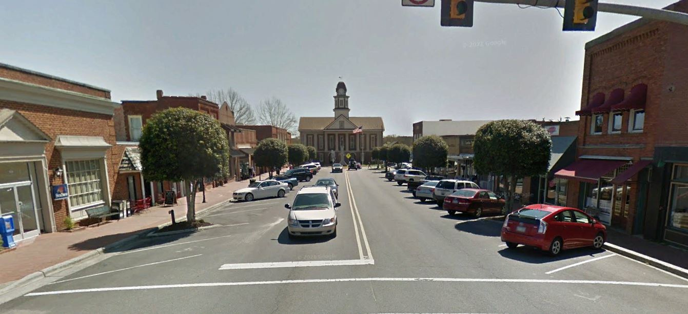
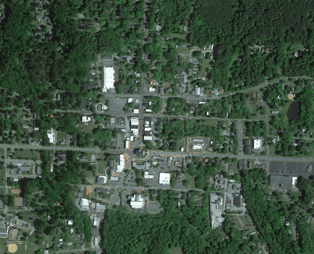
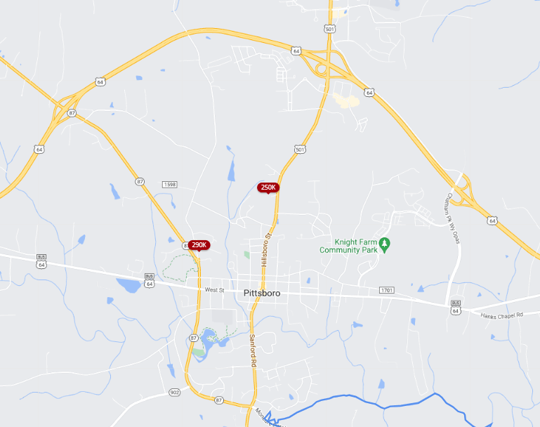
Pittsboro is a Town of 5,000 of roughly 35 miles West of Raleigh and 30 miles Southwest of Durham located along US-64. The previously rural Town has seen an explosion of growth in the past few years.
The modest Downtown features a collection of historic shops and restaurants located around a traffic circle. There’s also a small grid structure extending a few blocks from the center. While a small town at heart, Pittsboro has seen strong rates of occupancy and no signs of Downtown decline like many cities earlier in the series.
Downtown Pittsboro – GoogleEarth
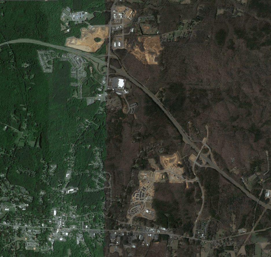
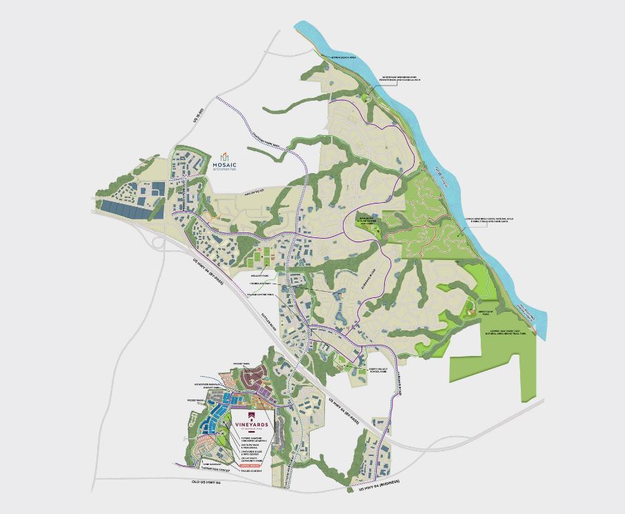
In recent years, strip centers have popped up around the interchange of US 15-501 and US-64. This has rapidly accelerated as Chatham Park begins it’s build out with the mixed-use Mosaic center and Lowe’s Food shopping center across the street.
Pittsboro with the influence of Chatham Park becoming evident – GoogleEarth
Currently, there’s only two properties within the walkshed of Downtown for under $300,000 as Pittsboro’s transformation to a suburb has already become evident As time goes on, through infill and densification, and diversification of housing choices, hopefully these properties will once again appear.
Zillow
Looking toward the future
Pittsboro’s future is vastly different any other municipality in this series due to the presence of Chatham Park and other mega planned developments. If these developments were to fully build out, Pittsboro’s population would soar from under 5,000 now to at least 100,000.
ChathamPark.ComChathamPark.Com
Chatham Park is a mind-blowing 8,000 acre development containing up to 22,000 homes, 22,000,000 sqft of non-residential development, and at least 1,300 acres of open / recreational space.
While it’s a bit far for a daily driving commute to Raleigh, Durham, and Greensboro, if the current plans come to fruition, Pittsboro will be a self-sufficient community. There’s also easy access to the forthcoming mega sites.
While most of the places earlier in this series focus on the potential growth, it seems that Pittsboro has it all planned out.
Stay tuned next time as we explore the future of Siler City.
Cover photo via GoogleEarth
Phil Veasley is a registered Professional Engineer in NC and GA. Opinions and insights are my own and are not representative of my employer or any organization. Any ideas displayed on this site are purely that – just ideas to help improve the future of the built environment and begin discussions.
As the Triangle continues to grow, the arc of fringe cities surrounding the region will start to evolve. Sanford has started to see the growth pressure.
Sanford is a city of roughly 30,000 about 45 miles Southwest of Raleigh and 50 miles Southwest of Durham. It is located at the interchange of US-1 and US-421 (Future I-685) which are both freeway grade facilities offering direct access to Raleigh, Durham, Greensboro, and in the future I-95.
GoogleMapsGoogleMaps
It is also located along the corridor of the future S-Line high speed rail corridor. The S-Line TOD (Transit Oriented Development) Study proposes a station in Downtown Sanford with a good amount of smart, walkable, mixed-use development surrounding.
Downtown Sanford features a couple blocks of classic brick buildings lined with a few shops and restaurants bisected by the railroad tracks.
Downtown Sanford – GoogleEarth
While the rate of Downtown decline is far less in Sanford when compared to a few earlier cities in this series, the sprawl influence is still evident. Strip centers have dominated the landscape outside of Downtown and sprawl style subdivisions are becoming numerous.
Strip centers and sprawl to the Southeast of Downtown Sanford – GoogleEarth
While there aren’t many three bedroom properties within walking distance of Downtown Sanford for under $300,000, there’s a glut of vacant infill lots just waiting for development.
Zillow
Looking toward the future
Sanford’s location along the future S-line, mega industrial development sites, and freeways give it a major leg up as a future industrial and economic hub. The sheer amount of infill and re-use potential make it a way more attractive option for becoming a thriving, and livable community than endless sprawl.
Conceptual infill (white), re-use (blue) and greenspace (green) plan for Downtown Sanford – Affinity Designer
While it’s a bit far for a daily driving commute to Raleigh, Durham, Greensboro, and Fayetteville, the future S-line and mega industrial sites put Sanford within easy reach to many of these places.
Unlike many of the cities featured earlier in this series where growth will be a long term play, the growth is here in Sanford.
Stay tuned next time as we explore the future of Pittsboro.
Cover photo via GoogleEarth
Phil Veasley is a registered Professional Engineer in NC and GA. Opinions and insights are my own and are not representative of my employer or any organization. Any ideas displayed on this site are purely that – just ideas to help improve the future of the built environment and begin discussions.