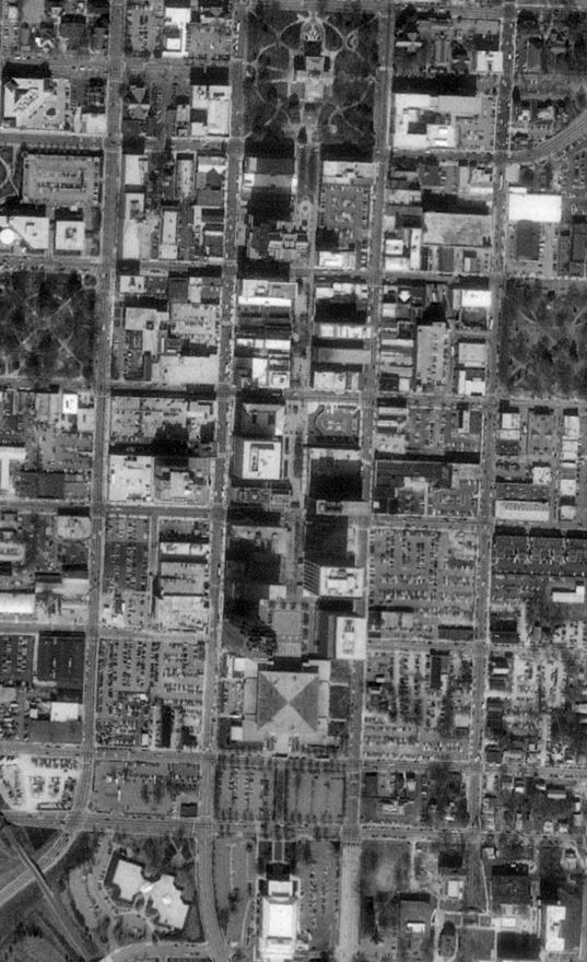
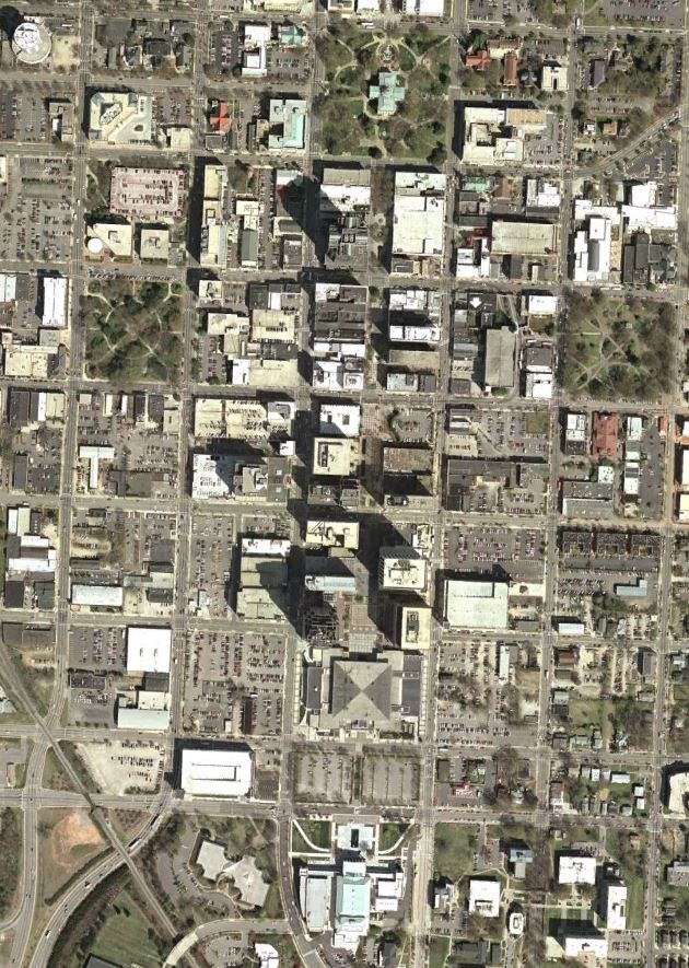
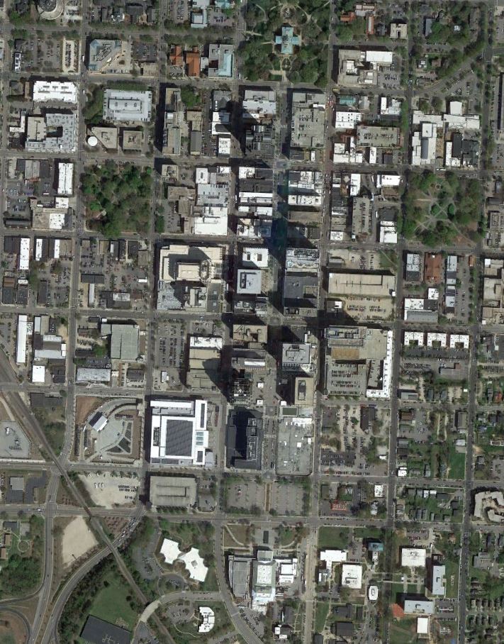
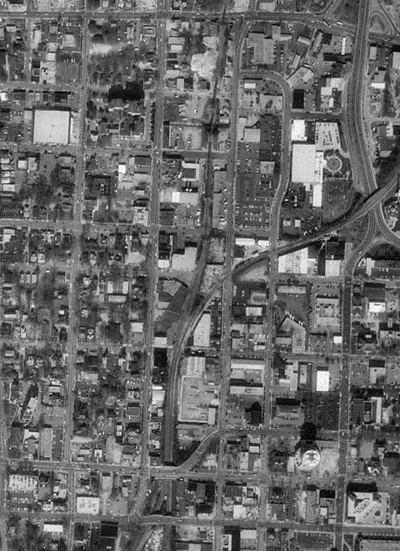
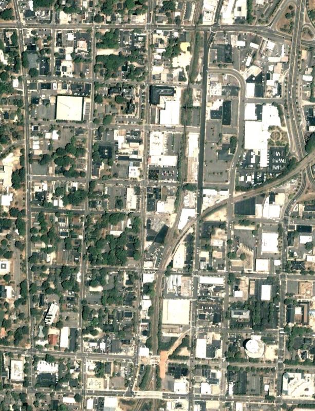
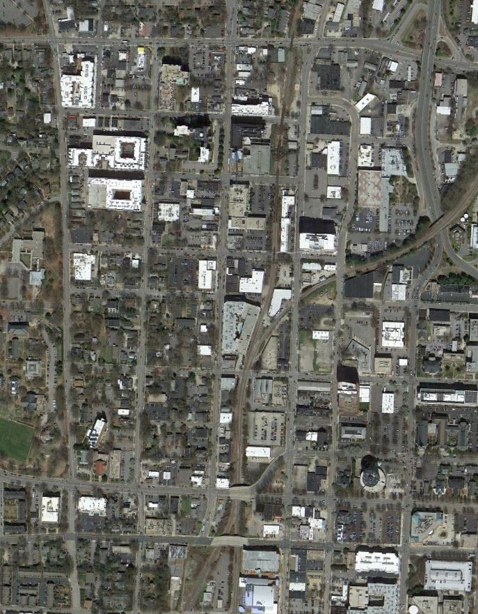
After taking a look at how the City of Atlanta has grown in the first installment of the visualization series, we turn our attention to the City of Oaks. As the City of Raleigh continues to grow, let’s take a look back through the past 30 years via Google Earth to see just how far the City has come. Images are via GoogleEarth and are 1993, 2002, 2014, and 2023 captures.
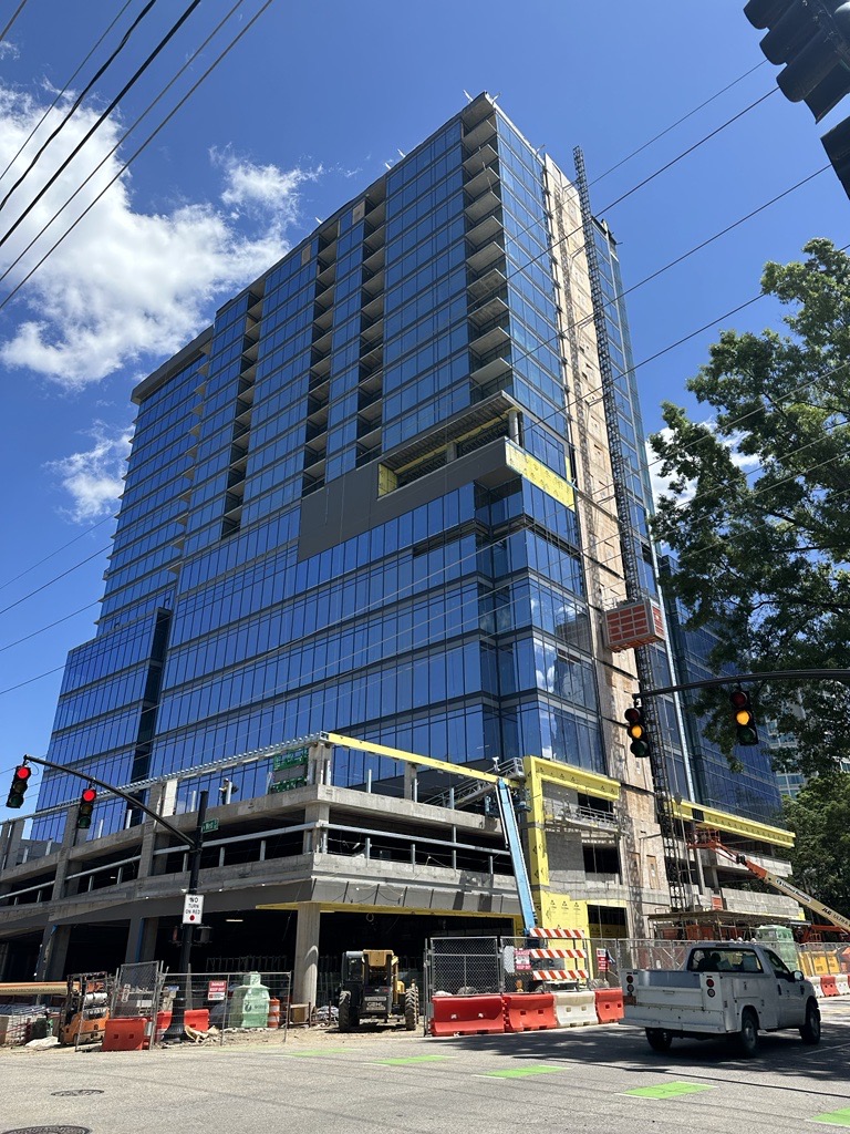
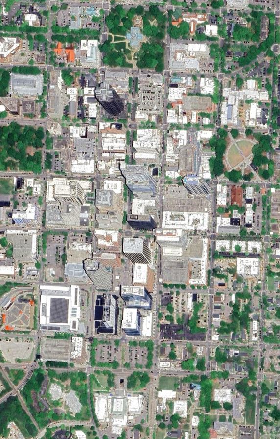
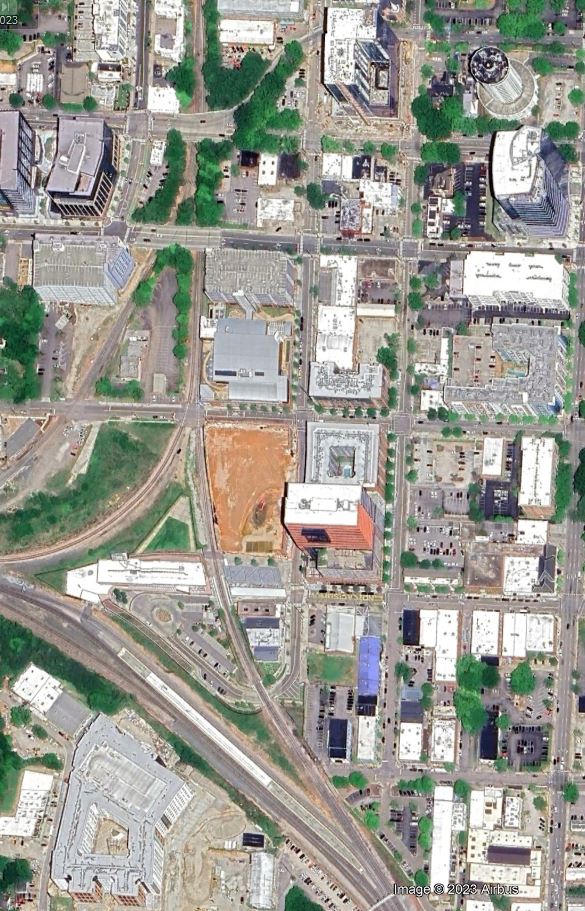
Fayetteville Street Corridor
Fayetteville Street has seen several additions (and subtractions) through the years. The old Civic Center and pedestrian mall made way for City Plaza. The City’s tallest building in PNC Tower was also constructed in the late 2000’s. Through all these changes, it’s still been mostly a struggle to bring sustained activity to Raleigh’s signature street. Hopefully as the number of residents in Downtown continues to surge, things will come along. It also may be time to try pedestrianizing the street again as we know a lot more than we did back then.
Glenwood South
Glenwood South and the surrounding blocks have seen the most visible signs of growth in Downtown over the past few decades. Raleigh’s party district sees blocks of bars and restaurants while several large scale new developments have bookend the district with Smoky Hollow and Bloc 83. There are several other towers planned but the market may have those on hold for a while. Future plans called for a great new park but even that may be up in the air since the rezoning case that may have been helping to fund that was inexplicably denied.
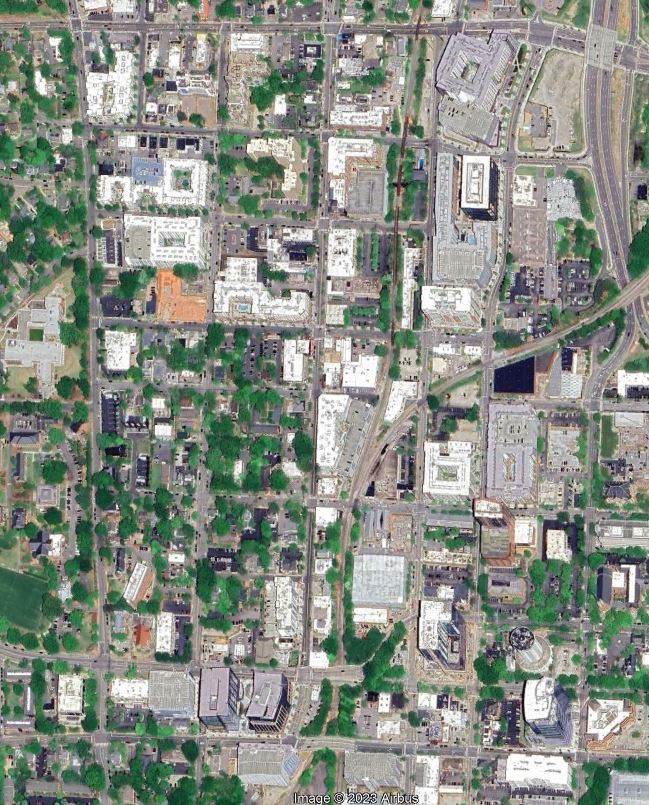
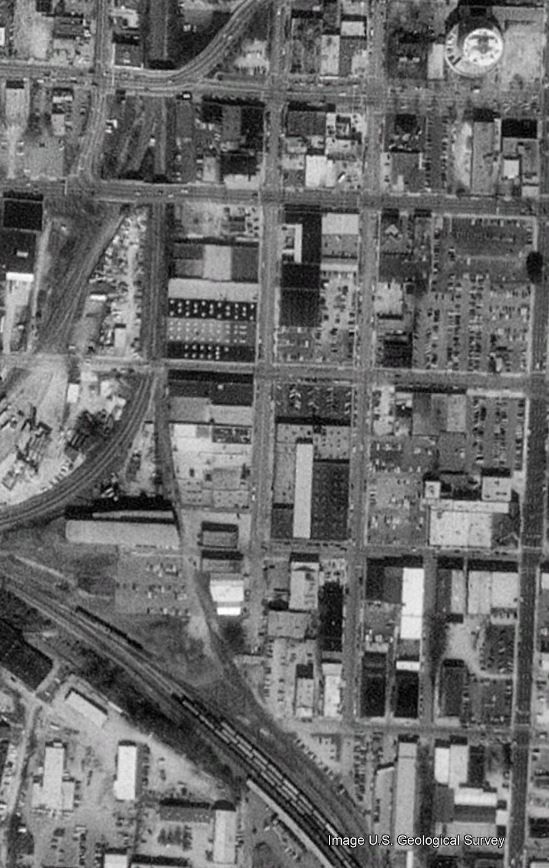
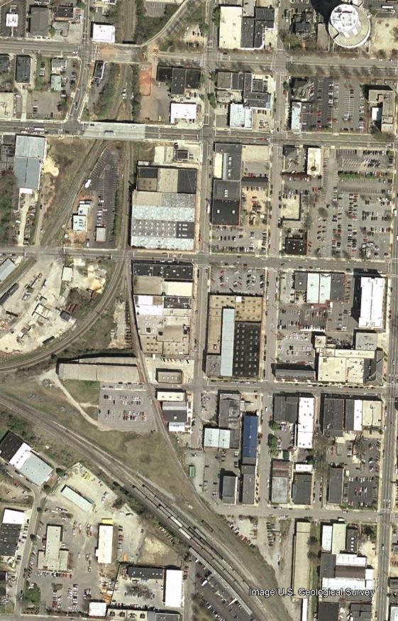
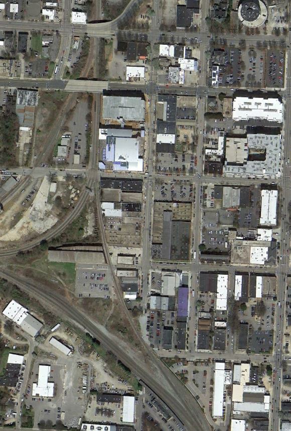
The Warehouse District
Raleigh’s Warehouse District seems to be the new epicenter for residential development. Union Station, Morgan Street Market and The Dillon kicked things off a few years ago with several new towers planned or in progress and a new bus hub with 30 stories of residential on top.
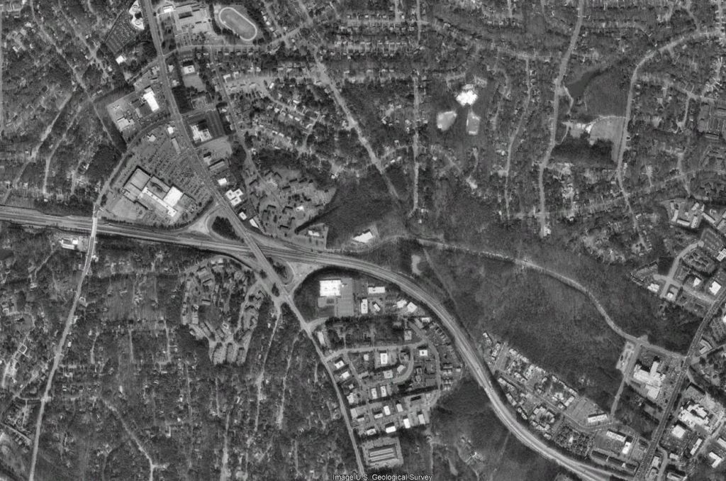
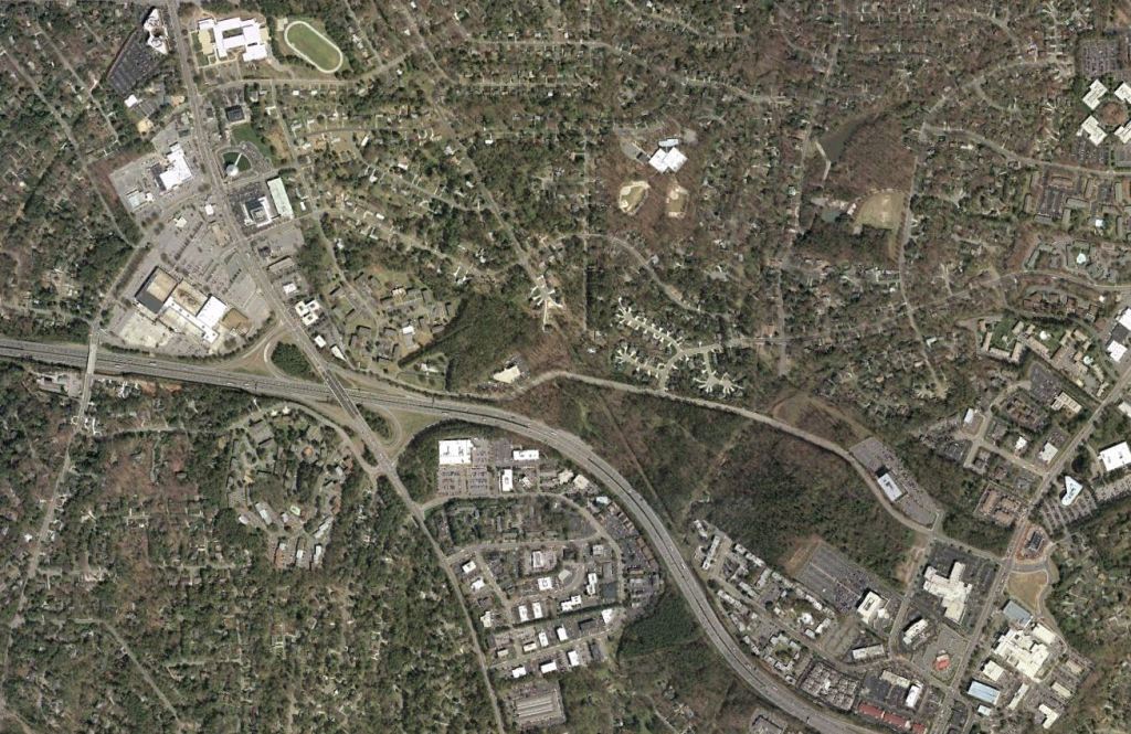
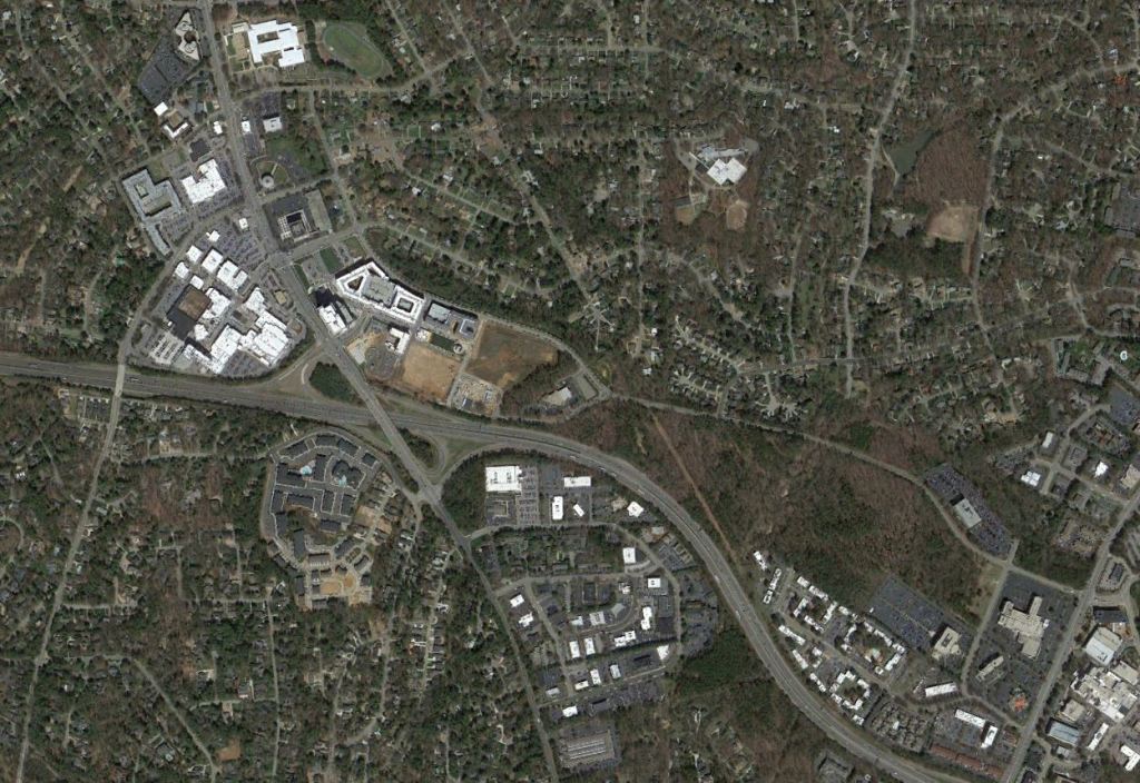
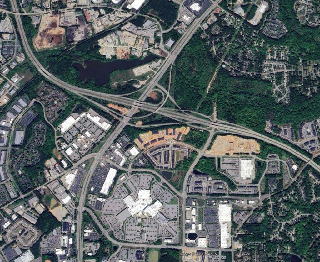
North Hills
Moving a few miles North from Downtown, Kane has transformed an old mall and residential parcels into a booming new Midtown. Things continue to spread East as seen in the latest aerials and were trending toward taller development but a contentious rezoning application was recently withdrawn. Maybe one day we can actually see some infrastructure improvements through the area. I’ve got some ideas for that.
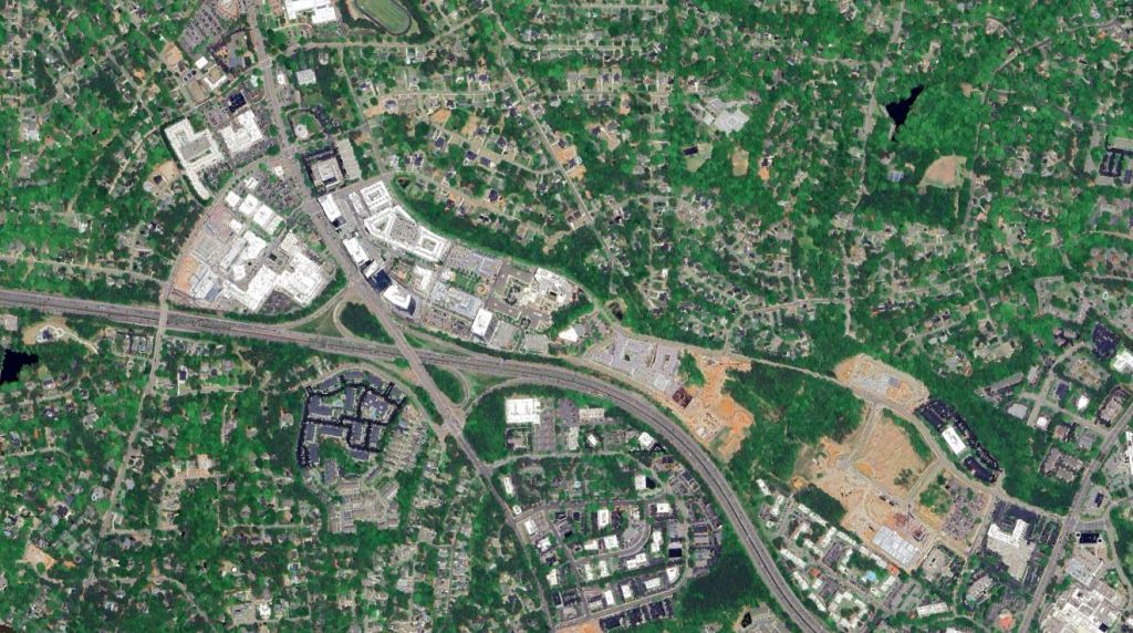
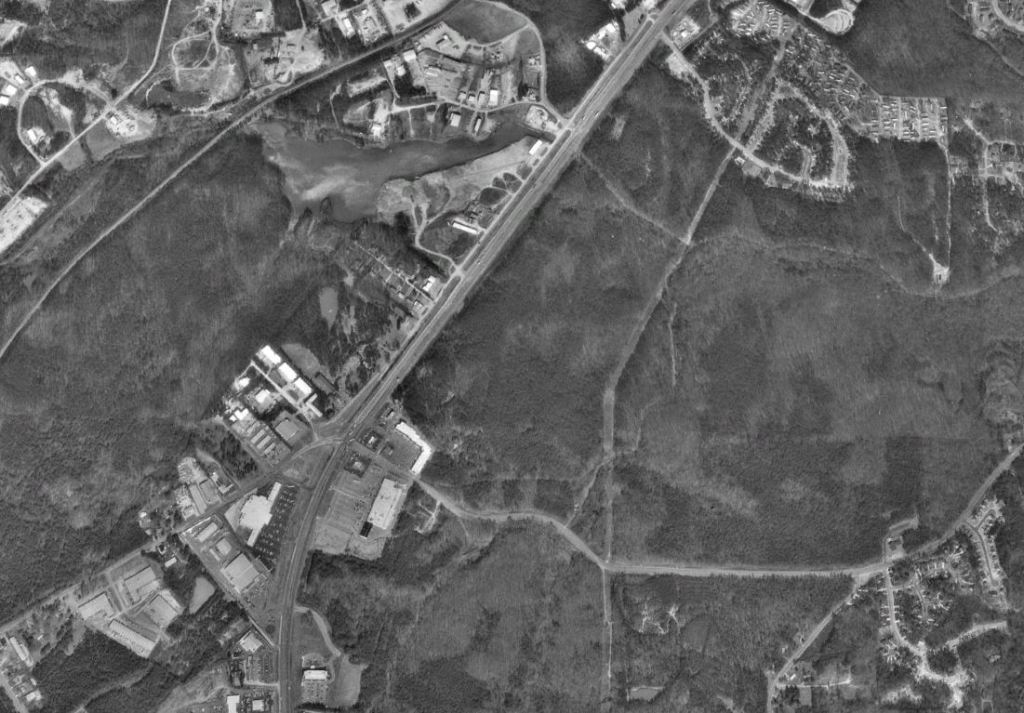
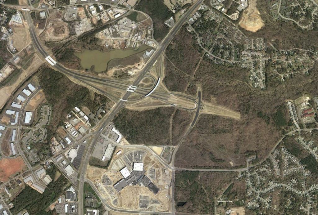
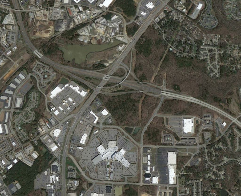
Triangle Town Center
While very suburban in nature, the Triangle Town Center area is still within the City limits of Raleigh. This will make a great suburban retrofit case one day.
Next time we’ll explore some of the explosive areas of growth in Charlotte.
For more photos, ideas, and insights on Raleigh visit https://philveasley.com/raleigh/
Click here for all of my articles and ideas. Through June 30th hit subscribe and you’ll be entered into a drawing to win a $50 gift card to a bike shop in your city.
Phil Veasley is a registered Professional Engineer in NC and GA. Opinions and insights are my own and are not representative of my employer or any organization. Any ideas displayed on this site are purely that – just ideas to help improve the future of the built environment and begin discussions.

One thought on “Visualizing 30 Years of Growth in Raleigh’s Core”