
The first two parts of the Connecting Downtown Raleigh series took a look at access from the East as well as the possibility of adding parks and trails over the railroad tracks. Part three of the Connecting Downtown Raleigh series examines the Southern extents of Downtown.
Currently, there are two direct routes in and out of Downtown to the South: US 70 / 401 / S. Saunders St and Hammond Drive. Both are currently six-lane urban corridors that aren’t pedestrian or dense development worthy. Wilmington St also extends out of Downtown but has no access to I-40 and not much else going on.
There are currently plans for a large development straddling I-40 and S. Saunders street titled appropriately, Downtown South. There are hopes that this will spur other development in this section of the city.
My plan would help facilitate development as well as give S. Saunders St and Hammond Dr a safer, bike and pedestrian urban boulevard feel. It would also enhance access to and from Downtown by constructing a three-mile limited access connector from the current junction of US 70 and US 401 to MLK Blvd.
Before we dive in to a detailed look at the plan, explore the interactive Google Map by clicking on the image below.
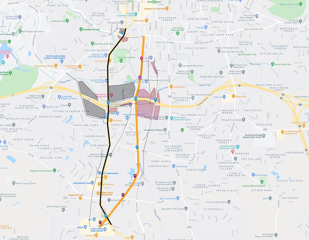
US 401 Downtown Connector
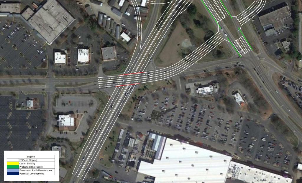
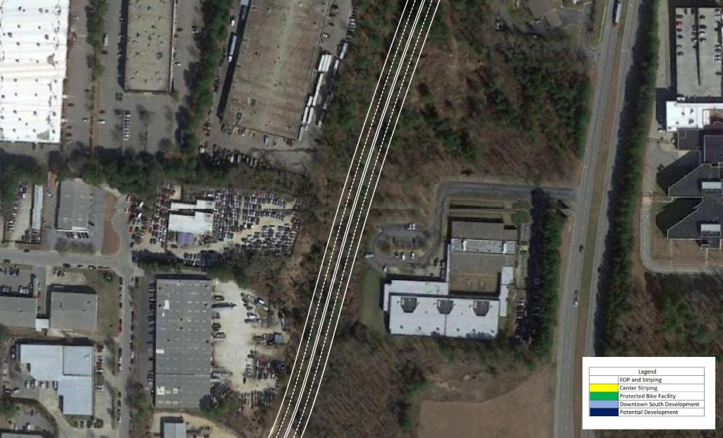
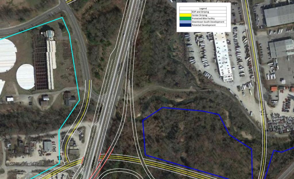
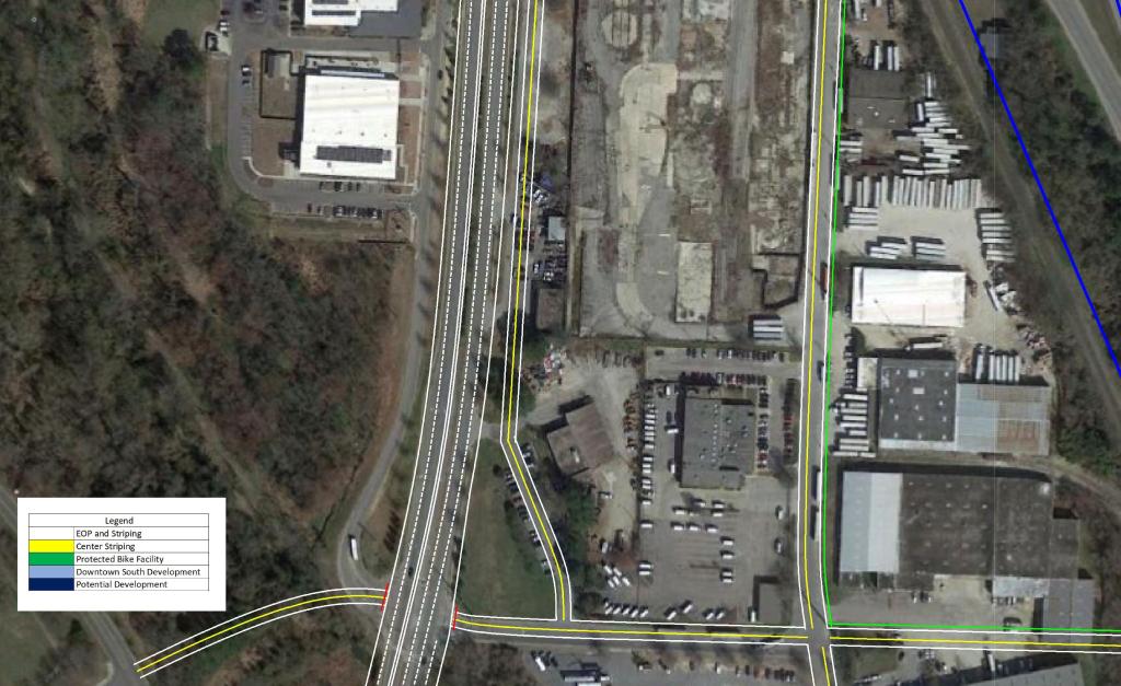
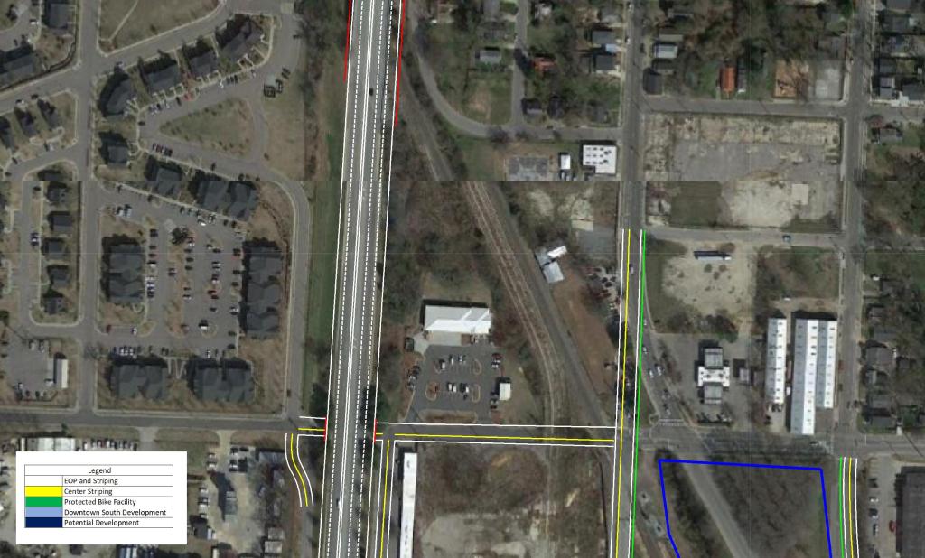
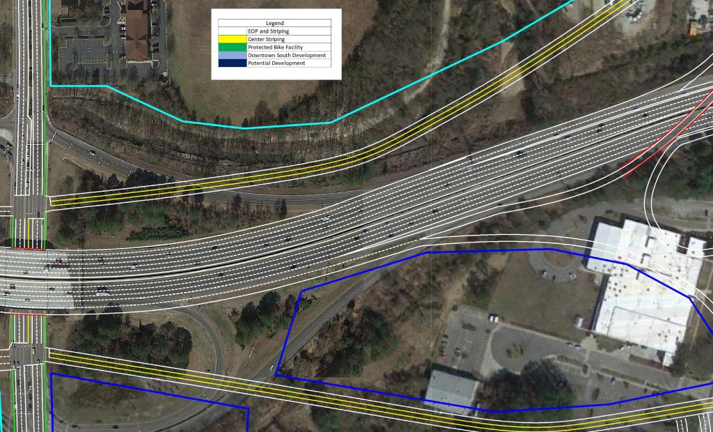
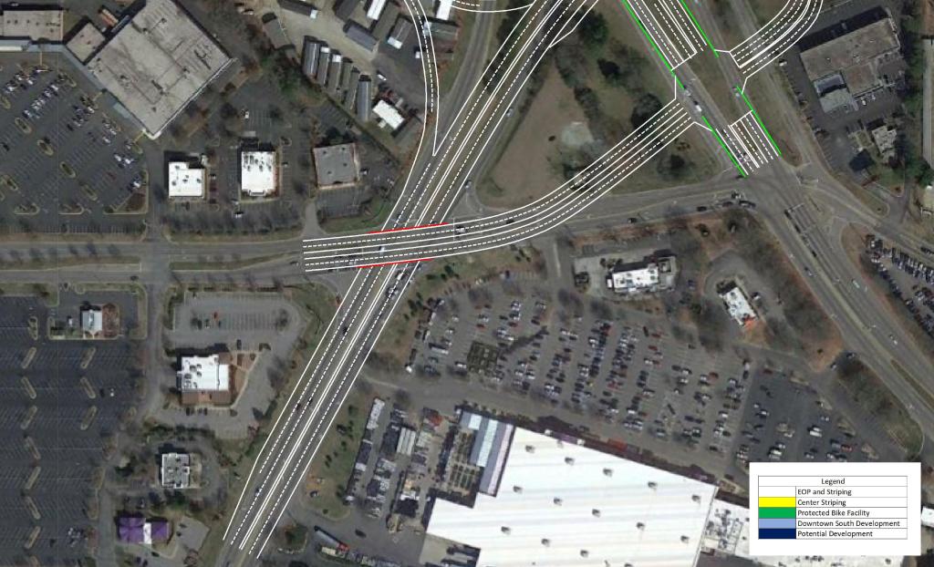
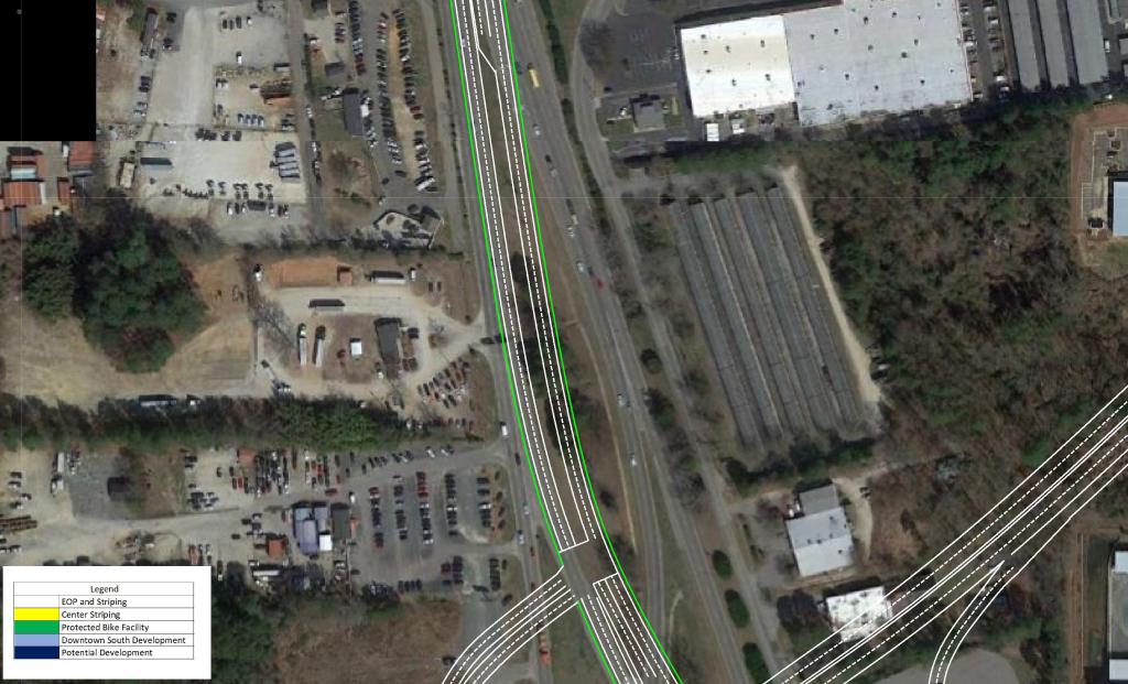
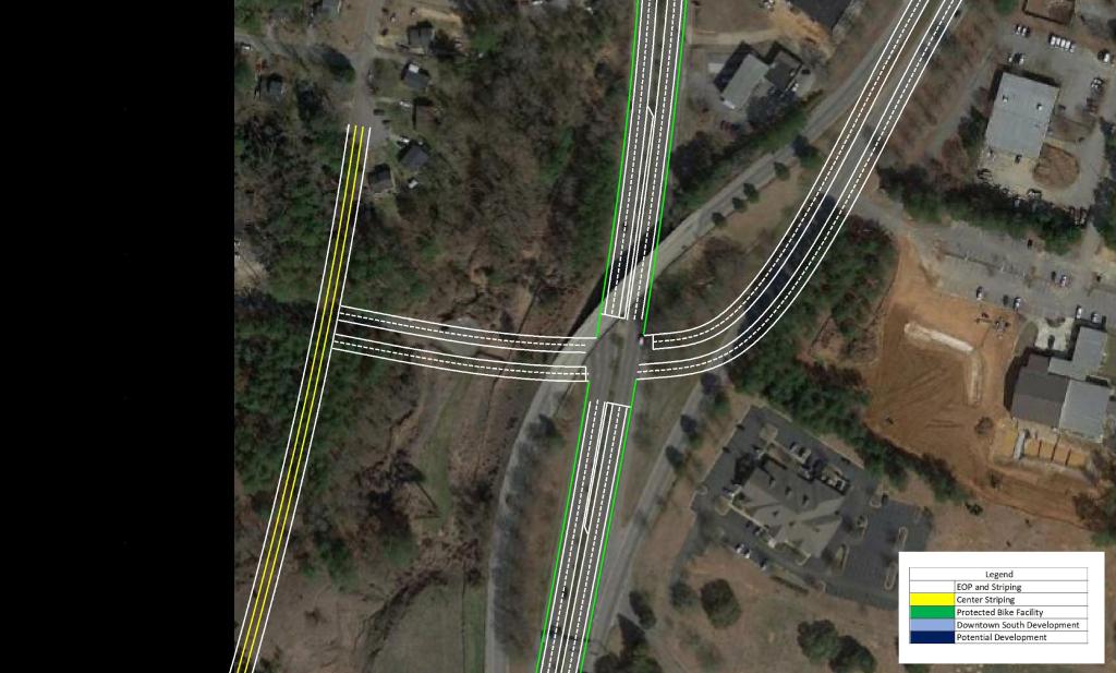
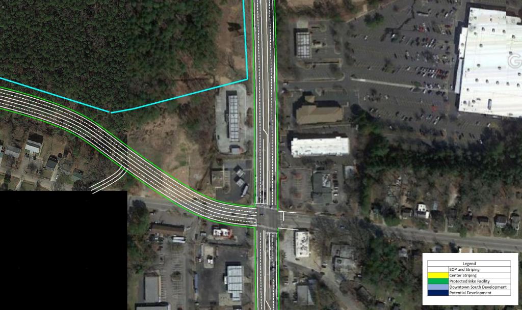
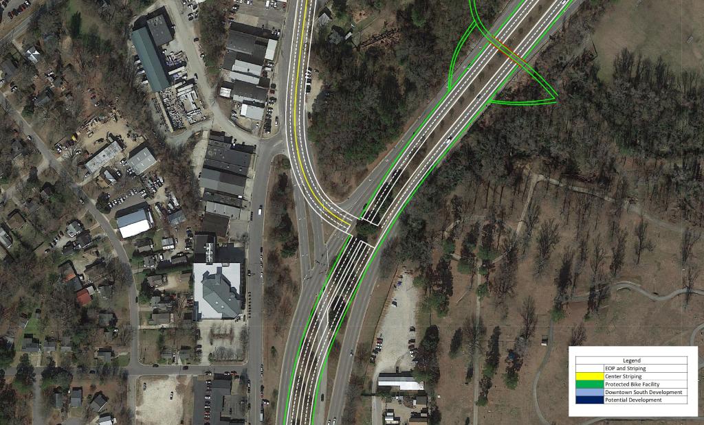
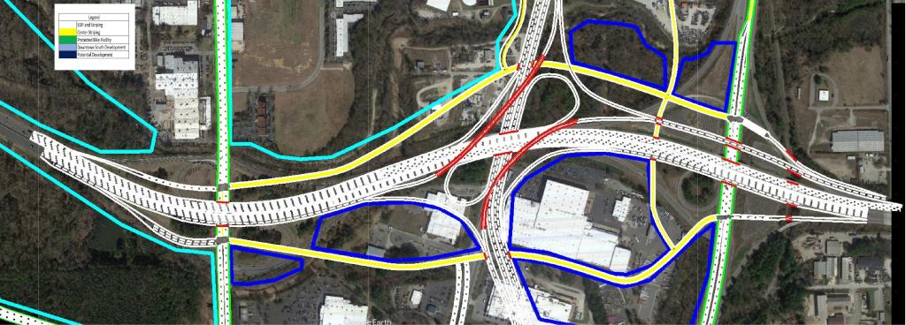
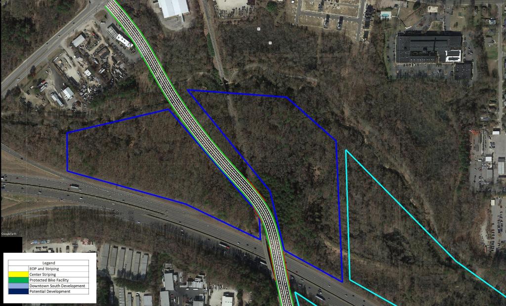
The focal point of the plan features the US 401 Downtown Connector. Currently, US 40 and US 70 merge just South of Tryon Rd to begin their approach to Downtown Raleigh to form S. Saunders St.
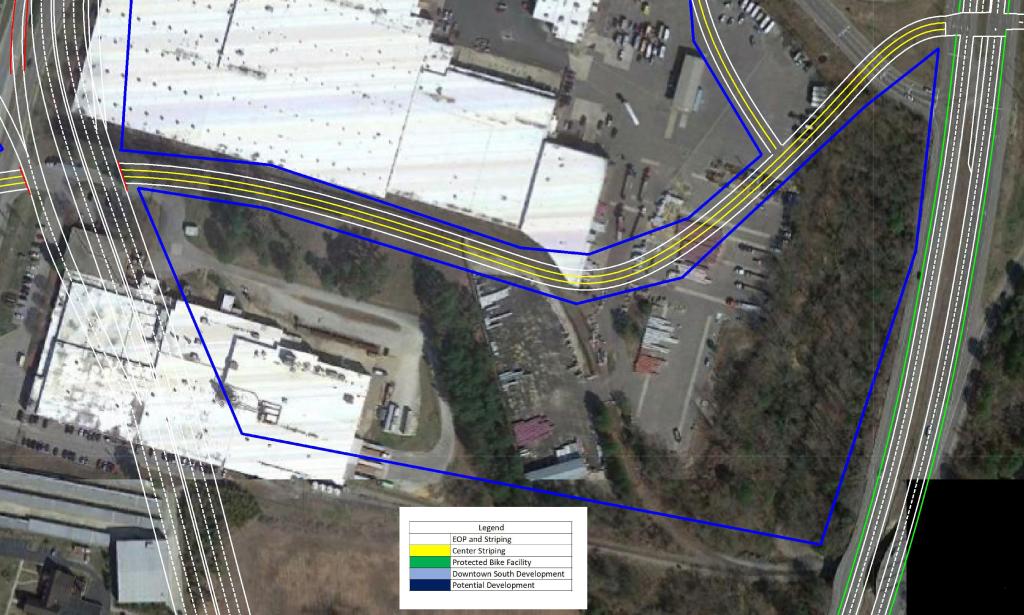
My plan would extend the current alignment of US 401 Northeastward past US 70 with a Partial Cloverleaf interchange. After passing Tryon Rd and Rush St with grade separations and briefly joining the current alignment of Hammond Rd, the connector would have a full interchange with Rush St.
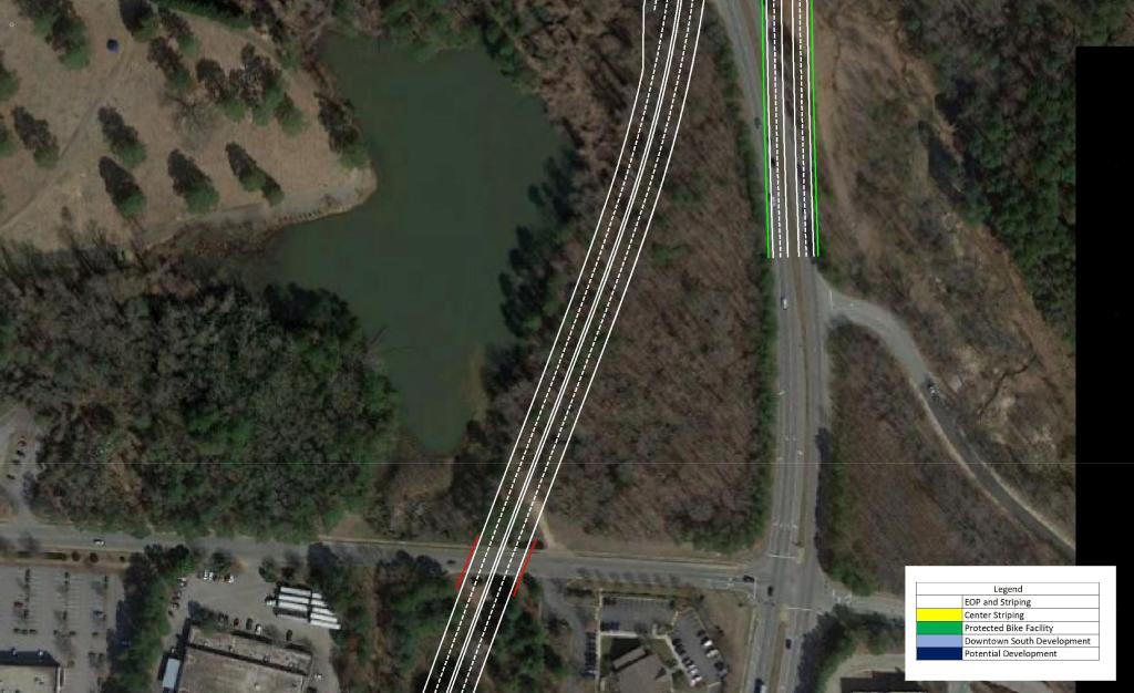
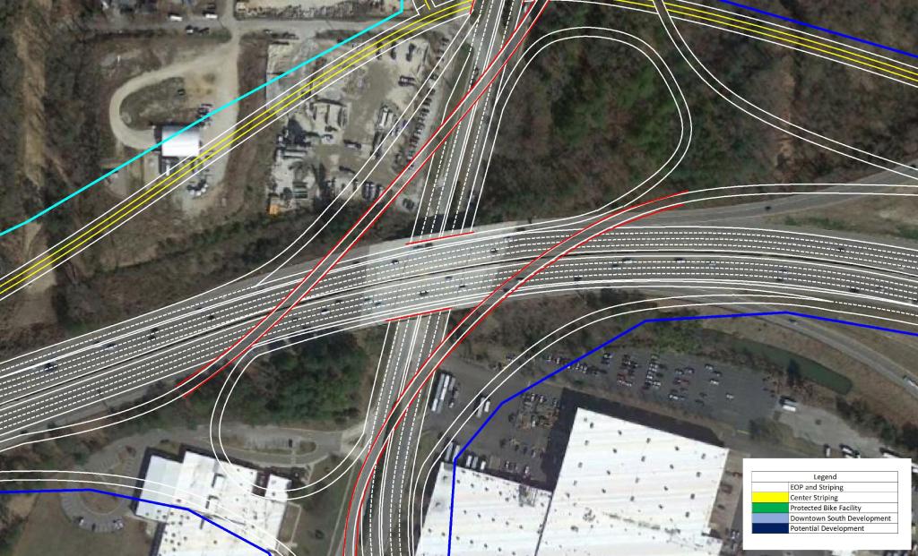
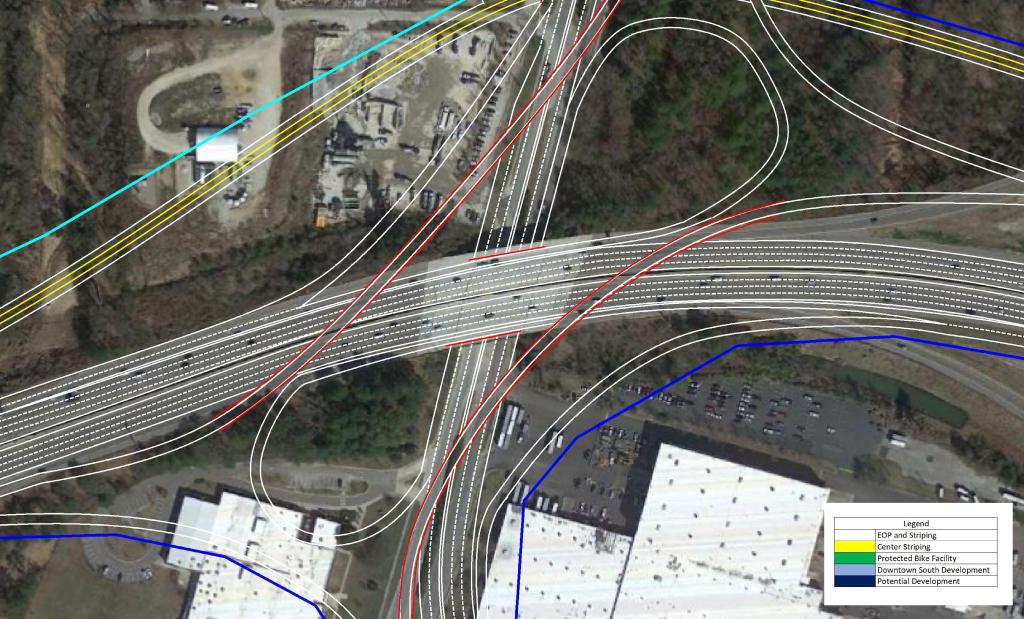
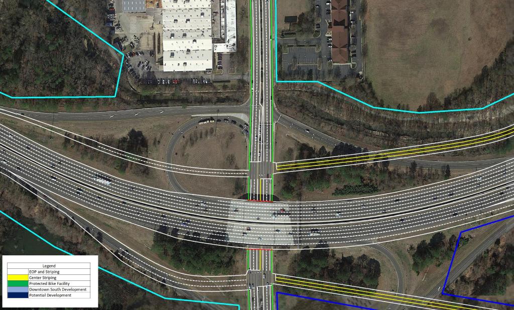
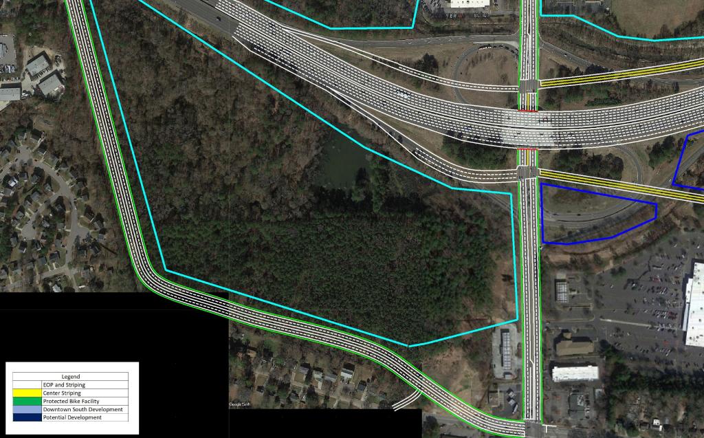
North of Rush St, an auxiliary lane would be added to help with the merge and diverge of the I-40 Interchange. The I-40 interchange is aligned as a Directional / Cloverleaf hybrid.
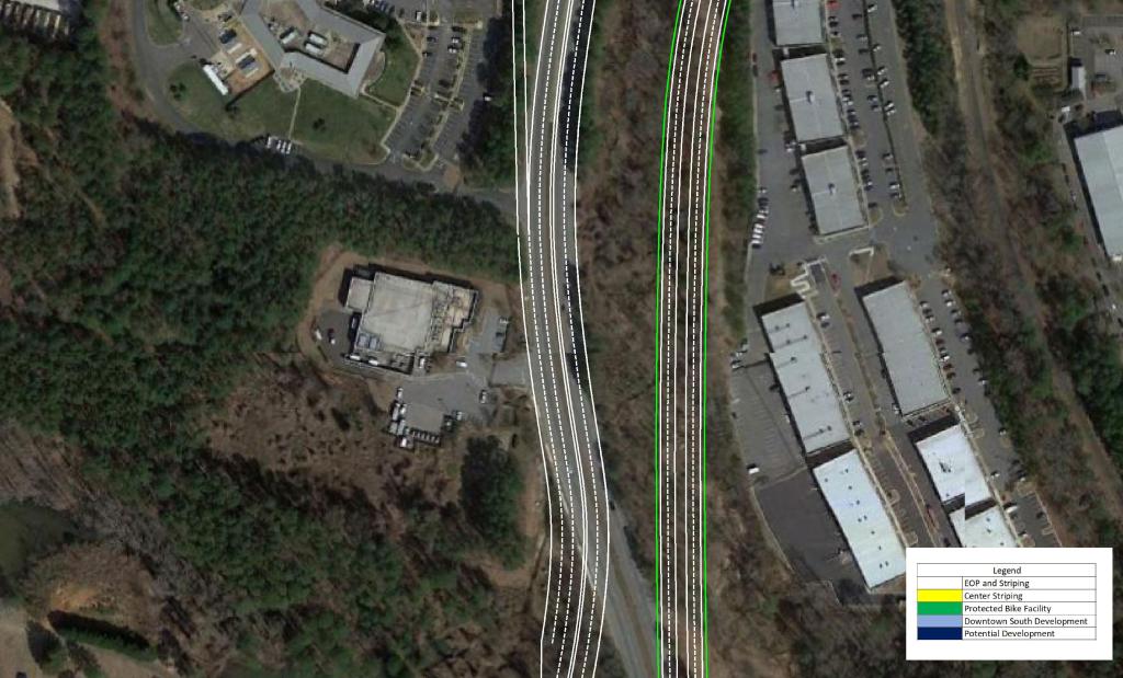
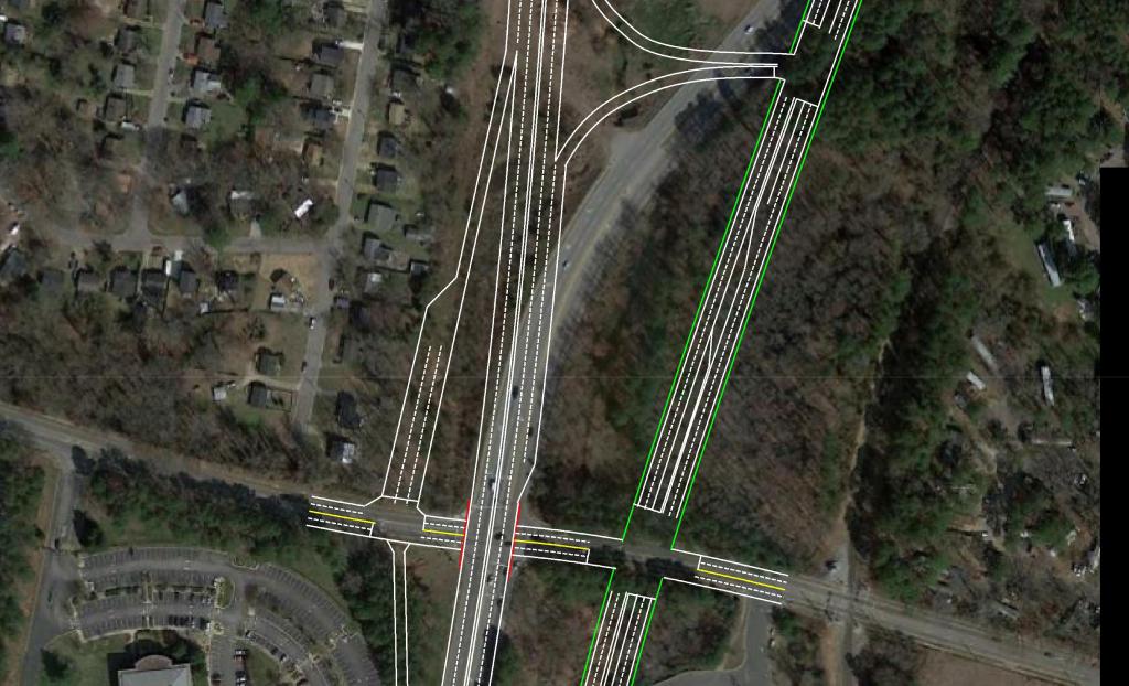
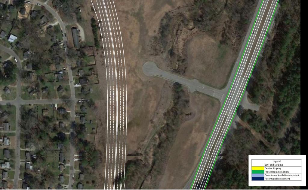
North of I-40 as the route approaches Downtown, grade separations are present City Farm Dr and Hoke St extension. In order to ensure minimal queuing in the AM Peak, the third lane from I-40 would be carried to the signal at MLK Blvd.
Although the route of least resistance is planned, a moderate amount of Right of Way – including a few factories – would be required.
View the conceptual drawings below by clicking through the pictures.
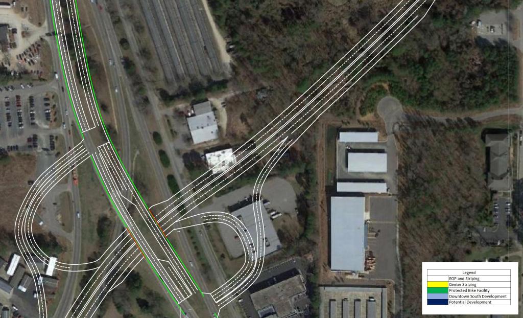
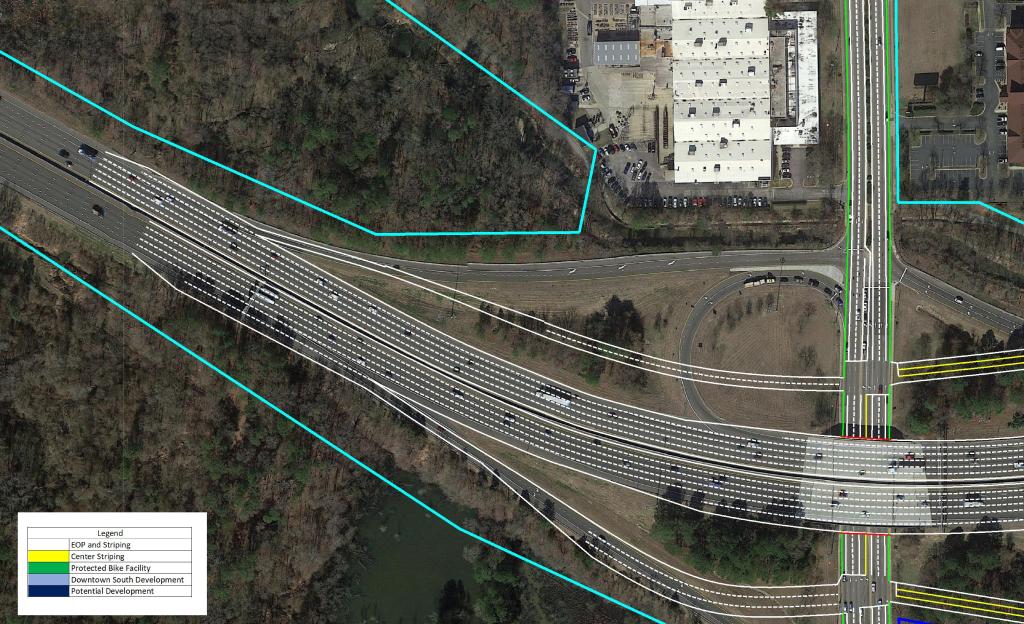
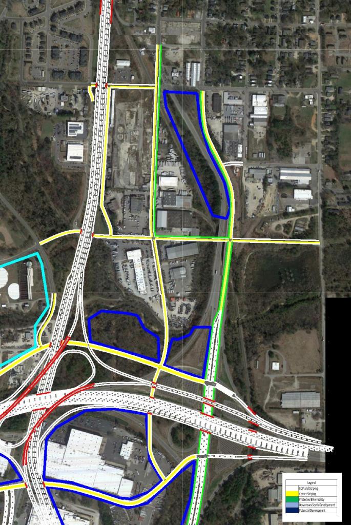
I-40
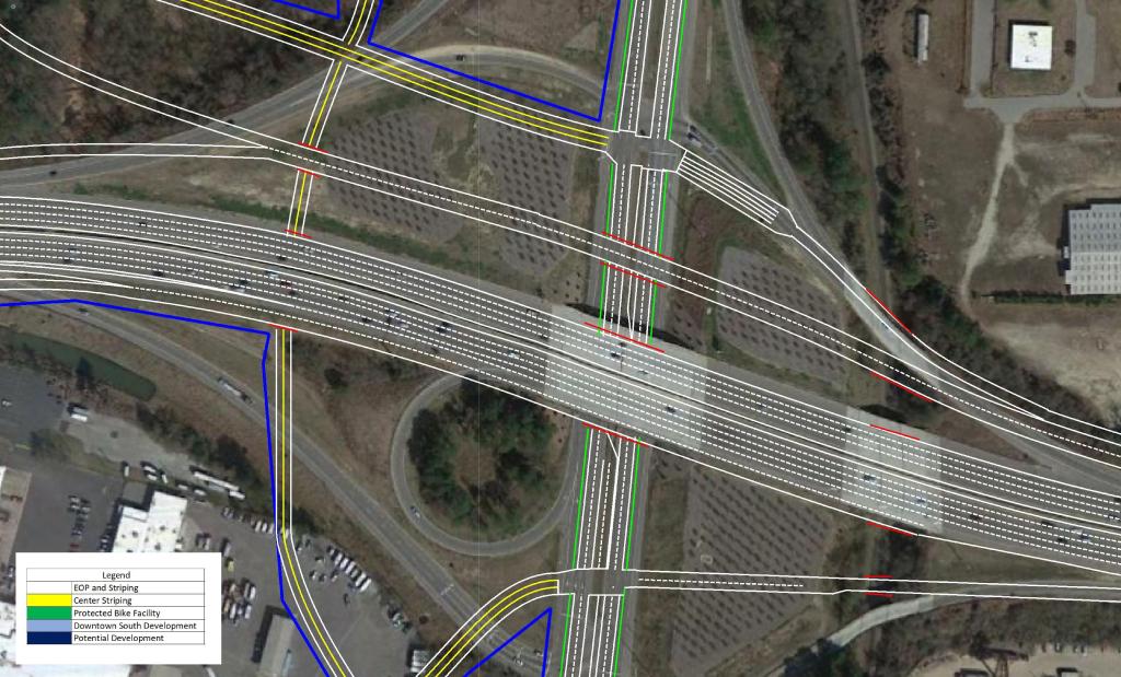
In order to tie into existing conditions with the new interchange, a few changes would have to be made to I-40 as well.
Existing exits 298 ( US 401 / US 70 / S. Saunders St) and 299 (Hammond Dr) would be converted to half-diamonds with a frontage road connecting the two roads. I don’t foresee this being an issue volume wise, because most traffic to and from Downtown and South will be using the US 401 Connector. This would also open the frontage roads to development.
View the conceptual drawings below by clicking through the pictures.
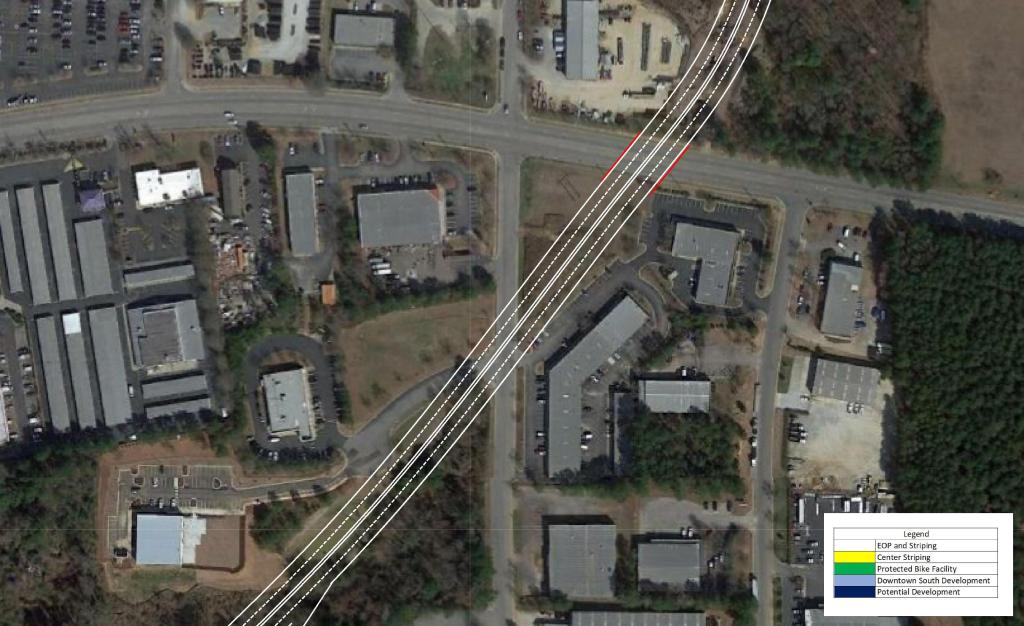
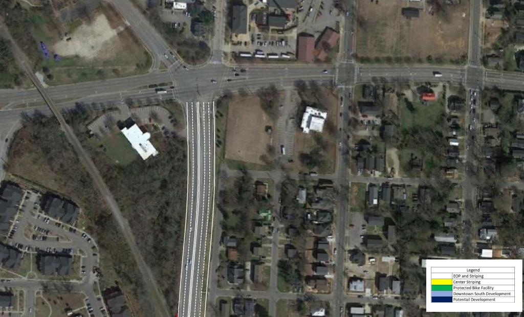
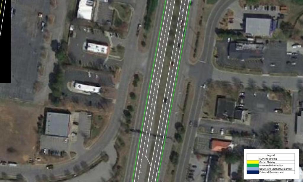
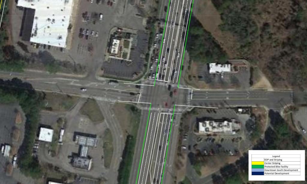
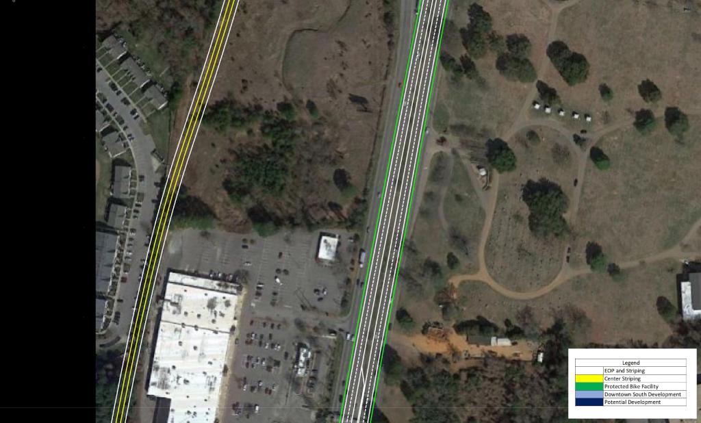
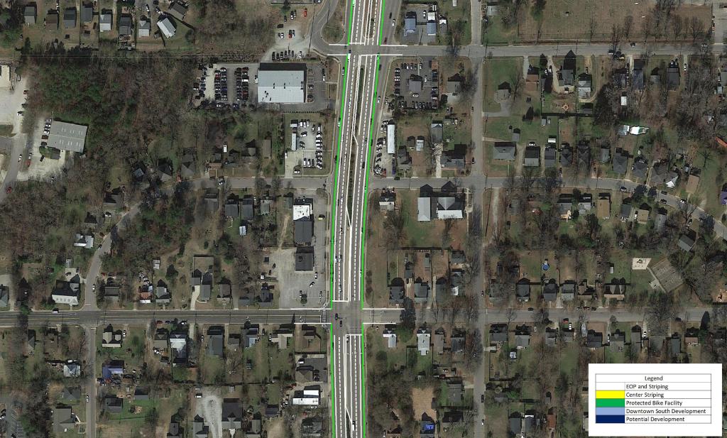
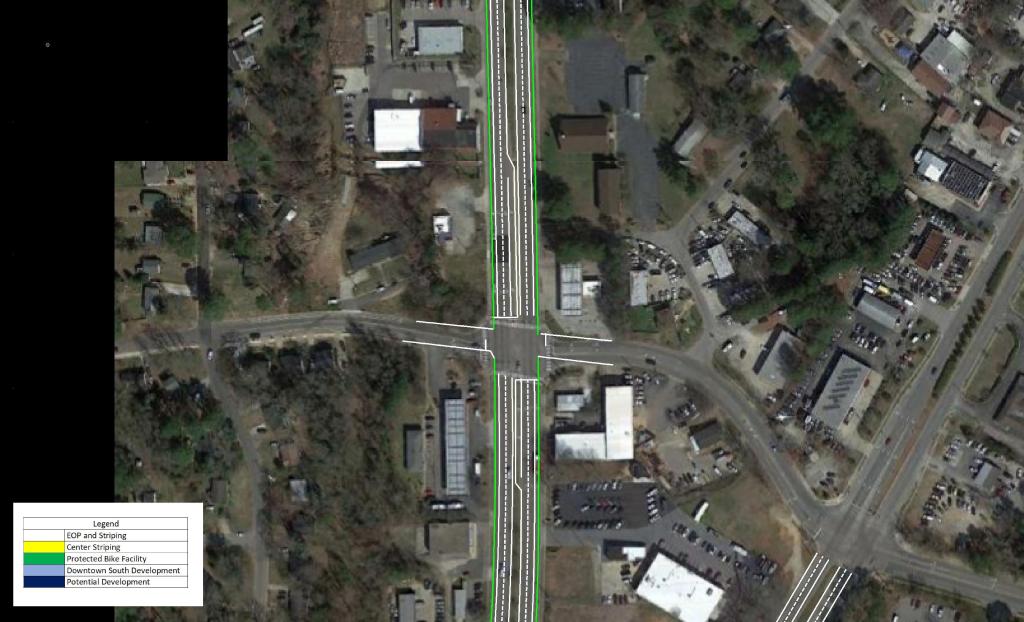
South Saunders Street
S Saunders St is the primary North – South route in, out, and through Downtown Raleigh. It exists as the primary vehicle and freight route. This leads to a busy corridor that has discouraged development on the fringe of Downtown.
With the vehicles heading in and out of Downtown diverted to the US 401 Connector, the opportunity presents itself to give S Saunders St the feel it deserves.
I propose reducing the street from three lanes in each direction to two as well as constructing dedicated bike lanes, and 8′ sidewalks.
An example of how I imagine S Saunders St can be seen in the image below.
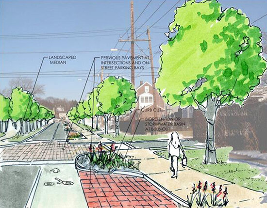
These measures should be paired with a reduction in speed limit along the corridor. This would promote the possibility of urban, dense, and walkable development in the area. As Downtown continues to quickly grow, S Saunders St will continue to become more congested and less likely to see urban development.
View the conceptual drawings below by clicking through the pictures.
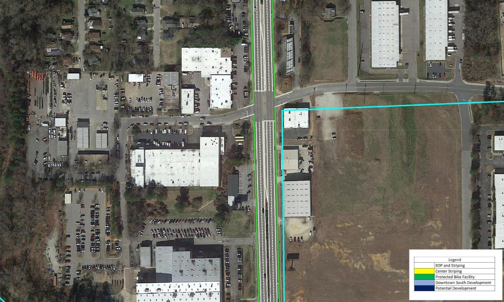
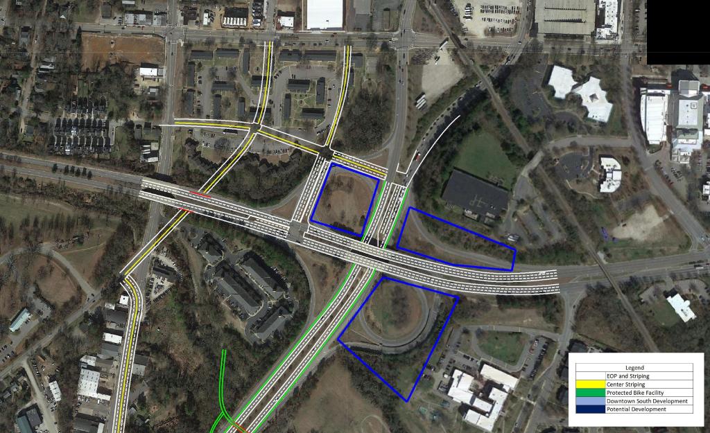
South Park Grid
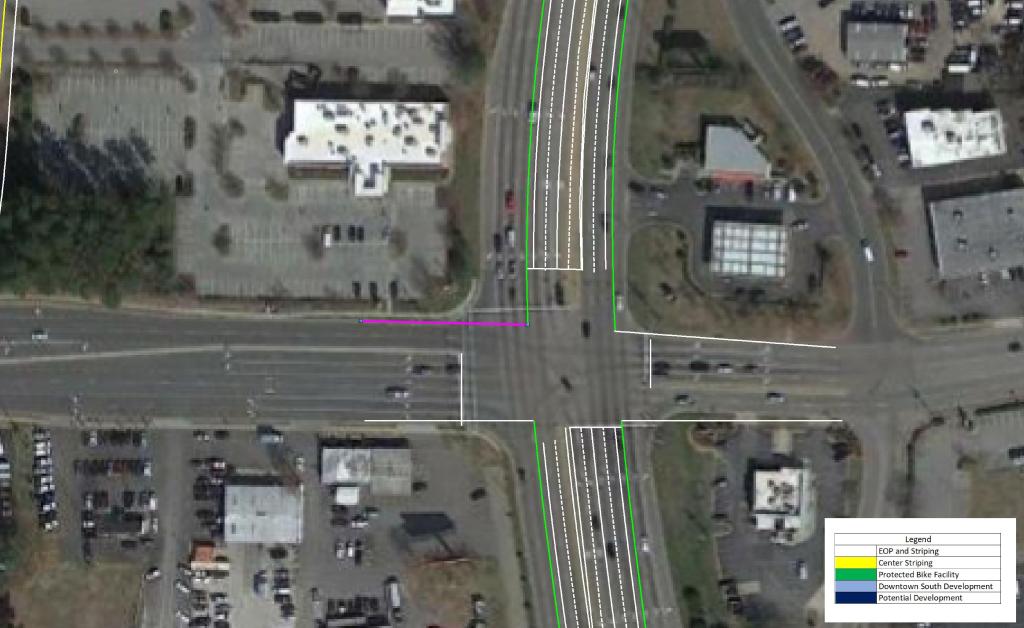
The street grid South of Downtown Raleigh is severely lacking. There are plans currently to convert Blount and Person St in Downtown to a pair of two-way streets. My plan would take this a step further and extend Blount St to the South to the proposed frontage road. It would also continue the road diet down Hammond Drive toward I-40 as a two-way road with protected Bike Lanes. From I-40 southward it would become a 4-lane road with Bike Lanes until tying into existing conditions around Chapanoke Rd.
Several other new connections would further enhance the gird south of Downtown as well as ensuring greater connectivity even with the addition of the US 401 Connector.
Centennial Parkway Extension
The Centennial Pkwy would enhance access to and from NC State University as well as serving the future phases of the Downtown South Development.
The addition of a limited access facility may be looked at as a negative to some. But by doing this, the City of Raleigh can free up two clogged corridors and transform them to urban gateways as well adding to the urban street grid. In addition, dense development would now be viable in what is currently a vastly underserved area.
I would love to hear everyone’s thoughts on this plan. Please be sure to share with your colleagues and stay tuned for my next ideas!
Phil Veasley

Can I just say what a aid to find somebody who really is aware of what theyre speaking about on the internet. You undoubtedly know learn how to convey an issue to mild and make it important. Extra individuals must read this and perceive this facet of the story. I cant consider youre not more standard because you definitely have the gift.
LikeLike