Urban Connector City Series: Providence First Impressions

When I first heard that CNU 33 was being held in Providence, I was a bit surprised.

Subscribe to my YouTube Channel

Subscribe to receive email notifications for new articles.

✓ Subscribed

Having spent my first 10 years of childhood between Hartford and Springfield, we constantly visited Boston, New York, the Upstate, the Cape and even Newport, but somehow never Providence.

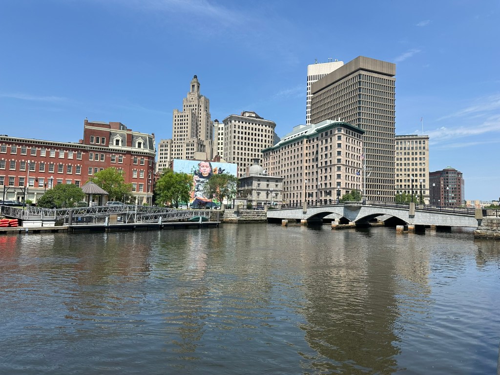
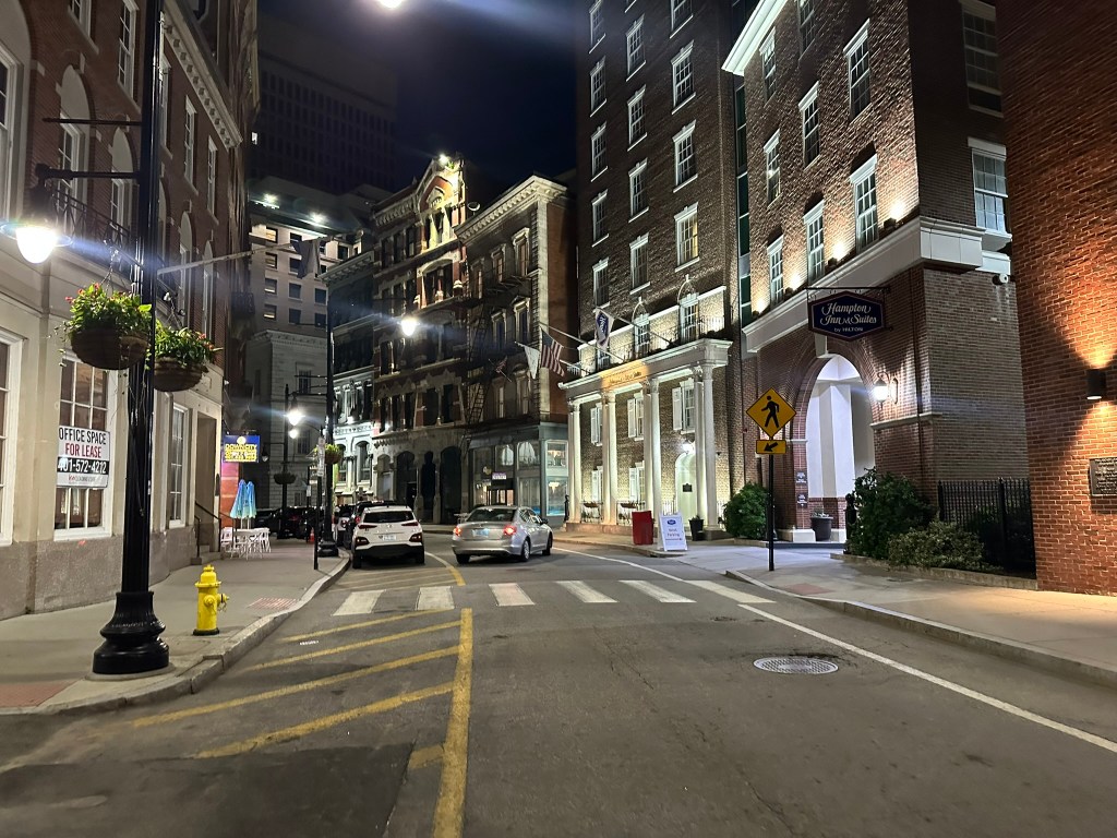
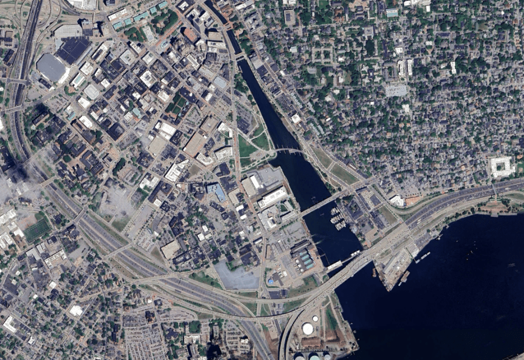
Arriving late night via train from New York, my very fist impression was how the train station felt so close, yet so separate from the core of Downtown. CNU was held mostly at the Omni Hotel which are directly in the heart of the core but also part of what was obviously an Urban Renewal project.

GoogleEarth

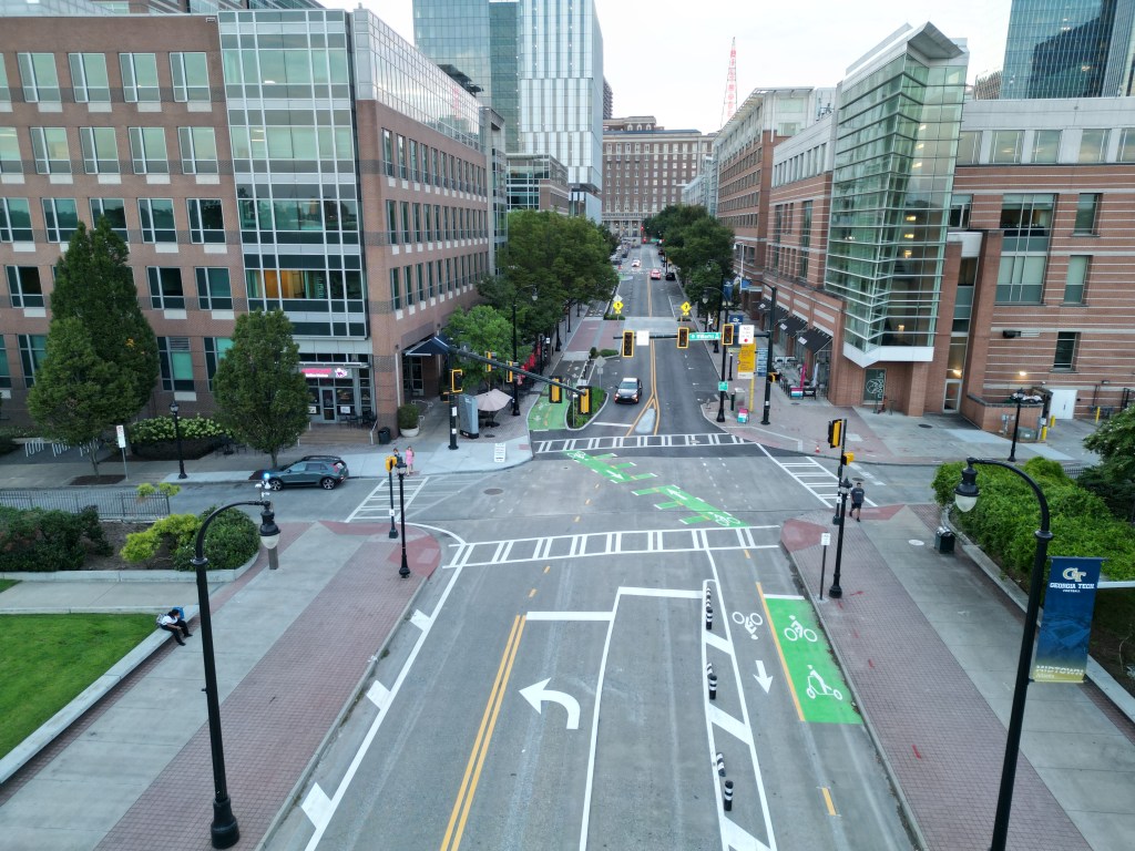
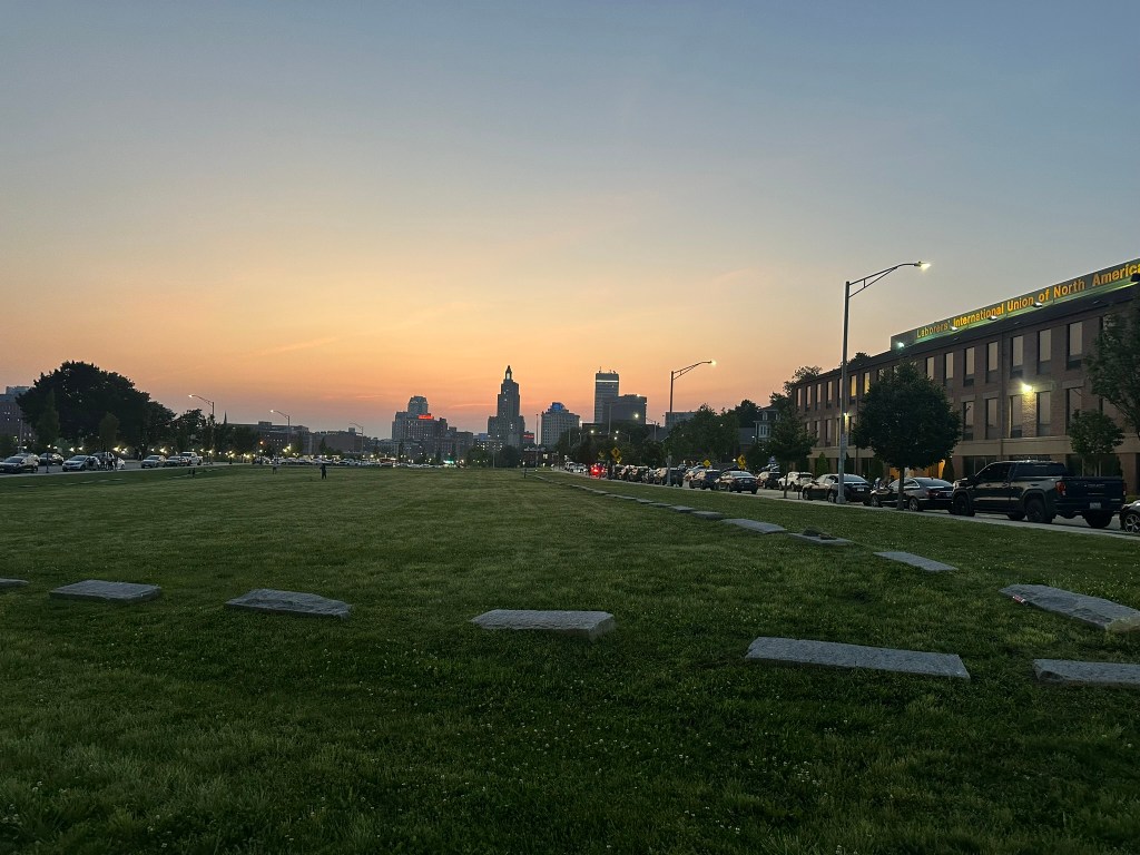
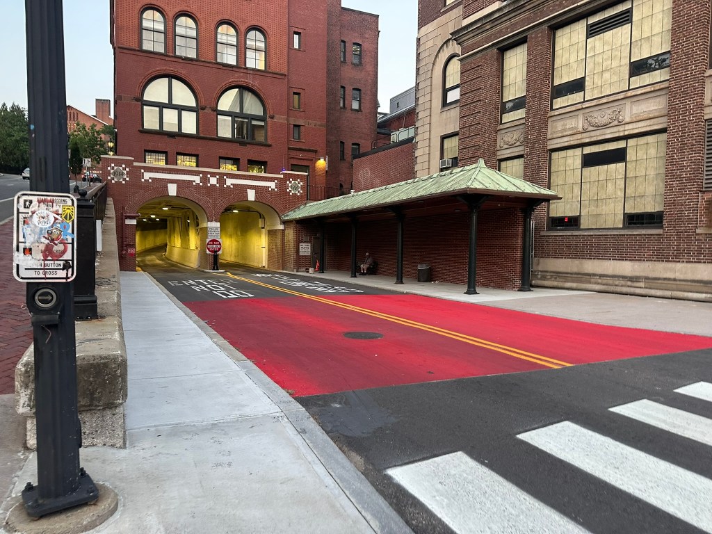
From the full scall suburban style mall right in the middle of Downtown (and even over a river), and a massive I-95 interchange feeding into a downtown street missing an important crosswalk leg – the signs were clear.

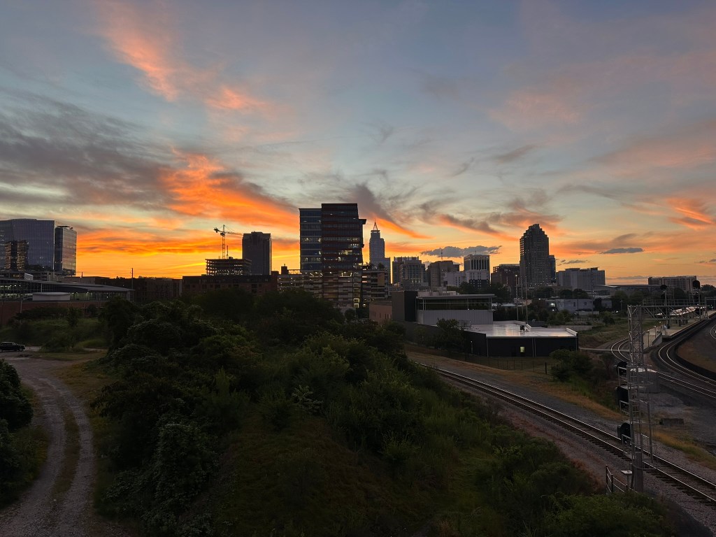
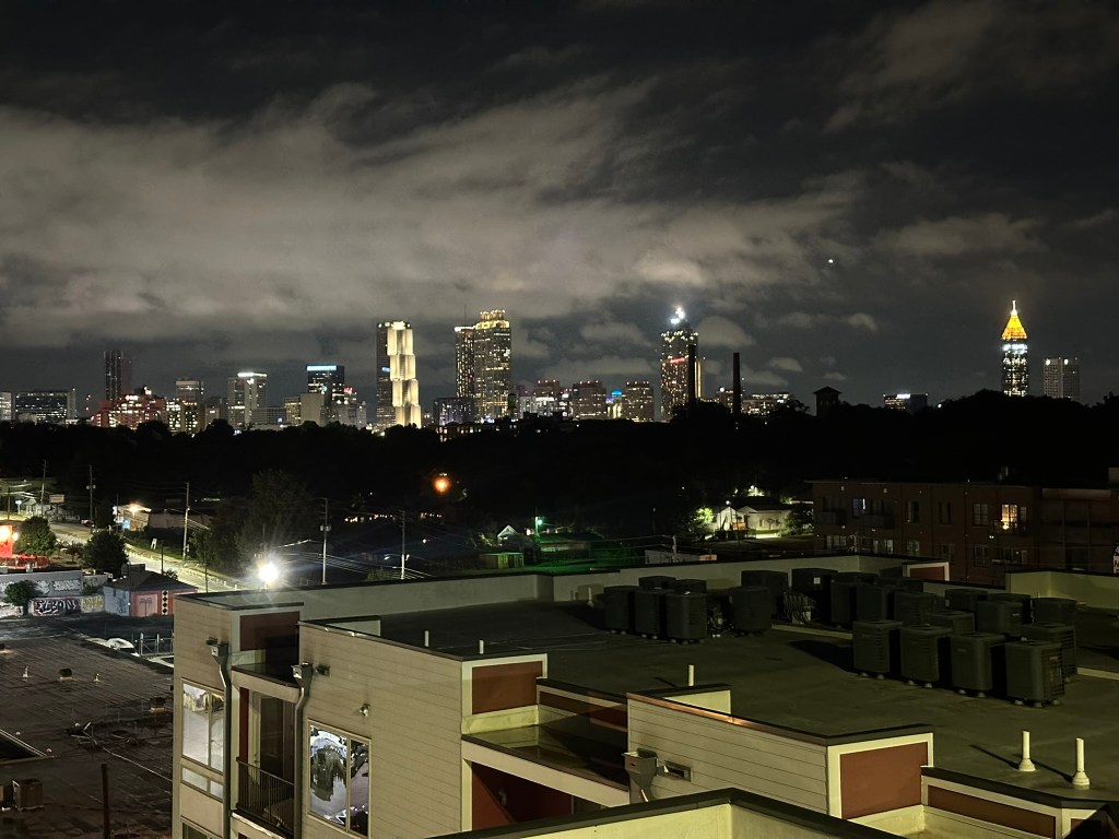
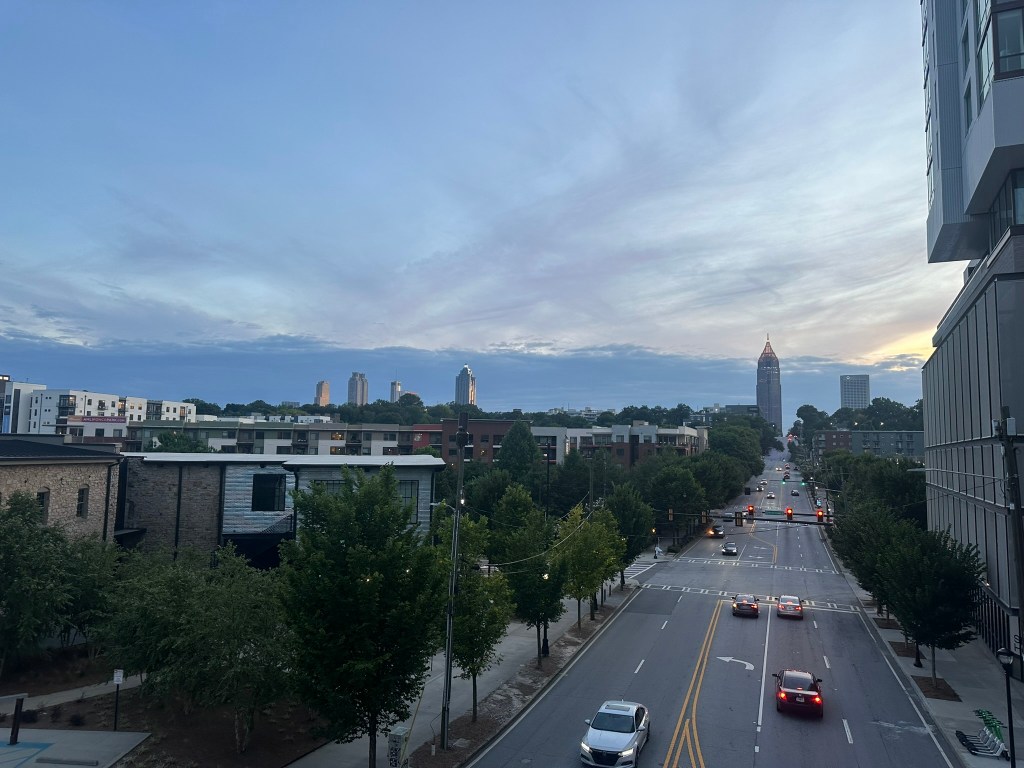
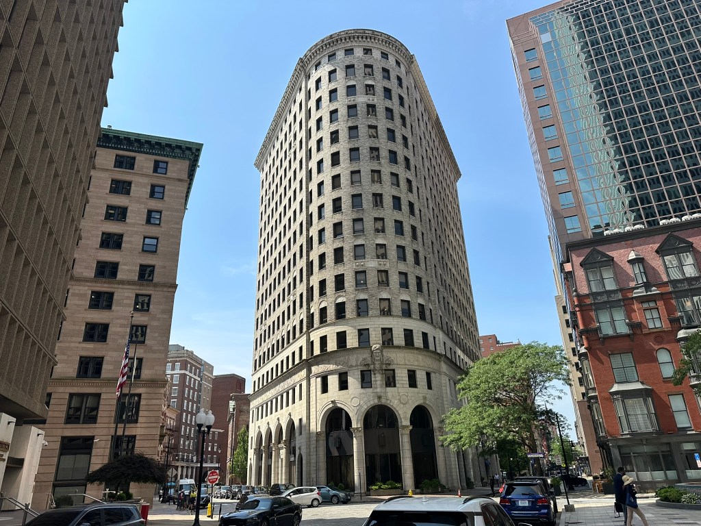
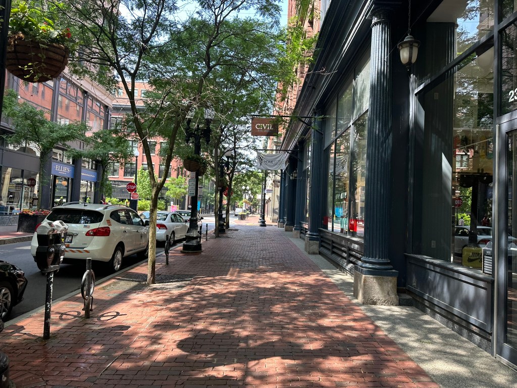
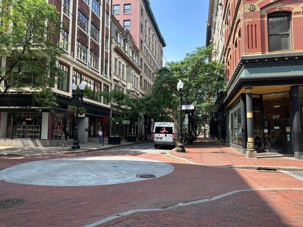
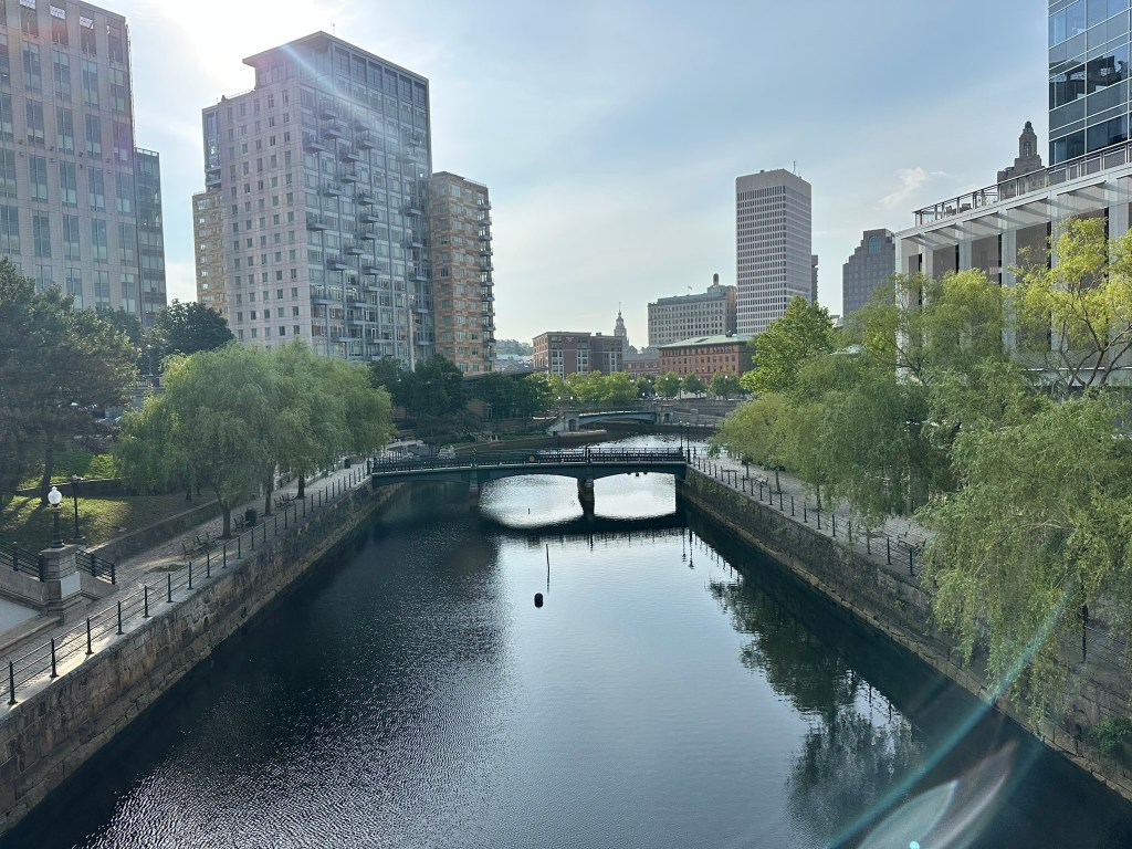
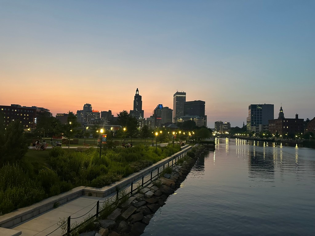
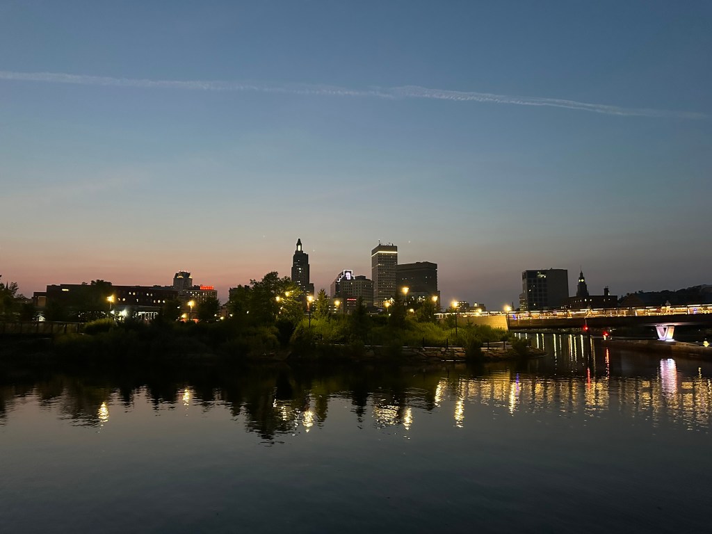
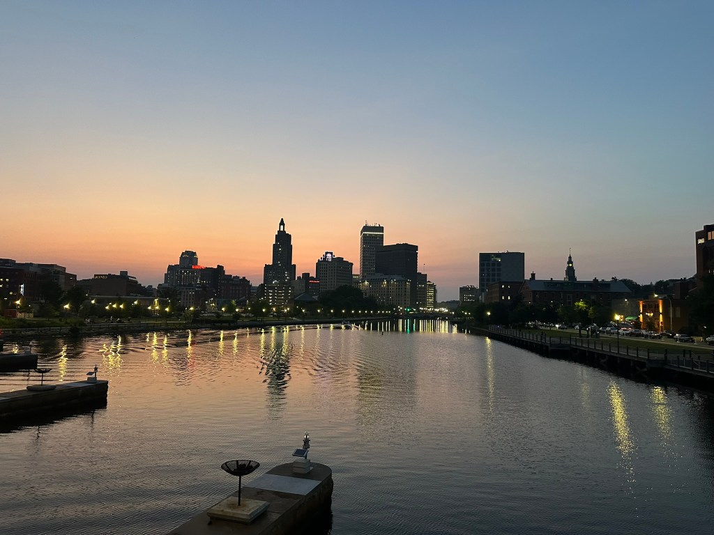
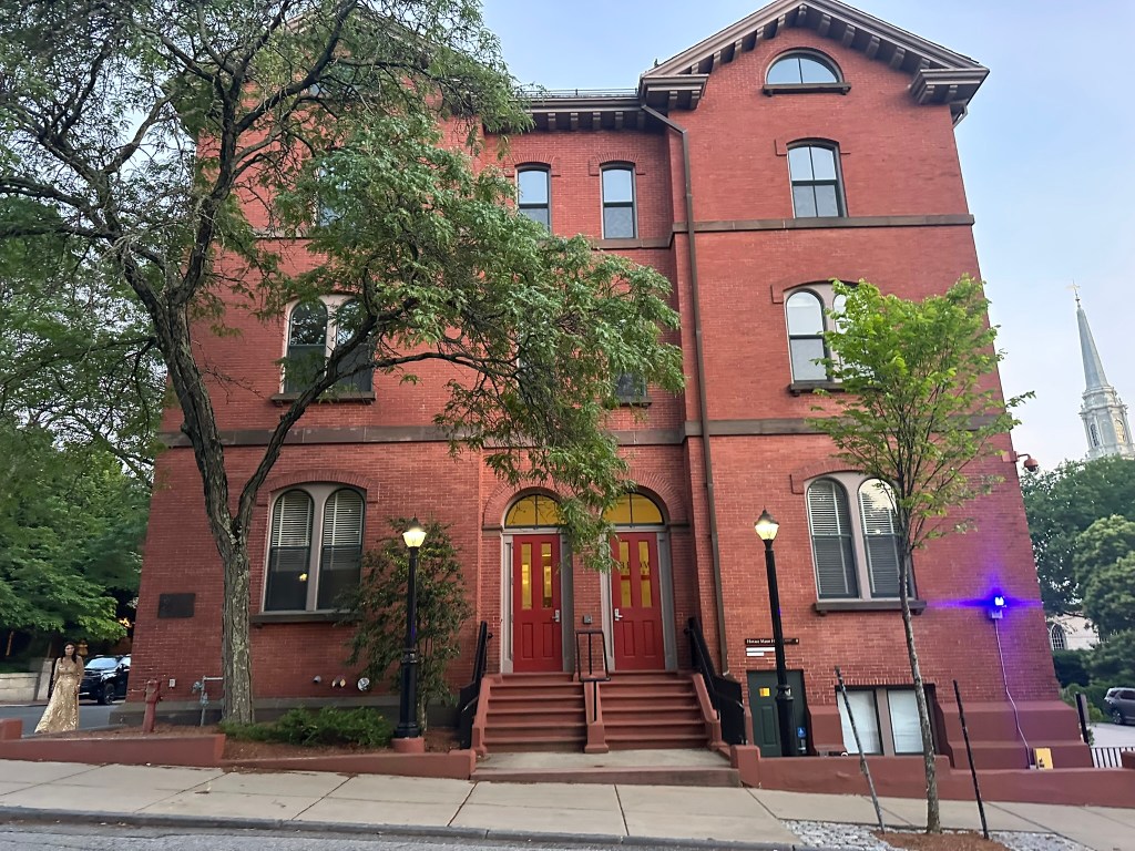
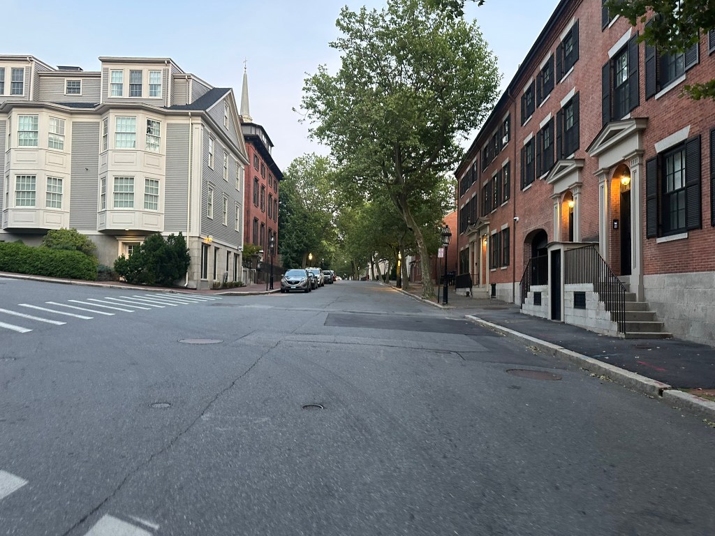
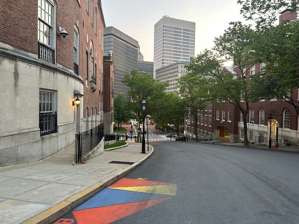
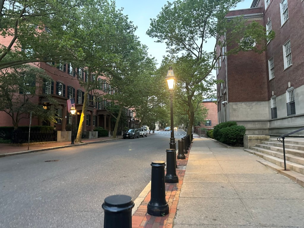
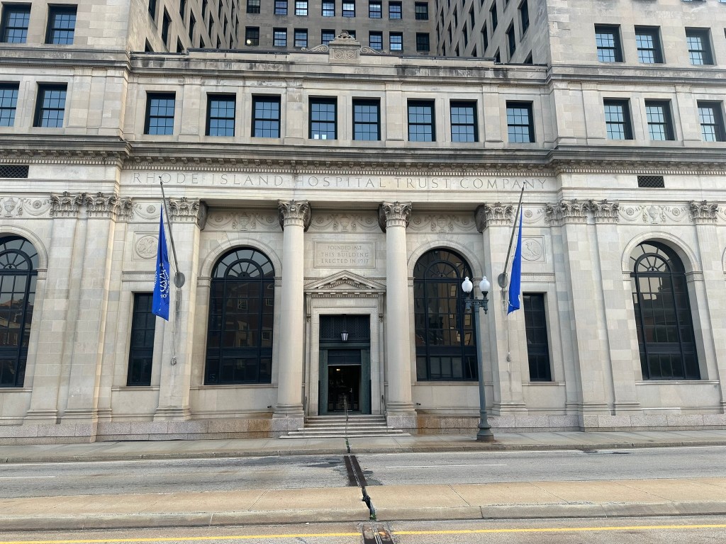
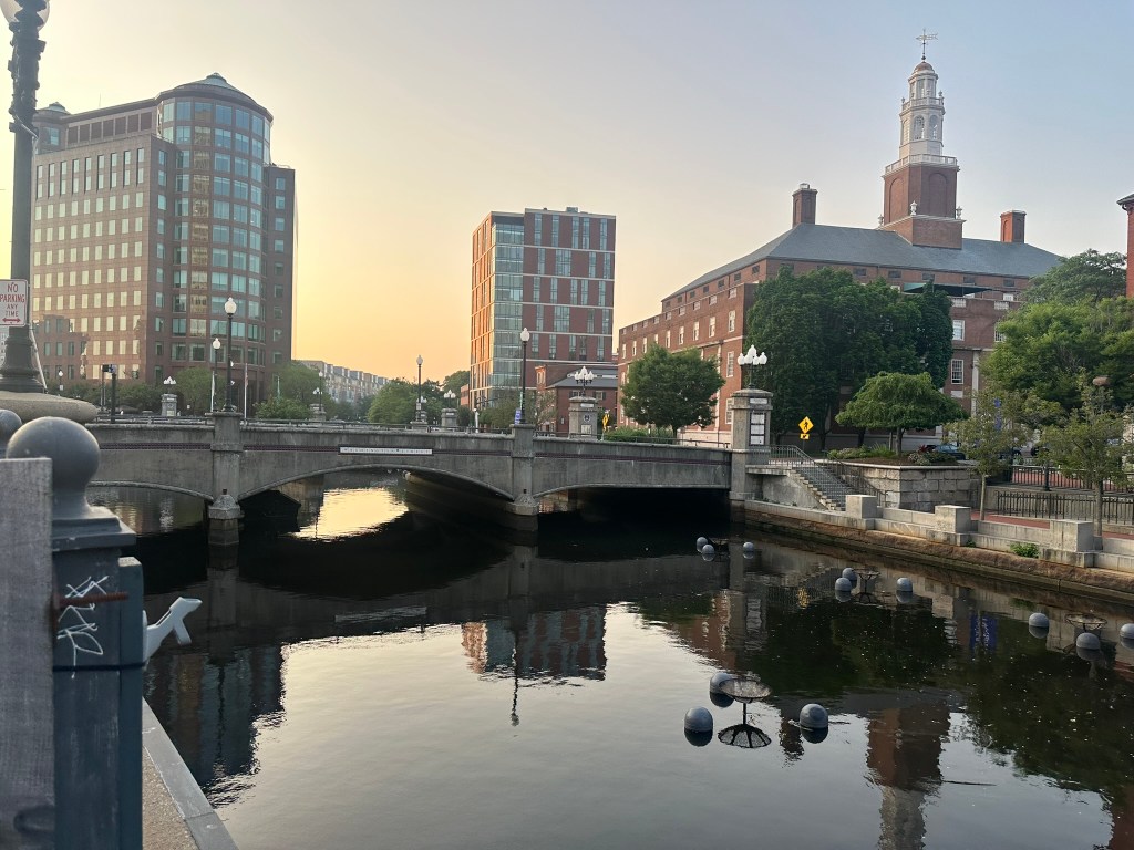
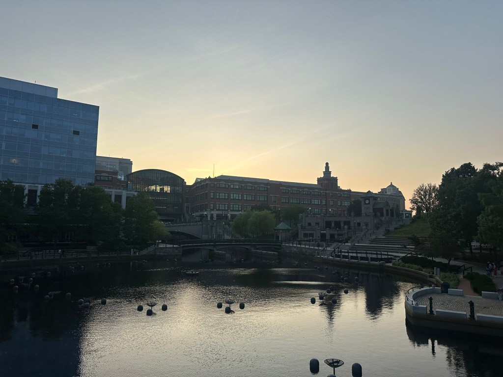
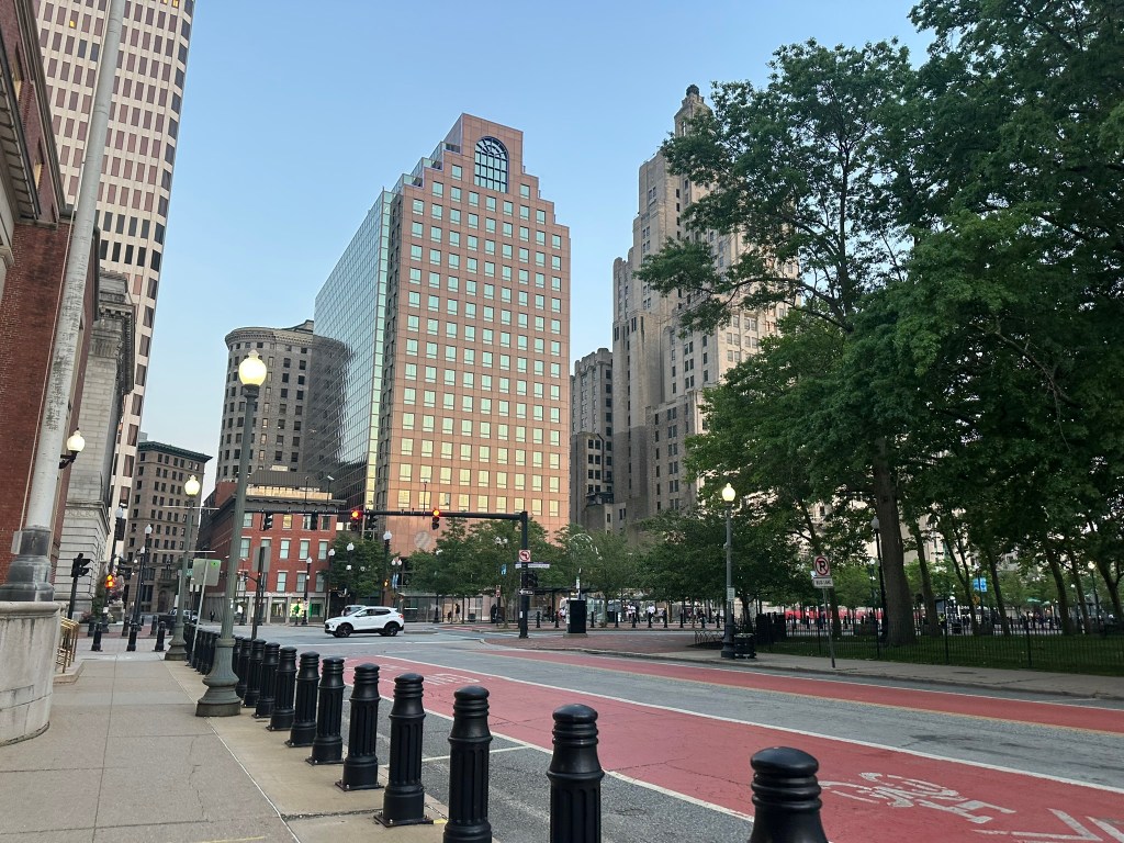
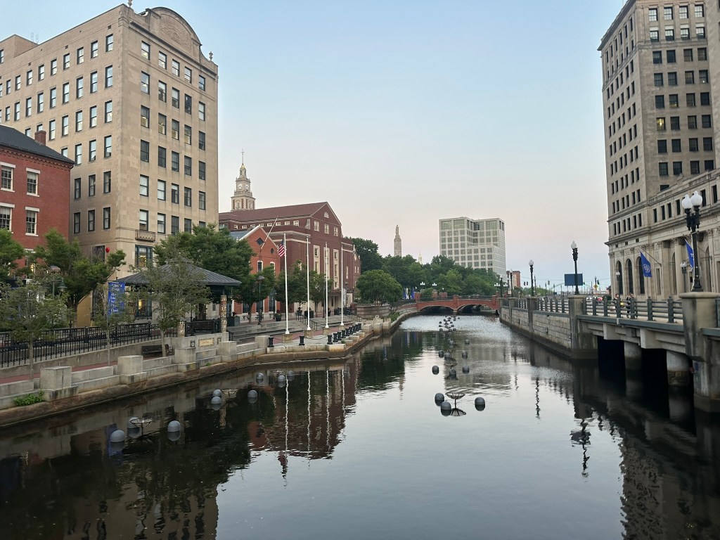
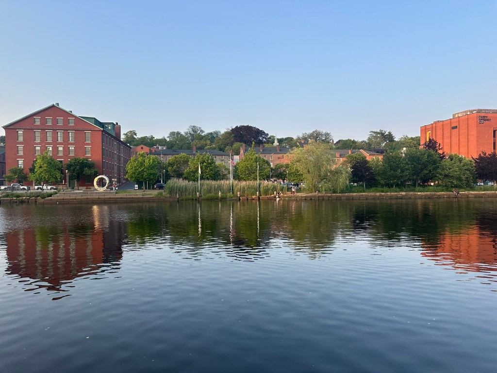
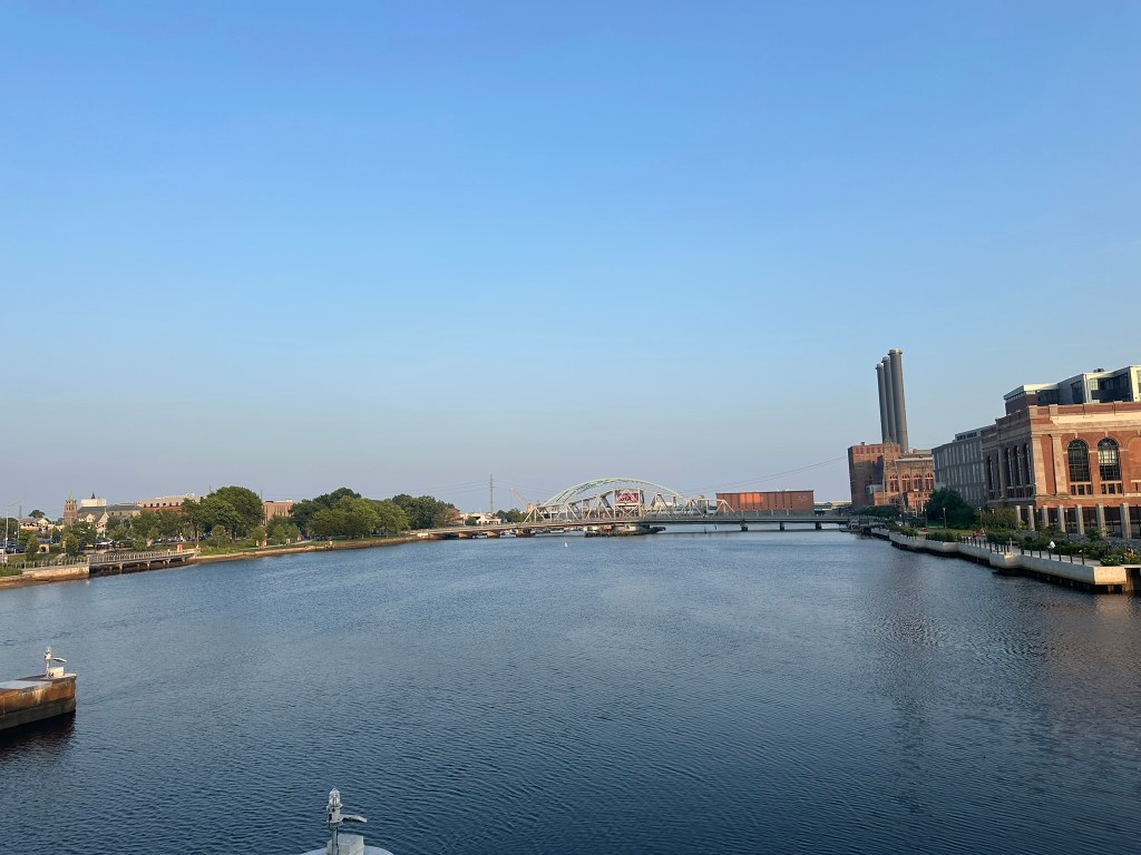
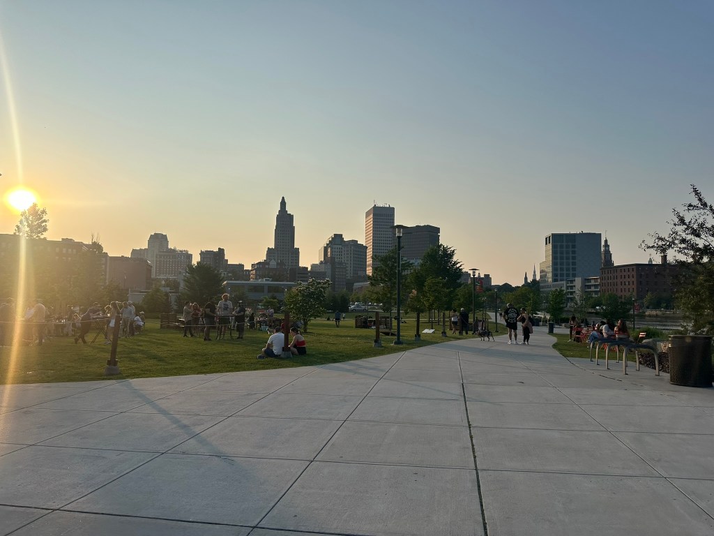
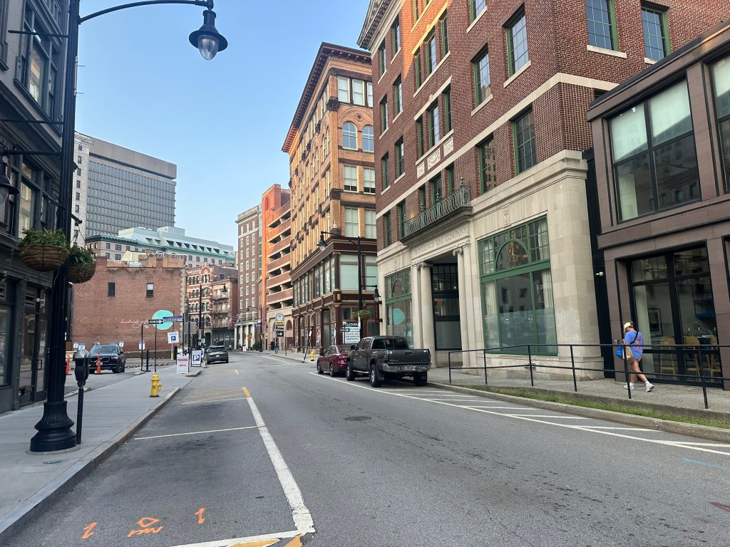
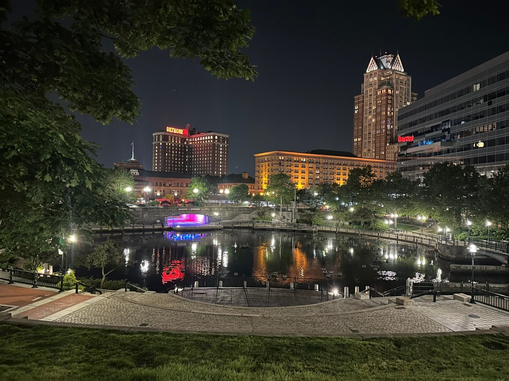
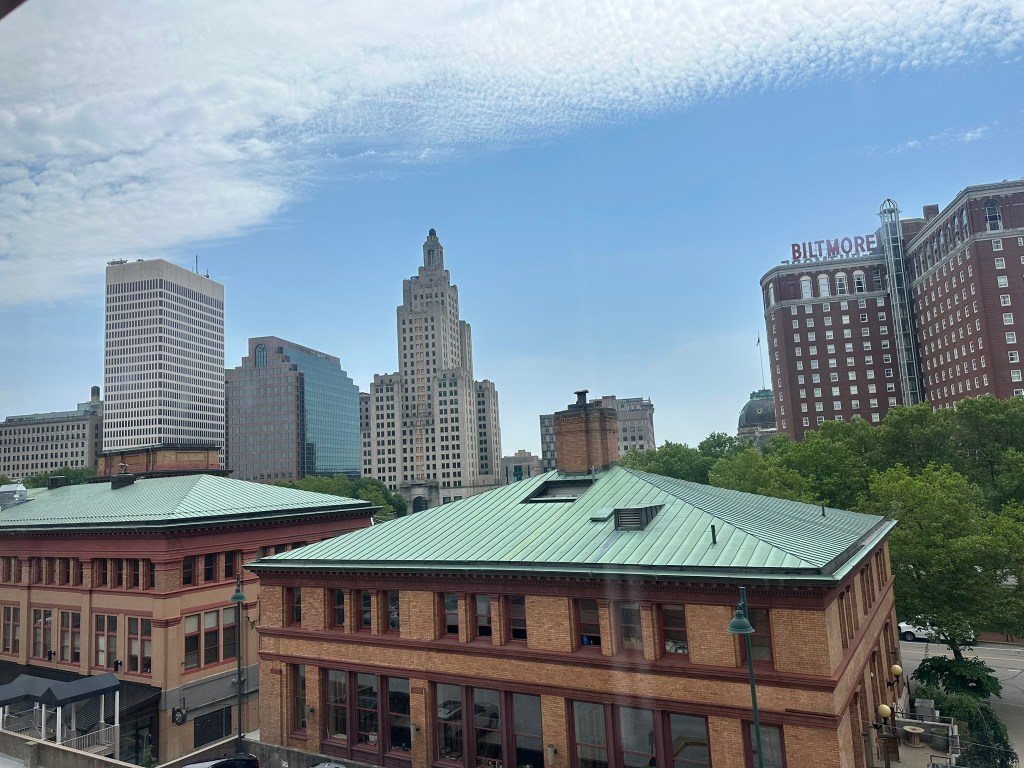
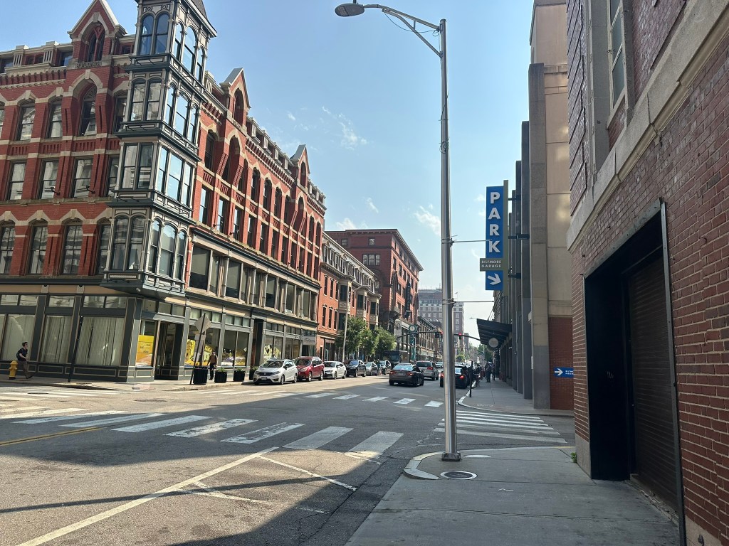
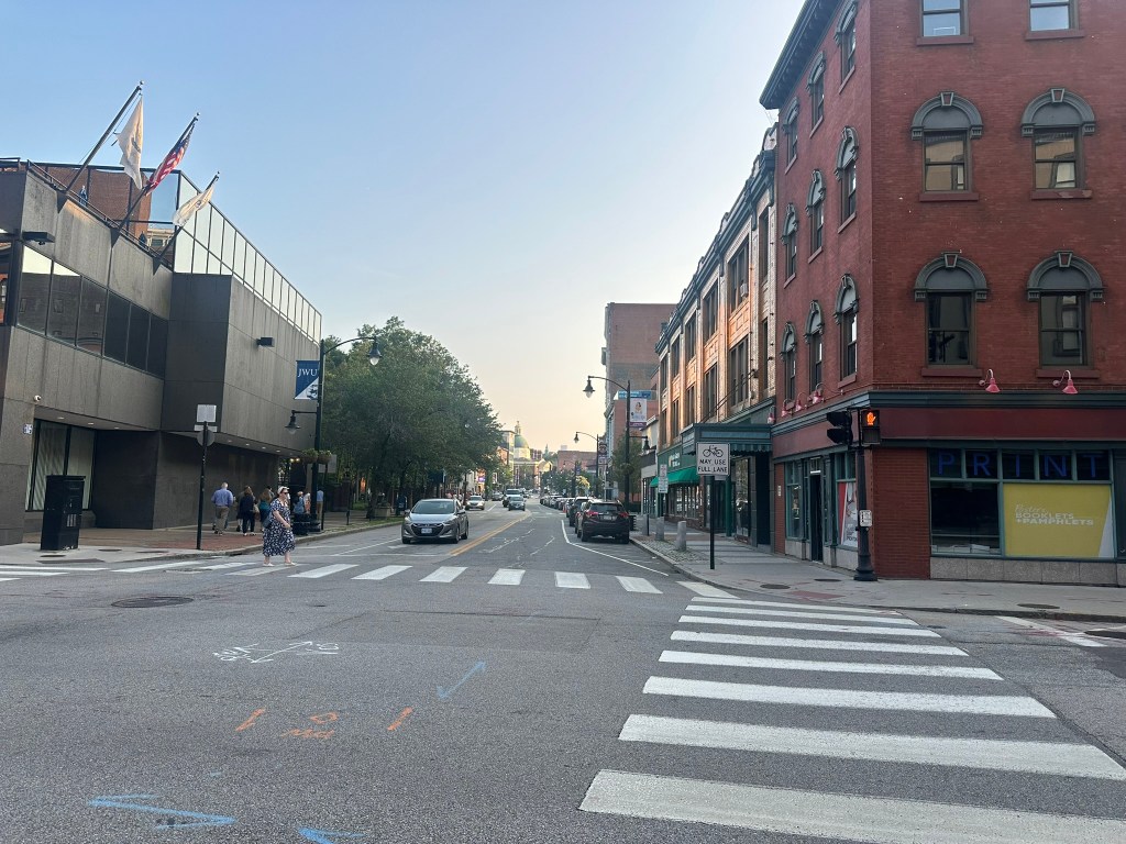
For the most part however, Downtown felt like a scaled down version of sections of Downtown Boston with 5-7 story buildings, some water, tons of history and a beautiful vista from this curved street.

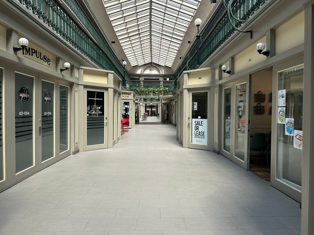
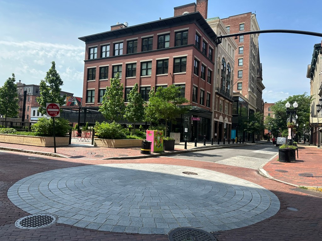
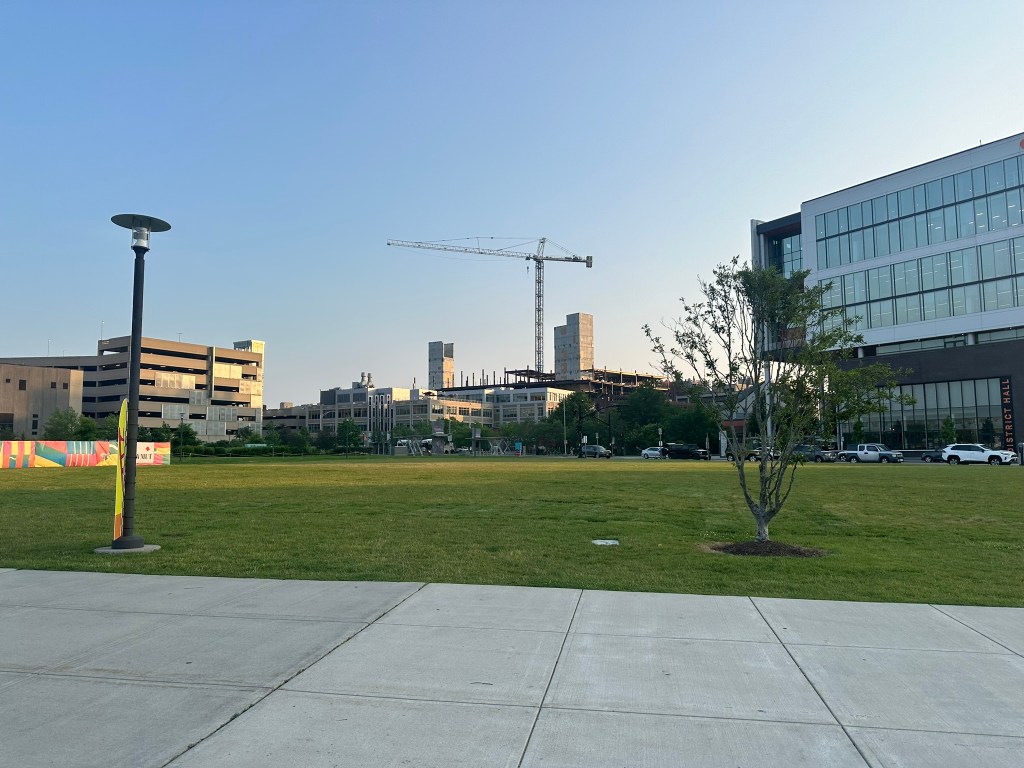
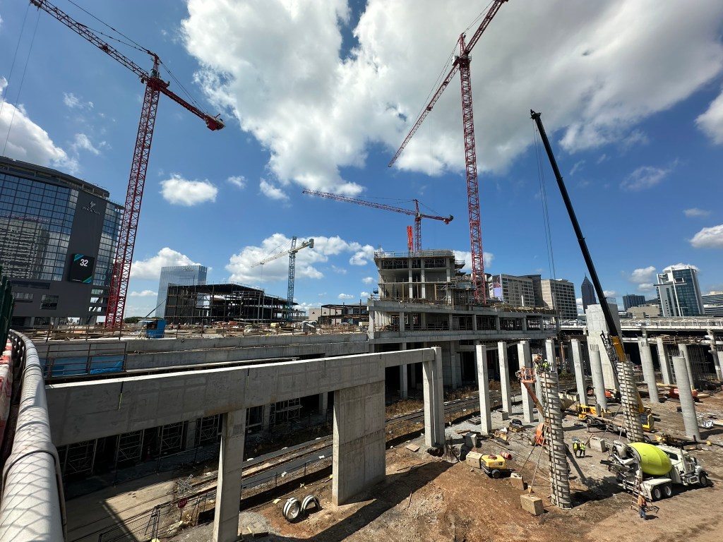
It was a bit weird to see the relative lack of any construction activity, but that’s the realities of today’s economic climate combined with being a low-growth city.

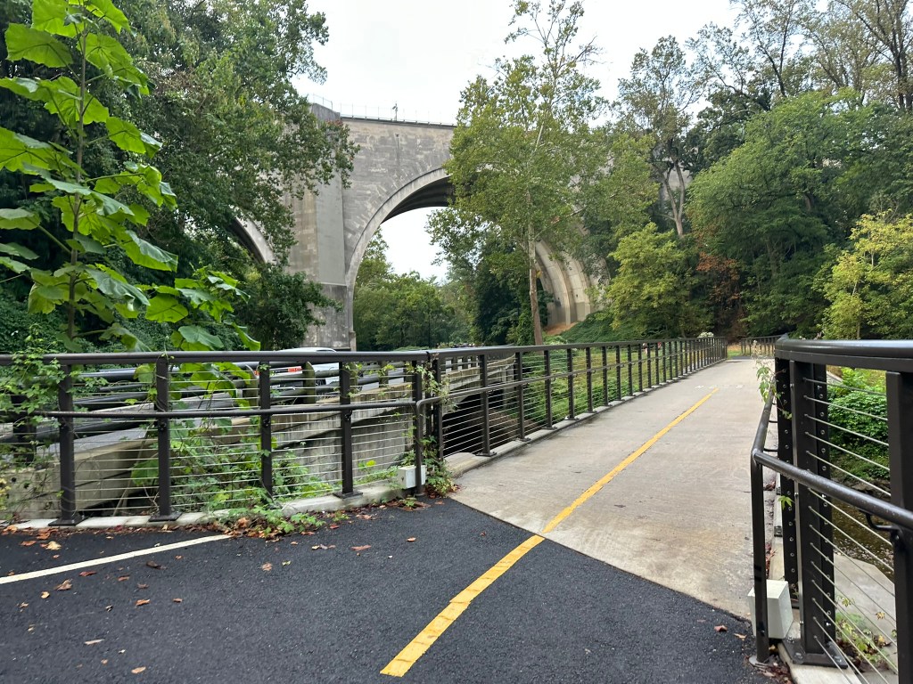
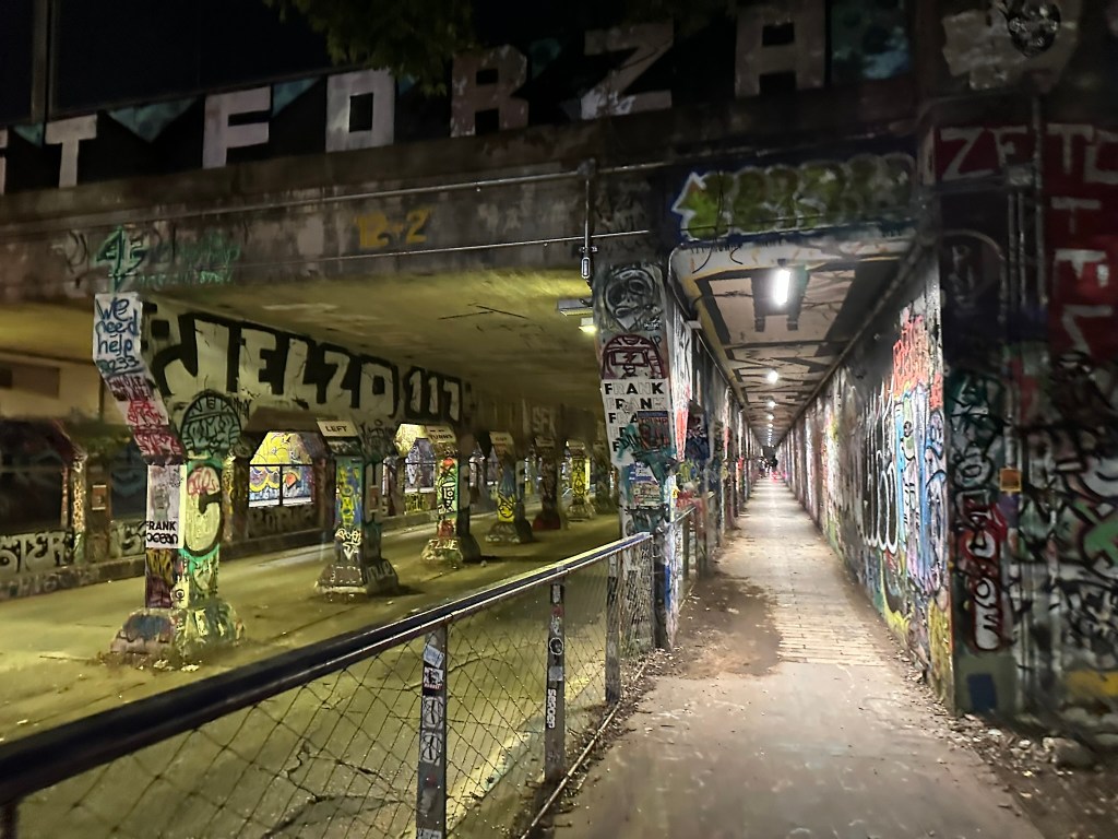
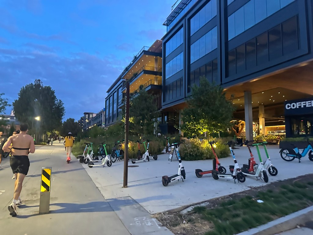
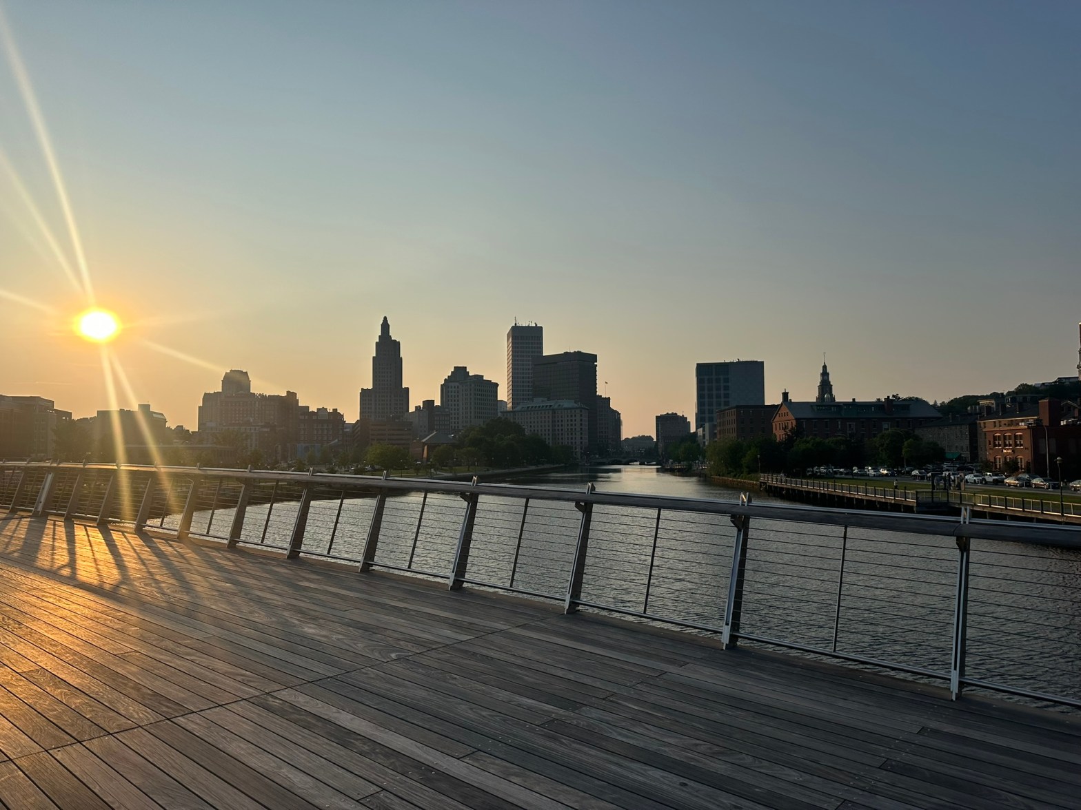
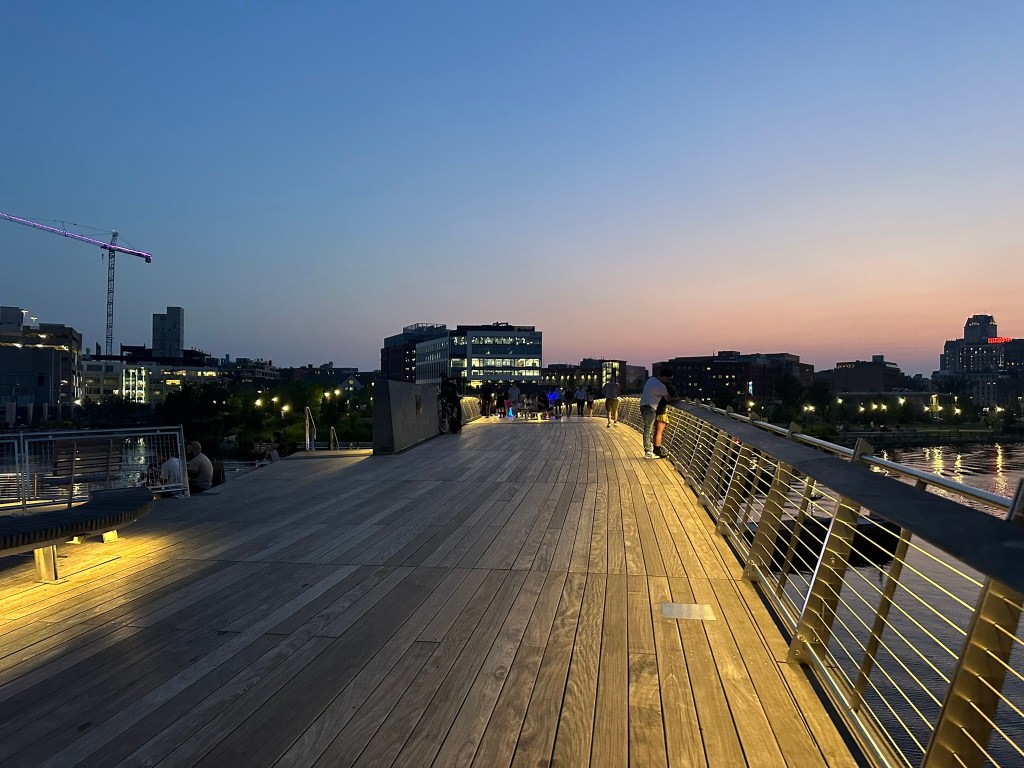
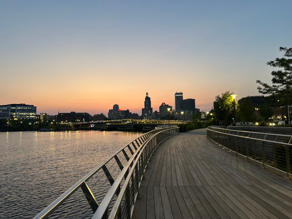
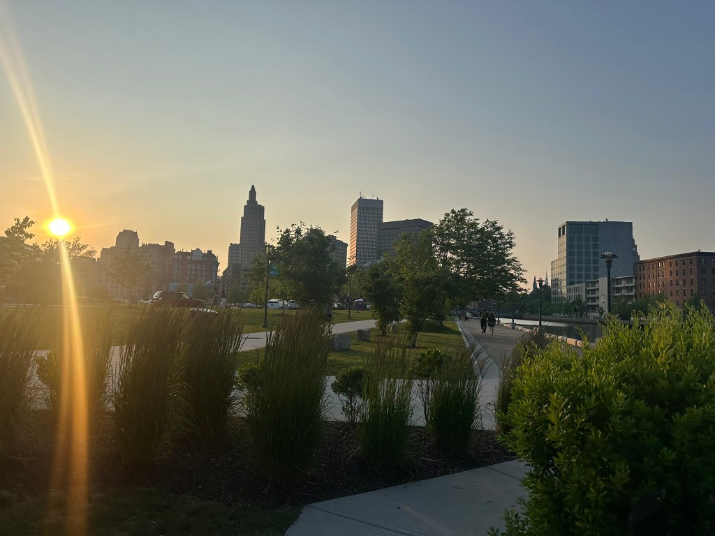
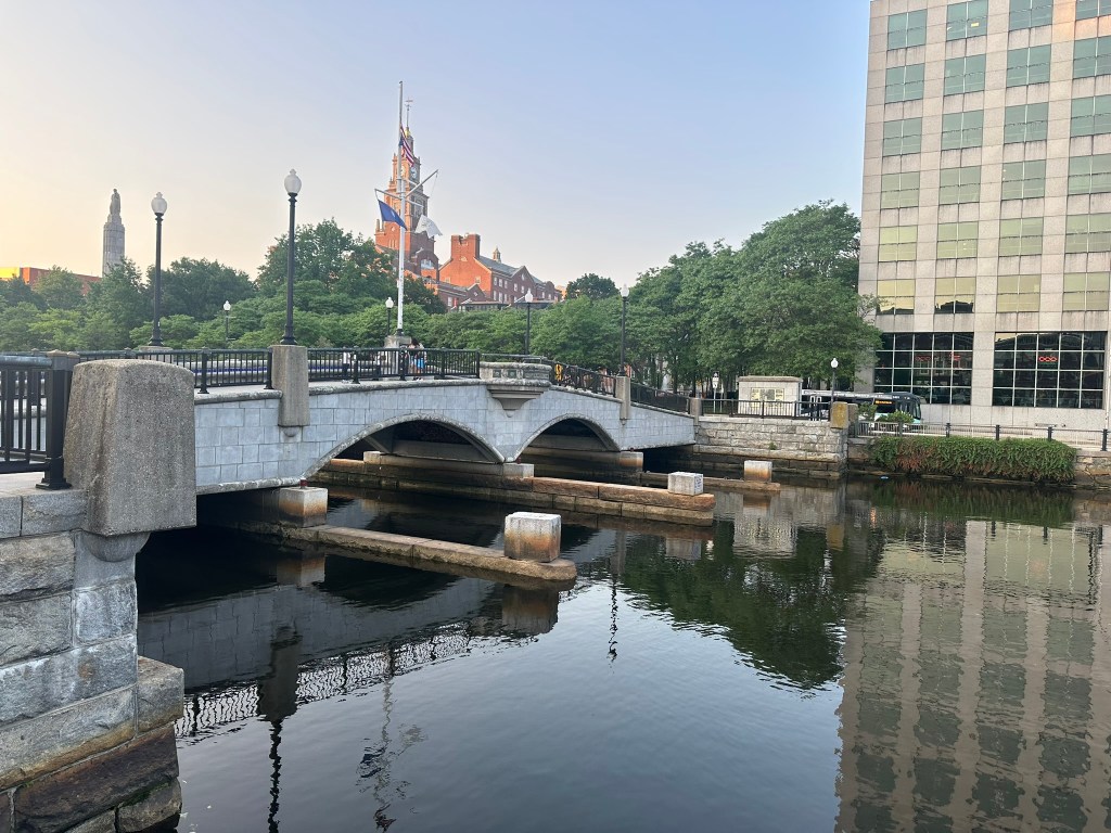
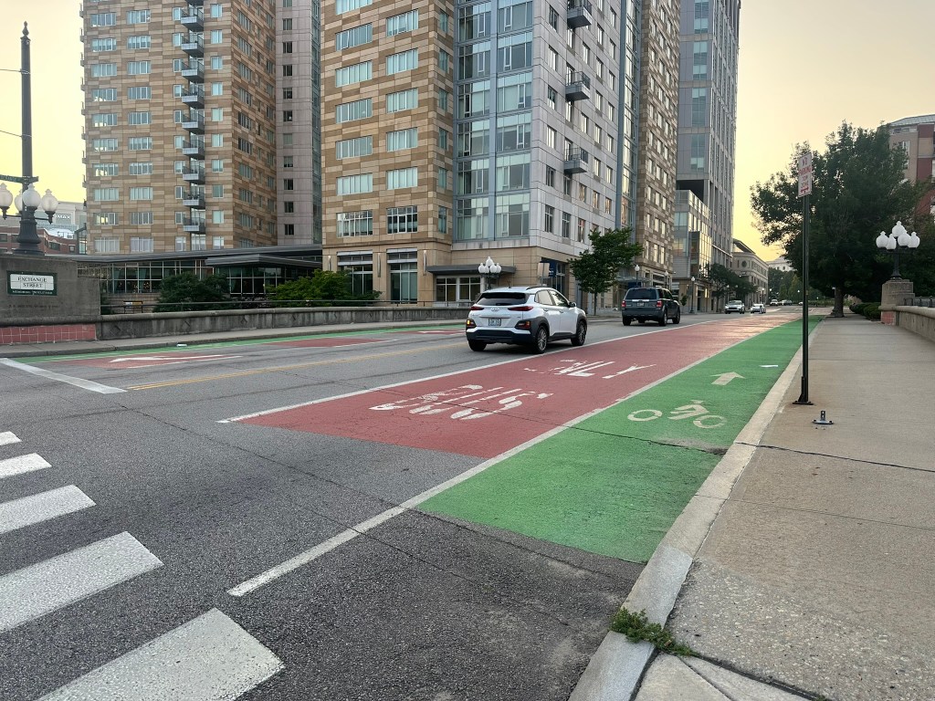
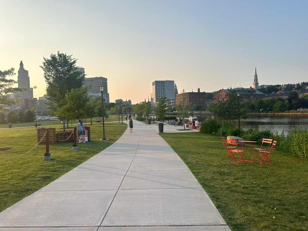
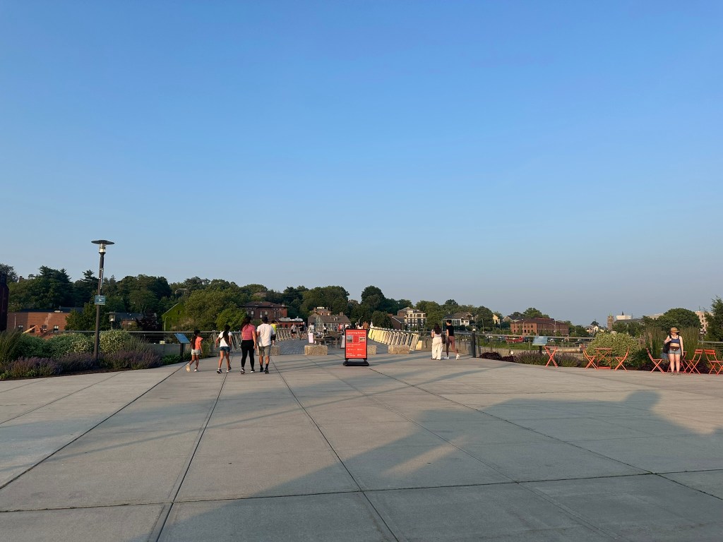
There was however some constuction going on in the former footprint of I-195. The highway was relocated almost 20 years ago a bit to the South and has made way for a beautiful ped bridge with skyline views, public spaces, and infill. It just goes to show how much urban highways suck!

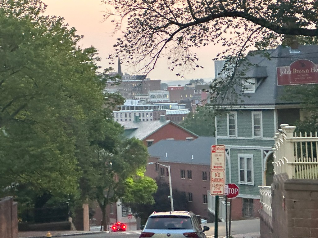
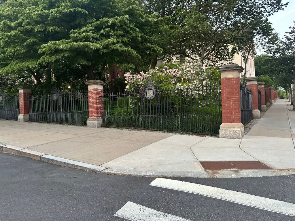
Perhaps the most surprising aspect of Providence I found was how cohesive the surrounding neighborhoods feel in connection with Downtown despite the tons of highways.

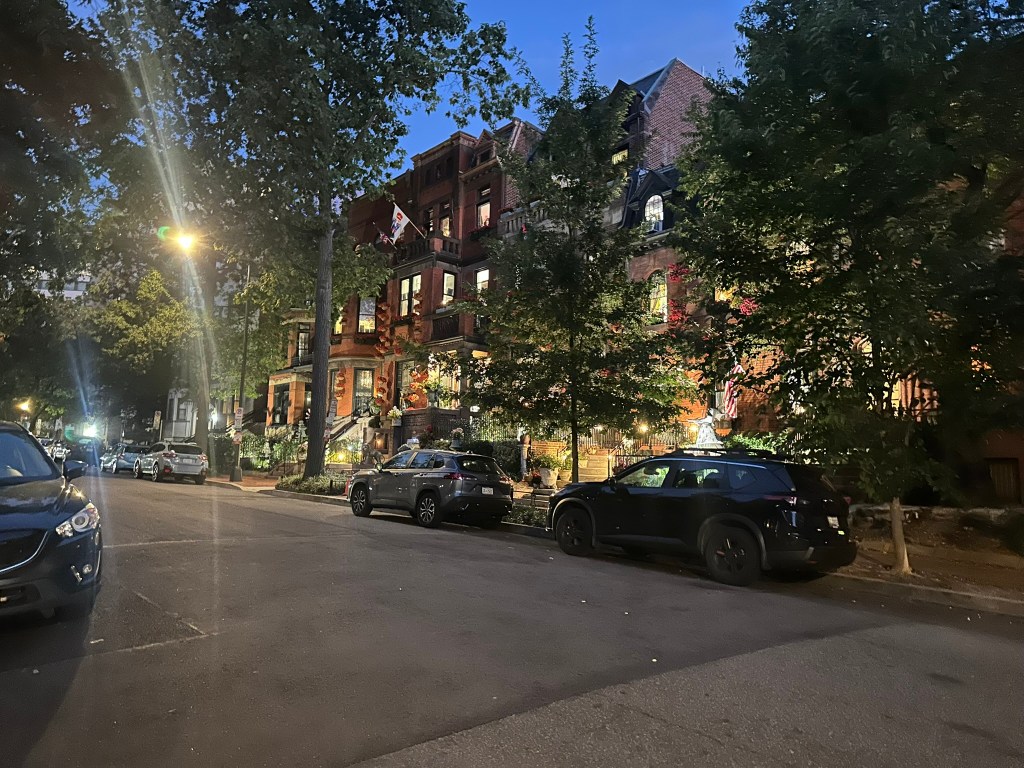
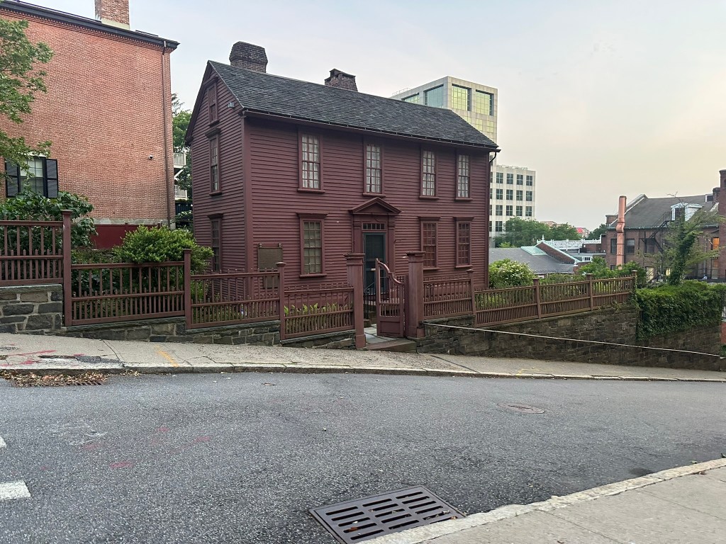
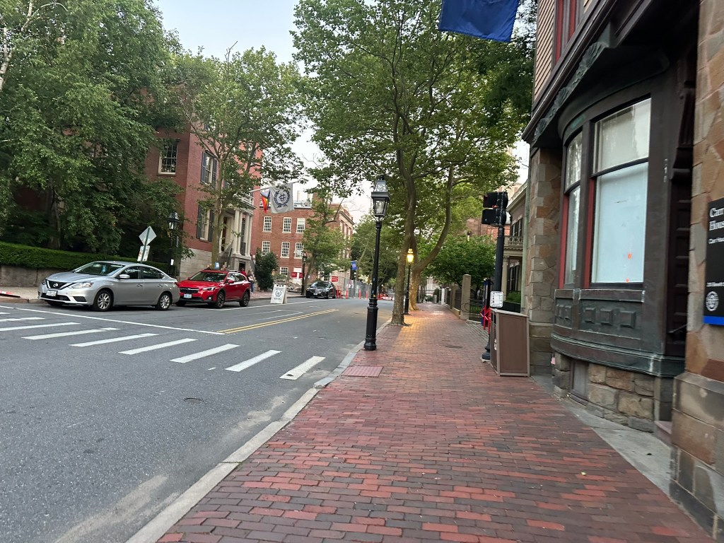
Being in the South for the past 20 years, it’s crazy to to see so many buildings from the 1700s that are in such good shape.

Overall, I have to say I’m impressed! I always had this notion that Providence was similar to Hartford and Springfield but that’s just not the case.

FURTHER READING

InPhil Designs: InPhil Designs

All ideas: The Urban Connector

Phil Veasley is a Professional Engineer and CNU accredited member working to design safer multimodal infrastructure in cities throughout the US.

My goal is to create cities that are safe and effective for all people to move about outside of cars. To achieve that we have to focus on creating equitable, dense, and vibrant cities full of walkable neighborhoods with a various mix of housing choices, schools, restaurants, transit, and services. We cannot have safe multimodal infrastructure without the density to support it and we cannot have equitable density without safe multimodal infrastructure. Outside of designing safe streets, my passions are sketching ideas for infill neighborhoods, floor plans, urban photography, and exploring our cities on foot or bike. Please check out the menus above for all of my ideas and also check out my YouTubeInstagram,  BlueSky Social, and Twitter accounts.

Opinions and insights are my own and are not representative of my employer or any organization.

YouTube – Centennial Yards October 2025 Progress

Centennial Yards is taking off! I recently headed out with my drone to capture all the progress. Head to YouTube to watch!

Subscribe to my YouTube Channel

Subscribe to receive email notifications for new articles.

✓ Subscribed

https://youtu.be/wsbchnitaTY

Phil Veasley is a Professional Engineer and CNU accredited member working to design safer multimodal infrastructure in cities throughout the US.

My goal is to create cities that are safe and effective for all people to move about outside of cars. To achieve that we have to focus on creating equitable, dense, and vibrant cities full of walkable neighborhoods with a various mix of housing choices, schools, restaurants, transit, and services. We cannot have safe multimodal infrastructure without the density to support it and we cannot have equitable density without safe multimodal infrastructure. Outside of designing safe streets, my passions are sketching ideas for infill neighborhoods, floor plans, urban photography, and exploring our cities on foot or bike. Please check out the menus above for all of my ideas and also check out my YouTubeInstagram,  BlueSky Social, and Twitter accounts.

Opinions and insights are my own and are not representative of my employer or any organization.

The Urban Connector Newsletter – October 2025

Happy October!

The Urban Connector monthly newsletter looks back on the best of the previous month as well as ways to get involved in the coming month. Please make sure you sign up below to have these delivered straight to your inbox and follow on YouTube, Twitter,  BlueSky Social, and Instagram.

✓ Subscribed

September Content

Atlanta BeltLine Northwest Trail Construction Progress – Opening soon!

Atlanta BeltLine Southeast Trail Construction Progress – Opening someday – hopefully by the year’s end.

InPhil Designs: Union Park – Increasing the sense of place in the center of booming Downtown Raleigh may be hiding in plain sight

2025 Raleigh Drone Tour

Photos of the Month

Urban Thoughts: Too small for an article, too big to miss

Election Season: 2025 is a big local election year. Many people seem to ignore local elections, but they affect our day-to-day lives just as much as the big ones. Make sure you’re informed on the issues. There are so many candidates who will fight for a better future and by building the needed housing and infrastructure. It starts right in your neighborhood.

Developments that Excited Me

Downtown Momentum

It feels like almost weekly we get great news out of Downtown these days. From South Downtown and Centennial Yards leasing, to the potential for filling in the dead space adjacent to the Stadium.

Chosewood Park

It’s been slow going and a parade of cancellations for our pipeline in Chosewood Park but it’s great to see this one moving forward.

Gwinnett Place Mall

Gwinnett, I’m rooting for you! Suburban retrofit is the best thing they could focus on. This would be a huge step toward that.

Boulevard SE
We are finally inching toward construction on one of the most dangerous, pot-hole filled streets in Atlanta. This change can’t come soon enough as it’s a terrifying part of my daily bike commute.

Way OTP for the win

If we’re going to build this far out, this is how we should do it.

Get Involved, Atlanta!

DateEventNotes
10/6City Council1:00 PM
10/13Zoning Committee10:00 AM
10/15Transportation Committee10:00 AM
10/20City Council1:00 PM
10/27Zoning Committee10:00 AM
10/29Transportation Committee10:00 AM
11/3City Council1:00 PM
11/4Election Day7-7

Raleigh folks, I miss y’all! Make sure you’re keeping up to date with the great people at Raleigh ForwardWakeUPOaks and SpokesNC Housing Table, and The Downtown Raleigh Community.

What I’m working on this month (and probably later)

  • More suburban spotlights
  • InPhil Designs ideas
  • Urban Thoughts – Cities: Chicago, Providence, Orlando

I’m sure this newsletter will evolve as time goes on. Comments or suggestions? Let me know!

Phil Veasley is a Professional Engineer and CNU-Accredited Professional member working to design safer multimodal infrastructure in cities throughout the US.

My goal is to create cities that are safe and effective for all people to move about outside of cars. To achieve that we have to focus on creating equitable, dense, and vibrant cities full of walkable neighborhoods with a various mix of housing choices, schools, restaurants, and services. We cannot have safe multimodal infrastructure without the density to support it and we cannot have equitable density without safe multimodal infrastructure. Outside of designing safe streets, my passions are sketching ideas for infill neighborhoods, floor plans, urban photography, and exploring our cities on foot or bike. Please check out the menus above for all of my ideas and also check out my YouTubeInstagram,  BlueSky Social, and Twitter accounts.

Opinions and insights are my own and are not representative of my employer or any organization.

YouTube – 2025 Raleigh Drone Tour

2025 Drone Tour of the City of Oaks. Head to YouTube to watch!

Subscribe to my YouTube Channel

Subscribe to receive email notifications for new articles.

✓ Subscribed

https://youtu.be/1TvAMph09b0

Phil Veasley is a Professional Engineer, certified drone pilot, and CNU accredited member working to design safer multimodal infrastructure in cities throughout the US.

My goal is to create cities that are safe and effective for all people to move about outside of cars. To achieve that we have to focus on creating equitable, dense, and vibrant cities full of walkable neighborhoods with a various mix of housing choices, schools, restaurants, transit, and services. We cannot have safe multimodal infrastructure without the density to support it and we cannot have equitable density without safe multimodal infrastructure. Outside of designing safe streets, my passions are sketching ideas for infill neighborhoods, floor plans, urban photography, and exploring our cities on foot or bike. Please check out the menus above for all of my ideas and also check out my YouTubeInstagram,  BlueSky Social, and Twitter accounts.

Opinions and insights are my own and are not representative of my employer or any organization.

InPhil Designs – Union Park: Downtown Raleigh

Increasing the sense of place in the center of booming Downtown Raleigh may be hiding in plain sight

Subscribe to my YouTube Channel

Subscribe to receive email notifications for new articles.

✓ Subscribed

Some of the best views of Downtown Raleigh are from the Boylan Bridge over the vast railroad junction.

Boylan Bridge location: GoogleEarth

The bridge itself however is a two-lane road with standard sidewalks and doesn’t rise to the potential or provide much of a sense of place.

Building a platform over the rail junction while maintaining existing (and hopefully expanding) operations underneath will provide a central gathering space in the heart of Downtown as well as connect to the multimodal hub of Union Station.

The park would capitalize on the City and train view opportunities with a tiered overlook adjacent to Union Station.

NOTE: I do not own, control, have actual say, etc over any of the proposed redeveloped parcels. This is just an idea and just a sketch.

Downtown Raleigh from Boylan Bridge

Other aspects of the park could include landscaped pathways and playgrounds. These features could serve as a lynchpin for possible future trail connections to Dix Park, Pullen Park, NC State and to the north.

Possible pathways stemming for Union Park – GoogleEarth

Some ideas I’ve introduced include a mix of already proposed infill and opportunistic infill on adjacent properties. Also – a bricked, curbless shared-street concept for Hillsborough Street to guide users from the park or surrounding trails to the Capitol and Faytteville Street on a safe, signature flush-street.

Raleigh is missing that central “go-to” spot that every successful Downtown needs. Union Park would build off of the budding multimodal hub of Union Station while also offering connections to some of the biggest destinations in the City.

FURTHER READING

InPhil Designs: InPhil Designs

All ideas: The Urban Connector

All things Raleigh: Triangle Articles

Prison site plan: Stich Central

Phil Veasley is a Professional Engineer and CNU accredited member working to design safer multimodal infrastructure in cities throughout the US.

My goal is to create cities that are safe and effective for all people to move about outside of cars. To achieve that we have to focus on creating equitable, dense, and vibrant cities full of walkable neighborhoods with a various mix of housing choices, schools, restaurants, transit, and services. We cannot have safe multimodal infrastructure without the density to support it and we cannot have equitable density without safe multimodal infrastructure. Outside of designing safe streets, my passions are sketching ideas for infill neighborhoods, floor plans, urban photography, and exploring our cities on foot or bike. Please check out the menus above for all of my ideas and also check out my YouTubeInstagram,  BlueSky Social, and Twitter accounts.

Opinions and insights are my own and are not representative of my employer or any organization.

YouTube – Atlanta BeltLine SE Trail Construction Progress

A look at construction progress on Southeast Trail. We have more concrete and it’s finally starting to come to life. Head to YouTube to watch!

Subscribe to my YouTube Channel

Subscribe to receive email notifications for new articles.

✓ Subscribed

https://youtu.be/vDzO9ThgeMY

Phil Veasley is a Professional Engineer, certified drone pilot, and CNU accredited member working to design safer multimodal infrastructure in cities throughout the US.

My goal is to create cities that are safe and effective for all people to move about outside of cars. To achieve that we have to focus on creating equitable, dense, and vibrant cities full of walkable neighborhoods with a various mix of housing choices, schools, restaurants, transit, and services. We cannot have safe multimodal infrastructure without the density to support it and we cannot have equitable density without safe multimodal infrastructure. Outside of designing safe streets, my passions are sketching ideas for infill neighborhoods, floor plans, urban photography, and exploring our cities on foot or bike. Please check out the menus above for all of my ideas and also check out my YouTubeInstagram,  BlueSky Social, and Twitter accounts.

Opinions and insights are my own and are not representative of my employer or any organization.

YouTube – Atlanta BeltLine NWT Construction Progress September 2025

A look at construction progress on Northwest Trail through Blandtown. Head to YouTube to watch!

Subscribe to my YouTube Channel

Subscribe to receive email notifications for new articles.

✓ Subscribed

https://www.youtube.com/watch?v=VqK9sqXM8Rw

Phil Veasley is a Professional Engineer, certified drone pilot, and CNU accredited member working to design safer multimodal infrastructure in cities throughout the US.

My goal is to create cities that are safe and effective for all people to move about outside of cars. To achieve that we have to focus on creating equitable, dense, and vibrant cities full of walkable neighborhoods with a various mix of housing choices, schools, restaurants, transit, and services. We cannot have safe multimodal infrastructure without the density to support it and we cannot have equitable density without safe multimodal infrastructure. Outside of designing safe streets, my passions are sketching ideas for infill neighborhoods, floor plans, urban photography, and exploring our cities on foot or bike. Please check out the menus above for all of my ideas and also check out my YouTubeInstagram,  BlueSky Social, and Twitter accounts.

Opinions and insights are my own and are not representative of my employer or any organization.

The Urban Connector Newsletter – September 2025

Fall is nearly upon us (or fully upon us if you follow meteorological seasons)!

The Urban Connector monthly newsletter looks back on the best of the previous month as well as ways to get involved in the coming month. Please make sure you sign up below to have these delivered straight to your inbox and follow on YouTube, Twitter,  BlueSky Social, and Instagram.

✓ Subscribed

August Content

SouthSide Trail Progress

Atlanta Summer Drone Tour

Urban Thoughts: Too small for an article, too big to miss

The BeltLine

The BeltLine released their monthly design and construction updates the other day and there was a lot of disappointing but not surprising news in it:

  • As most of us figured by now, the SouthEast segment from Glenwood to Boulevard will probably not be done in October – it’s now looking like it could be next year
  • The SouthSide Trail may not be ready in time for the World Cup. This is probably the most crucial segment to date as it’s the lynchpin that will complete the “U”
  • In what has become the norm the last few months in these, there was not a word spoken about transit. This is even more flagrant this month as the BeltLine unveiled the full transit plan with station locations and costs. Not even a week later, the CEO basically trashed the plan and said rail on the Eastside somehow doesn’t make “sense”. Yeah, I don’t get it either!

Related to BeltLine Rail, there are a lot of smart people in this City who are against it for one reason or another but I’ve yet to see one idea that gives us the amount of benefit that rail does.

One take surrounds the cost with some people saying that we could spend less than 3.5 billion and give every resident who wants one an E-Bike and build out the cities’ bike infrastructure. While this seems like a good idea on the surface, let’s think about the BeltLine on a cold day, a rainy day, when it get’s dark at 5:30 in the winter, etc. There are so many limitations that would come with that – not even to mention the many people who can’t ride a bike. Coming from someone who bikes everywhere for transportation, it’s not for everyone and just doesn’t have the capabilities that actual mass transit does.

If you missed my six part series on BeltLine rail late last year catch up here:

State of Downtown Raleigh

While the future skyline map that DRA puts out each year seems a lot quieter than the past few years, Raleigh is rising! The focus on Downtown housing and connectivity has the future of the City looking bright!

Marietta’s Mayor Race

Smart suburbs are evolving! If you’re in Marietta please check out Sam Foster’s campaign which is focused on safe infrastructure and housing. A better future is possible.

Photos of the Month

Developments that Excited Me

Downtown Wendell

This might be the thing that really gets Downtown Wendell going! As I’ve said many times, Wendell has the best bones of any of the small town Wake County municipalities.

Hopefully this is just step one of many. Check out my ideas for the underutilized Downtown parcels.

South Downtown

It feels like almost weekly we get great news out of South Downtown these days. Make sure you’re signed up to get Jon’s monthly newsletter full of updates.

Arts Center TOD

I’d argue that this is one of the most impactful sites in Midtown. We must get it right.

Memorial Drive Greenway Back From the Dead?

It’s been years since we’ve heard about this one. Would go an long way in making Downtown have a cohesive connection to the Eastern neighborhoods.

Choseline Component

I think parts of this should go here!

Reynoldstown Stunner

Reynoldstown is my favorite neighborhood in the City for a reason. This is just the cherry on top.

Get Involved, Atlanta!

DateEventNotes
9/8Zoning Committee10:00 AM
9/10Transportation Committee10:00 AM
9/15City Council1:00 PM
9/16Fatal Crash Review Commission10:00 AM
9/24Zoning Committee10:00 AM
9/26Transportation Committee10:00 AM
10/6City Council1:00 PM

Raleigh folks, I miss y’all! Make sure you’re keeping up to date with the great people at Raleigh ForwardWakeUPOaks and SpokesNC Housing Table, and The Downtown Raleigh Community.

What I’m working on this month (and probably late

  • Updates to earlier drawings of the Reconnecting Communities sketches
  • More suburban spotlights
  • InPhil Designs ideas
  • Urban Thoughts – Cities: Chicago, Providence, Orlando

I’m sure this newsletter will evolve as time goes on. Comments or suggestions? Let me know!

Phil Veasley is a Professional Engineer and CNU-Accredited Professional member working to design safer multimodal infrastructure in cities throughout the US.

My goal is to create cities that are safe and effective for all people to move about outside of cars. To achieve that we have to focus on creating equitable, dense, and vibrant cities full of walkable neighborhoods with a various mix of housing choices, schools, restaurants, and services. We cannot have safe multimodal infrastructure without the density to support it and we cannot have equitable density without safe multimodal infrastructure. Outside of designing safe streets, my passions are sketching ideas for infill neighborhoods, floor plans, urban photography, and exploring our cities on foot or bike. Please check out the menus above for all of my ideas and also check out my YouTubeInstagram,  BlueSky Social, and Twitter accounts.

Opinions and insights are my own and are not representative of my employer or any organization.

YouTube – Atlanta Summer 2025 Drone Tour

Back with another Atlanta drone tour featuring Downtown and Midtown sunrise views. Head to YouTube to watch!

Subscribe to my YouTube Channel

Subscribe to receive email notifications for new articles.

✓ Subscribed

https://www.youtube.com/watch?v=9FluDQ4o6WQ

Phil Veasley is a Professional Engineer, certified drone pilot, and CNU accredited member working to design safer multimodal infrastructure in cities throughout the US.

My goal is to create cities that are safe and effective for all people to move about outside of cars. To achieve that we have to focus on creating equitable, dense, and vibrant cities full of walkable neighborhoods with a various mix of housing choices, schools, restaurants, transit, and services. We cannot have safe multimodal infrastructure without the density to support it and we cannot have equitable density without safe multimodal infrastructure. Outside of designing safe streets, my passions are sketching ideas for infill neighborhoods, floor plans, urban photography, and exploring our cities on foot or bike. Please check out the menus above for all of my ideas and also check out my YouTubeInstagram,  BlueSky Social, and Twitter accounts.

Opinions and insights are my own and are not representative of my employer or any organization.

YouTube – August 2025 Atlanta BeltLine Progress: South Side Trail

A look at construction progress on the highly anticipated South Side Trail. Officials maintain that the trail will be ready for the World Cup next June! Head to YouTube to watch!

Subscribe to my YouTube Channel

Subscribe to receive email notifications for new articles.

✓ Subscribed

Phil Veasley is a Professional Engineer, certified drone pilot, and CNU accredited member working to design safer multimodal infrastructure in cities throughout the US.

My goal is to create cities that are safe and effective for all people to move about outside of cars. To achieve that we have to focus on creating equitable, dense, and vibrant cities full of walkable neighborhoods with a various mix of housing choices, schools, restaurants, transit, and services. We cannot have safe multimodal infrastructure without the density to support it and we cannot have equitable density without safe multimodal infrastructure. Outside of designing safe streets, my passions are sketching ideas for infill neighborhoods, floor plans, urban photography, and exploring our cities on foot or bike. Please check out the menus above for all of my ideas and also check out my YouTubeInstagram,  BlueSky Social, and Twitter accounts.

Opinions and insights are my own and are not representative of my employer or any organization.