
Part one of this series explored the lack of access approaching Downtown Raleigh from the East. This time, I took a look at what would happen if we capped our below grade railroad tracks and created over 25 acres of greenspace and trails.
Downtown Raleigh, like any other Downtown, has no shortage of railroad tracks. Thankfully, many segments of track through and adjacent to Downtown happen to fall below the grade of the surrounding land. This gives us an unique opportunity to cap the tracks and add to the city’s greenspace while connecting areas that are currently cut off from each other.
Currently there is a track coming from the West, two from the South, and two from the North.
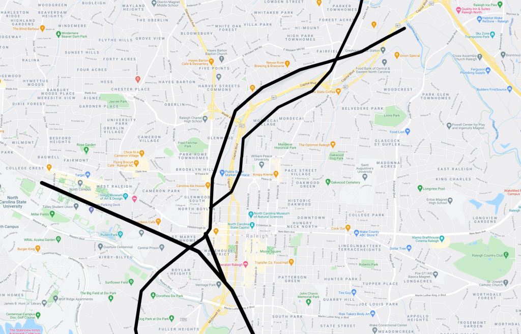
The first time I explored Downtown Raleigh, my lasting impressions were how segmented parts of Glenwood South were from the rest of Downtown and how much valuable land was wasted on the tracks junction known as the Boylan Wye.
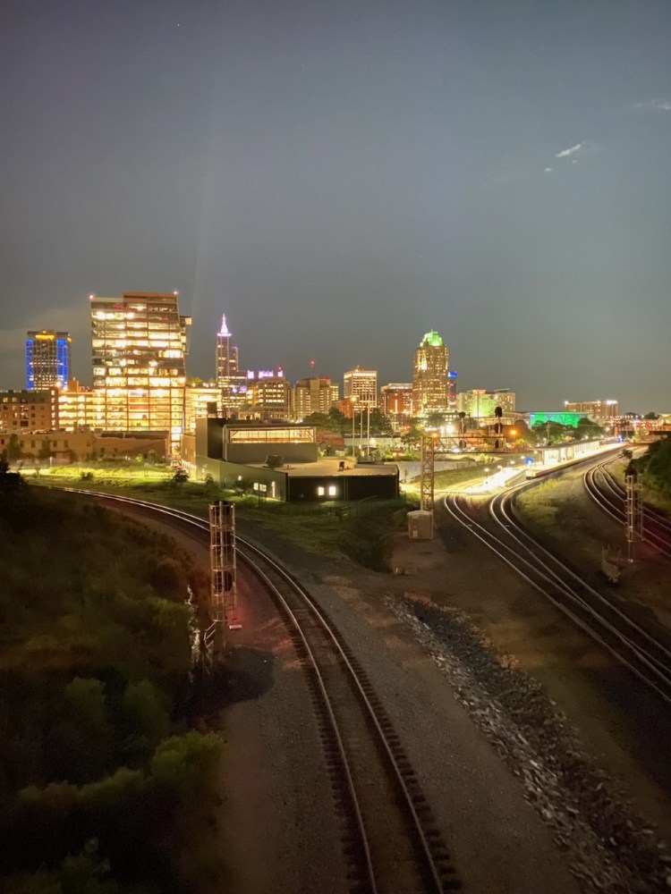
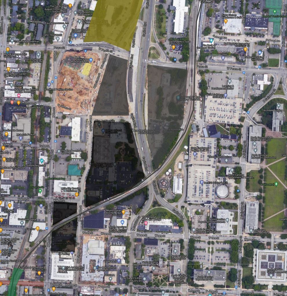
From the Boylan Bridge, visitors are treated not only to perhaps the best view of Raleigh, but also the sprawling tracks. But what if we capped all of those tracks? The result would be a 10 acre park in the heart of Downtown.
For an interactive look at the map below please visit: https://www.google.com/maps/d/embed?mid=1UXzUZ7sxPGcbIY3TRzsdwEYEaUt1VzbT
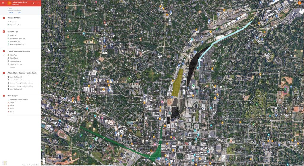
The centerpiece of this plan would be Union Station Park, named for the adjacent Multimodal Hub – Raleigh Union Station. The park would be a 10 acre oasis in the heart of Downtown Raleigh surrounded by office towers, hotels, shops, restaurants, and a mix of residences ranging from single family to 30 story apartment towers.
Union Station Park would fit perfectly into Owen Evans’ upcoming Artery plan. More information is soon to come but go ahead and sign up to stay in the know. https://raleighartery.org/
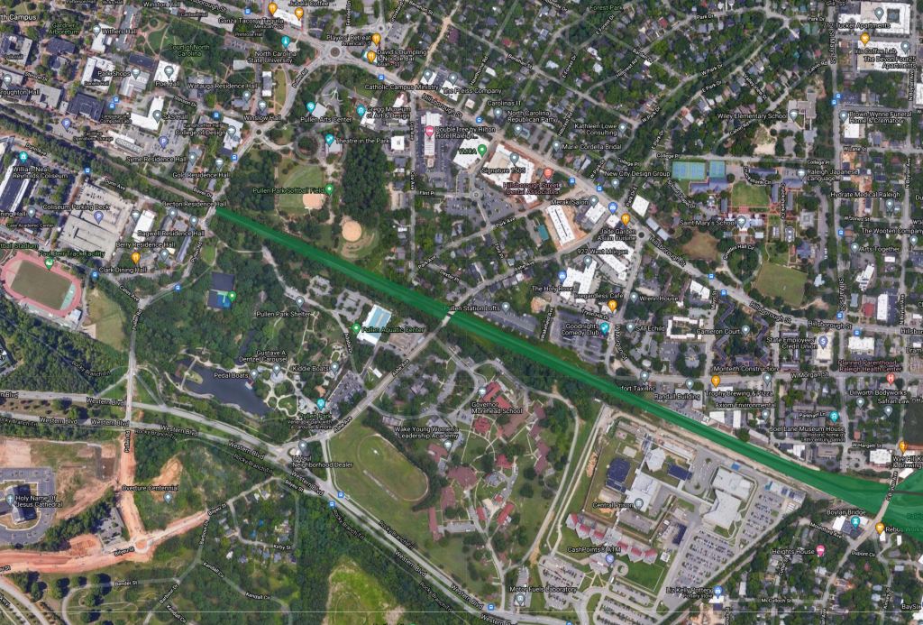
About a mile west of Downtown Raleigh sits the campus of North Carolina State University and Pullen Park. NC State and Pullen Park are both currently bisected by the rail line. As I mentioned earlier, the rail line sits below grade through Pullen Road, affording the opportunity to cap the track. This would provide the perfect opportunity to add a direct greenway connection from Union Station Park to Pullen Park and NC State. This would also help stich together several neighborhoods enhance the cohesiveness of Raleigh.
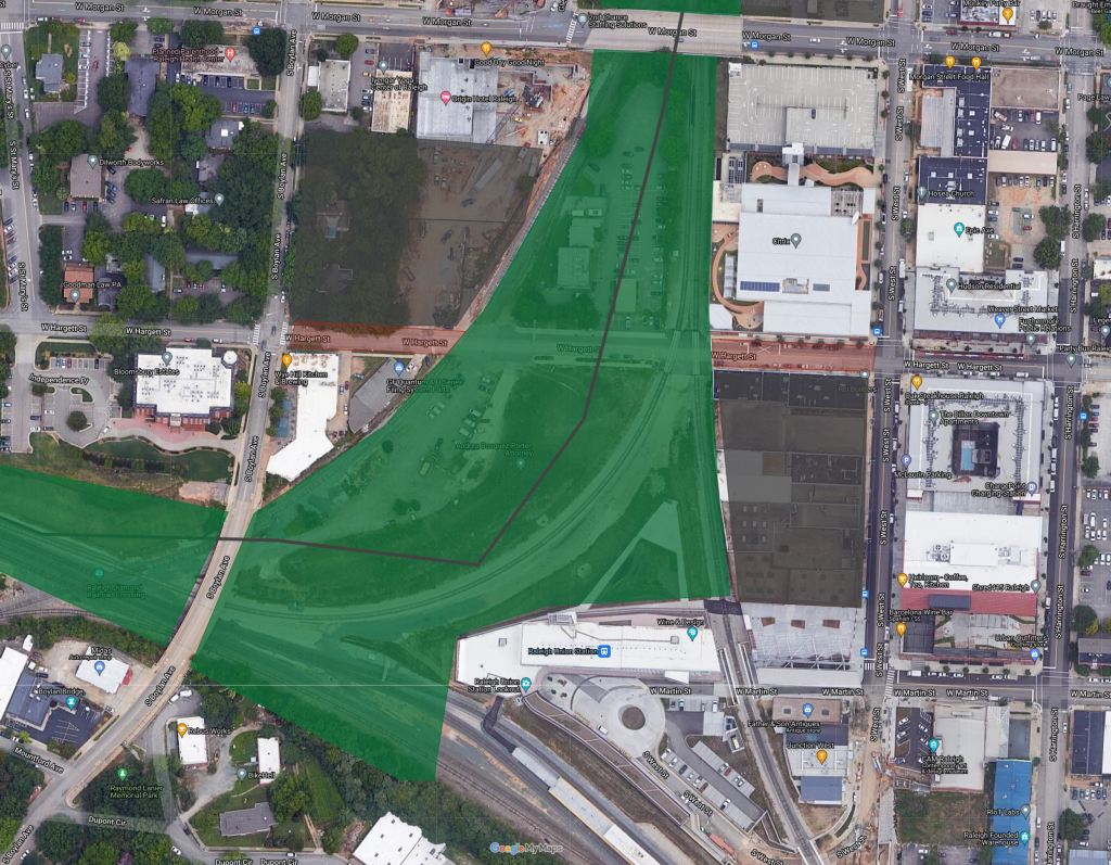
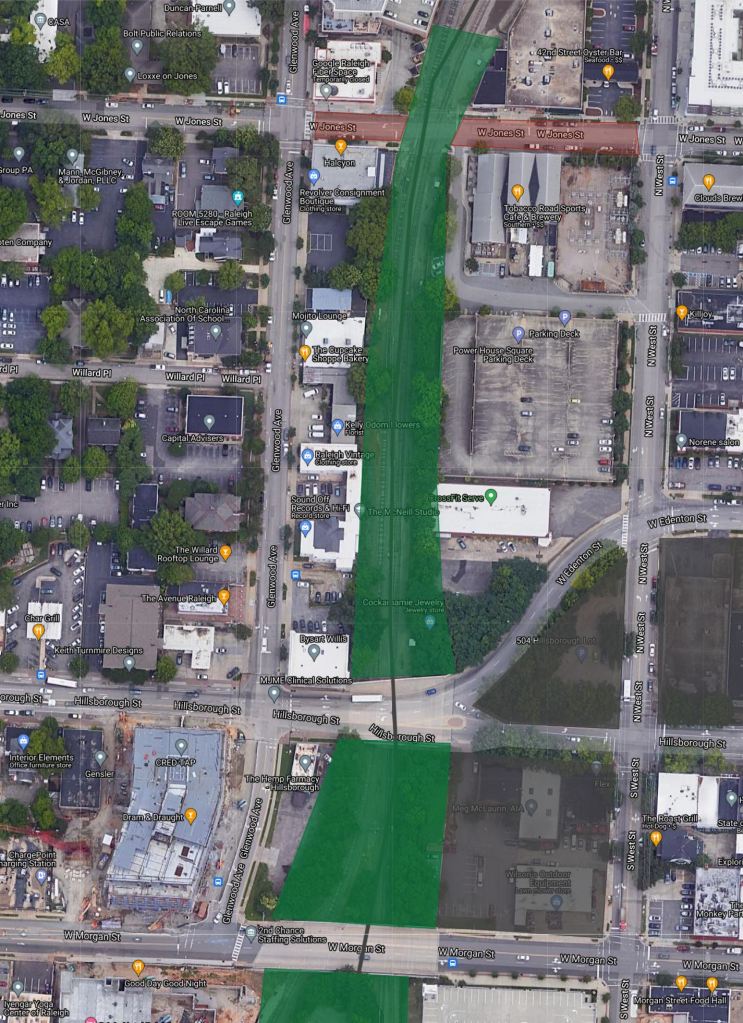
Just North of Union Station park, Morgan St and Hillsborough St cross over the tracks. These are two of the most important East-West streets in Downtown Raleigh vehicular and pedestrian wise. But as they are right now, there is only a typical 5′ sidewalk over the bridges. Capping the land between these two bridges would not only create an extra acre of greenspace but also further connect the Bloc 83 development and Glenwood South to Downtown.
Continuing North, another cap would stretch from Hillsborough St to just North of where Jones St currently sits.
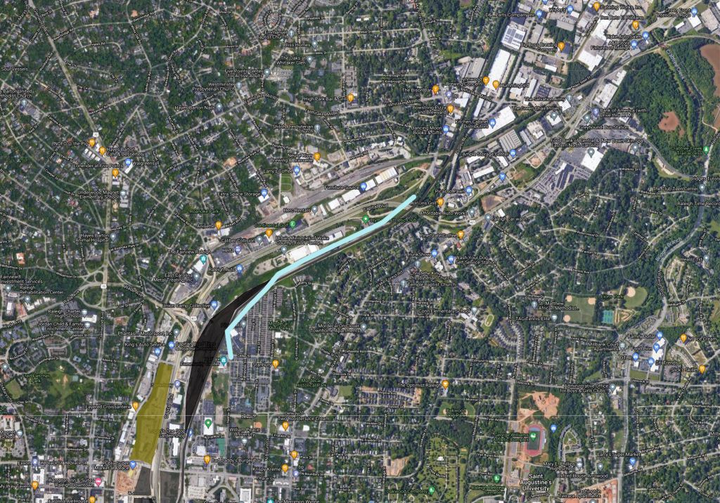
North of Jones St, the two tracks split. However, a couple of miles north, the tracks once again meet. This seems rather redundant, thus the opportunity to repurpose the eastern branch into a Greenway.
Straddling the proposed Greenway, are mixed light industrial facilities, underused parking lots, and proposed mixed-use developments. Building out these parcels would give this Greenway section a similar feel of the Eastside Beltline trail in Atlanta.
Further North the Greenway would straddle the current Railyard which would be a prime redevelopment site before connecting to the emerging Iron Works District. The adjacent Wake Forest-Halifax connector (more information to come in Part 3 of this series) would also help drive dense intown development.
In total, this plan would add over 25 acres of greenspace and 3.5 miles of greenway trail to Downtown Raleigh. It would also connect NC State, the Union Station mulit-modal hub, Glenwood South, and the Iron Works District to Downtown as well as provide an economic driver for development.
Stay tuned for Part Three of my Connecting Downtown Raleigh series as we explore access into Downtown from the North.

I really appreciate your piece of work, Great post.
LikeLike